
Two Barrows S Cairn
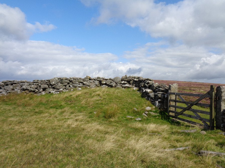
Photo taken on 19-08-2017
Database entries
OS Map: SX 70663 79203
OS Source: Google
Butler OS: SX70657918
HER: MDV7411
Megalithic Portal: 16632
Alternate name: Two Barrows 2
Short Name: CN TwoBarrows2
Butler map: 20.11.2
Butler Vol 5: p.23 & Fig.106
Grinsell: WIDECOMBE IN THE MOOR 3
Exist: Yes
Record: Unique
Record Source: Butler
Hut Class: No
Cairn Class: Yes
Dimensions (m): 11.5 x 1.0
Lidar: SX 70663 79203
Guide Map: 29
Nearest Bus Stop (Minor): Widecombe in the Moor Car Park (3.5 km) [Route: 271]
Nearest Bus Stop (Major): Postbridge Bellever (5.5 km) [Route: 98]
Nearby sites: SX 70663 79203
Notes
Two Barrows 2. An oval, stony mound measuring 15.5m E-W and 10.5m N-S. It stands up to 1.1m high and was probably originally bowl-profiled. The N slope is spit by a narrow path and a N-S slope across the top of the barrow has caused minor damage. It appears to be unexcavated. The mound is crossed by a maintained drystone field wall, approaching from the SE and turning W on the barrow. The wall is built over the mound and does not seem to have caused much damage. This barrow appears to have been a target point for a reave, Fleming's Hameldon South, approaching from the E and stopping 3.5m short of the mound. The reave line is continued W by the modern wall beyond the barrow.See also: Bate, C Spence, Researches into Some Antient Tumuli on Dartmoor, T.D.A. Vol. 5 pp.549-58 (1872). Butler Volume 1 Map 20.11
References
These are selected references with an emphasis on out of copyright sources linked as PDFs. For more detailed references try any linked HER or PMD record above.
- Butler, Jeremy, Dartmoor Atlas of Antiquities, vol.1: The East, (1991)
- Butler, Jeremy, Dartmoor Atlas of Antiquities, vol.5: The Second Millennium B.C., (1997)
- Grinsell, L.V., Dartmoor Barrows, Devon Archaeological Society Proceedings No.36 (1978)