
Grimspound Enclosed Settlement
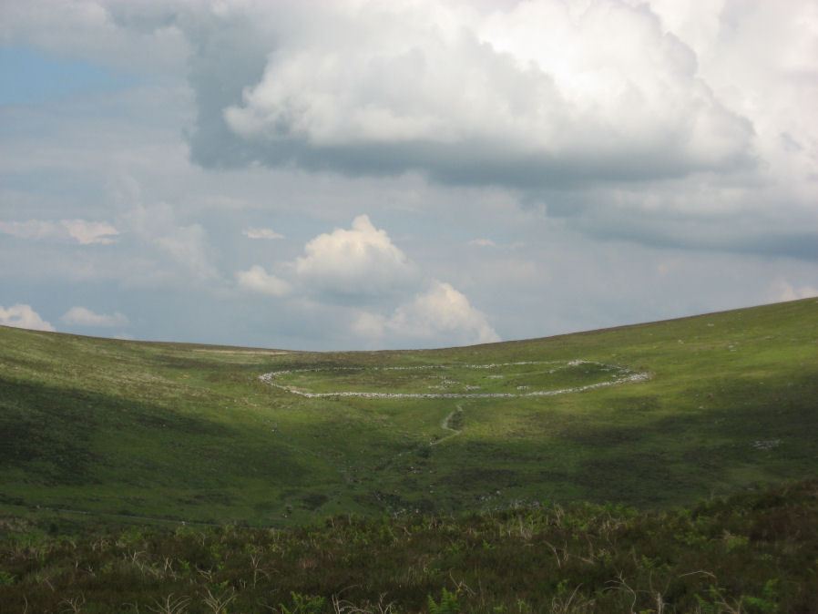
Photo taken on 14-06-2014

Ormerod Rude Stone Remains situate on the Easterly Side of Dartmoor (1876) [See Archaeological memoirs ...]
Database entries
PDW coverage: Dartmoor Site: Grimspound Enclosed Settlement
OS Map: SX 70073 80909
OS Source: Constructed
HER: MDV8778
Megalithic Portal: 1344141065
Alternate name: Grimspound
Short Name: ES Grimspound
DPD page: 127
Exist: Yes
Record: Unique
Record Source: PDW
Hut Class: No
Lidar: SX 70073 80909
Guide Map: 29
Nearest Bus Stop (Minor): Warren House Inn (3.4 km) [Route: 171(20/07/26 to 19/09/26)]
Nearest Bus Stop (Major): Postbridge Post Office (5.7 km) [Route: 98,171(20/07/26 to 19/09/26)]
Nearby sites: SX 70073 80909
Notes
Probabaly the best known enclosed settlement on Dartmoor, within walking distance of Warren House Inn. "Prehistoric enclosed settlement with a substantial granite surrounding wall, containing 24 hut circles, as well as several 'pens' built into the enclosure wall, positioned in a valley between Hookney Tor and Hameldon. First planned by A. C. Shillibeer in 1829, this site was excavated by the Dartmoor Exploration Committee in 1894-5. Within the guardianship area managed by Dartmoor National Park Authority". Extensive notes on the HER record, see also coverage on Wikipedia and Legendary Dartmoor.References
These are selected references with an emphasis on out of copyright sources linked as PDFs. For more detailed references try any linked HER or PMD record above.
- Baring-Gould, Sabine, The Exploration of Grimspound. First Report of The Dartmoor Exploration Committee, T.D.A. Vol.26 pp.101-21 (1894)
- Baring-Gould, Sabine, Second Report of the Dartmoor Exploration Committee, T.D.A. Vol.27 pp.81-92 (1895)
- Brailsford, J. W, Bronze Age Stone Monuments of Dartmoor, Antiquity Volume 12, Number 48 pp.444-63 (1938)
- Breton, Henry Hugh, The Heart of Dartmoor, (1926)
- Burnard, Robert, Early Man, The Victoria History of the County of Devon: v. 1 (1906)
- Fox, Aileen, Excavations at Kestor, an Early Iron Age Settlement near Chagford, Devon, T.D.A. Vol.86 pp.21-62 (1954)
- Fox, Aileen, Cairns and stone alignments on Shovel Down, Archaeological Journal Vol 114. pp.155-158 (1957)
- Gerrard, Sandy, English Heritage Book of Dartmoor: Landscapes Through Time, (1997)
- Grinsell, L.V., Grinsell, Folklore of Prehistoric Sites in England, (1976)
- Jones, J. P, Observations on the scenery and antiquities in the neighbourhood of Moretonhampstead, (1823)
- Lethbridge, William D., Discover Preshistoric Dartmoor, (2015)
- Lowe, H. J., The Dartmoor Antiquities and their Builders, Transactions of the Torquay Natural History Society. 2. 134-135 (1920)
- Ormerod, George Wareing, On the Hut-Circles of the Eastern Side of Dartmoor, Journal of the British Archaeological Association Vol.20 (1864)
- Ormerod, George Wareing, What is Grimspound?, T.D.A. Vol.5 pp.41-46 (1872)
- Ormerod, George Wareing, Archaeological memoirs relating to the East of Dartmoor, (1876)
- Rowe, Samuel, A Perambulation of Dartmoor (3rd Edition), (1896)
- Wilkinson J. Gardner, On Ancient British Walls, Journal Brit. Arch. Assoc. xvii. pp.1-14. (1861)
- Wilkinson J. Gardner, British Remains on Dartmoor, Journal Brit. Arch. Assoc. xviii. pp.22-53, 111-133. (1862)
- Worth, R. Hansford, The Prehistoric Pounds of Dartmoor, T.D.A. Vol.75 pp.273-302 (1943)