
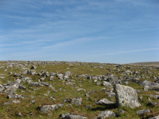
Prehistoric sites within 2km of SX 58401 69021
Guidance for walkers: The monuments featured in this database are archaeological treasures and need to be protected and preserved - please do not disturb any sites. Please check access and firing times before visiting sites, not all sites listed are on open access land. Firing ranges and boundaries of open access areas are marked on the OL28 OS Dartmoor Explorer map. Please stick to the country code and consider giving support to the numerous agencies that help to keep Dartmoor a fabulous natural and historic environment!
About the database listings: In all listings clicking on the photo or the site name will open a page for the site with a larger photo and further details from the database. The database now has over 6680 records covering nearly all publicly listed sites on Dartmoor including around 4800 round houses. This level of detail is of interest to archaeologists but tends to swamp listings of sites more likely to be of interest for walkers. For this reason, the listings default to around 550 core sites only. These are the stone circles, stone rows and the ring cairns listed by Turner. The default search radius is 2 km. The controls below the map can be used to start a new search by entering a 6- or 8-digit reference (without the prefix "SX"). The search radius can be specified and you can add incremental Display layers of detail on top of the core sites. If using a more detailed layer you will need to decrease the search radius to avoid getting hundreds of search results.
- Core sites Default listing of core sites consisting of stone circles & rows and some of the major ring cairns.
- Plus cairns adds approx. 1000 cairns and other minor sites not included in the core listings but excluding round houses.
- Plus round houses adds approx. 4800 round houses.
- Plus non-sites adds in the records for sites that no longer exist or are not prehistoric sites.
- Plus duplicates adds records excluded as duplicates. Those maybe duplicate records in external listings (e.g. the Historic Environment Records). For example, some sites have been identified as cairns in some listings and interpreted as round houses in other listings and both records appear.
These listings have incorporated, matched up and merged all of the records from all of the major archaeological listings including: Worth, Grinsell, Turner, Butler, Bill Radcliffe, Sandy Gerrard, Megalithic Portal, the National Monument Records and the Historic Environment Records. The author would like to thank Bill, Sandy, the lovely people both at Megalithic Portal (especially Anne Tate who did an amazing job to link listings) and at ACE Archaeology for collaborative work over the years to synchronise and correct listings across the various websites which now interlink. A culmination of years of work the final merger of cairn records took 3 months of cross referencing in 2017 the result being a snapshot of the records at that time. This data has in turn been refined since by field work and research. The round house data was supplied by Sandy Gerrard. Grid references are in order of accuracy: from Google Earth satellite, if visible and found, from a Garmin GPS reading, if visited by the author and from the literature otherwise. Individual site pages will state the source of the grid reference and provide satellite imagery. If a site listing lacks a photo it has not yet been visited by the author in which case the grid reference is from the literature.
Currently the database only includes sites which can be represented by a grid reference. Reaves are not included as they require GIS shape technology which is beyond the current capability of this system. To see the sources for the records, look at the tables on the resources menu. The database listings can also be viewed on a Google map and downloaded as GPS datasets for Garmin devices.
Corrections, or any feedback or suggestions are very welcome, email: info@dartmoorwalks.org.uk.
NOTE: Clicking on the icons for each monument in the map will give the name of the site. You can zoom in and out and drag the map around.
List of sites within 2km of SX 58401 69021
Drizzlecombe Round House
OS Map: SX 59345 67265
HER: MDV4033
ShortName: HT:Drizzleco16
Nearby sites: SX 59345 67265
Distance: 1.99km
Drizzlecombe Round House
OS Map: SX 59315 67246
HER: MDV4033
ShortName: HT:Drizzleco18
Nearby sites: SX 59315 67246
Distance: 2.00km
Drizzlecombe Round House
OS Map: SX 59313 67284
HER: MDV4033
ShortName: HT:Drizzleco19
Nearby sites: SX 59313 67284
Distance: 1.96km
Hemery's Rows Reported Cist
OS Map: SX 591 693
HER: MDV56216
PMD: Hemery's Rows
ShortName: CT?Hemery's 1
Notes: "Aligned with the row and two hundred yards beyond its termination is a cairn, and near this a pear-shaped pound having one good entrance-jamb standing; a little to the south there stands a much overgrown single row (of only nine stones) leading to the (probable) remains of a kistvaen, and yet another single row, fallen and overgrown leading north-east to a ruined cairn". Hemery High Dartmoor p.147
Nearby sites: SX 591 693
Distance: 0.75km
Raddick Hill SE pound Cist
OS Map: SX 57712 70827
HER: MDV-1
PMD: Raddick Hill SE pound
ShortName: CT Raddick H6
Notes: Radcliffe: "Possible cist found by RH Bruce on 11th Feb 2016. A stone set vertically across a section of the pound wall, with another stone aligned with the wall, the two giving the appearance of a side and end of a cist. There are two large stones downslope within the pound, possibly another sidestone and capstone. The DNPA archaeologist happened to be on hand, and agreed it is a possible cist." Visited by author on 22/07/19 - looks very much like a cist embedded in a pound wall. There is no HER entry for this site, the enclosed settlement is HER record MDV4952.
Nearby sites: SX 57712 70827
Distance: 1.93km
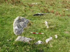
Raddick Hill W.2 Cairn
OS Map: SX 57553 70832
HER: MDV48476
ShortName: CN Raddick H12
Butler map: 46.3.2
Notes: Butler Raddick Hill W.1-7 has been split into 7 records.NMR: 8 cairns, see also 440321. See Butler Vol.3 p56-7 fig 46.3 - group of cairns just north of enclosure C. The author visited this group of cairns on 22/07/19. It is impossible to match up these cairns with these records. Butler gave just one grid reference for the group and the HER entries do not accurately transpose on to what is actually there on the ground. The grid references used for this group of records match the location of the site in the photo as recorded with a Garmin GPS device. The assignment/match with HER records is arbitrary and/or as good a match going by cairn size as the grid references are too inaccurate to match by location.
This cairn notably has a hole that matches a slab that was clearly displaced from it and is located near the cairn.
Nearby sites: SX 57553 70832
Distance: 2.00km
Raddick Hill W.7 Cairn
OS Map: SX 57428 70748
ShortName: CN Raddick H17
Butler map: 46.3.7
Notes: Butler Raddick Hill W.1-7 has been split into 7 records.NMR: 8 cairns, see also 440321. See Butler Vol.3 p56-7 fig 46.3 - group of cairns just north of enclosure C. The author visited this group of cairns on 22/07/19. It is impossible to match up these cairns with these records. Butler gave just one grid reference for the group and the HER entries do not accurately transpose on to what is actually there on the ground. The grid references used for this group of records match the location of the site in the photo as recorded with a Garmin GPS device. The assignment/match with HER records is arbitrary and/or as good a match going by cairn size as the grid references are too inaccurate to match by location.
UPDATE 02/01/2023 HER entry MDV50943 that this record used to link to has been deleted. The are new HER entries but they are too confusing to match up in any meaningful way.
Nearby sites: SX 57428 70748
Distance: 1.95km
Outcombe Round House
OS Map: SX 58405 68132
HER: MDV25100
ShortName: HT:Outcombe1
Nearby sites: SX 58405 68132
Distance: 0.89km
Raddick Hilll (SW slope) Reported Cairn
OS Map: SX 57456 70752
HER: MDV28494
ShortName: CN?Raddick H19
Grinsell: WAL 17a
Notes: This cairn was not identified in dense gorse vegetation. See also HER 48474
Nearby sites: SX 57456 70752
Distance: 1.97km
Newleycombe Lake Cairn
OS Map: SX 5963 6983
HER: MDV52393
ShortName: CN:Newleycombe
Nearby sites: SX 5963 6983
Distance: 1.47km
Stanlake Plantation Round House
OS Map: SX 56845 70220
HER: MDV12834
ShortName: HT:Stanlake 6
Nearby sites: SX 56845 70220
Distance: 1.96km
Stanlake Plantation Round House
OS Map: SX 56820 70223
HER: MDV12834
ShortName: HT:Stanlake 12
Nearby sites: SX 56820 70223
Distance: 1.99km
Stanlake Plantation Round House
OS Map: SX 56844 70268
HER: MDV12834
ShortName: HT:Stanlake 15
Nearby sites: SX 56844 70268
Distance: 1.99km
Stanlake Plantation Round House
OS Map: SX 56896 70285
HER: MDV4996
ShortName: HT:Stanlake 19
Notes: This record is a duplicate of SiteID=299 which is currently listed as a cairn but is in fact a round house.
Nearby sites: SX 56896 70285
Distance: 1.97km
Stanlake Plantation Round House
OS Map: SX 56863 70249
HER: MDV12834
ShortName: HT:Stanlake 22
Nearby sites: SX 56863 70249
Distance: 1.97km
Stanlake Plantation Round House
OS Map: SX 56840 70241
HER: MDV12834
ShortName: HT:Stanlake 23
Nearby sites: SX 56840 70241
Distance: 1.98km
Stanlake Plantation Round House
OS Map: SX 56870 70246
HER: MDV12834
ShortName: HT:Stanlake 24
Nearby sites: SX 56870 70246
Distance: 1.96km
Stanlake Plantation Round House
OS Map: SX 56852 70274
HER: MDV12834
ShortName: HT:Stanlake 25
Nearby sites: SX 56852 70274
Distance: 1.99km
Whittenknowles Rocks Round House
OS Map: SX 58645 67038
HER: MDV3995
ShortName: HT:Whittenkn1
Nearby sites: SX 58645 67038
Distance: 2.00km
Gutter Tor N Round House
OS Map: SX 57847 67329
HER: MDV23178
ShortName: HT:Gutter To6
Nearby sites: SX 57847 67329
Distance: 1.78km
Whittenknowles Rocks Round House
OS Map: SX 58613 67078
HER: MDV3995
ShortName: HT:Whittenkn3
Nearby sites: SX 58613 67078
Distance: 1.95km
Whittenknowles Rocks Round House
OS Map: SX 58620 67048
HER: MDV3995
ShortName: HT:Whittenkn4
Nearby sites: SX 58620 67048
Distance: 1.99km
Whittenknowles Rocks Round House
OS Map: SX 58494 67049
HER: MDV3995
ShortName: HT:Whittenkn5
Nearby sites: SX 58494 67049
Distance: 1.97km
Whittenknowles Rocks Round House
OS Map: SX 58633 67041
HER: MDV3995
ShortName: HT:Whittenkn6
Nearby sites: SX 58633 67041
Distance: 1.99km
Whittenknowles Rocks Round House
OS Map: SX 58642 67079
HER: MDV3995
ShortName: HT:Whittenkn7
Nearby sites: SX 58642 67079
Distance: 1.96km
Whittenknowles Rocks Round House
OS Map: SX 58587 67065
HER: MDV3995
ShortName: HT:Whittenkn9
Nearby sites: SX 58587 67065
Distance: 1.96km
Down Tor, SE of, Tor cairn Cairn
OS Map: SX 58105 69391
HER: MDV61957
ShortName: CN:DownTor1
Notes: "6m by 5.8m by 0.4m high. Two parallel lines of edge set stones form the n side of the cairn. They lead from a large granite outcrop situated to the w. The inner line of stones survives as a 4.3m long by 0.8m wide line of at least 10 stones. The outer is 4m long and also includes at least 10 stones. The s side is denoted by 9 stones set on top of a large granite boulder. The e side includes a jumble of large stones, with others lying on the slope directly below. The w side is formed by the tor. The area enclosed by these features measures 6m wide at the w end, 2.8m wide at the e end and up to 4.3m long e-w."
Nearby sites: SX 58105 69391
Distance: 0.47km
Whittenknowles Rocks Round House
OS Map: SX 58491 67104
HER: MDV3995
ShortName: HT:Whittenkn11
Nearby sites: SX 58491 67104
Distance: 1.92km
Whittenknowles Rocks Round House
OS Map: SX 58662 67089
HER: MDV3995
ShortName: HT:Whittenkn12
Nearby sites: SX 58662 67089
Distance: 1.95km
Whittenknowles Rocks Round House
OS Map: SX 58490 67067
HER: MDV3995
ShortName: HT:Whittenkn13
Nearby sites: SX 58490 67067
Distance: 1.96km
Whittenknowles Rocks Round House
OS Map: SX 58665 67085
HER: MDV3995
ShortName: HT:Whittenkn15
Nearby sites: SX 58665 67085
Distance: 1.95km
Whittenknowles Rocks Round House
OS Map: SX 58482 67026
HER: MDV3995
ShortName: HT:Whittenkn16
Nearby sites: SX 58482 67026
Distance: 2.00km
Whittenknowles Rocks Round House
OS Map: SX 58473 67113
HER: MDV3995
ShortName: HT:Whittenkn17
Nearby sites: SX 58473 67113
Distance: 1.91km
Whittenknowles Rocks Round House
OS Map: SX 58553 67048
HER: MDV3995
ShortName: HT:Whittenkn18
Nearby sites: SX 58553 67048
Distance: 1.98km
Whittenknowles Rocks Round House
OS Map: SX 58512 67099
HER: MDV3995
ShortName: HT:Whittenkn21
Nearby sites: SX 58512 67099
Distance: 1.93km
Whittenknowles Rocks Round House
OS Map: SX 58511 67033
HER: MDV3995
ShortName: HT:Whittenkn22
Nearby sites: SX 58511 67033
Distance: 1.99km
Raddick Hill Round House
OS Map: SX 57762 70754
HER: MDV4952
ShortName: HT:Raddick H1
Nearby sites: SX 57762 70754
Distance: 1.85km
Whittenknowles Rocks Round House
OS Map: SX 58512 67058
HER: MDV3995
ShortName: HT:Whittenkn23
Nearby sites: SX 58512 67058
Distance: 1.97km
Cuckoo Rock E.1 Cairn
OS Map: SX 5909 6881
HER: MDV3477
ShortName: CN:Cuckoo ro1
Notes: UPDATE 31/12/2022. The 8 HER records MDV66371 - MDV66378 that these records were based on have since been deleted. The old NMR record has this entry:
Summary : Remains of a cairnfield and enclosure. The cairnfield contains at least sixteen circular and oval mounds, with five arranged in a single line along the contour. The enclosure, which incorporates two of the cairns, is defined by a rubble bank.
Centred at SX 590 687 are seven stony mounds in a boulder-free area some 90.0m by 130.0m. They average 3.0m in diameter and 0.7m high. Also visible is the fragmentary remains of a field
25.0m by 38.0m with rubble walling 0.8m wide and 0.3m high. It is fairly certain these are the mounds referred to by Breton. The general situation, construction and appearance of the mounds suggests that they are clearance. The period of the clearance is uncertain though the apparently prehistoric field wall has also been partly stripped out suggesting a late (19th century) date.
The mounds are at, SX 59096881, SX 59146880, SX 59136879, SX 59096879, SX 59096875, SX 59106874 and SX 59106873.
Surveyed at 1:10 000 on MSD. (2)
SX 59106878. Remains of a Bronze Age cairnfield and enclosure. The cairnfield contains at least nine circular and oval mounds, with five arranged in a single line along the contour. The enclosure, which incorporates two of the cairns, is defined by a rubble bank. A large stone set through the southern bank may represent the site of an original entrance. Scheduled. (3)
Sixteen small turf covered mounds, and a short length of bank have been recorded. The largest of the cairns is 3m diameter by 0.4m high. The bank is less than 1m wide by 0.2m high. There can be no certainty as to date for any of these features, though the existence of a nearby settlement suggests a prehistoric origin. (4)
Nearby sites: SX 5909 6881
Distance: 0.72km
Whittenknowles Rocks Round House
OS Map: SX 58521 67057
HER: MDV3995
ShortName: HT:Whittenkn24
Nearby sites: SX 58521 67057
Distance: 1.97km
Cuckoo Rock E.2 Cairn
OS Map: SX 5912 6881
HER: MDV3477
ShortName: CN:Cuckoo ro2
Notes: UPDATE 31/12/2022. The 8 HER records MDV66371 - MDV66378 that these records were based on have since been deleted. Summary : Remains of a cairnfield and enclosure. The cairnfield contains at least sixteen circular and oval mounds, with five arranged in a single line along the contour. The enclosure, which incorporates two of the cairns, is defined by a rubble bank. NB. See first of these records for further details.
Nearby sites: SX 5912 6881
Distance: 0.75km
Whittenknowles Rocks Round House
OS Map: SX 58524 67079
HER: MDV3995
ShortName: HT:Whittenkn25
Nearby sites: SX 58524 67079
Distance: 1.95km
Cuckoo Rock E.3 Cairn
OS Map: SX 5908 6878
HER: MDV3477
ShortName: CN:Cuckoo ro3
Notes: UPDATE 31/12/2022. The 8 HER records MDV66371 - MDV66378 that these records were based on have since been deleted. Summary : Remains of a cairnfield and enclosure. The cairnfield contains at least sixteen circular and oval mounds, with five arranged in a single line along the contour. The enclosure, which incorporates two of the cairns, is defined by a rubble bank. NB. See first of these records for further details.
Nearby sites: SX 5908 6878
Distance: 0.72km
Whittenknowles Rocks Round House
OS Map: SX 58595 67061
HER: MDV3995
ShortName: HT:Whittenkn26
Nearby sites: SX 58595 67061
Distance: 1.97km
Cuckoo Rock E.4 Cairn
OS Map: SX 5909 6875
HER: MDV3477
ShortName: CN:Cuckoo ro4
Notes: UPDATE 31/12/2022. The 8 HER records MDV66371 - MDV66378 that these records were based on have since been deleted. Summary : Remains of a cairnfield and enclosure. The cairnfield contains at least sixteen circular and oval mounds, with five arranged in a single line along the contour. The enclosure, which incorporates two of the cairns, is defined by a rubble bank. NB. See first of these records for further details.
Nearby sites: SX 5909 6875
Distance: 0.74km
Whittenknowles Rocks Round House
OS Map: SX 58540 67053
HER: MDV3995
ShortName: HT:Whittenkn27
Nearby sites: SX 58540 67053
Distance: 1.97km
Cuckoo Rock E.5 Cairn
OS Map: SX 5910 6874
HER: MDV3477
ShortName: CN:Cuckoo ro5
Notes: UPDATE 31/12/2022. The 8 HER records MDV66371 - MDV66378 that these records were based on have since been deleted. Summary : Remains of a cairnfield and enclosure. The cairnfield contains at least sixteen circular and oval mounds, with five arranged in a single line along the contour. The enclosure, which incorporates two of the cairns, is defined by a rubble bank. NB. See first of these records for further details.
Nearby sites: SX 5910 6874
Distance: 0.75km
Whittenknowles Rocks Round House
OS Map: SX 58479 67080
HER: MDV3995
ShortName: HT:Whittenkn28
Nearby sites: SX 58479 67080
Distance: 1.94km
Cuckoo Rock E.6 Cairn
OS Map: SX 5910 6873
HER: MDV3477
ShortName: CN:Cuckoo ro6
Notes: UPDATE 31/12/2022. The 8 HER records MDV66371 - MDV66378 that these records were based on have since been deleted. Summary : Remains of a cairnfield and enclosure. The cairnfield contains at least sixteen circular and oval mounds, with five arranged in a single line along the contour. The enclosure, which incorporates two of the cairns, is defined by a rubble bank. NB. See first of these records for further details.
Nearby sites: SX 5910 6873
Distance: 0.76km
Whittenknowles Rocks Round House
OS Map: SX 58561 67047
HER: MDV3995
ShortName: HT:Whittenkn29
Nearby sites: SX 58561 67047
Distance: 1.98km
Cuckoo Rock E.7 Cairn
OS Map: SX 5912 6878
HER: MDV3477
ShortName: CN:Cuckoo ro7
Notes: UPDATE 31/12/2022. The 8 HER records MDV66371 - MDV66378 that these records were based on have since been deleted. Summary : Remains of a cairnfield and enclosure. The cairnfield contains at least sixteen circular and oval mounds, with five arranged in a single line along the contour. The enclosure, which incorporates two of the cairns, is defined by a rubble bank. NB. See first of these records for further details.
Nearby sites: SX 5912 6878
Distance: 0.76km
Cuckoo Rock E.8 Cairn
OS Map: SX 5915 6879
HER: MDV3477
ShortName: CN:Cuckoo ro8
Notes: UPDATE 31/12/2022. The 8 HER records MDV66371 - MDV66378 that these records were based on have since been deleted. Summary : Remains of a cairnfield and enclosure. The cairnfield contains at least sixteen circular and oval mounds, with five arranged in a single line along the contour. The enclosure, which incorporates two of the cairns, is defined by a rubble bank. NB. See first of these records for further details.
Nearby sites: SX 5915 6879
Distance: 0.78km
Whittenknowles Rocks Round House
OS Map: SX 58571 67035
HER: MDV3995
ShortName: HT:Whittenkn31
Nearby sites: SX 58571 67035
Distance: 1.99km
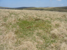
Hingston Hill SW Round House
OS Map: SX 58446 69024
HER: MDV52380
ShortName: HT:Hingston 1
Nearby sites: SX 58446 69024
Distance: 0.05km
Hingston Hill SW Round House
OS Map: SX 58429 69016
HER: MDV52380
ShortName: HT:Hingston 2
Nearby sites: SX 58429 69016
Distance: 0.03km
Whittenknowles Rocks Round House
OS Map: SX 58575 67093
HER: MDV3995
ShortName: HT:Whittenkn33
Nearby sites: SX 58575 67093
Distance: 1.94km
Hingston Hill SW Round House
OS Map: SX 58433 69013
HER: MDV52380
ShortName: HT:Hingston 3
Nearby sites: SX 58433 69013
Distance: 0.03km
Whittenknowles Rocks Round House
OS Map: SX 58492 67030
HER: MDV3995
ShortName: HT:Whittenkn34
Nearby sites: SX 58492 67030
Distance: 1.99km
Hingston Hill SW Round House
OS Map: SX 58405 68969
HER: MDV52380
ShortName: HT:Hingston 4
Nearby sites: SX 58405 68969
Distance: 0.05km
Hingston Hill SW Round House
OS Map: SX 58419 68982
HER: MDV52380
ShortName: HT:Hingston 5
Nearby sites: SX 58419 68982
Distance: 0.04km
Whittenknowles Rocks Round House
OS Map: SX 58532 67053
HER: MDV3995
ShortName: HT:Whittenkn36
Nearby sites: SX 58532 67053
Distance: 1.97km
Hingston Hill SW Round House
OS Map: SX 58407 69049
HER: MDV52380
ShortName: HT:Hingston 6
Nearby sites: SX 58407 69049
Distance: 0.03km
Hingston Hill SW Round House
OS Map: SX 58441 69027
HER: MDV52380
ShortName: HT:Hingston 7
Nearby sites: SX 58441 69027
Distance: 0.04km
Whittenknowles Rocks Round House
OS Map: SX 58454 67109
HER: MDV3995
ShortName: HT:Whittenkn38
Nearby sites: SX 58454 67109
Distance: 1.91km
Hingston Hill SW Round House
OS Map: SX 58416 69031
HER: MDV52380
ShortName: HT:Hingston 8
Nearby sites: SX 58416 69031
Distance: 0.02km
Whittenknowles Rocks Round House
OS Map: SX 58458 67044
HER: MDV3995
ShortName: HT:Whittenkn39
Nearby sites: SX 58458 67044
Distance: 1.98km
Hingston Hill SW Round House
OS Map: SX 58406 69000
HER: MDV52380
ShortName: HT:Hingston 9
Nearby sites: SX 58406 69000
Distance: 0.02km
Whittenknowles Rocks Round House
OS Map: SX 58462 67063
HER: MDV3995
ShortName: HT:Whittenkn40
Nearby sites: SX 58462 67063
Distance: 1.96km
Hingston Hill SW Round House
OS Map: SX 58377 69019
HER: MDV52380
ShortName: HT:Hingston 10
Nearby sites: SX 58377 69019
Distance: 0.02km
Whittenknowles Rocks Round House
OS Map: SX 58464 67035
HER: MDV3995
ShortName: HT:Whittenkn41
Nearby sites: SX 58464 67035
Distance: 1.99km
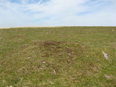
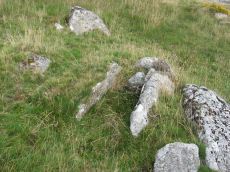
Hingston Hill SW Round House
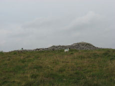
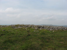
OS Map: SX 58401 69021
HER: MDV52380
ShortName: HT:Hingston 11
Nearby sites: SX 58401 69021
Distance: 0.00km
Whittenknowles Rocks Round House
OS Map: SX 58495 67036
HER: MDV3995
ShortName: HT:Whittenkn42
Nearby sites: SX 58495 67036
Distance: 1.99km
Yellowmead Down 4 Cairn Circle
OS Map: SX 58195 67810
HER: MDV102935
ShortName: CN Yellowmead4
Nearby sites: SX 58195 67810
Distance: 1.23km
Hingston Hill SW Round House
OS Map: SX 58393 68995
HER: MDV52380
ShortName: HT:Hingston 12
Nearby sites: SX 58393 68995
Distance: 0.03km
Hingston Hill SW Round House
OS Map: SX 58375 68983
HER: MDV52380
ShortName: HT:Hingston 13
Nearby sites: SX 58375 68983
Distance: 0.05km
Whittenknowles Rocks Round House
OS Map: SX 58475 67088
HER: MDV3995
ShortName: HT:Whittenkn44
Nearby sites: SX 58475 67088
Distance: 1.93km
Hingston Hill SW Round House
OS Map: SX 58403 68981
HER: MDV52380
ShortName: HT:Hingston 14
Nearby sites: SX 58403 68981
Distance: 0.04km
Whittenknowles Rocks Round House
OS Map: SX 58673 67058
HER: MDV3995
ShortName: HT:Whittenkn45
Nearby sites: SX 58673 67058
Distance: 1.98km
Hingston Hill SW Round House
OS Map: SX 58368 68996
HER: MDV52380
ShortName: HT:Hingston 15
Nearby sites: SX 58368 68996
Distance: 0.04km
Whittenknowles Rocks Round House
OS Map: SX 58473 67025
HER: MDV3995
ShortName: HT:Whittenkn46
Nearby sites: SX 58473 67025
Distance: 2.00km
Raddick Hill W.1 Cairn
OS Map: SX 5755 7082
HER: MDV4963
ShortName: CN:Raddick H11
Butler map: 46.3.1
Notes: Butler Raddick Hill W.1-7 has been split into 7 records.NMR: 8 cairns, see also 440321. See Butler Vol. 3 p56-7 fig 46.3 - group of cairns just north of enclosure C. The author visited this group of cairns on 22/07/19. On that occasion only 6 of these cairns were logged and the co-ordinates did not match up with the HER records. This record records the location of the group cairns and is a place holder for one of the missing cairns - the co-ordinates will be updated to match if and when found.
Nearby sites: SX 5755 7082
Distance: 1.99km
Raddick Plantation 1 Cairn
OS Map: SX 57511 70303
HER: MDV5008
ShortName: CN:Raddick P1
Butler map: 46.4.1
Notes: Matches NMR. Not clear on Grinsell he gives a grid reference 23m off at 57277028 Burator Wood (WAL 35) WAL 35?
Nearby sites: SX 57511 70303
Distance: 1.56km
Yellowmead Down 5 Cairn
OS Map: SX 58371 67842
HER: MDV103585
ShortName: CN:Yellowmead5
Nearby sites: SX 58371 67842
Distance: 1.18km
Raddick Plantation 2 Cairn
OS Map: SX 57508 70261
HER: MDV48351
ShortName: CN:Raddick P2
Butler map: 46.4.2
Notes: sub-circular cairn, 5m diam, 0.2m high (mpp). Location? Butler's description suggests couldbe octed at SX 57847 70310.
Nearby sites: SX 57508 70261
Distance: 1.53km
Raddick Hill S Round House
OS Map: SX 57700 70778
HER: MDV4952
ShortName: HT:Raddick H33
Nearby sites: SX 57700 70778
Distance: 1.89km
Raddick Hill S Round House
OS Map: SX 57706 70780
HER: MDV4952
ShortName: HT:Raddick H34
Nearby sites: SX 57706 70780
Distance: 1.89km
Raddick Hill S Round House
OS Map: SX 57692 70762
HER: MDV4952
ShortName: HT:Raddick H35
Nearby sites: SX 57692 70762
Distance: 1.88km
Raddick Hill S Round House
OS Map: SX 57678 70761
HER: MDV4952
ShortName: HT:Raddick H36
Nearby sites: SX 57678 70761
Distance: 1.88km
Raddick Hill S Round House
OS Map: SX 5765 7082
HER: MDV4952
ShortName: HT:Raddick H37
Nearby sites: SX 5765 7082
Distance: 1.95km
Raddick Hill S Round House
OS Map: SX 57641 70795
HER: MDV4952
ShortName: HT:Raddick H38
Nearby sites: SX 57641 70795
Distance: 1.93km
Cramber Tor S.1-11 Reported Cairn
OS Map: SX 584 705
ShortName: CNxCramber T1
Butler map: 46.7
Notes: Two irregular enclosures and fifteen associated clearance cairns on the southern slopes of Cramber Tor
Nearby sites: SX 584 705
Distance: 1.48km
Raddick Hill S Round House
OS Map: SX 57675 70791
HER: MDV4952
ShortName: HT:Raddick H39
Nearby sites: SX 57675 70791
Distance: 1.91km
Raddick Hill S Round House
OS Map: SX 57658 70794
HER: MDV4952
ShortName: HT:Raddick H40
Nearby sites: SX 57658 70794
Distance: 1.92km
Raddick Hill S Round House
OS Map: SX 57631 70788
HER: MDV4952
ShortName: HT:Raddick H41
Nearby sites: SX 57631 70788
Distance: 1.93km
Narrator Brookhead 2, 3 Reported Cairn
OS Map: SX 5864 6931
ShortName: CN:Narrator 2
Butler map: 47.7.2,3
Notes: Butler: AT the base of Narrator Brookhead 1 "on the west side are two tiny mounds nomore than 2.5m across containing upended slabs, miniature cairns like those at the foot of Giant's Basin". No entry in NMR or HER.
Nearby sites: SX 5864 6931
Distance: 0.38km
Raddick Hill S Round House
OS Map: SX 57706 70761
HER: MDV4952
ShortName: HT:Raddick H42
Nearby sites: SX 57706 70761
Distance: 1.87km
Narrator Brookhead 4 Reported Cairn
OS Map: SX 5910 6937
ShortName: CN?Narrator 3
Butler map: 47.7.4
Notes: Buler lists this as a small cairn. An entry appears in the NMR but not in te HER.
Nearby sites: SX 5910 6937
Distance: 0.78km
Raddick Plantation Round House
OS Map: SX 57569 70348
HER: MDV52319
ShortName: HT:Raddick P1
Nearby sites: SX 57569 70348
Distance: 1.57km
Narrator Brookhead 5 Reported Cairn
OS Map: SX 5926 6944
ShortName: CN:Narrator 4
Butler map: 47.7.5
Notes: Butler: "the overgrown remains of another [cairn] with two inner rings but no apparent retaining circle". No entry in NMR or HER.
Nearby sites: SX 5926 6944
Distance: 0.96km
Raddick Plantation Round House
OS Map: SX 57723 70319
HER: MDV52354
ShortName: HT:Raddick P2
Nearby sites: SX 57723 70319
Distance: 1.46km
Drizzlecombe 23 Reported Cairn
OS Map: SX 59423 67331
HER: MDV103613
ShortName: CN Drizzle 23
Notes: This record has previously been listed as a "pos duplicate". However, there is a cairn at this location that matches no other records as can be seen in the photo. The HER NGR was SX 59418 67321. The item in the photo is at SX 59423 67331
Nearby sites: SX 59423 67331
Distance: 1.97km
Raddick Plantation Round House
OS Map: SX 57577 70351
HER: MDV52318
ShortName: HT:Raddick P3
Nearby sites: SX 57577 70351
Distance: 1.56km
Raddick Plantation Round House
OS Map: SX 57772 70190
HER: MDV52354
ShortName: HT:Raddick P4
Nearby sites: SX 57772 70190
Distance: 1.33km
Raddick Plantation Round House
OS Map: SX 57711 70176
HER: MDV52354
ShortName: HT:Raddick P5
Nearby sites: SX 57711 70176
Distance: 1.35km
Raddick Plantation Round House
OS Map: SX 57746 70190
HER: MDV52354
ShortName: HT:Raddick P6
Nearby sites: SX 57746 70190
Distance: 1.34km
Hingston Hill Summit 2 Reported Cairn
OS Map: SX 58753 69483
ShortName: CN-Hingston 9
Butler map: 47.12.2
Notes: Butler: "Another burial mound lies just over the crest 220 m to the north [of te Down Tor cairn and row], an inconspicuous mound at the centre close to a line of tinners' pits". No entry in NMR or HER.
Nearby sites: SX 58753 69483
Distance: 0.58km
Raddick Plantation Round House
OS Map: SX 5775 7033
HER: MDV52354
ShortName: HT:Raddick P7
Nearby sites: SX 5775 7033
Distance: 1.46km
Combshead Tor Round House
OS Map: SX 58566 68786
HER: MDV66668
ShortName: HT:Combshead1
Nearby sites: SX 58566 68786
Distance: 0.29km
Raddick Plantation Round House
OS Map: SX 57756 70342
HER: MDV52354
ShortName: HT:Raddick P8
Nearby sites: SX 57756 70342
Distance: 1.47km
Combshead Tor Round House
OS Map: SX 58606 68684
HER: MDV66667
ShortName: HT:Combshead2
Nearby sites: SX 58606 68684
Distance: 0.39km
Raddick Plantation Round House
OS Map: SX 57756 70328
HER: MDV52354
ShortName: HT:Raddick P9
Nearby sites: SX 57756 70328
Distance: 1.46km
Combshead Tor Round House
OS Map: SX 5864 6867
HER: MDV66666
ShortName: HT:Combshead3
Nearby sites: SX 5864 6867
Distance: 0.42km
Raddick Plantation Round House
OS Map: SX 57755 70272
HER: MDV52354
ShortName: HT:Raddick P10
Nearby sites: SX 57755 70272
Distance: 1.41km
Combshead Tor Round House
OS Map: SX 5868 6874
HER: MDV66665
ShortName: HT:Combshead4
Nearby sites: SX 5868 6874
Distance: 0.40km
Raddick Plantation Round House
OS Map: SX 57761 70199
HER: MDV52354
ShortName: HT:Raddick P11
Nearby sites: SX 57761 70199
Distance: 1.34km
Drizzlecombe 24 Reported Cairn
OS Map: SX 59376 67356
HER: MDV103613
ShortName: CN Drizzle 24
Notes: There is a cairn at this location that matches no other records as can be seen in the photo. It is at the uphill end of a little known stone row.
Nearby sites: SX 59376 67356
Distance: 1.93km
Raddick Plantation Round House
OS Map: SX 57772 70343
HER: MDV52354
ShortName: HT:Raddick P12
Nearby sites: SX 57772 70343
Distance: 1.46km
Yellowmead Down 2 Cairn
OS Map: SX 57782 67747
HER: MDV4026
ShortName: CN Yellowmead2
Butler map: 47.14.2
Grinsell: SHE 6
Nearby sites: SX 57782 67747
Distance: 1.42km
Raddick Plantation Round House
OS Map: SX 57744 70308
HER: MDV52354
ShortName: HT:Raddick P13
Nearby sites: SX 57744 70308
Distance: 1.44km
Yellowmead Down 3 Cairn
OS Map: SX 5748 6813
HER: MDV20141
ShortName: CN:Yellowmead3
Butler map: 47.14.3
Grinsell: SHE 1
Nearby sites: SX 5748 6813
Distance: 1.28km
Raddick Plantation Round House
OS Map: SX 57773 70270
HER: MDV52354
ShortName: HT:Raddick P14
Nearby sites: SX 57773 70270
Distance: 1.40km
Sheepstor Brook Ford 1 Reported Cairn
OS Map: SX 5817 6749
HER: MDV103586
ShortName: CNxSheepstor1
Butler map: 47.14.4
Notes: NMR B. Group of clearance cairns north-west of Ditsworthy Warren thought to be medieval or later.
Nearby sites: SX 5817 6749
Distance: 1.55km
Raddick Plantation Round House
OS Map: SX 57737 70190
HER: MDV52354
ShortName: HT:Raddick P15
Nearby sites: SX 57737 70190
Distance: 1.34km
Sheepstor Brook Ford 2 Reported Cairn
OS Map: SX 5815 6747
HER: MDV103586
ShortName: CNxSheepstor2
Butler map: 47.14.5
Notes: NMR A. Group of clearance cairns north-west of Ditsworthy Warren thought to be medieval or later.
Nearby sites: SX 5815 6747
Distance: 1.57km
Raddick Plantation Round House
OS Map: SX 57775 70300
HER: MDV52354
ShortName: HT:Raddick P16
Nearby sites: SX 57775 70300
Distance: 1.42km
Sheepstor Brook Ford 3 Reported Cist
OS Map: SX 58207 67348
HER: MDV22766
PMD: Sheepstor Brook
ShortName: CT?Sheepstor3
Butler map: 47.14.6
Notes: A cairn lies on the SW facing slope E of the Scout Hut . It measures 5.0m in diameter and 0.5m high with a hollow in its S side. The form, location and relationship of all the cairns in this area is suggestive of clearance activity in the medieval or later periods. Radcliffe notes: "A possible endslab, noticed by WJR 19/5/2002 ". There is a typo in the grid reference. The NMR gives both SX58206734 & 58206743. Butler gives SX58206742. The HER gives SX58206734, probably taken from NMR. This cairn is also described in NMR 1237842 (a fourth cairn ...).
Nearby sites: SX 58207 67348
Distance: 1.68km
Raddick Plantation Round House
OS Map: SX 57775 70256
HER: MDV52354
ShortName: HT:Raddick P17
Nearby sites: SX 57775 70256
Distance: 1.38km
Eylesbarrow Cairn
OS Map: SX 59971 68587
HER: MDV4014
ShortName: CN Eylesbarr1
Butler map: 47.15
Grinsell: SHE 3
Barrow Report: 12
Notes: Southern of the 2 large cairns. Butler had SHE 2 - typo!
Nearby sites: SX 59971 68587
Distance: 1.63km
Raddick Plantation Round House
OS Map: SX 57784 70339
HER: MDV52354
ShortName: HT:Raddick P18
Nearby sites: SX 57784 70339
Distance: 1.46km
Eylesbarrow 1 Cairn
OS Map: SX 59958 68627
HER: MDV4031
ShortName: CN Eylesbarr3
Butler map: 47.15.1
Grinsell: WAL 33
Barrow Report: 12
Notes: Northern of the 2 large cairns
Nearby sites: SX 59958 68627
Distance: 1.61km
Eylesbarrow Round House
OS Map: SX 59320 68284
HER: MDV4035
ShortName: HT:Eylesbarr1
Nearby sites: SX 59320 68284
Distance: 1.18km
Raddick Plantation Round House
OS Map: SX 57789 70368
HER: MDV52354
ShortName: HT:Raddick P19
Nearby sites: SX 57789 70368
Distance: 1.48km
Eylesbarrow 2 Reported Cairn
OS Map: SX 5998 6858
ShortName: CN?Eylesbarr4
Butler map: 47.15.2
Notes: Butler: "Not unusually smaller cairns share the peaks withhe giants and two can be found east of th larger cairn (HER 4014) approcimately in line with the reave. Neither listed on HER.
Nearby sites: SX 5998 6858
Distance: 1.64km
Eylesbarrow Round House
OS Map: SX 59336 68279
HER: MDV4035
ShortName: HT:Eylesbarr2
Nearby sites: SX 59336 68279
Distance: 1.19km
Raddick Plantation Round House
OS Map: SX 57794 70355
HER: MDV52354
ShortName: HT:Raddick P20
Nearby sites: SX 57794 70355
Distance: 1.47km
Eylesbarrow 3 Reported Cairn
OS Map: SX 6005 6858
ShortName: CN?Eylesbarr5
Butler map: 47.15.3
Notes: Butler: "Not unusually smaller cairns share the peaks withhe giants and two can be found east of th larger cairn (HER 4014) approcimately in line with the reave. Neither listed on HER.
Nearby sites: SX 6005 6858
Distance: 1.71km
Eylesbarrow Round House
OS Map: SX 59334 68171
HER: MDV4035
ShortName: HT:Eylesbarr3
Nearby sites: SX 59334 68171
Distance: 1.26km
Raddick Plantation Round House
OS Map: SX 5782 7015
HER: MDV52365
ShortName: HT:Raddick P21
Nearby sites: SX 5782 7015
Distance: 1.27km
Eylesbarrow Round House
OS Map: SX 59081 68546
HER: MDV52388
ShortName: HT:Eylesbarr4
Nearby sites: SX 59081 68546
Distance: 0.83km
Raddick Plantation Round House
OS Map: SX 5783 7012
HER: MDV52418
ShortName: HT:Raddick P22
Nearby sites: SX 5783 7012
Distance: 1.24km
Eylesbarrow Round House
OS Map: SX 58947 68465
HER: MDV66662
ShortName: HT:Eylesbarr5
Nearby sites: SX 58947 68465
Distance: 0.78km
Raddick Plantation Round House
OS Map: SX 57865 70308
HER: MDV52353
ShortName: HT:Raddick P23
Nearby sites: SX 57865 70308
Distance: 1.39km
Eylesbarrow Round House
OS Map: SX 5936 6848
HER: MDV25105
ShortName: HT:Eylesbarr6
Nearby sites: SX 5936 6848
Distance: 1.10km
Raddick Plantation Round House
OS Map: SX 57773 70292
HER: MDV52354
ShortName: HT:Raddick P24
Nearby sites: SX 57773 70292
Distance: 1.42km
Eylesbarrow Round House
OS Map: SX 5922 6857
HER: MDV25272
ShortName: HT:Eylesbarr7
Nearby sites: SX 5922 6857
Distance: 0.93km
Raddick Plantation Round House
OS Map: SX 57699 70180
HER: MDV52354
ShortName: HT:Raddick P25
Nearby sites: SX 57699 70180
Distance: 1.36km
Eylesbarrow Round House
OS Map: SX 59281 68296
HER: MDV4035
ShortName: HT:Eylesbarr8
Nearby sites: SX 59281 68296
Distance: 1.14km
Raddick Plantation Round House
OS Map: SX 5745 7014
HER: MDV35576
ShortName: HT:Raddick P26
Nearby sites: SX 5745 7014
Distance: 1.47km
Eylesbarrow Round House
OS Map: SX 59045 68518
HER: MDV52387
ShortName: HT:Eylesbarr9
Nearby sites: SX 59045 68518
Distance: 0.82km
Raddick Plantation Round House
OS Map: SX 5735 7015
HER: MDV35577
ShortName: HT:Raddick P27
Nearby sites: SX 5735 7015
Distance: 1.54km
Eylesbarrow Round House
OS Map: SX 59073 68311
HER: MDV52382
ShortName: HT:Eylesbarr10
Nearby sites: SX 59073 68311
Distance: 0.98km
Raddick Plantation Round House
OS Map: SX 5761 7023
HER: MDV12845
ShortName: HT:Raddick P28
Nearby sites: SX 5761 7023
Distance: 1.44km
Eylesbarrow Round House
OS Map: SX 59079 68588
HER: MDV52389
ShortName: HT:Eylesbarr11
Nearby sites: SX 59079 68588
Distance: 0.80km
Raddick Plantation Round House
OS Map: SX 57632 70323
HER: MDV52354
ShortName: HT:Raddick P29
Nearby sites: SX 57632 70323
Distance: 1.51km
Eylesbarrow Round House
OS Map: SX 59072 68514
HER: MDV3371
ShortName: HT:Eylesbarr12
Nearby sites: SX 59072 68514
Distance: 0.84km
Middleworth Round House
OS Map: SX 5756 6911
HER: MDV61955
ShortName: HT:Middlewor1
Nearby sites: SX 5756 6911
Distance: 0.85km
Raddick Plantation Round House
OS Map: SX 57676 70316
HER: MDV52354
ShortName: HT:Raddick P30
Nearby sites: SX 57676 70316
Distance: 1.48km
Eylesbarrow Round House
OS Map: SX 59062 68550
HER: MDV3371
ShortName: HT:Eylesbarr13
Nearby sites: SX 59062 68550
Distance: 0.81km
Middleworth Round House
OS Map: SX 5754 6910
HER: MDV61954
ShortName: HT:Middlewor2
Nearby sites: SX 5754 6910
Distance: 0.86km
Raddick Plantation Round House
OS Map: SX 57683 70180
HER: MDV52354
ShortName: HT:Raddick P31
Nearby sites: SX 57683 70180
Distance: 1.36km
Eylesbarrow Round House
OS Map: SX 59083 68507
HER: MDV52386
ShortName: HT:Eylesbarr14
Nearby sites: SX 59083 68507
Distance: 0.85km
Raddick Plantation Round House
OS Map: SX 57692 70194
HER: MDV52354
ShortName: HT:Raddick P32
Nearby sites: SX 57692 70194
Distance: 1.37km
Eylesbarrow Round House
OS Map: SX 59082 68326
HER: MDV52381
ShortName: HT:Eylesbarr15
Nearby sites: SX 59082 68326
Distance: 0.97km
Raddick Plantation Round House
OS Map: SX 57697 70356
HER: MDV52354
ShortName: HT:Raddick P33
Nearby sites: SX 57697 70356
Distance: 1.51km
Eylesbarrow Round House
OS Map: SX 59064 68545
HER: MDV3371
ShortName: HT:Eylesbarr16
Nearby sites: SX 59064 68545
Distance: 0.82km
Raddick Plantation Round House
OS Map: SX 57747 70272
HER: MDV52354
ShortName: HT:Raddick P34
Nearby sites: SX 57747 70272
Distance: 1.41km
Eylesbarrow Round House
OS Map: SX 59302 68282
HER: MDV4035
ShortName: HT:Eylesbarr17
Nearby sites: SX 59302 68282
Distance: 1.17km
Raddick Plantation Round House
OS Map: SX 57694 70180
HER: MDV52354
ShortName: HT:Raddick P35
Nearby sites: SX 57694 70180
Distance: 1.36km
Eylesbarrow Round House
OS Map: SX 58954 68473
HER: MDV66662
ShortName: HT:Eylesbarr18
Nearby sites: SX 58954 68473
Distance: 0.78km
Raddick Plantation Round House
OS Map: SX 575 701
HER: MDV28498
ShortName: HT:Raddick P36
Nearby sites: SX 575 701
Distance: 1.41km
Raddick Plantation Round House
OS Map: SX 57705 70326
HER: MDV52354
ShortName: HT:Raddick P37
Nearby sites: SX 57705 70326
Distance: 1.48km
Raddick Plantation Round House
OS Map: SX 57711 70366
HER: MDV52354
ShortName: HT:Raddick P38
Nearby sites: SX 57711 70366
Distance: 1.51km
Raddick Plantation Round House
OS Map: SX 57707 70192
HER: MDV52354
ShortName: HT:Raddick P39
Nearby sites: SX 57707 70192
Distance: 1.36km
Raddick Plantation Round House
OS Map: SX 57713 70374
HER: MDV52354
ShortName: HT:Raddick P40
Nearby sites: SX 57713 70374
Distance: 1.52km
Raddick Plantation Round House
OS Map: SX 57714 70356
HER: MDV52354
ShortName: HT:Raddick P41
Nearby sites: SX 57714 70356
Distance: 1.50km
Raddick Plantation Round House
OS Map: SX 57716 70178
HER: MDV52354
ShortName: HT:Raddick P42
Nearby sites: SX 57716 70178
Distance: 1.34km
Raddick Plantation Round House
OS Map: SX 57723 70310
HER: MDV52354
ShortName: HT:Raddick P43
Nearby sites: SX 57723 70310
Distance: 1.46km
Raddick Plantation Round House
OS Map: SX 57729 70209
HER: MDV52354
ShortName: HT:Raddick P44
Nearby sites: SX 57729 70209
Distance: 1.36km
Raddick Plantation Round House
OS Map: SX 57697 70295
HER: MDV52354
ShortName: HT:Raddick P45
Nearby sites: SX 57697 70295
Distance: 1.46km
Burrator Wood Reported Cairn
OS Map: SX 5727 7028
HER: MDV14311
ShortName: CN?Burrator 1
Grinsell: WAL 35
Notes: All are in a conifer plantation but are undoubtedly chearance cairns, probably of 18/19th century date when the area was enclosed.
Nearby sites: SX 5727 7028
Distance: 1.69km
Newleycombe Lake Round House
OS Map: SX 58903 70040
HER: MDV35504
ShortName: HT:Newleycom1
Nearby sites: SX 58903 70040
Distance: 1.14km
Newleycombe Lake Round House
OS Map: SX 58926 70011
HER: MDV35503
ShortName: HT:Newleycom2
Nearby sites: SX 58926 70011
Distance: 1.12km
Newleycombe Lake Head Round House
OS Map: SX 59429 70139
ShortName: HT:Newleycom3
Nearby sites: SX 59429 70139
Distance: 1.52km
Newleycombe Lake Head N Round House
OS Map: SX 59623 70006
HER: MDV50897
ShortName: HT:Newleycom4
Nearby sites: SX 59623 70006
Distance: 1.57km
Newleycombe Lake Head N Round House
OS Map: SX 59684 70047
HER: MDV3780
ShortName: HT:Newleycom5
Nearby sites: SX 59684 70047
Distance: 1.64km
Newleycombe Lake Head N Round House
OS Map: SX 5967 7003
HER: MDV3781
ShortName: HT:Newleycom6
Nearby sites: SX 5967 7003
Distance: 1.62km
Newleycombe Lake Head N Round House
OS Map: SX 5964 7000
HER: MDV50898
ShortName: HT:Newleycom7
Nearby sites: SX 5964 7000
Distance: 1.58km
Newleycombe Lake Head N Round House
OS Map: SX 59706 70003
HER: MDV3783
ShortName: HT:Newleycom8
Nearby sites: SX 59706 70003
Distance: 1.63km
Newleycombe Lake Head N Round House
OS Map: SX 59710 70012
HER: MDV3783
ShortName: HT:Newleycom9
Nearby sites: SX 59710 70012
Distance: 1.64km
Newleycombe Lake Head S Round House
OS Map: SX 59669 69824
HER: MDV3427
ShortName: HT:Newleycom10
Nearby sites: SX 59669 69824
Distance: 1.50km
Newleycombe Lake Head S Round House
OS Map: SX 59700 69798
HER: MDV3427
ShortName: HT:Newleycom11
Nearby sites: SX 59700 69798
Distance: 1.51km
Newleycombe Lake Head S Round House
OS Map: SX 59619 69806
HER: MDV3427
ShortName: HT:Newleycom12
Nearby sites: SX 59619 69806
Distance: 1.45km
Newleycombe Lake Head S Round House
OS Map: SX 59623 69880
HER: MDV3427
ShortName: HT:Newleycom13
Nearby sites: SX 59623 69880
Distance: 1.49km
Whittenknowles Rocks Cairn
OS Map: SX 58712 67167
HER: MDV66369
ShortName: CN:Whittenkn1
Butler map: 49.11
Notes: The cairn survives as a 4m diameter mound standing up to 0.6m high. Stones protruding around the western and southern edges of the mound may represent a kerb which survives elsewhere as a buried feature.
Nearby sites: SX 58712 67167
Distance: 1.88km
Newleycombe Lake Head S Round House
OS Map: SX 59564 69769
HER: MDV52434
ShortName: HT:Newleycom14
Nearby sites: SX 59564 69769
Distance: 1.38km
Sheeps Tor Round House
OS Map: SX 56959 68189
HER: MDV3354
ShortName: HT:Sheeps To1
Nearby sites: SX 56959 68189
Distance: 1.66km
Newleycombe Lake Head S Round House
OS Map: SX 59661 69774
HER: MDV3427
ShortName: HT:Newleycom15
Nearby sites: SX 59661 69774
Distance: 1.47km
Sheeps Tor Round House
OS Map: SX 56936 68165
HER: MDV3354
ShortName: HT:Sheeps To2
Nearby sites: SX 56936 68165
Distance: 1.70km
Newleycombe Lake Head S Round House
OS Map: SX 59678 69825
HER: MDV3427
ShortName: HT:Newleycom16
Nearby sites: SX 59678 69825
Distance: 1.51km
Sheeps Tor Round House
OS Map: SX 56900 68157
HER: MDV3354
ShortName: HT:Sheeps To3
Nearby sites: SX 56900 68157
Distance: 1.73km
Down Tor N Round House
OS Map: SX 58026 69681
HER: MDV52410
ShortName: HT:Down Tor 1
Nearby sites: SX 58026 69681
Distance: 0.76km
Newleycombe Lake Head S Round House
OS Map: SX 59547 69755
HER: MDV52432
ShortName: HT:Newleycom17
Nearby sites: SX 59547 69755
Distance: 1.36km
Sheeps Tor Round House
OS Map: SX 56971 68191
HER: MDV3354
ShortName: HT:Sheeps To4
Nearby sites: SX 56971 68191
Distance: 1.65km
Down Tor N Round House
OS Map: SX 58014 69706
HER: MDV52412
ShortName: HT:Down Tor 2
Nearby sites: SX 58014 69706
Distance: 0.79km
Newleycombe Lake Head S Round House
OS Map: SX 59575 69777
HER: MDV52435
ShortName: HT:Newleycom18
Nearby sites: SX 59575 69777
Distance: 1.40km
Sheeps Tor Round House
OS Map: SX 56985 68231
HER: MDV3354
ShortName: HT:Sheeps To5
Nearby sites: SX 56985 68231
Distance: 1.62km
Down Tor N Round House
OS Map: SX 58041 69720
HER: MDV52411
ShortName: HT:Down Tor 3
Nearby sites: SX 58041 69720
Distance: 0.79km
Newleycombe Lake Head S Round House
OS Map: SX 5957 6976
HER: MDV3429
ShortName: HT:Newleycom19
Nearby sites: SX 5957 6976
Distance: 1.38km
Down Tor N Round House
OS Map: SX 58034 69662
HER: MDV52409
ShortName: HT:Down Tor 4
Nearby sites: SX 58034 69662
Distance: 0.74km
Newleycombe Lake Head S Round House
OS Map: SX 59636 69849
HER: MDV3427
ShortName: HT:Newleycom20
Nearby sites: SX 59636 69849
Distance: 1.49km
Down Tor N Round House
OS Map: SX 58036 69753
HER: MDV52414
ShortName: HT:Down Tor 5
Nearby sites: SX 58036 69753
Distance: 0.82km
Newleycombe Lake Head S Round House
OS Map: SX 59704 69840
HER: MDV3427
ShortName: HT:Newleycom21
Nearby sites: SX 59704 69840
Distance: 1.54km
Down Tor N Round House
OS Map: SX 57971 69638
HER: MDV52404
ShortName: HT:Down Tor 6
Nearby sites: SX 57971 69638
Distance: 0.75km
Newleycombe Lake Head S Round House
OS Map: SX 59679 69763
HER: MDV3427
ShortName: HT:Newleycom22
Nearby sites: SX 59679 69763
Distance: 1.48km
Down Tor N Round House
OS Map: SX 58016 69735
HER: MDV52414
ShortName: HT:Down Tor 7
Nearby sites: SX 58016 69735
Distance: 0.81km
Newleycombe Lake Head S Round House
OS Map: SX 59561 69736
HER: MDV52438
ShortName: HT:Newleycom23
Nearby sites: SX 59561 69736
Distance: 1.36km
Down Tor N Round House
OS Map: SX 57976 69663
HER: MDV52406
ShortName: HT:Down Tor 8
Nearby sites: SX 57976 69663
Distance: 0.77km
Newleycombe Lake Head S Round House
OS Map: SX 59542 69762
HER: MDV52437
ShortName: HT:Newleycom24
Nearby sites: SX 59542 69762
Distance: 1.36km
Down Tor N Round House
OS Map: SX 57995 69671
HER: MDV52407
ShortName: HT:Down Tor 9
Nearby sites: SX 57995 69671
Distance: 0.77km
Down Tor N Round House
OS Map: SX 58011 69668
HER: MDV52409
ShortName: HT:Down Tor 10
Nearby sites: SX 58011 69668
Distance: 0.76km
Drizzlecombe Settlement Reported Cist
OS Map: SX 59232 67271
HER: MDV-1
PMD: Drizzlecombe Settlement
ShortName: CT-Drizzle 26
Notes: A claimed possible cist that could just be a natural arrangement. "An arrangement of stones made up of a pair of long edge-set orthostatic slabs placed to the E and S of a large tilted slab. It is possible that this is a disturbed cist, comprising a displaced sidestone and two endstones but the two orthostats are not parallel and there is no clear central depression. the length between the endstones is 1.2m and the height of the tilted slab is 0.49m. NGR SX 5928 6727" (From Robertson,Jennifer 1991 The Archaeology of the Upper Plym Unpublished PhD Thesis p875). No HER record, the NMR (Sept 1999) gives NGR SX 5927 6727. The item in the photo is probably the site referred to and is located at SX 59232 67271
Nearby sites: SX 59232 67271
Distance: 1.94km
Down Tor N Round House
OS Map: SX 57987 69634
HER: MDV52405
ShortName: HT:Down Tor 11
Nearby sites: SX 57987 69634
Distance: 0.74km
Down Tor S Round House
OS Map: SX 57999 69241
HER: MDV28532
ShortName: HT:Down Tor 12
Nearby sites: SX 57999 69241
Distance: 0.46km
Down Tor S Round House
OS Map: SX 57987 69236
HER: MDV28532
ShortName: HT:Down Tor 13
Nearby sites: SX 57987 69236
Distance: 0.47km
Down Tor S Round House
OS Map: SX 5798 6919
HER: MDV28532
ShortName: HT:Down Tor 14
Nearby sites: SX 5798 6919
Distance: 0.45km
Down Tor S Round House
OS Map: SX 57975 69154
HER: MDV53602
ShortName: HT:Down Tor 15
Nearby sites: SX 57975 69154
Distance: 0.45km
Eylesbarrow (reported cist) Reported Cairn
OS Map: SX 59733 68119
HER: MDV66398
PMD: Narrator Brookhead S
ShortName: CT?Eylesbarr2
Notes: Doubtful. SX 59406820. The site of a possible cist lies on the lower SW flank of Eylesbarrow some 400m W of Eylesbarrow Mine.The feature is marked by a single upright slab 1.1m long 0.2m wide and 0.3m high resembling a sidestone adjacent to a second slab 1.4m long and 0.9m wide perhaps representing the coverstone.Both stones are earthfast and are surrounded by a cluster of smaller stones which could represent the remains of a cairn. The area surrounding these stones has been disturbed by later tin extraction activity and it is also possible that they are products of this activity.
Nearby sites: SX 59733 68119
Distance: 1.61km
Cuckoo Rock Cup Stone
OS Map: SX 58463 68712
HER: MDV133689
ShortName: CS:Cuckoo Rock
Notes: "There appear to be eight circular cupmarks on the south-west corner of Cuckoo Rock in the Deancombe valley; apparently in pairs. Three pairs are arranged horizontally with a smaller pair just above them arranged vertically. Six of the marks measure approximately 5cm diameter by 2cm deep. The remaining two marks measure approximately 2cm diameter by 1cm deep. The carver likely stood on a boulder situated below to mark the rock. Reported to archaeologist at Dartmoor National Park authority who has visited the site (21/11/2022) and agrees with potential interpretation."
Nearby sites: SX 58463 68712
Distance: 0.32km
Deancombe Valley Cup Stone
OS Map: SX 57638 69264
HER: MDV133691
ShortName: CS:Deancombe
Notes: "SX 57638 69264 Two discreet circular cupmarks of ‘classic’ type are visible on the top surface of a small granite rock which is situated close to the base of the vertical west face of a massive boulder (one of the largest in the Deancombe valley)."
Nearby sites: SX 57638 69264
Distance: 0.80km
Down Tor Cairn
OS Map: SX 58642 69315
HER: MDV3440
Megalithic Portal: 27903
Alternate name: Hingston Hill Summit 1 Cairn
ShortName: CN DownTor
Butler map: 47.12.1
Grinsell: WAL 30
Notes: "cairn mound measures 15.5m in diam and stands up to 1.5m high. A t-shaped trench cutting into the centre of the mound suggests partial early excavation, though the results of the investigation are not known. This cairn forms part of a ritual complex of monuments including 3 cairns, a stone alignment and enclosure". Approx 70 m NW of the cairn circle at the end of the Down Tor stone row.
Nearby sites: SX 58642 69315
Distance: 0.38km
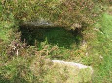
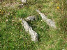
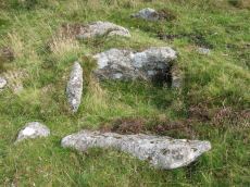
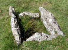
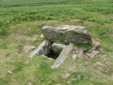
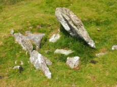
Down Tor Cist
OS Map: SX 58037 69293
HER: MDV3423
Megalithic Portal: 45757
PMD: Down Tor S.
Alternate name: Down Tor S. Cist
ShortName: CT Down Tor
Butler map: 47.5
DPD page: 28
Grinsell: WAL 26
Barrow Report: 67
Notes: Butler Down Tor S. Vol. 3. Map 47.5 (diagram p.67).
Nearby sites: SX 58037 69293
Distance: 0.45km
Down Tor N.E. (Eastern) Platform Cairn Circle and Cist
OS Map: SX 58397 69562
HER: MDV3499
Megalithic Portal: 52347
PMD: Down Tor N 3
Alternate name: Hingston Hill N.3 Platform Cairn Circle and Cist
ShortName: CT DownTorNE E
Butler map: 47.13.3
DPD page: 27
Grinsell: WAL 29
Turner: E34
Barrow Report: 73
Notes: Butler Hingston Hill N. 3. - Vol. 3. Map 47.13.3 (diagram p.73 OS SX58396955). Grinsell WALKHAMPTON 29 (OS 58276949 approx - same as HER MDV3499). Lethbridge p.27 Cist No.1.
Copyright for photos and plans from Barrow Reports 71-73 belongs to the Dixon estate. Reproduced here with kind permission.
Nearby sites: SX 58397 69562
Distance: 0.54km
Down Tor N.E. (Northern) Cist
OS Map: SX 58388 69568
HER: MDV3498
Megalithic Portal: 52348
PMD: Down Tor N 1
Alternate name: Hingston Hill N.1 Cist
ShortName: CT DownTorNE N
Butler map: 47.13.1
DPD page: 27
Grinsell: WAL 28
Barrow Report: 73
Notes: Butler Hingston Hill N. 1. - Vol. 3. Map 47.13.1 (diagram p.73 OS SX58386956). Grinsell (OS SX58256951 approx same as HER record MDV3498). Lethbridge p.27 Cist No.3.
Copyright for photos and plans from Barrow Reports 71-73 belongs to the Dixon estate. Reproduced here with kind permission.
Nearby sites: SX 58388 69568
Distance: 0.55km
Down Tor N.E. (Western) Cist
OS Map: SX 58386 69565
HER: MDV3497
Megalithic Portal: 45766
PMD: Down Tor N 2
Alternate name: Hingston Hill N.2 Cist
ShortName: CT DownTorNE W
Butler map: 47.13.2
DPD page: 27
Grinsell: WAL 27
Barrow Report: 73
Notes: Butler Hingston Hill N.2. - Vol. 3. Map 47.13.2 (diagram p.73, OS SX58376955). Grinsell (OS SX58246950 approx - same as the HER record MDV12715). Lethbridge p.27 Cist No.2.
Copyright for photos and plans from Barrow Reports 71-73 belong to the Dixon estate. Reproduced here with kind permission.
Nearby sites: SX 58386 69565
Distance: 0.54km
Drizzlecombe Cist
Prehistoric Dartmoor Walks: Dartmoor Site: Drizzlecombe Ceremonial Complex (Photos 1)
OS Map: SX 59227 67478
HER: MDV3363
Megalithic Portal: 16934
PMD: Drizzlecombe N.
Alternate name: Drizzlecombe 21 Cist
ShortName: CT Drizzle
Butler map: 49.19.21
DPD page: 41
Grinsell: SHE 24
Barrow Report: 26 34
Notes: Butler Vol. 3. Map 49.19.21 (pp.135-142, general plan of Drizzlecombe complex p.135, diagram p.141 Cist 21). Lethbridge p.38-41, diagram p.38 Cist C(3)
Nearby sites: SX 59227 67478
Distance: 1.75km
Drizzlecombe 4 Stone Row
Prehistoric Dartmoor Walks: Dartmoor Site: Drizzlecombe Ceremonial Complex (Photos 1)
OS Map: SX 59257 67256
Megalithic Portal: 1902
The Stone Rows of GB: Drizzlecombe 4
ShortName: SR Drizzle 4
Notes: See also Megalithic Portal: Standing Stone for a nearby small standing stone.
Nearby sites: SX 59257 67256
Distance: 1.96km
Drizzlecombe Row 4 Kerbed Reported Cairn
Prehistoric Dartmoor Walks: Dartmoor Site: Drizzlecombe Ceremonial Complex (Photos 1)
OS Map: SX 59278 67279
Megalithic Portal: 1902
The Stone Rows of GB: Drizzlecombe 4
ShortName: CN Driz Kerbed
Notes: This site is a possible kerbed cairn very close to Drizzlecombe Stone Row 4. This site was looked at by Sandy Gerrard, ACE Archaeology and the current author on 07/09/2019 whilst surveying the possible stone row 4.
Nearby sites: SX 59278 67279
Distance: 1.95km
Drizzlecombe, North Cist
Prehistoric Dartmoor Walks: Dartmoor Site: Drizzlecombe Ceremonial Complex (Photos 1)
OS Map: SX 59156 67215
HER: MDV3339
Megalithic Portal: 534
PMD: Drizzlecombe N 13
Alternate name: Drizzlecombe 13 Cist
ShortName: CT Drizzle N
Butler map: 49.19.13
DPD page: 41
Grinsell: SHE 25
Barrow Report: 19
Notes: Butler Drizzlecombe - Vol. 3. Map 49.19.13 (pp.135-142, general plan of Drizzlecombe complex p.135, diagram p.140 Cairn 13). Lethbridge p.38-41, diagram p.38 Cist B(2)
Nearby sites: SX 59156 67215
Distance: 1.96km
Hingston Hill Enclosed Settlement
OS Map: SX 59118 69477
HER: MDV3435
Megalithic Portal: 27901
ShortName: ES Down Tor
Butler map: 47.7
DPD page: 29
Notes: "Hingston hill pound, east of down tor, is a circular enclosure whose wall consists of large stones. Entrance is marked by a slab like stone which extends through the thickness of a wall. About 100m from the pound in a direction 15 s of e lies the centre of a cairn, c.18m in diameter at the base. The down tor stone row points to this cairn (Worth)". Lethbridge pp.27-29, diagram p.27. Listed as Narrator Brookhead Enclosure on Megalithic Portal.
Nearby sites: SX 59118 69477
Distance: 0.85km
Hingston Hill Chambered Cairn
Prehistoric Dartmoor Walks: Dartmoor Site: Down Tor Stone Row and Cairn Circle
OS Map: SX 59201 69453
HER: MDV3375
Megalithic Portal: 27900
PMD: Narrator Brookhead N.
Alternate name: Narrator Brookhead 1 Chambered Cairn
ShortName: CN Hingston
Butler map: 47.7.1
Butler Vol 5: p.158
Grinsell: WAL 32
Notes: The large cairn to NW of Down Tor (Hingston Hill) stone row has been claimed to contain a cist or "elements of chambering" (Burnard via PMD). A stony round cairn located on the flatish sadle of Hingston Hill. The cairn mound measures 17 metres in diameter and stands up to 1.5 metres high. A hollow in the centre of the mound measures 4 metres long, 3 metres wide and 1.2 metres deep, and is probably the result of partial robbing or early excavation. The edges of the mound are steep-sided, indicating the existence of a kerb, which now survives mainly as a buried feature. A quarry ditch surrounds the mound, visible as a 1.5 metre wide band of rushes on the northern side of the mound, the result of increased moisture in the buried ditch. This cairn is in direct line with the two terminal stones at either end of a stone alignment to the south-west.
Nearby sites: SX 59201 69453
Distance: 0.91km
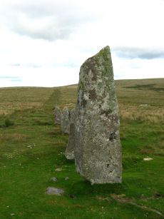
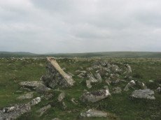
Hingston Hill (Down Tor) Standing Stone
Prehistoric Dartmoor Walks: Dartmoor Site: Down Tor Stone Row and Cairn Circle
OS Map: SX 58702 69276
HER: MDV3502
Megalithic Portal: 1901
PMD: Down Tor Standing Stone
ShortName: SS Down Tor
Butler map: 47.12
DPD page: 29
Notes: "A stone alignment and cairn, situated on a saddle 620 metres east of Down Tor. The alignment is orientated east-north-east to west-south-west, running for 316 metres and containing at least 174 stones, with the tallest at either end. The westernmost stone stands 2.8 metre high, the easternmost stone stands 1.6 metres high, and the remainder vary between 1 metre and 0.2 metres in height. The westernmost stone, and an unknown number of others, were re-erected by Baring-Gould and Burnard in 1890."
Nearby sites: SX 58702 69276
Distance: 0.39km
Hingston Hill (Down Tor) Stone Row
Prehistoric Dartmoor Walks: Dartmoor Site: Down Tor Stone Row and Cairn Circle
OS Map: SX 58697 69267
HER: MDV3502
Megalithic Portal: 1901
The Stone Rows of GB: Hingston Hill
PMD: Down Tor Stone Row
Alternate name: Hingston Hill Stone Row
ShortName: SR Down Tor
Butler map: 47.12
DPD page: 28
Barrow Report: 66
Notes: "A stone alignment and cairn, situated on a saddle 620 metres east of Down Tor. The alignment is orientated east-north-east to west-south-west, running for 316 metres and containing at least 174 stones, with the tallest at either end. The westernmost stone stands 2.8 metre high, the easternmost stone stands 1.6 metres high, and the remainder vary between 1 metre and 0.2 metres in height. The westernmost stone, and an unknown number of others, were re-erected by Baring-Gould and Burnard in 1894. The cairn lies 4 metres west of the western end of the alignment. The cairn mound measures 8 metres in diameter and 0.7 metres high. It is surrounded by a kerb made up of 24 orthostats, standing between 0.3 and 1 metre high, forming a ring with a diameter of 11.5 metres. A hollow in the centre of the mound suggests partial early excavation or robbing. Two tin prospecting pits lie immediately against the edge of the kerb. The alignment is in direct line with another cairn to the north-east (438589)". Lethbridge pp.27-29, diagram p.27. See also: Sea Views at Hingston Hill
Nearby sites: SX 58697 69267
Distance: 0.38km
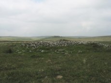
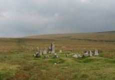
Hingston Hill (Down Tor) Encircled Cairn
Prehistoric Dartmoor Walks: Dartmoor Site: Down Tor Stone Row and Cairn Circle
OS Map: SX 58693 69270
HER: MDV3439
Megalithic Portal: 541
PMD: Down Tor Cairn Circle
Alternate name: Hingston Hill stone row Encircled Cairn
ShortName: EC Down Tor
Butler map: 47.12
DPD page: 28
Grinsell: WAL 31
Turner: F6
Barrow Report: 14
Notes: "The cairn circle consists of 26 upright stones and possibly two more now recumbent; it has an internal diameter of 11.5m. Within the circle is a cairn of 8.5m diameter and 0.6m height with a small depression in the centre which may be the site of a cist". Lethbridge pp.27-29, diagram p.27.
Nearby sites: SX 58693 69270
Distance: 0.38km
Leeden Cist
OS Map: SX 58695 67845
HER: MDV3341
Megalithic Portal: 45710
PMD: Eylesburrow W.
Alternate name: Eylesbarrow S.W. Cist
ShortName: CT Leeden
Butler map: 47.11
DPD page: 30
Grinsell: SHE 7
Barrow Report: 48
Notes: Butler Eylesbarrow S.W - Vol. 3. Map 47.11 (diagram p.70).
Nearby sites: SX 58695 67845
Distance: 1.21km
Outholme Newtake Cist
Prehistoric Dartmoor Walks: Dartmoor Walk: Yellowmead and Drizzlecombe
OS Map: SX 57993 68278
HER: MDV4024
Megalithic Portal: 45730
PMD: Outcombe
ShortName: CT OutholmeNew
Butler map: 47.10
DPD page: 30
Grinsell: SHE 2
Barrow Report: 52
Notes: "Located in an isolated pocket of closely cropped grass and surounded by tinners pits. Only three slabs survive in place surrounding a hollow and forming the sides of the cist. The fourth side is missing as is the capstone and any trace of a mound." Lethbridge Outcombe (note different spelling) Cist p.30. Butler Vol. 3. Map 47.10 (diagram p.70).
Nearby sites: SX 57993 68278
Distance: 0.85km
Stan Lake Platform Cairn Circle
Prehistoric Dartmoor Walks: Dartmoor Walk: Sharpitor area Stone Rows and Cists
OS Map: SX 56896 70285
HER: MDV4996
Megalithic Portal: 45649
ShortName: PC:Stan Lake
Turner: E29
Notes: "much disturbed". Alleged cairn circle. NMR record states "At SX 56897029, a felled conifer currently obscures much of what appears to be a hut circle rather than a cairn, situated on a south-east slope near a valley bottom. (Identification as a cairn may have originated with H. Breton)." Idenitified as a round house in the HER. This record is marked as a duplicate as it replicates PWD record SiteID=8769.
Nearby sites: SX 56896 70285
Distance: 1.97km
SW of Down Tor Stone Row Cup Stone
OS Map: SX 58595 69204
HER: MDV133690
ShortName: CS:Down Tor
Notes: "A flattish boulder recorded at SX 58595 69204, a short distance west of the north-south reave which lies west of the Down Tor stone row. The upper surface of this boulder is pitted over an area of at least 1m by 1m with numerous possible cupmarks. It is unlike any other boulder in the near vicinity. Stone photographed."
Nearby sites: SX 58595 69204
Distance: 0.27km
Whittenknowles Rocks Enclosed Settlement
OS Map: SX 5855 6705
HER: MDV3995
Megalithic Portal: 19400
ShortName: ES Whittenknow
Nearby sites: SX 5855 6705
Distance: 1.98km
Yellowmead Stone Row
Prehistoric Dartmoor Walks: Dartmoor Site: Yellowmead 4-fold Cairn Circle
OS Map: SX 57482 67842
HER: MDV80769
Megalithic Portal: 2202
The Stone Rows of GB: Yellowmead Down
PMD: Yellowmead Stone Row
Alternate name: Yellowmead Down Stone Row
ShortName: SR Yellowmead
Butler map: 47.14
DPD page: 31
Barrow Report: 41 56
Notes: "A group of four concentric stone circles of which the innermost one is considered to be a cairn circle. Three stones were standing in 1921 when all the fallen stones were raised during restoration. There also appears to have been a stone row leading away from the stone circles." and "The double row as planned by Worth except that one stone is now missing. It is 6.9m long with mostly small line slabs, set on edge. They are about 0.3m long and 0.3m high, the intervals between stones and between the rows being 0.8m".
Nearby sites: SX 57482 67842
Distance: 1.49km
Yellowmead Down Encircled Cairn
Prehistoric Dartmoor Walks: Dartmoor Site: Yellowmead 4-fold Cairn Circle
OS Map: SX 57535 67861
HER: MDV4025
Megalithic Portal: 31040
Alternate name: Yellowmead Down 1 Encircled Cairn
ShortName: EC Yellowmead1
Butler map: 47.14.1
DPD page: 31
Grinsell: SHE 5
Turner: F21
Barrow Report: 41
Notes: Cairn around 50 meters north-east of the Yellowmead stone circles, consisting of an earth and stone mound approximately 4 meters in diameter and up to 0.3 meters high. Four stones of a retaining kerb on its west and south sides. Turner F21.
Nearby sites: SX 57535 67861
Distance: 1.45km

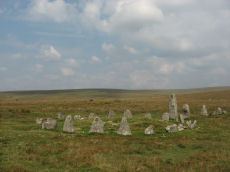
Yellowmead Fourfold Cairn Circle
Prehistoric Dartmoor Walks: Dartmoor Site: Yellowmead 4-fold Cairn Circle
OS Map: SX 57488 67846
HER: MDV3338
Megalithic Portal: 1371
PMD: Yellowmead Stone Circles
Alternate name: Yellowmead fourfold circle Cairn Circle
ShortName: CC Fourfold
Butler map: 47.14
DPD page: 31
Grinsell: SHE 4
Turner: G30
Barrow Report: 41 56
Notes: "A group of four concentric stone circles of which the innermost one is considered to be a cairn circle. Three stones were standing in 1921 when all the fallen stones were raised during restoration. There also appears to have been a stone row leading away from the stone circles." See also, Legendary Dartmoor: Yellowmead Stone Circle.
Nearby sites: SX 57488 67846
Distance: 1.49km