
Hingston Hill (Down Tor) Standing Stone
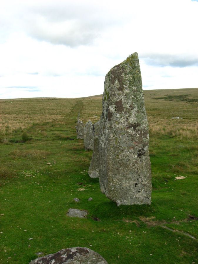
Photo taken on 09-08-2009
Database entries
PDW coverage: Dartmoor Site: Down Tor Stone Row and Cairn Circle
OS Map: SX 58702 69276
OS Source: PDW
HER: MDV3502
Megalithic Portal: 1901
PMD: Down Tor Standing Stone
Alternate name: Hingston Hill (Down Tor)
Short Name: SS Down Tor
Butler map: 47.12
DPD page: 29
Exist: Yes
Record: Unique
Record Source: PDW
Hut Class: No
Dimensions (m): 2.8
Lidar: SX 58702 69276
Guide Map: 43
Nearest Bus Stop: Princetown Dartmoor Visitor Centre (5.5 km) [Route: 98,171(20/07/26 to 19/09/26)]
Nearby sites: SX 58702 69276
Notes
"A stone alignment and cairn, situated on a saddle 620 metres east of Down Tor. The alignment is orientated east-north-east to west-south-west, running for 316 metres and containing at least 174 stones, with the tallest at either end. The westernmost stone stands 2.8 metre high, the easternmost stone stands 1.6 metres high, and the remainder vary between 1 metre and 0.2 metres in height. The westernmost stone, and an unknown number of others, were re-erected by Baring-Gould and Burnard in 1890."References
These are selected references with an emphasis on out of copyright sources linked as PDFs. For more detailed references try any linked HER or PMD record above.
- Bate, C Spence, On the Prehistoric Antiquities of Dartmoor, T.D.A. Vol.4 pp.491-516 (1871)
- Brailsford, J. W, Bronze Age Stone Monuments of Dartmoor, Antiquity Volume 12, Number 48 pp.444-63 (1938)
- Brent, Francis, Prehistoric Remains on Dartmoor, Journal of the British Archaeological Association Vol.39 pp.217-222 (1883)
- Butler, Jeremy, Dartmoor Atlas of Antiquities, vol.3: The South-West, (1994)
- Emmett, D.D., Stone rows: the traditional view reconsidered, D.A.S.P. No.37 pp.94-114 (1979)
- Greeves, T, Cramber Tor Training Area Monument Condition Survey, (2012)
- Lethbridge, William D., Discover Preshistoric Dartmoor, (2015)
- Lukis, W.C, Report on the Monuments of Dartmoor, Proceeding of the Society of Antiquaries Vol.8 (1881)
- Worth, R. Hansford, The Dartmoor Menhirs, T.D.A. Vol.72 pp.191-200 (1940)
- Worth, R. Hansford, The Stone Rows of Dartmoor Part 1, T.D.A. Vol.78 pp.285-316 (1946)
- Worth, R.N., The Stone Rows of Dartmoor - Part 1, T.D.A. Vol.24 pp.387-417 (1892)
- Worth, R.N., Barrow Report 14, T.D.A. Vol.24 (1892)