
Guide to the Monuments on Holne Chase

Table of Ritual and Burial Monuments on Holne Chase
The following table lists the records currently in this Guide Map. For an explantion of the Guide Maps and a table of all 62 Guide Maps, follow this link: Guide List Table. Introductory text will be added to each guide list in 2025. Notes on duplication and omissions will appear below the table once checks have been finalised.
Notes on possible duplications and omissions
Sherberton Common Stone Row Actually a passageway to round house. Sandy Gerrard (see link to SRGB): According R.N. Worth this is a double stone row that measured 68.6m long situated on a gently sloping south facing slope. According to him the row was destroyed in 1897 shortly after its discovery. The rows were described as being between 8 and 9 feet apart and included some contiguous stones. Jeremy Butler suggested that it was a passage similar to one surviving at Fernworthy Reservoir but he was unable to identify the site of the feature described by Worth (Butler, J., 1997, 214). Fresh fieldwork has identified the structure, which survives comparatively well and is clearly a passageway leading to a robbed roundhouse from a length of prehistoric rubble walling. The structure has only been partly robbed and several stones remain together with the original 1897 stone robbing pits.PS. These notes are to assist untangling complicated records and are neither permanent nor a criticism of the HER who do a fantastic job! The author finds it easier to systematically work through these records (2000+ of them) and add these notes, which are then to be communicated with the HER, if appropriate, it is a pragmatic way of dealing with lots of data without continually stopping and starting.
Holne Chase Guide Map
Guidance for walkers: The monuments featured in this database are archaeological treasures and need to be protected and preserved - please do not disturb any sites. Please check access and firing times before visiting sites, not all sites listed are on open access land. Firing ranges and boundaries of open access areas are marked on the OL28 OS Dartmoor Explorer map. Please stick to the country code and consider giving support to the numerous agencies that help to keep Dartmoor a fabulous natural and historic environment!
List of Ritual and Burial Monuments on Holne Chase
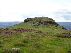
Buckland Beacon Cairn
OS Map: SX 73510 73118
HER record: MDV7977
ShortName: CN BuckBeacon
Butler map: 10.
Grinsell: B:BITM 1
Notes: HER referring to Newman: Buckland Beacon, probable tor cairn. The tor outcrop is surrounded by small, turf-covered stones indicating a possible tor cairn. Condition is mostly stable but subject to visitor erosion. SX73500 73100.
Nearby sites: SX73517312
Buckland Ridge (S) Stone Ring Cairn Circle
OS Map: SX 73570 73240
HER record: MDV30630
Megalithic Portal: 45827
Alternate name: Buckland Common 5 Stone Ring Cairn Circle
ShortName: RC:BucklandRid
Butler map: 10.9
Turner: A13
Notes: Linear arrangement of mounds incorporated into boundary. Could be prehistoric cairns. Turner A13. No NMR record. "Robbed cairn. Stone ring is 13m inside diameter bank 1.80m wide and 50cms high, much of the bank on the eastern side has been destroyed. The central area has been disturbed, modern stone wall running north to south through the eastern section of the stone ring."
Nearby sites: SX73577324
Buckland Beacon Ancient Pool
OS Map: SX 73558 73260
HER record: MDV127202
ShortName: PO:BuckBeacon
Notes: "A pool measuring 10.5 by 9.5m. One of over 40 such 'sacred' pools identified on Dartmoor that are thought to have potentially been designed during the prehistoric period. Lies near a cairn." NB. Nearby is Turner A13 ring cairn.
Nearby sites: SX73567326
Welstor Common Cairn
OS Map: SX 73740 73010
HER record: MDV112763
ShortName: CN:Welstor
Nearby sites: SX73747301
Brake Corner 1 Cairn
OS Map: SX 70220 71700
HER record: MDV8030
ShortName: CN?Brake 1
Butler map: 11.1.1
Turner: A17
Notes: Hut circle at brake corner. HER: A circular enclosure bounded by a bank consisting of small stone. Part of the interior has been filled in with cleared field stones. there is no trace of an entrance. Certain identification of the feature as a hut circle could not be made. No orthostats are visible and the construction using small stones is unusual for a hut. The exposed situation on the crest of a spur is more appropriate to a cairn but the walling, at best about 0.4 m. high, appears too regular for a cairn rim
Nearby sites: SX70227170
Brake Corner 2 Reported Cairn
OS Map: SX 70180 71680
HER: No record found
ShortName: CN?Brake 2
Butler map: 11.1.2
Notes: Possible hut circle.
Nearby sites: SX70187168
Sherberton Common Reported Stone Row
OS Map: SX 69148 73346
HER record: MDV6426
The Stone Rows of GB: Sherberton Common
PMD: Sherberton Common
ShortName: SR:SherberCom
Butler map: 11.6
Butler Vol 5: p.214
Notes: Sandy Gerrard (see link to SRGB): According R.N. Worth this is a double stone row that measured 68.6m long situated on a gently sloping south facing slope. According to him the row was destroyed in 1897 shortly after its discovery. The rows were described as being between 8 and 9 feet apart and included some contiguous stones. Jeremy Butler suggested that it was a passage similar to one surviving at Fernworthy Reservoir but he was unable to identify the site of the feature described by Worth (Butler, J., 1997, 214). Fresh fieldwork has identified the structure, which survives comparatively well and is clearly a passageway leading to a robbed roundhouse from a length of prehistoric rubble walling. The structure has only been partly robbed and several stones remain together with the original 1897 stone robbing pits.
Nearby sites: SX69157335
Sherberton Common Stone Row Reported Cist
OS Map: SX 69100 73200
HER record: MDV6426
PMD: Sherberton Common Stone Row
ShortName: CT?SherberCom
Butler map: 11.6
Grinsell: WID 22
Notes: NGR taken from NMR. Grinsell gives location SX 691739. Destroyed by 1897 but see entry for the stone row which is in fact a passageway to a round house.
Nearby sites: SX69107320
Bench Tor S. Reported Cairn
OS Map: SX 69160 71400
HER record: MDV130253
ShortName: CN?Bench Tor
Butler map: 59.2
Notes: Butler: in the field system "a small mound near the north end was probably a cairn".
Nearby sites: SX69167140

Ausewell Rocks E. Cairn
OS Map: SX 73548 71735
HER record: MDV8019
ShortName: CN Ausewell E
Grinsell: ASH 3
Barrow Report: 41
Notes: HER: Eastern cairn of a pair south-east of Ausewell Rocks. Recorded by the Ordnance Survey in 1960. This cairn measures 18m in diameter and has a crater-like centre with two trenches driven from the margin towards the centre, and 3 small round chambers like hut circles within the margin; all modern disturbances.
Nearby sites: SX73557174

Ausewell Rocks W. Cairn
OS Map: SX 73477 71753
HER record: MDV7988
ShortName: CN Ausewell W
Grinsell: ASH 2
Barrow Report: 41
Notes: HER: diameter 18.0m, crude stone wall around cairn obviously modern survives as a semi circular enclosure on west side of cairns flat top.
Nearby sites: SX73487175
Holne Chase Castle Fort
OS Map: SX 72437 71979
HER record: MDV7996
Megalithic Portal: 62571
ShortName: FT:HolneChase
Notes: "A slight univallate hillfort situated on the north facing side of Holne Chase overlooking the River Dart. The hillfort survives as an oval enclosure measuring 120m long by 96m wide internally, defined by a single rampart and ditch with a counterscarp bank present to the north east, west and south west. It has two entrances, a simple gap to the south east and an inturned entrance to the south west."
Nearby sites: SX72447198
Kingshead Reported Cairn
OS Map: SX 73000 72320
HER record: MDV20513
ShortName: CN?Kingshead
Nearby sites: SX73007232

Boro Wood Camp Fort
OS Map: SX 74869 71598
HER record: MDV7985
Megalithic Portal: 62573
ShortName: FT BoroWood
Notes: HER: Boro Wood Camp. Hillslope enclosure of probable Iron Age date, situated on the eastern promontory which forms the south-east extremity of Ausewell Hill at approximately 230m OD. The enclosure is approximately elliptical and constructed from stone rubble. The wall or rampart has been heavily robbed. There are several gaps in the wall though none may be identified as an entrance with any confidence.
Location
Nearby sites: SX74877160
Venford Reservoir E. Embanked Cairn Circle
OS Map: SX 69033 70678
HER record: MDV63936
ShortName: CC:VenfordResE
Notes: HER: A ring cairn sited 6m east of the Holne to Hexworthy road and on the crest of the ridge which extends between Bench Tor and Holne Lee. The cairn consists of a low (0.2m) circular earthwork with a diameter of approximately 20m, and a central mound. Much of the circle has been effaced, possibly by road builders and a pair of tinners' pits have destroyed part of the western sector. The best preserved section is on the northern side where a low, curved bank survives with a spread of approximately 2m. The eastern side is currently occupied by a car park, delineated by a row of large, loose boulders. The section of the circle within the car park has become badly eroded and the stony cairn material is exposed. The central mound is roughly elliptical measuring 9m by 7m.
Nearby sites: SX69037068
Page last updated 10/12/24