
Guide to the Monuments on Cox Tor and Whitchurch Common
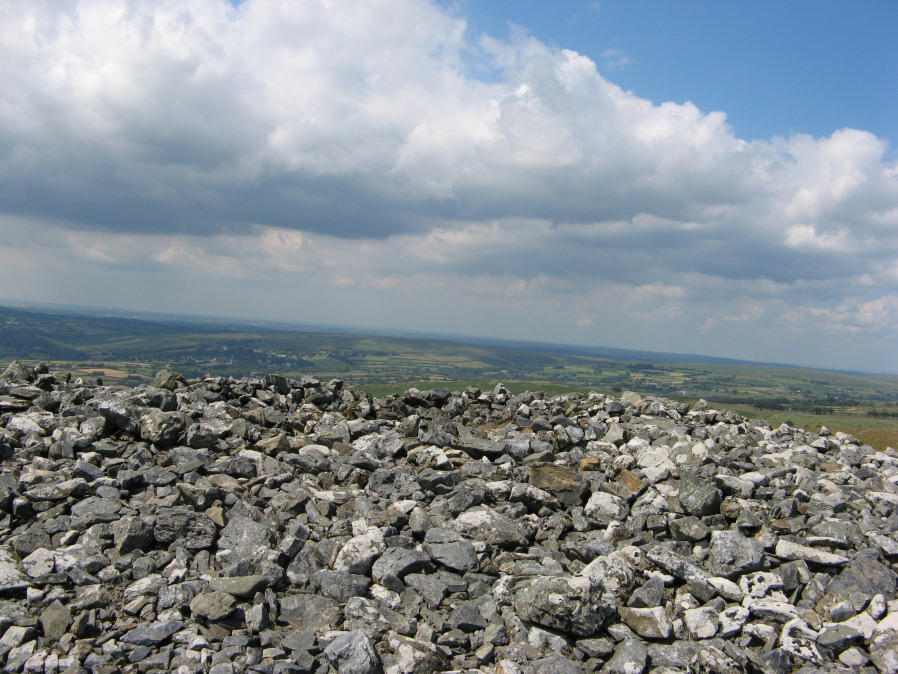
Table of Ritual and Burial Monuments on Cox Tor and Whitchurch Common
The following table lists the records currently in this Guide Map. For an explantion of the Guide Maps and a table of all 62 Guide Maps, follow this link: Guide List Table. Introductory text will be added to each guide list in 2025. Notes on duplication and omissions will appear below the table once checks have been finalised.
Notes on possible duplications and omissions
Cox Tor S.E.9 and PETER TAVY 37b: The entry Cox Tor S.E.9 (duplicate) (MDV4108) relates to the Grinsell record that refers to a group of cairns including the ones now named S.E.8 and S.E.9. As such it was marked as a duplicate or master record in these listings, a required entry to have a complete listing of the Grinsell records. The HER record MDV56607 for S.E.9 was deleted leaving MDV4108 as a defacto unique entry for S.E.9 on the HER. Our record for S.E.9 has now been linked to MDV4108. There are no HER duplicates or omissions if MDV4108 is considered to reflect Cox Tor S.E.9 Cairn. We will retain our duplicate for completeness of Grinsell records as we want a unique record for PETER TAVY 37b.PS. These notes are to assist untangling complicated records and are neither permanent nor a criticism of the HER who do a fantastic job! The author finds it easier to systematically work through these records (2000+ of them) and add these notes, which are then to be communicated with the HER, if appropriate, it is a pragmatic way of dealing with lots of data without continually stopping and starting.
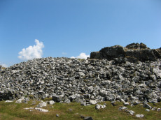
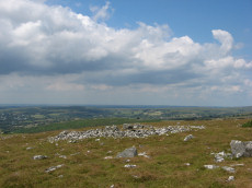
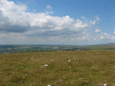
Cox Tor and Whitchurch Common Guide Map
Guidance for walkers: The monuments featured in this database are archaeological treasures and need to be protected and preserved - please do not disturb any sites. Please check access and firing times before visiting sites, not all sites listed are on open access land. Firing ranges and boundaries of open access areas are marked on the OL28 OS Dartmoor Explorer map. Please stick to the country code and consider giving support to the numerous agencies that help to keep Dartmoor a fabulous natural and historic environment!
List of Ritual and Burial Monuments on Cox Tor and Whitchurch Common
Cox Tor Stone Row
OS Map: SX 53070 76180
HER record: MDV12802
Megalithic Portal: 1840
PMD: Cox Tor
ShortName: SRxCoxTor
Butler map: 31.1
Notes: Stone row reported by R.N. Worth in 1894 and referred to by R.H. Worth in 1953. The row is no longer visible. The NMR states: "R.N. Worth mentions, like Crossing, one stone row, while R.H.Worth notes one or more rows. These cannot be traced, and the depth of peat on the grassy plateau is so little that if the row/rows were obvious with slight shrinkage they should still be reasonably visible. Spaced stones abound, particularly towards the northern end and numerous fictitious rows of four of five stones can be deduced but nothing acceptable from any of the cairns."
Nearby sites: SX53077618

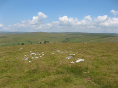
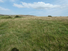
Cox Tor Tor Cairn Stone Ring Cairn Circle
OS Map: SX 53012 76012
HER record: MDV50062
ShortName: RC CoxTor 2
Notes: A well preserved Tor cairn approximately 21m in diameter encloses a small, unamed tor 180m SSW of Cox Tor. It comprises a ring of large to medium stones approximately 7m in width which are piled around a natural outcrop. The stones are of a fairly uniform size and most are not earth-fast. To the immediate NE a stretch of low turf-covered rubble walling 1.2m wide, 0.4m high and 15m in length connects two outcrops - it is probably of prehistoric origin but its function is obscure..
Nearby sites: SX53017601
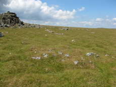
Cox Tor Stone Ring Cairn Circle
OS Map: SX 53060 76190
HER record: MDV4151
Megalithic Portal: 32104
Alternate name: Cox Tor Summit Stone Ring Cairn Circle
ShortName: RC CoxTor 3
Butler map: 31.1.3
Grinsell: PET 37a
Turner: A59
Notes: "Cox tor, ring cairn. The outcrop of granite on the summit is surrounded by an ancient wall, enclosing a space of about 21m in diameter, built of small stones. Pillaged and part used in erection of the cairn for the 1887 jubilee."
NB. The NMR listings had two entries for this feature. The entry SiteID=3229 referred to NMR entry SX 57 NW 132 (Monument Number 919075) which was a duplicate. As the NMR listings are no longer public our entry SiteID=3229 has been deleted.
Nearby sites: SX53067619

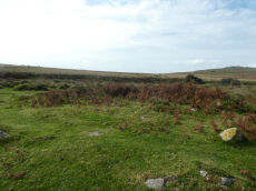
Cox Tor N.4 Cairn
OS Map: SX 53032 76347
HER record: MDV4191
ShortName: CN CoxTor 4
Butler map: 31.1.4
Grinsell: PET 37
Notes: HER: Oval cairn of 23.8 metres by 28.2 metres by 1.2 metres high lying 160 metres to the north of Cox Tor
Nearby sites: SX53037635
Cox Tor (NW) Stone Ring Cairn Circle
OS Map: SX 53024 76424
HER record: MDV4128
Megalithic Portal: 32104
Alternate name: Cox Tor N.5 Stone Ring Cairn Circle
ShortName: RC CoxTor 5
Butler map: 31.1.5
Grinsell: PET 35
Turner: A48
Notes: Breton p.16 Two very curious ring cairns; one has a diameter of 55ft and the other 27ft.
Nearby sites: SX53027642
Cox Tor (NE) Stone Ring Cairn Circle
OS Map: SX 53047 76430
HER record: MDV4127
Megalithic Portal: 32104
Alternate name: Cox Tor N.6 Stone Ring Cairn Circle
ShortName: RC CoxTor 6
Butler map: 31.1.6
Grinsell: PET 36
Turner: A51
Notes: "Narrow ridge of north-south outcropping rock measuring 10 metres in diameter, surrounded by circular stoney bank 4 metres wide, 0.8 metres high. 1890 excavation showed it to consist of an outer bank with central infill of loose stones and earth. No trace of burials or artefacts." "Cox Tor. Smaller of two adjacent cairns. Lies 12.5 metres south-east of larger one (see related record). Similar in shape, though smaller; diameter 8.23 metres. Construction of centre was loose, much earth being mingled with the stone. Nothing found and no pit in the "calm". (Baring-Gould - fifth report of the DEC) Breton p.16 Two very curious ring cairns; one has a diameter of 55ft and the other 27ft.
Nearby sites: SX53057643
Cox Tor N.7 Cairn
OS Map: SX 53053 76495
HER record: MDV49710
ShortName: CN CoxTor 7
Butler map: 31.1.7
Notes: HER: Small mutilated cairn of 5.8 metres in diameter and 0.5 metres high lying 300 metres north of Cox Tor
Nearby sites: SX53057650
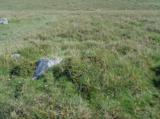
Cox Tor S.E.8 Cairn
OS Map: SX 53206 76138
HER record: MDV28512
ShortName: CN CoxTor 8
Butler map: 31.1.8
Notes: Butler lists a pair of two small cairns south of the tor; cairn 8 at SX 5316 7613 and cairn 9 at SX 5318 7614.
Nearby sites: SX53217614
Cox Tor S.E.9 Cairn
OS Map: SX 53228 76174
HER record: MDV4108
ShortName: CN CoxTor 9
Butler map: 31.1.9
Notes: Butler lists a pair of two small cairns south of the tor; cairn 8 at SX 5316 7613 and cairn 9 at SX 5318 7614. The author visited this area and found two possible cairns that could match the pair are located around 30-40 metres to the north-east. These match very closely to the NGR given by the the HER for SX 53210 76180 (HER 28512) and SX 53203 76131 (56607).
Nearby sites: SX53237617
Cox Tor S.E.9 (duplicate) Reported Cairn
OS Map: SX 53000 76100
HER record: MDV4108
ShortName: CN?CoxTor 9Dup
Grinsell: PET 37b
Notes: Mentioned by Breton 1912. NMR refers to clearance cairns SE of Cox Tor and cites Grinsell who is referring back to Baring-Gould. Cox tor. On southern slope of tor is a cluster of cairns, sepulchral. Five definitely cairns and a number of other doubtful mounds. Two examined. Originally circular, composed of earth and stones. Nothing found.(baring-gould). This very much sounds like a description of cairns 8 & 9 which are to the SE of cox tor and were excavated by the Dartmoor Exploration Committee. This grid reference is comparatively to the west and is probably wrong. This record is being marked as a duplicate for this reason, see Cox Tor S.E.8 and Cox Tor S.E.9. N.B Previously named Cox Tor 11 (PET 37b). This record is being retained as a duplicate acting as both a master record and for completeness of Grinsell listings.
Nearby sites: SX53007610
Cox Tor S.E.10 Clearance Cairn
OS Map: SX 53100 76100
HER record: MDV49831
ShortName: CN?CoxTor10
Notes: HER (1987): SX 5321 7618. An oval cairn situated on a slight slope SE of Cox Tor. It is composed of small and medium size stones (up to 0.2m diameter) forming a mound 4.6m by 4m and 0.35m to 0.45m high. There is a flattish top 2m across. No formal constructional details are visible. This cairn is similar to another situated 45m to the SW (see SX 57 NW 94). Its small size might suggest a connection with clearance; there are hut circles in the vicinity (see SX 57 NW 40, 141).
Nearby sites: SX53107610
Cox Tor N.E. Settlement
OS Map: SX 53600 76500
HER record: MDV4105
Megalithic Portal: 17508
ShortName: ST:CoxTorNE
Notes: Details via Megalithic Portal.
Nearby sites: SX53607650

Cox Tor Ancient Pool
OS Map: SX 53635 76205
HER record: MDV26281
ShortName: PO Cox Tor
Notes: "Previously recorded from aerial photographs as a possible quarry. Marked as 'pond' on modern mapping and is one of the examples suggested by Greeves (2019) to potentially have Prehistoric origins."
Nearby sites: SX53647621
Vixen Tor Cist
OS Map: SX 54244 74404
HER record: MDV3596
Megalithic Portal: 29932
PMD: Vixen Tor
Alternate name: Vixen Tor 1 Cist
ShortName: CT Vixen Tor 1
Butler map: 44.10.1
DPD page: 15
Grinsell: WHI 2
Barrow Report: 39
Notes: "Cist and possible remains of a barrow. The east and south sides of the cist lean inwards and the north end is slightly defective. The cover stone seems to have been in two parts and it leans against the south corner of the cist. There appears to be traces of a retaining circle of barrows, three stones only, in radius of 3.0m from the centre of the cist. The condition is good. The original dimensions would, however, appear to have been 1.219m x 533mm. One side stone is 1.524m in length, and the other is over 1.372m in length. The present depth below the top of the side stones is 330mm, but excavation would probably prove this to be at least twice this."
Nearby sites: SX54247440
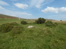
Vixen Tor 2 Cairn
OS Map: SX 54174 74459
HER record: MDV35898
ShortName: CN Vixen Tor 2
Butler map: 44.10.2
Notes: This entry originates from Butler at SX 5417 7446. Previously this entry had been associated with a mound at SX 54115 74445 (photo and grid reference). On 14/10/24 the author visited this location with Steve Szypko and we concluded this was a misidentification. The photo above and the grid reference have been updated to the correct feature referred to by Butler. The second photo here is of the feature previously recorded as this cairn (photo 14/09/2020) at SX 54115 74445. It is possible they are both cairns.
The HER grid reference is SX 54130 74460
Nearby sites: SX54177446
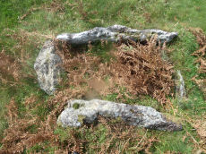
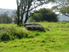
Barn Hill Cist
OS Map: SX 53318 74558
HER record: MDV14685
Megalithic Portal: 45785
PMD: Barn Hill
Alternate name: Barn Hill S. Cist
ShortName: CT Barn Hill 1
Butler map: 44.10.3
DPD page: 15
Grinsell: WHI 3
Notes: "The cairn mound measures 5.7 metres in diameter and stands up to 0.2 metres high. The cist lies slightly south of the cairn's centre and survives as a 0.98 metre long by 0.6 metre wide and 0.3 metre deep stone-lined pit".
Barrow Report 39 refers to a posible cist on the northern side of Barn Hill and this is a different feature on the southern side. The Barrow Report refers to MDV4114.
Butler Barn Hill S. - Vol. 3. Map 44.10.3. (diagram p.34). Previously listed with an inaccurate grid reference. Now confirmed at SX 53318 74558.
Nearby sites: SX53327456
Barn Hill N.E. Reported Cairn
OS Map: SX 53442 75013
HER record: MDV63573
ShortName: CN BarnHill NE
Butler map: 44.10.4
Notes: Possibly NMR 1359050. "Despoiled prehistoric barrow on the east side of barn hill just to the west of the streamwork. The top of the monument has recently been dug into."
Nearby sites: SX53447501
Barn Hill 2 Reported Cist
OS Map: SX 52970 74720
HER record: MDV4114
ShortName: CT:Barn Hill 2
Butler map: 49.22
Barrow Report: 39
Notes: HER: "Earth bank, with some stones standing up and two large stones standing long ways across the bank. Visible on the aerial photographs it was recorded in 1980 running between SX 5299 7502 to SX 5297 7472 and appears to form the eastern boundary of settlement MDV12822."
Nearby sites: SX52977472
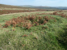
Whitchurch Common (N) Stone Ring Cairn Circle
OS Map: SX 53020 75005
HER record: MDV4115
Megalithic Portal: 3535
Alternate name: Whitchurch Common N. Stone Ring Cairn Circle
ShortName: RC Whitchurch1
Turner: A41
Notes: Hut Circle or ring cairn? "Ring cairn with entrance. Stone ring 5.5m internal diam, with bank 1.5m wide and 0.4m high.2.5m wide entrance on ssw side" " A hut with an internal diam of 5.8m and walling 1.5m wide and 0.4m high; there is an entrance gap in the sw. This is evidently grinsell's cairn and worth's barrow.(broadly it is on the n slope of barn hill as stated by worth, but locally on the sw slope). While the structure might in isolation be construed as a cairn, the lack of any internal stone, the consistently smooth angle of the inner face of the wall and the presence of other huts and a field system militate against the worth and grinsell classifications"
Nearby sites: SX53027501

Whitchurch Common E. Cairn
OS Map: SX 54139 74888
HER record: MDV64833
ShortName: CN Whitchurch2
Butler map: 44.10.5
Notes: "Diam 6m, height 0.9m. A number of large stones protrude through the surface of the mound, which appears to be intact having escaped antiquarian investigation. Lies within extensive coaxial field system which is the subject of separate schedulings"
Nearby sites: SX54147489
Whitchurch Common 3 Cairn
OS Map: SX 53004 74984
HER record: MDV48866
ShortName: CN Whitchurch3
Turner: B10
Notes: "A 2m wide rubble bank containing a large number of edge set stones. Bank is up to 0.6m high, surrounding an area of 6.6m diam. A 3m wide, 0.1m deep ditch surrounds the bank. Lies within extensive coaxial field system".
Nearby sites: SX53007498
Whitchurch Common 4 Cairn
OS Map: SX 53700 74930
HER record: MDV63574
ShortName: CN:Whitchurch4
Notes: Ring cairn c18m diameter surviving as a circular earthwork bank c30cm high on the hillside to the east of the streamwork. Part of the bank has been disturbed by a rectangular hollow which may be the remains of a later building (newman).
Nearby sites: SX53707493
Whitchurch Common 5 Reported Cairn
OS Map: SX 53496 75192
HER record: MDV56594
ShortName: CN Whitchurch5
Notes: This record originates as a cairn reported in the old NMR listings. It is very likely a round house. The HER entry 56594 relates to round houses and the entry lists 3 items but also includes an NGR (SX 5349 7518) which matches this feature. In these listings we also have a round house listed as SiteID=5112 (HER=56594). The HER entry includes round houses which are apparently over 100m away from this feature and for that reason we will not treat that entry as a duplicate as it represents different unique features.
Nearby sites: SX53507519
Whitchurch Common S. Reported Cairn
OS Map: SX 53032 74954
HER record: MDV48865
ShortName: CN?Whitchurch6
Grinsell: WHI 1
Turner: A19
Barrow Report: 39
Notes: Hut Circle or ring cairn? This is probably the cairn referred to by Worth in Barrow Report 39 (not the cist on the southern slope of barn Hill).
Nearby sites: SX53037495
Pew Tor Reported Cist
OS Map: SX 53250 72920
HER record: MDV64700
PMD: Pew Tor
ShortName: CT?Pew Tor
Notes: Pit to the north of the standing stone is a possible cist. The rectangular pit c2.5m x 1m x 0.3m deep has three vertical sides + the remains of a possible capstone standing on edge within it. Banks adjacent to the pit suggest the remains of a mound which could have been 11m x 6m oriented north-south + covered the cist
Nearby sites: SX53257292

Pew Tor (N side) Ancient Pool
OS Map: SX 53354 73597
HER record: MDV127216
ShortName: PO Pew Tor
Notes: "A pool measuring 28 by 14m. One of over 40 such 'sacred' pools identified on Dartmoor that are thought to have potentially been designed during the prehistoric period."
Nearby sites: SX53357360
Page last updated 10/12/24