
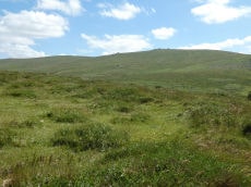
Prehistoric sites within 2km of SX 53617 86313
Guidance for walkers: The monuments featured in this database are archaeological treasures and need to be protected and preserved - please do not disturb any sites. Please check access and firing times before visiting sites, not all sites listed are on open access land. Firing ranges and boundaries of open access areas are marked on the OL28 OS Dartmoor Explorer map. Please stick to the country code and consider giving support to the numerous agencies that help to keep Dartmoor a fabulous natural and historic environment!
About the database listings: In all listings clicking on the photo or the site name will open a page for the site with a larger photo and further details from the database. The database now has over 6680 records covering nearly all publicly listed sites on Dartmoor including around 4800 round houses. This level of detail is of interest to archaeologists but tends to swamp listings of sites more likely to be of interest for walkers. For this reason, the listings default to around 550 core sites only. These are the stone circles, stone rows and the ring cairns listed by Turner. The default search radius is 2 km. The controls below the map can be used to start a new search by entering a 6- or 8-digit reference (without the prefix "SX"). The search radius can be specified and you can add incremental Display layers of detail on top of the core sites. If using a more detailed layer you will need to decrease the search radius to avoid getting hundreds of search results.
- Core sites Default listing of core sites consisting of stone circles & rows and some of the major ring cairns.
- Plus cairns adds approx. 1000 cairns and other minor sites not included in the core listings but excluding round houses.
- Plus round houses adds approx. 4800 round houses.
- Plus non-sites adds in the records for sites that no longer exist or are not prehistoric sites.
- Plus duplicates adds records excluded as duplicates. Those maybe duplicate records in external listings (e.g. the Historic Environment Records). For example, some sites have been identified as cairns in some listings and interpreted as round houses in other listings and both records appear.
These listings have incorporated, matched up and merged all of the records from all of the major archaeological listings including: Worth, Grinsell, Turner, Butler, Bill Radcliffe, Sandy Gerrard, Megalithic Portal, the National Monument Records and the Historic Environment Records. The author would like to thank Bill, Sandy, the lovely people both at Megalithic Portal (especially Anne Tate who did an amazing job to link listings) and at ACE Archaeology for collaborative work over the years to synchronise and correct listings across the various websites which now interlink. A culmination of years of work the final merger of cairn records took 3 months of cross referencing in 2017 the result being a snapshot of the records at that time. This data has in turn been refined since by field work and research. The round house data was supplied by Sandy Gerrard. Grid references are in order of accuracy: from Google Earth satellite, if visible and found, from a Garmin GPS reading, if visited by the author and from the literature otherwise. Individual site pages will state the source of the grid reference and provide satellite imagery. If a site listing lacks a photo it has not yet been visited by the author in which case the grid reference is from the literature.
Currently the database only includes sites which can be represented by a grid reference. Reaves are not included as they require GIS shape technology which is beyond the current capability of this system. To see the sources for the records, look at the tables on the resources menu. The database listings can also be viewed on a Google map and downloaded as GPS datasets for Garmin devices.
Corrections, or any feedback or suggestions are very welcome, email: info@dartmoorwalks.org.uk.
NOTE: Clicking on the icons for each monument in the map will give the name of the site. You can zoom in and out and drag the map around.
List of sites within 2km of SX 53617 86313
Little Links Tor NW Round House
OS Map: SX 54114 87236
HER: MDV50934
ShortName: HT:Little Li1
Nearby sites: SX 54114 87236
Distance: 1.05km
Little Links Tor NW Round House
OS Map: SX 54236 87199
HER: MDV50937
ShortName: HT:Little Li2
Nearby sites: SX 54236 87199
Distance: 1.08km
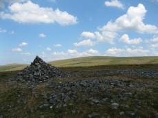
Great Nodden 1 Cairn Circle
Prehistoric Dartmoor Walks: Dartmoor Site: Guide to the Cairns on Great Nodden
OS Map: SX 53079 86222
ShortName: CN Great Nod 1
Butler map: 43.7.1
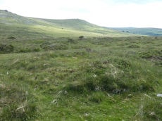
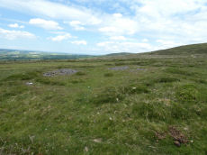
Notes: This site originates with Butler but is not listed elsewhere. A mound can be seen on Lidar imagery at SX 53077 86213 which matches the location given by Butler. Visited 3 June 2022 and there is clearly a substantial but badly damaged cairn at this location. It can also be seen on Google satellite imagery. Whether it is prehistoric or later clearance is hard to say but the mutilated state suggests maybe more likely a robbed out prehistoric cairn. The Great Nodden Cairns 1-3 are not listed on the HER but there is an entry for the field system which states "May include some cairns, which presumably may be clearance cairns". See HER record Field system south of Nodden Gate MDV27320.
Nearby sites: SX 53079 86222
Distance: 0.55km
Little Links Tor NW Round House
OS Map: SX 54087 87180
HER: MDV4677
ShortName: HT:Little Li3
Nearby sites: SX 54087 87180
Distance: 0.99km
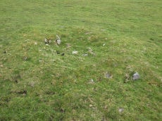
Great Nodden 2 Cairn
Prehistoric Dartmoor Walks: Dartmoor Site: Guide to the Cairns on Great Nodden
OS Map: SX 53101 86256
ShortName: CN Great Nod 2
Butler map: 43.7.2
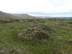
Notes: This site originates with Butler but is not listed elsewhere. A mound can be seen on Lidar imagery at SX 53098 86249 which matches the location given by Butler. Butler: "two smaller and much pitted cairns 5 and 6 m across lie close to the field wall." Visited 3 June 2022. This was previously listed as a "reported cairn", this has now been updated to "cairn". It looks a genuine site to the author. NGR and photo updated after visit 28 April 2023. The Great Nodden Cairns 1-3 are not listed on the HER but there is an entry for the field system which states "May include some cairns, which presumably may be clearance cairns". See HER record Field system south of Nodden Gate MDV27320.
Nearby sites: SX 53101 86256
Distance: 0.52km
Little Links Tor NW Round House
OS Map: SX 54116 87201
HER: MDV4677
ShortName: HT:Little Li4
Nearby sites: SX 54116 87201
Distance: 1.02km
Great Nodden 3 Cairn
Prehistoric Dartmoor Walks: Dartmoor Site: Guide to the Cairns on Great Nodden
OS Map: SX 53078 86287
ShortName: CN Great Nod 3
Butler map: 43.7.3
Notes: This site originates with Butler but is not listed elsewhere. A mound can be seen on Lidar imagery at SX 53073 86276 which matches the location given by Butler.Butler: "two smaller and much pitted cairns 5 and 6 m across lie close to the field wall". This was previously listed as a "reported cairn", this has now been updated to "cairn". It looks a genuine site to the author. The Great Nodden Cairns 1-3 are not listed on the HER but there is an entry for the field system which states "May include some cairns, which presumably may be clearance cairns". See HER record Field system south of Nodden Gate MDV27320.
Nearby sites: SX 53078 86287
Distance: 0.54km
Little Links Tor NW Round House
OS Map: SX 54116 87245
HER: MDV50935
ShortName: HT:Little Li5
Nearby sites: SX 54116 87245
Distance: 1.06km
Great Nodden 4 Cairn
Prehistoric Dartmoor Walks: Dartmoor Site: Guide to the Cairns on Great Nodden
OS Map: SX 53249 86629
HER: MDV51450
ShortName: CN Great Nod 4
Butler map: 43.7.4
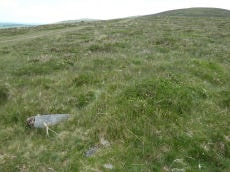
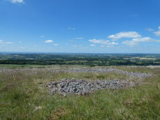
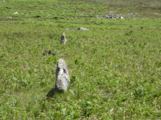
Notes: Ring cairn. "Earthwork survives as a circular bank, 2.3m wide and 0.3m high surrounding an internal area measuring 13.4m in diameter. A mound measuring 6m in diam and 0.2m high stands in the centre of the area enclosed by the circular bank (mpp)". The grid reference given by Butler is a rare mistake. The Butler 43 map and the description make it clear the site is actually located in the vicinity of SX 5324 8660 which is around 400m north the grid reference given on p.245. This corrected grid reference corresponds with the cairn listed here. Visit on 20/06/22 resulted in the photo used. Follow up visit 28/04/23 - found again with difficulty despite having correct grid reference. Not easy to see in the vegetation but it is clearly there and for that reason the entry has been changed from reported cairn to cairn.
Nearby sites: SX 53249 86629
Distance: 0.49km
Little Links Tor NW Round House
OS Map: SX 54092 87178
HER: MDV4677
ShortName: HT:Little Li6
Nearby sites: SX 54092 87178
Distance: 0.99km
Great Nodden 5 Cairn
Prehistoric Dartmoor Walks: Dartmoor Site: Guide to the Cairns on Great Nodden
OS Map: SX 53343 86810
HER: MDV51448
ShortName: CN Great Nod 5
Butler map: 43.7.5
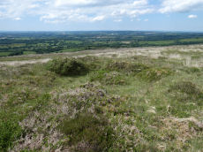
Notes: Group of 6 small cairns. This clear mound is not far from Great Nodden 6. NGR from Garmin reading taken 28/04/23. "One of two Bronze Age round cairns south-west of Great Nodden. Cairn mound is flat-topped, measures 5m in diameter and stands up to 0.6m high"
Nearby sites: SX 53343 86810
Distance: 0.57km
Little Links Tor NW Round House
OS Map: SX 54204 87209
HER: MDV50936
ShortName: HT:Little Li7
Nearby sites: SX 54204 87209
Distance: 1.07km
Great Nodden 6 Cairn
Prehistoric Dartmoor Walks: Dartmoor Site: Guide to the Cairns on Great Nodden
OS Map: SX 53340 86820
HER: MDV51449
ShortName: CN Great Nod 6
Butler map: 43.7.6
Notes: Group of 6 small cairns. These 6 small cairns are quite difficult to find in the undergrowth especially when original NGRs were inaccurate. Visited 03/06/22 and 28/04/23. NGR has been updated with an accurate Garmin reading. Very clear mound for this cairn.
Nearby sites: SX 53340 86820
Distance: 0.58km
Little Links Tor NW Round House
OS Map: SX 54115 87229
HER: MDV50933
ShortName: HT:Little Li8
Nearby sites: SX 54115 87229
Distance: 1.04km
Great Nodden 7 Cairn
Prehistoric Dartmoor Walks: Dartmoor Site: Guide to the Cairns on Great Nodden
OS Map: SX 53337 86887
HER: MDV51447
ShortName: CN Great Nod 7
Butler map: 43.7.7
Notes: Group of 6 small cairns. Visited on 03/06/22 and 28/04/23. NGR and details confirmed on 28/04/23.
Nearby sites: SX 53337 86887
Distance: 0.64km
Great Nodden 8 Cairn
Prehistoric Dartmoor Walks: Dartmoor Site: Guide to the Cairns on Great Nodden
OS Map: SX 5339 8689
HER: MDV51446
ShortName: CN Great Nod 8
Butler map: 43.7.8
Notes: Group of 6 small cairns
Nearby sites: SX 5339 8689
Distance: 0.62km
Great Nodden 9 Cairn
Prehistoric Dartmoor Walks: Dartmoor Site: Guide to the Cairns on Great Nodden
OS Map: SX 5340 8691
HER: MDV51507
ShortName: CN:Great Nod 9
Butler map: 43.7.9
Notes: Group of 6 small cairns. Not found on 03/06/22, 20/06/22 and 28/04/23. However, this is overgrown terrain with many clumps of vegetation looking like mounds. The NGRs for these 6 were often very inccurate in the original listings.
Nearby sites: SX 5340 8691
Distance: 0.64km

Great Nodden 10 Cairn
Prehistoric Dartmoor Walks: Dartmoor Site: Guide to the Cairns on Great Nodden
OS Map: SX 53370 86934
HER: MDV51445
ShortName: CN Great Nod10
Butler map: 43.7.10
Notes: Group of 6 small cairns. Visited 03/06/22 and again 28/04/23. "Round cairn. Mound measures 6m in diameter and stands up to 0.6m high. A 1.4m square stone filled hollow in the centre of the mound suggests partial early excavation or robbing."
Nearby sites: SX 53370 86934
Distance: 0.67km
Great Nodden 11 Cairn
Prehistoric Dartmoor Walks: Dartmoor Site: Guide to the Cairns on Great Nodden
OS Map: SX 53477 87054
HER: MDV51505
ShortName: CN Great Nod11
Butler map: 43.7.11
Notes: Ring cairn. Earthwork survives as a circular bank, 3.5m wide and 0.5m high surrounding an internal area measuring 10.7m in diameter. A 2.5m wide gap in the w side of the bank may represent an original entrance. Interior of this cairn is pitted with hollows, which suggest partial robbing or early excavation. Visited 3 June 2022.
Nearby sites: SX 53477 87054
Distance: 0.75km
Great Nodden 12 Cairn
Prehistoric Dartmoor Walks: Dartmoor Site: Guide to the Cairns on Great Nodden
OS Map: SX 53445 87077
HER: MDV27341
ShortName: CN Great Nod12
Butler map: 43.7.12
Notes: Butler: "a circular bank 9 m across surrounds a pit with a floor well below ground level". On the western side of the path, near the larger ring cairn that is located on the eastern side.
Nearby sites: SX 53445 87077
Distance: 0.78km
Great Nodden 13 Cairn
Prehistoric Dartmoor Walks: Dartmoor Site: Guide to the Cairns on Great Nodden
OS Map: SX 53620 87409
HER: MDV4676
ShortName: CN Great Nod13
Butler map: 43.7.13
Grinsell: BRI 6
Notes: "Cairn mound measures 17.3m in diameter and stands up to 1m high. Loose rubble covering the centre of the mound suggests that the cairn has been partially excavated or robbed." Visited 3 & 20 June 2022.
Nearby sites: SX 53620 87409
Distance: 1.10km
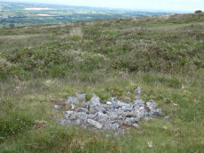
Great Nodden 14 Reported Cairn
Prehistoric Dartmoor Walks: Dartmoor Site: Guide to the Cairns on Great Nodden
OS Map: SX 53695 87564
ShortName: CN-Great Nod14
Butler map: 43.7.14
Notes: Butler: "The pit with a surrounding bank is also probably the remains of a robbed cairn". Visited 3 June 2022 ans 28/04/23. Butler suggests this pit is probably part of bronze age cairn. He could be right. Lake Viaduct can be seen from this location. A few hundred metres to the north on Lake Down there are some pits which are gun dug-outs overlooking the then railway over the viaduct. This pit doesn't look so modern and regular but it is quite overgrown.
Nearby sites: SX 53695 87564
Distance: 1.25km
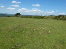
Great Nodden 20 Cairn
Prehistoric Dartmoor Walks: Dartmoor Site: Guide to the Cairns on Great Nodden
OS Map: SX 53860 87842
HER: MDV55724
ShortName: CN Great Nod20
Notes: "a well preserved and undisturbed prehistoric cairn a short distance above the king wall". Visited 3 June 2022. The grid reference on the HER is SX 53900 87880. The grid reference SX 53860 87842 is a Garmin reading taken standing very near to it. Dense vegetation and rough terrain - I did not fancy attempting to clamber on it so not the centre of the feature as usual.
Nearby sites: SX 53860 87842
Distance: 1.55km
Great Nodden 15 Cairn
Prehistoric Dartmoor Walks: Dartmoor Site: Guide to the Cairns on Great Nodden
OS Map: SX 54225 87874
HER: MDV12847
ShortName: CN Great Nod15
Butler map: 43.7.15
Grinsell: BRI 5
Notes: "Cairn mound measures 11m north-east to south-west by 7m north-west to south-east and stands up to 0.5m high. Two narrow trenches cut into either end of the mound, represent partial early excavation or robbing. The north trench measures 3m by 1.2m by 0.2m deep, whilst the southern one is 2.5m by 1m wide by 0.1m deep." Visit 3 June 2022 on which I recorded a cist-shaped trench. The HER refers to trenches dug into this cairn.
Nearby sites: SX 54225 87874
Distance: 1.68km
Great Nodden 16 Cairn
Prehistoric Dartmoor Walks: Dartmoor Site: Guide to the Cairns on Great Nodden
OS Map: SX 53887 87421
HER: MDV4625
ShortName: CN Great Nod16
Butler map: 43.7.16
Grinsell: BRI 7
Notes: This is a badly damaged cairn 14m across.
Nearby sites: SX 53887 87421
Distance: 1.14km
Great Nodden 18 Crop Mark
Prehistoric Dartmoor Walks: Dartmoor Site: Guide to the Cairns on Great Nodden
OS Map: SX 5345 8723
ShortName: CN?Great Nod18
Butler map: 43.7.18
Notes: Butler. Two of the cairns "show up only as crop marks on aerial photographs". Visit 3 June 2022 - unable to locate feature.
Nearby sites: SX 5345 8723
Distance: 0.93km
Great Nodden 19 Crop Mark
Prehistoric Dartmoor Walks: Dartmoor Site: Guide to the Cairns on Great Nodden
OS Map: SX 5341 8713
ShortName: CN?Great Nod19
Butler map: 43.7.19
Notes: Butler. Two of the cairns "show up only as crop marks on aerial photgraphs". Visit 3 June 2022 - unable to locate feature.
Nearby sites: SX 5341 8713
Distance: 0.84km
Sharp Tor Round House
OS Map: SX 54705 84875
HER: MDV51474
ShortName: HT:Sharp Tor1
Nearby sites: SX 54705 84875
Distance: 1.80km
Sharp Tor Round House
OS Map: SX 54709 84852
HER: MDV51477
ShortName: HT:Sharp Tor2
Nearby sites: SX 54709 84852
Distance: 1.82km
Sharp Tor Round House
OS Map: SX 54705 84899
HER: MDV51471
ShortName: HT:Sharp Tor3
Nearby sites: SX 54705 84899
Distance: 1.78km
Sharp Tor Round House
OS Map: SX 54687 84869
HER: MDV51480
ShortName: HT:Sharp Tor4
Nearby sites: SX 54687 84869
Distance: 1.80km
Sharp Tor Round House
OS Map: SX 54740 84881
HER: MDV51473
ShortName: HT:Sharp Tor5
Nearby sites: SX 54740 84881
Distance: 1.82km
Sharp Tor Round House
OS Map: SX 54687 84897
HER: MDV51470
ShortName: HT:Sharp Tor6
Nearby sites: SX 54687 84897
Distance: 1.77km
Sharp Tor Round House
OS Map: SX 54716 84857
HER: MDV51474
ShortName: HT:Sharp Tor7
Nearby sites: SX 54716 84857
Distance: 1.82km
Sharp Tor Round House
OS Map: SX 54677 84849
HER: MDV51479
ShortName: HT:Sharp Tor8
Nearby sites: SX 54677 84849
Distance: 1.81km
Sharp Tor Round House
OS Map: SX 54669 84892
HER: MDV51469
ShortName: HT:Sharp Tor9
Nearby sites: SX 54669 84892
Distance: 1.77km
Sharp Tor Round House
OS Map: SX 54718 84899
HER: MDV51472
ShortName: HT:Sharp Tor10
Nearby sites: SX 54718 84899
Distance: 1.79km
Sharp Tor Round House
OS Map: SX 54725 84860
HER: MDV51475
ShortName: HT:Sharp Tor11
Nearby sites: SX 54725 84860
Distance: 1.83km
Sharp Tor Round House
OS Map: SX 54647 84883
HER: MDV51468
ShortName: HT:Sharp Tor12
Nearby sites: SX 54647 84883
Distance: 1.76km
Highdown 2 Cairn
OS Map: SX 52760 85044
HER: MDV103576
ShortName: CN:Highdown 2
Nearby sites: SX 52760 85044
Distance: 1.53km
Arms Tor Round House
OS Map: SX 53559 86255
HER: MDV4635
ShortName: HT:Arms Tor1
Nearby sites: SX 53559 86255
Distance: 0.08km
Arms Tor Round House
OS Map: SX 5356 8631
HER: MDV50901
ShortName: HT:Arms Tor2
Nearby sites: SX 5356 8631
Distance: 0.06km
Arms Tor Round House
OS Map: SX 5360 8633
HER: MDV4643
ShortName: HT:Arms Tor3
Nearby sites: SX 5360 8633
Distance: 0.02km
Arms Tor Round House
OS Map: SX 53578 86257
HER: MDV50904
ShortName: HT:Arms Tor4
Nearby sites: SX 53578 86257
Distance: 0.07km
Arms Tor Round House
OS Map: SX 5385 8595
HER: MDV27323
ShortName: HT:Arms Tor5
Nearby sites: SX 5385 8595
Distance: 0.43km
Arms Tor Round House
OS Map: SX 5357 8633
HER: MDV4644
ShortName: HT:Arms Tor6
Nearby sites: SX 5357 8633
Distance: 0.05km
Arms Tor Round House
OS Map: SX 53563 86252
HER: MDV50900
ShortName: HT:Arms Tor7
Nearby sites: SX 53563 86252
Distance: 0.08km
Arms Tor Round House
OS Map: SX 5351 8618
HER: MDV4637
ShortName: HT:Arms Tor8
Nearby sites: SX 5351 8618
Distance: 0.17km
Arms Tor Round House
OS Map: SX 53586 86255
HER: MDV4634
ShortName: HT:Arms Tor9
Nearby sites: SX 53586 86255
Distance: 0.07km
Arms Tor Round House
OS Map: SX 5360 8622
HER: MDV4636
ShortName: HT:Arms Tor10
Nearby sites: SX 5360 8622
Distance: 0.09km
Arms Tor Round House
OS Map: SX 53615 86326
ShortName: HT:Arms Tor11
Nearby sites: SX 53615 86326
Distance: 0.01km
Arms Tor Round House
OS Map: SX 53617 86313
ShortName: HT:Arms Tor12
Nearby sites: SX 53617 86313
Distance: 0.00km
Arms Tor Round House
OS Map: SX 53618 86311
ShortName: HT:Arms Tor13
Nearby sites: SX 53618 86311
Distance: 0.00km
Arms Tor Round House
OS Map: SX 5356 8632
HER: MDV50902
ShortName: HT:Arms Tor14
Nearby sites: SX 5356 8632
Distance: 0.06km
Arms Tor Round House
OS Map: SX 53631 86289
HER: MDV4638
ShortName: HT:Arms Tor15
Nearby sites: SX 53631 86289
Distance: 0.03km
Arms Tor Round House
OS Map: SX 53619 86296
ShortName: HT:Arms Tor16
Nearby sites: SX 53619 86296
Distance: 0.02km
Arms Tor Round House
OS Map: SX 53634 86304
ShortName: HT:Arms Tor17
Nearby sites: SX 53634 86304
Distance: 0.02km
Arms Tor Round House
OS Map: SX 5363 8632
HER: MDV4641
ShortName: HT:Arms Tor18
Nearby sites: SX 5363 8632
Distance: 0.01km
Arms Tor Round House
OS Map: SX 53629 86292
ShortName: HT:Arms Tor19
Nearby sites: SX 53629 86292
Distance: 0.02km
Arms Tor Round House
OS Map: SX 53626 86299
ShortName: HT:Arms Tor20
Nearby sites: SX 53626 86299
Distance: 0.02km
Arms Tor Round House
OS Map: SX 53625 86290
ShortName: HT:Arms Tor21
Nearby sites: SX 53625 86290
Distance: 0.02km
Woodcock Hill W Round House
OS Map: SX 54538 87715
HER: MDV51429
ShortName: HT:Woodcock 1
Nearby sites: SX 54538 87715
Distance: 1.68km
Woodcock Hill W Round House
OS Map: SX 54155 87505
HER: MDV51431
ShortName: HT:Woodcock 2
Nearby sites: SX 54155 87505
Distance: 1.31km
Woodcock Hill W Round House
OS Map: SX 54185 87505
HER: MDV51432
ShortName: HT:Woodcock 3
Nearby sites: SX 54185 87505
Distance: 1.32km
Woodcock Hill W Round House
OS Map: SX 54483 87766
HER: MDV51429
ShortName: HT:Woodcock 4
Nearby sites: SX 54483 87766
Distance: 1.69km
Woodcock Hill W Round House
OS Map: SX 54499 87703
HER: MDV51429
ShortName: HT:Woodcock 5
Nearby sites: SX 54499 87703
Distance: 1.65km
Woodcock Hill W Round House
OS Map: SX 54503 87753
HER: MDV51429
ShortName: HT:Woodcock 6
Nearby sites: SX 54503 87753
Distance: 1.69km
Woodcock Hill W Round House
OS Map: SX 54523 87691
HER: MDV51429
ShortName: HT:Woodcock 7
Nearby sites: SX 54523 87691
Distance: 1.65km
Doetor Common Round House
OS Map: SX 53599 84546
HER: MDV12860
ShortName: HT:Doetor Co1
Nearby sites: SX 53599 84546
Distance: 1.77km
Woodcock Hill W Round House
OS Map: SX 54546 87715
HER: MDV51429
ShortName: HT:Woodcock 8
Nearby sites: SX 54546 87715
Distance: 1.68km
Doetor Common Round House
OS Map: SX 53621 84525
HER: MDV12860
ShortName: HT:Doetor Co2
Nearby sites: SX 53621 84525
Distance: 1.79km
Woodcock Hill W Round House
OS Map: SX 54547 87729
HER: MDV51429
ShortName: HT:Woodcock 9
Nearby sites: SX 54547 87729
Distance: 1.69km
Doetor Common Round House
OS Map: SX 53565 84535
HER: MDV12860
ShortName: HT:Doetor Co3
Nearby sites: SX 53565 84535
Distance: 1.78km
Woodcock Hill W Round House
OS Map: SX 54549 87761
HER: MDV51429
ShortName: HT:Woodcock 10
Nearby sites: SX 54549 87761
Distance: 1.72km
Doetor Common Round House
OS Map: SX 53604 84531
HER: MDV12860
ShortName: HT:Doetor Co4
Nearby sites: SX 53604 84531
Distance: 1.78km
Woodcock Hill W Round House
OS Map: SX 54563 87716
HER: MDV51429
ShortName: HT:Woodcock 11
Nearby sites: SX 54563 87716
Distance: 1.69km
Doetor Common Round House
OS Map: SX 53529 84533
HER: MDV12860
ShortName: HT:Doetor Co5
Nearby sites: SX 53529 84533
Distance: 1.78km
Woodcock Hill W Round House
OS Map: SX 54519 87744
HER: MDV51429
ShortName: HT:Woodcock 12
Nearby sites: SX 54519 87744
Distance: 1.69km
Doetor Common Round House
OS Map: SX 53577 84514
HER: MDV12860
ShortName: HT:Doetor Co6
Nearby sites: SX 53577 84514
Distance: 1.80km
Woodcock Hill W Round House
OS Map: SX 54557 87765
HER: MDV51429
ShortName: HT:Woodcock 13
Nearby sites: SX 54557 87765
Distance: 1.73km
Doetor Common Round House
OS Map: SX 53536 84543
HER: MDV12860
ShortName: HT:Doetor Co7
Nearby sites: SX 53536 84543
Distance: 1.77km
Doetor Common Round House
OS Map: SX 53586 84537
HER: MDV12860
ShortName: HT:Doetor Co8
Nearby sites: SX 53586 84537
Distance: 1.78km
Doetor Common Round House
OS Map: SX 53623 84537
HER: MDV12860
ShortName: HT:Doetor Co9
Nearby sites: SX 53623 84537
Distance: 1.78km
Nodden Gate Round House
Prehistoric Dartmoor Walks: Dartmoor Site: Guide to the Cairns on Great Nodden
OS Map: SX 53154 86034
HER: MDV27351
ShortName: HT:Nodden Ga1
Nearby sites: SX 53154 86034
Distance: 0.54km
Nodden Gate Round House
Prehistoric Dartmoor Walks: Dartmoor Site: Guide to the Cairns on Great Nodden
OS Map: SX 53151 86029
HER: MDV27351
ShortName: HT:Nodden Ga2
Nearby sites: SX 53151 86029
Distance: 0.55km
Highdown 1 Cairn
OS Map: SX 5248 8474
HER: MDV3218
ShortName: CN?Highdown 1
Grinsell: LYD 11
Turner: A52
Nearby sites: SX 5248 8474
Distance: 1.94km
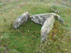
Doe Tor Cist
OS Map: SX 54383 84846
HER: MDV3251
Megalithic Portal: 44223
PMD: Doe Tor
Alternate name: Doe Tor E. Cist
ShortName: CT Doe Tor
Butler map: 32.21
Butler Vol 5: p.198 & Fig.141
DPD page: 10
Grinsell: LYD 12
Barrow Report: 24
Notes: Butler Doe Tor E - Vol. 2. Map 32.21 (diagram Vol. 5. p.198).
Nearby sites: SX 54383 84846
Distance: 1.65km
Great Links Tor Cairn
OS Map: SX 54922 86496
HER: MDV4653
Megalithic Portal: 10043
ShortName: CN:GreatLinksT
Butler map: 43.13
Grinsell: BRI 8
Notes: "cairn with hollow in centre. Diam 17.5m, height 1.6m. ... (grinsell) 18.0m diameter, 1.4m high. Siting - hillspur. ... (gerrard) cairn mound measures 19m in diameter and stands up to 1.5m high. An irregular shaped hollow in the centre of the mound, measuring 4m long, 3m wide and up to 1.3m deep, suggests partial early excavation or robbing (mpp)."
Nearby sites: SX 54922 86496
Distance: 1.32km
Great Nodden Cist
Prehistoric Dartmoor Walks: Dartmoor Site: Guide to the Cairns on Great Nodden
OS Map: SX 5388 8741
HER: MDV4625
Megalithic Portal: 45796
PMD: Great Nodden
Alternate name: Great Nodden 17 Cist
ShortName: CT Great Nod17
Butler map: 43.7.17
Grinsell: BRI 7a
Barrow Report: 13 21
Notes: Butler: "recorded on the summit in 1891". This was excavated revealing a cist. No longer traceable. This cairn and cist was around 6m away from the Great Nodden cairn. The photograph accompanying this record is of the Great Nodden Cairn in the vicinity of where this cist used to exist. Butler Vol. 2. Map 43.7.17.
Nearby sites: SX 5388 8741
Distance: 1.13km
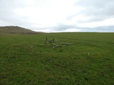
Little Links Tor Stone Row
OS Map: SX 54234 87486
HER: MDV51434
The Stone Rows of GB: Little Links Tor
PMD: Little Links Tor
ShortName: SR LittleLinks
Notes: Formerly listed at SX 54160 87470. Visited on 20 June 2022 and correct location is SX 54234 87486.
Nearby sites: SX 54234 87486
Distance: 1.33km