
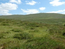
Guide to the Cairns on Great Nodden
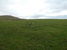
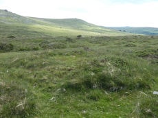
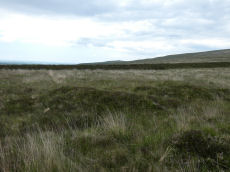
Nodden Gate Round House
OS Map: SX 53154 86034
NMR: No record found
HER record: MDV27351
ShortName: HT:Nodden Ga1
Nearby sites: SX53158603
Nodden Gate Round House
OS Map: SX 53151 86029
NMR: No record found
HER record: MDV27351
ShortName: HT:Nodden Ga2
Nearby sites: SX53158603
Great Nodden 1 Cairn Circle
OS Map: SX 53079 86222
NMR: No record found
HER: No record found
ShortName: CN Great Nod 1
Butler map: 43.7.1
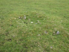
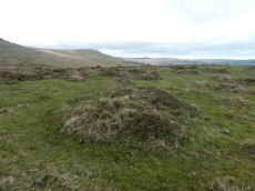
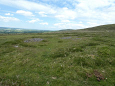
Notes: This site originates with Butler but is not listed elsewhere. A mound can be seen on Lidar imagery at SX 53077 86213 which matches the location given by Butler. Visited 3 June 2022 and there is clearly a substantial but badly damaged cairn at this location. It can also be seen on Google satellite imagery. Whether it is prehistoric or later clearance is hard to say but the mutilated state suggests maybe more likely a robbed out prehistoric cairn. The Great Nodden Cairns 1-3 are not listed on the HER but there is an entry for the field system which states "May include some cairns, which presumably may be clearance cairns". See HER record Field system south of Nodden Gate MDV27320.
Nearby sites: SX53088622
Great Nodden 2 Cairn
OS Map: SX 53101 86256
NMR: No record found
HER: No record found
ShortName: CN Great Nod 2
Butler map: 43.7.2
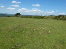
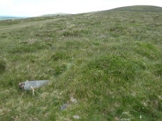
Notes: This site originates with Butler but is not listed elsewhere. A mound can be seen on Lidar imagery at SX 53098 86249 which matches the location given by Butler. Butler: "two smaller and much pitted cairns 5 and 6 m across lie close to the field wall." Visited 3 June 2022. This was previously listed as a "reported cairn", this has now been updated to "cairn". It looks a genuine site to the author. NGR and photo updated after visit 28 April 2023. The Great Nodden Cairns 1-3 are not listed on the HER but there is an entry for the field system which states "May include some cairns, which presumably may be clearance cairns". See HER record Field system south of Nodden Gate MDV27320.
Nearby sites: SX53108626
Great Nodden 3 Cairn
OS Map: SX 53078 86287
NMR: No record found
HER: No record found
ShortName: CN Great Nod 3
Butler map: 43.7.3
Notes: This site originates with Butler but is not listed elsewhere. A mound can be seen on Lidar imagery at SX 53073 86276 which matches the location given by Butler.Butler: "two smaller and much pitted cairns 5 and 6 m across lie close to the field wall". This was previously listed as a "reported cairn", this has now been updated to "cairn". It looks a genuine site to the author. The Great Nodden Cairns 1-3 are not listed on the HER but there is an entry for the field system which states "May include some cairns, which presumably may be clearance cairns". See HER record Field system south of Nodden Gate MDV27320.
Nearby sites: SX53088629
Great Nodden 4 Cairn
OS Map: SX 53249 86629
NMR: No record found
HER record: MDV51450
ShortName: CN Great Nod 4
Butler map: 43.7.4
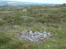
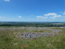
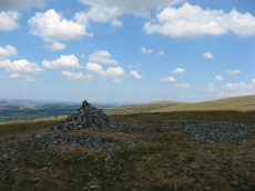
Notes: Ring cairn. "Earthwork survives as a circular bank, 2.3m wide and 0.3m high surrounding an internal area measuring 13.4m in diameter. A mound measuring 6m in diam and 0.2m high stands in the centre of the area enclosed by the circular bank (mpp)". The grid reference given by Butler is a rare mistake. The Butler 43 map and the description make it clear the site is actually located in the vicinity of SX 5324 8660 which is around 400m north the grid reference given on p.245. This corrected grid reference corresponds with the cairn listed here. Visit on 20/06/22 resulted in the photo used. Follow up visit 28/04/23 - found again with difficulty despite having correct grid reference. Not easy to see in the vegetation but it is clearly there and for that reason the entry has been changed from reported cairn to cairn.
Nearby sites: SX53258663
Great Nodden 5 Cairn
OS Map: SX 53343 86810
NMR record: SX 58 NW 36
HER record: MDV51448
ShortName: CN Great Nod 5
Butler map: 43.7.5
Notes: Group of 6 small cairns. This clear mound is not far from Great Nodden 6. NGR from Garmin reading taken 28/04/23. "One of two Bronze Age round cairns south-west of Great Nodden. Cairn mound is flat-topped, measures 5m in diameter and stands up to 0.6m high"
Nearby sites: SX53348681
Great Nodden 6 Cairn
OS Map: SX 53340 86820
NMR: No record found
HER record: MDV51449
ShortName: CN Great Nod 6
Butler map: 43.7.6
Notes: Group of 6 small cairns. These 6 small cairns are quite difficult to find in the undergrowth especially when original NGRs were inaccurate. Visited 03/06/22 and 28/04/23. NGR has been updated with an accurate Garmin reading. Very clear mound for this cairn.
Nearby sites: SX53348682
Great Nodden 7 Cairn
OS Map: SX 53337 86887
NMR record: SX 58 NW 34
HER record: MDV51447
ShortName: CN Great Nod 7
Butler map: 43.7.7
Notes: Group of 6 small cairns. Visited on 03/06/22 and 28/04/23. NGR and details confirmed on 28/04/23.
Nearby sites: SX53348689
Great Nodden 8 Cairn
OS Map: SX 53390 86890
NMR record: SX 58 NW 35
HER record: MDV51446
ShortName: CN Great Nod 8
Butler map: 43.7.8
Notes: Group of 6 small cairns
Nearby sites: SX53398689
Great Nodden 9 Cairn
OS Map: SX 53400 86910
NMR record: SX 58 NW 35
HER record: MDV51507
ShortName: CN:Great Nod 9
Butler map: 43.7.9
Notes: Group of 6 small cairns. Not found on 03/06/22, 20/06/22 and 28/04/23. However, this is overgrown terrain with many clumps of vegetation looking like mounds. The NGRs for these 6 were often very inccurate in the original listings.
Nearby sites: SX53408691

Great Nodden 10 Cairn
OS Map: SX 53370 86934
NMR record: SX 58 NW 32
HER record: MDV51445
ShortName: CN Great Nod10
Butler map: 43.7.10
Notes: Group of 6 small cairns. Visited 03/06/22 and again 28/04/23. "Round cairn. Mound measures 6m in diameter and stands up to 0.6m high. A 1.4m square stone filled hollow in the centre of the mound suggests partial early excavation or robbing."
Nearby sites: SX53378693
Great Nodden 11 Cairn
OS Map: SX 53477 87054
NMR record: SX 58 NW 33
HER record: MDV51505
ShortName: CN Great Nod11
Butler map: 43.7.11
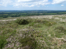
Notes: Ring cairn. Earthwork survives as a circular bank, 3.5m wide and 0.5m high surrounding an internal area measuring 10.7m in diameter. A 2.5m wide gap in the w side of the bank may represent an original entrance. Interior of this cairn is pitted with hollows, which suggest partial robbing or early excavation. Visited 3 June 2022.
Nearby sites: SX53488705
Great Nodden 12 Cairn
OS Map: SX 53445 87077
NMR: No record found
HER record: MDV27341
ShortName: CN Great Nod12
Butler map: 43.7.12
Notes: Butler: "a circular bank 9 m across surrounds a pit with a floor well below ground level". On the western side of the path, near the larger ring cairn that is located on the eastern side.
Nearby sites: SX53458708
Great Nodden 13 Cairn
OS Map: SX 53620 87409
NMR record: SX 58 NW 6
HER record: MDV4676
ShortName: CN Great Nod13
Butler map: 43.7.13
Grinsell: BRI 6
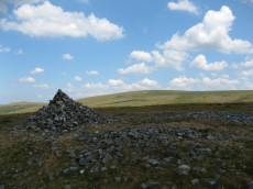
Notes: "Cairn mound measures 17.3m in diameter and stands up to 1m high. Loose rubble covering the centre of the mound suggests that the cairn has been partially excavated or robbed." Visited 3 & 20 June 2022.
Nearby sites: SX53628741
Great Nodden 14 Reported Cairn
OS Map: SX 53695 87564
NMR: No record found
HER: No record found
ShortName: CN-Great Nod14
Butler map: 43.7.14
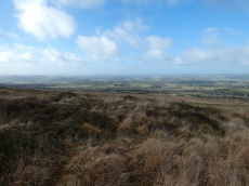
Notes: Butler: "The pit with a surrounding bank is also probably the remains of a robbed cairn". Visited 3 June 2022 ans 28/04/23. Butler suggests this pit is probably part of bronze age cairn. He could be right. Lake Viaduct can be seen from this location. A few hundred metres to the north on Lake Down there are some pits which are gun dug-outs overlooking the then railway over the viaduct. This pit doesn't look so modern and regular but it is quite overgrown.
Nearby sites: SX53708756
Great Nodden 15 Cairn
OS Map: SX 54225 87874
NMR record: SX 58 NW 23
HER record: MDV12847
ShortName: CN Great Nod15
Butler map: 43.7.15
Grinsell: BRI 5
Notes: "Cairn mound measures 11m north-east to south-west by 7m north-west to south-east and stands up to 0.5m high. Two narrow trenches cut into either end of the mound, represent partial early excavation or robbing. The north trench measures 3m by 1.2m by 0.2m deep, whilst the southern one is 2.5m by 1m wide by 0.1m deep." Visit 3 June 2022 on which I recorded a cist-shaped trench. The HER refers to trenches dug into this cairn.
Nearby sites: SX54238787
Great Nodden 16 Cairn
OS Map: SX 53887 87421
NMR record: SX 58 NW 5
HER record: MDV4625
ShortName: CN Great Nod16
Butler map: 43.7.16
Grinsell: BRI 7
Notes: This is a badly damaged cairn 14m across.
Nearby sites: SX53898742
Great Nodden Cist
OS Map: SX 53880 87410
NMR record: SX 58 NW 5
HER record: MDV4625
Megalithic Portal: 45796
PMD: Great Nodden
Alternate name: Great Nodden 17 Cist
ShortName: CT Great Nod17
Butler map: 43.7.17
Grinsell: BRI 7a
Barrow Report: 13 21
Notes: Butler: "recorded on the summit in 1891". This was excavated revealing a cist. No longer traceable. This cairn and cist was around 6m away from the Great Nodden cairn. The photograph accompanying this record is of the Great Nodden Cairn in the vicinity of where this cist used to exist. Butler Vol. 2. Map 43.7.17.
Nearby sites: SX53888741
Great Nodden 18 Crop Mark
OS Map: SX 53450 87230
NMR: No record found
HER: No record found
ShortName: CN?Great Nod18
Butler map: 43.7.18
Notes: Butler. Two of the cairns "show up only as crop marks on aerial photographs". Visit 3 June 2022 - unable to locate feature.
Nearby sites: SX53458723
Great Nodden 19 Crop Mark
OS Map: SX 53410 87130
NMR: No record found
HER: No record found
ShortName: CN?Great Nod19
Butler map: 43.7.19
Notes: Butler. Two of the cairns "show up only as crop marks on aerial photgraphs". Visit 3 June 2022 - unable to locate feature.
Nearby sites: SX53418713
Great Nodden 20 Cairn
OS Map: SX 53860 87842
NMR: No record found
HER record: MDV55724
ShortName: CN Great Nod20
Notes: "a well preserved and undisturbed prehistoric cairn a short distance above the king wall". Visited 3 June 2022. The grid reference on the HER is SX 53900 87880. The grid reference SX 53860 87842 is a Garmin reading taken standing very near to it. Dense vegetation and rough terrain - I did not fancy attempting to clamber on it so not the centre of the feature as usual.
Nearby sites: SX53868784
Page last updated 01/05/23