
Prehistoric sites within 3km of SX 68750 68250
Guidance for walkers: The monuments featured in this database are archaeological treasures and need to be protected and preserved - please do not disturb any sites. Please check access and firing times before visiting sites, not all sites listed are on open access land. Firing ranges and boundaries of open access areas are marked on the OL28 OS Dartmoor Explorer map. Please stick to the country code and consider giving support to the numerous agencies that help to keep Dartmoor a fabulous natural and historic environment!
About the database listings: In all listings clicking on the photo or the site name will open a page for the site with a larger photo and further details from the database. The database now has over 6680 records covering nearly all publicly listed sites on Dartmoor including around 4800 round houses. This level of detail is of interest to archaeologists but tends to swamp listings of sites more likely to be of interest for walkers. For this reason, the listings default to around 550 core sites only. These are the stone circles, stone rows and the ring cairns listed by Turner. The default search radius is 2 km. The controls below the map can be used to start a new search by entering a 6- or 8-digit reference (without the prefix "SX"). The search radius can be specified and you can add incremental Display layers of detail on top of the core sites. If using a more detailed layer you will need to decrease the search radius to avoid getting hundreds of search results.
- Core sites Default listing of core sites consisting of stone circles & rows and some of the major ring cairns.
- Plus cairns adds approx. 1000 cairns and other minor sites not included in the core listings but excluding round houses.
- Plus round houses adds approx. 4800 round houses.
- Plus non-sites adds in the records for sites that no longer exist or are not prehistoric sites.
- Plus duplicates adds records excluded as duplicates. Those maybe duplicate records in external listings (e.g. the Historic Environment Records). For example, some sites have been identified as cairns in some listings and interpreted as round houses in other listings and both records appear.
These listings have incorporated, matched up and merged all of the records from all of the major archaeological listings including: Worth, Grinsell, Turner, Butler, Bill Radcliffe, Sandy Gerrard, Megalithic Portal, the National Monument Records and the Historic Environment Records. The author would like to thank Bill, Sandy, the lovely people both at Megalithic Portal (especially Anne Tate who did an amazing job to link listings) and at ACE Archaeology for collaborative work over the years to synchronise and correct listings across the various websites which now interlink. A culmination of years of work the final merger of cairn records took 3 months of cross referencing in 2017 the result being a snapshot of the records at that time. This data has in turn been refined since by field work and research. The round house data was supplied by Sandy Gerrard. Grid references are in order of accuracy: from Google Earth satellite, if visible and found, from a Garmin GPS reading, if visited by the author and from the literature otherwise. Individual site pages will state the source of the grid reference and provide satellite imagery. If a site listing lacks a photo it has not yet been visited by the author in which case the grid reference is from the literature.
Currently the database only includes sites which can be represented by a grid reference. Reaves are not included as they require GIS shape technology which is beyond the current capability of this system. To see the sources for the records, look at the tables on the resources menu. The database listings can also be viewed on a Google map and downloaded as GPS datasets for Garmin devices.
Corrections, or any feedback or suggestions are very welcome, email: info@dartmoorwalks.org.uk.
NOTE: Clicking on the icons for each monument in the map will give the name of the site. You can zoom in and out and drag the map around.
List of sites within 3km of SX 68750 68250
Biller's Pound Round House
OS Map: SX 66754 66142
HER: MDV5188
Alternate name: Biller's Pound Round House
ShortName: HT:Biller's 1
Nearby sites: SX 66754 66142
Distance: 2.90km
Biller's Pound Round House
OS Map: SX 66722 66214
HER: MDV5189
Alternate name: Biller's Pound Round House
ShortName: HT:Biller's 2
Nearby sites: SX 66722 66214
Distance: 2.87km
Biller's Pound Round House
OS Map: SX 6675 6620
HER: MDV5189
Alternate name: Biller's Pound Round House
ShortName: HT:Biller's 3
Nearby sites: SX 6675 6620
Distance: 2.86km
Biller's Pound Round House
OS Map: SX 66729 66109
HER: MDV5190
Alternate name: Biller's Pound Round House
ShortName: HT:Biller's 4
Nearby sites: SX 66729 66109
Distance: 2.94km
Biller's Pound Round House
OS Map: SX 66731 66215
HER: MDV5189
Alternate name: Biller's Pound Round House
ShortName: HT:Biller's 5
Nearby sites: SX 66731 66215
Distance: 2.87km
Biller's Pound Round House
OS Map: SX 66669 66191
HER: MDV5190
Alternate name: Biller's Pound Round House
ShortName: HT:Biller's 6
Nearby sites: SX 66669 66191
Distance: 2.93km
Biller's Pound Round House
OS Map: SX 66723 66127
HER: MDV5190
Alternate name: Biller's Pound Round House
ShortName: HT:Biller's 7
Nearby sites: SX 66723 66127
Distance: 2.94km
Biller's Pound Round House
OS Map: SX 66657 66188
HER: MDV5190
Alternate name: Biller's Pound Round House
ShortName: HT:Biller's 8
Nearby sites: SX 66657 66188
Distance: 2.94km
Biller's Pound Round House
OS Map: SX 66694 66206
HER: MDV5189
Alternate name: Biller's Pound Round House
ShortName: HT:Biller's 9
Nearby sites: SX 66694 66206
Distance: 2.90km
Biller's Pound Round House
OS Map: SX 66693 66199
HER: MDV5189
Alternate name: Biller's Pound Round House
ShortName: HT:Biller's 10
Nearby sites: SX 66693 66199
Distance: 2.90km
Biller's Pound Round House
OS Map: SX 66690 66193
HER: MDV5189
Alternate name: Biller's Pound Round House
ShortName: HT:Biller's 11
Nearby sites: SX 66690 66193
Distance: 2.91km
Biller's Pound Round House
OS Map: SX 66674 66207
HER: MDV5190
Alternate name: Biller's Pound Round House
ShortName: HT:Biller's 12
Nearby sites: SX 66674 66207
Distance: 2.91km
Biller's Pound Round House
OS Map: SX 66653 66204
HER: MDV5190
Alternate name: Biller's Pound Round House
ShortName: HT:Biller's 13
Nearby sites: SX 66653 66204
Distance: 2.93km
Biller's Pound Round House
OS Map: SX 66667 66201
HER: MDV5190
Alternate name: Biller's Pound Round House
ShortName: HT:Biller's 14
Nearby sites: SX 66667 66201
Distance: 2.92km
Biller's Pound Round House
OS Map: SX 66656 66215
HER: MDV5190
Alternate name: Biller's Pound Round House
ShortName: HT:Biller's 15
Nearby sites: SX 66656 66215
Distance: 2.92km
Biller's Pound Round House
OS Map: SX 66665 66211
HER: MDV5190
Alternate name: Biller's Pound Round House
ShortName: HT:Biller's 16
Nearby sites: SX 66665 66211
Distance: 2.92km
Biller's Pound Round House
OS Map: SX 66727 66215
HER: MDV5189
Alternate name: Biller's Pound Round House
ShortName: HT:Biller's 17
Nearby sites: SX 66727 66215
Distance: 2.87km
Biller's Pound Round House
OS Map: SX 66734 66093
HER: MDV5190
Alternate name: Biller's Pound Round House
ShortName: HT:Biller's 18
Nearby sites: SX 66734 66093
Distance: 2.95km
Brockhill Foot W Round House
OS Map: SX 67740 65435
HER: MDV14799
ShortName: HT:Brockhill1
Nearby sites: SX 67740 65435
Distance: 2.99km
Brockhill Foot W Round House
OS Map: SX 67786 65413
HER: MDV14799
ShortName: HT:Brockhill2
Nearby sites: SX 67786 65413
Distance: 3.00km
Brockhill Foot W Round House
OS Map: SX 67692 65465
HER: MDV14799
ShortName: HT:Brockhill3
Nearby sites: SX 67692 65465
Distance: 2.98km
Brockhill Foot W Round House
OS Map: SX 67734 65495
HER: MDV14799
ShortName: HT:Brockhill4
Nearby sites: SX 67734 65495
Distance: 2.94km
Brockhill Foot W Round House
OS Map: SX 67690 65478
HER: MDV14799
ShortName: HT:Brockhill5
Nearby sites: SX 67690 65478
Distance: 2.97km
Brockhill Foot W Round House
OS Map: SX 67689 65469
HER: MDV14799
ShortName: HT:Brockhill6
Nearby sites: SX 67689 65469
Distance: 2.98km
Brockhill Foot W Round House
OS Map: SX 67685 65502
HER: MDV14799
ShortName: HT:Brockhill7
Nearby sites: SX 67685 65502
Distance: 2.95km
Brockhill Foot W Round House
OS Map: SX 67753 65455
HER: MDV14799
ShortName: HT:Brockhill8
Nearby sites: SX 67753 65455
Distance: 2.97km
Brockhill Foot W Round House
OS Map: SX 67780 65421
HER: MDV14799
ShortName: HT:Brockhill9
Nearby sites: SX 67780 65421
Distance: 2.99km
Brockhill Foot W Round House
OS Map: SX 67763 65445
HER: MDV14799
ShortName: HT:Brockhill10
Nearby sites: SX 67763 65445
Distance: 2.97km
Brockhill Foot W Round House
OS Map: SX 67690 65494
HER: MDV14799
ShortName: HT:Brockhill11
Nearby sites: SX 67690 65494
Distance: 2.95km
Brockhill Foot W Round House
OS Map: SX 67787 65430
HER: MDV14799
ShortName: HT:Brockhill12
Nearby sites: SX 67787 65430
Distance: 2.98km
Brockhill Foot W Round House
OS Map: SX 67732 65457
HER: MDV14799
ShortName: HT:Brockhill13
Nearby sites: SX 67732 65457
Distance: 2.97km
Brockhill Foot W Round House
OS Map: SX 67696 65474
HER: MDV14799
ShortName: HT:Brockhill14
Nearby sites: SX 67696 65474
Distance: 2.97km
Brockhill Foot W Round House
OS Map: SX 67808 65461
HER: MDV14799
ShortName: HT:Brockhill15
Nearby sites: SX 67808 65461
Distance: 2.94km
Brockhill Foot W Round House
OS Map: SX 67717 65486
HER: MDV14799
ShortName: HT:Brockhill16
Nearby sites: SX 67717 65486
Distance: 2.95km
Brockhill Foot W Round House
OS Map: SX 67794 65432
HER: MDV14799
ShortName: HT:Brockhill17
Nearby sites: SX 67794 65432
Distance: 2.98km
Brockhill Foot W Round House
OS Map: SX 67793 65449
HER: MDV14799
ShortName: HT:Brockhill18
Nearby sites: SX 67793 65449
Distance: 2.96km
Brockhill Foot W Round House
OS Map: SX 67726 65460
HER: MDV14799
ShortName: HT:Brockhill19
Nearby sites: SX 67726 65460
Distance: 2.97km
Brockhill Foot W Round House
OS Map: SX 67724 65689
HER: MDV5233
ShortName: HT:Brockhill20
Nearby sites: SX 67724 65689
Distance: 2.76km
Brockhill Foot W Round House
OS Map: SX 67731 65689
HER: MDV5233
ShortName: HT:Brockhill21
Nearby sites: SX 67731 65689
Distance: 2.76km
Brockhill Foot W Round House
OS Map: SX 67692 65452
HER: MDV14799
ShortName: HT:Brockhill22
Nearby sites: SX 67692 65452
Distance: 2.99km
Buckfastleigh Moor Round House
OS Map: SX 67371 67772
ShortName: HT:Buckfastl1
Nearby sites: SX 67371 67772
Distance: 1.46km
Hickaton Hill Round House
OS Map: SX 67192 66471
HER: MDV5295
ShortName: HT:Hickaton 1
Nearby sites: SX 67192 66471
Distance: 2.36km
Hickaton Hill Round House
OS Map: SX 67250 66508
HER: MDV5294
ShortName: HT:Hickaton 2
Nearby sites: SX 67250 66508
Distance: 2.30km
Hickaton Hill Round House
OS Map: SX 67236 66498
HER: MDV5294
ShortName: HT:Hickaton 3
Nearby sites: SX 67236 66498
Distance: 2.32km
Hickaton Hill Round House
OS Map: SX 67254 66521
HER: MDV5294
ShortName: HT:Hickaton 4
Nearby sites: SX 67254 66521
Distance: 2.29km
Hickaton Hill Round House
OS Map: SX 67245 66509
HER: MDV5294
ShortName: HT:Hickaton 5
Nearby sites: SX 67245 66509
Distance: 2.30km
Hickaton Hill Round House
OS Map: SX 67248 66519
HER: MDV5294
ShortName: HT:Hickaton 6
Nearby sites: SX 67248 66519
Distance: 2.29km
Hickaton Hill Round House
OS Map: SX 67235 66510
HER: MDV5294
ShortName: HT:Hickaton 7
Nearby sites: SX 67235 66510
Distance: 2.31km
Hickaton Hill E Round House
OS Map: SX 6827 6685
HER: MDV24781
ShortName: HT:Hickaton 8
Nearby sites: SX 6827 6685
Distance: 1.48km
Hickaton Hill E Round House
OS Map: SX 68020 66671
ShortName: HT:Hickaton 9
Nearby sites: SX 68020 66671
Distance: 1.74km
Hickaton Hill E Round House
OS Map: SX 68321 66778
HER: MDV24768
ShortName: HT:Hickaton 10
Nearby sites: SX 68321 66778
Distance: 1.53km
Hickaton Hill E Round House
OS Map: SX 6817 6670
HER: MDV24780
ShortName: HT:Hickaton 11
Nearby sites: SX 6817 6670
Distance: 1.65km
Hickaton Hill S Round House
OS Map: SX 67415 65628
HER: MDV5303
ShortName: HT:Hickaton 12
Nearby sites: SX 67415 65628
Distance: 2.94km
Hickaton Hill S Round House
OS Map: SX 6744 6558
ShortName: HT:Hickaton 13
Nearby sites: SX 6744 6558
Distance: 2.97km
Hickaton Hill S Round House
OS Map: SX 67395 65616
HER: MDV5303
ShortName: HT:Hickaton 14
Nearby sites: SX 67395 65616
Distance: 2.96km
Hickaton Hill S Round House
OS Map: SX 67424 65707
HER: MDV5304
ShortName: HT:Hickaton 15
Nearby sites: SX 67424 65707
Distance: 2.87km
Hickaton Hill S Round House
OS Map: SX 67307 65623
HER: MDV5232
ShortName: HT:Hickaton 16
Nearby sites: SX 67307 65623
Distance: 3.00km
Hickaton Hill S Round House
OS Map: SX 67455 65600
ShortName: HT:Hickaton 17
Nearby sites: SX 67455 65600
Distance: 2.95km
Hickaton Hill S Round House
OS Map: SX 67433 65635
HER: MDV5303
ShortName: HT:Hickaton 18
Nearby sites: SX 67433 65635
Distance: 2.93km
Hickaton Hill SE Round House
OS Map: SX 6753 6589
HER: MDV5227
ShortName: HT:Hickaton 19
Nearby sites: SX 6753 6589
Distance: 2.66km
Hickaton Hill SE Round House
OS Map: SX 6775 6595
HER: MDV24691
ShortName: HT:Hickaton 20
Nearby sites: SX 6775 6595
Distance: 2.51km
Hickaton Hill SE Round House
OS Map: SX 67529 65851
HER: MDV5227
ShortName: HT:Hickaton 21
Nearby sites: SX 67529 65851
Distance: 2.69km
Hickaton Hill SE Round House
OS Map: SX 67664 65985
HER: MDV5227
ShortName: HT:Hickaton 22
Nearby sites: SX 67664 65985
Distance: 2.51km
Hickaton Hill SE Round House
OS Map: SX 67588 65994
HER: MDV5227
ShortName: HT:Hickaton 23
Nearby sites: SX 67588 65994
Distance: 2.54km
Hickaton Hill SE Round House
OS Map: SX 67585 65976
HER: MDV5227
ShortName: HT:Hickaton 24
Nearby sites: SX 67585 65976
Distance: 2.56km
Hickaton Hill SE Round House
OS Map: SX 67656 65820
HER: MDV24774
ShortName: HT:Hickaton 25
Nearby sites: SX 67656 65820
Distance: 2.66km
Hickaton Hill SE Round House
OS Map: SX 67613 65966
HER: MDV5227
ShortName: HT:Hickaton 26
Nearby sites: SX 67613 65966
Distance: 2.55km
Hickaton Hill SE Round House
OS Map: SX 6776 6597
HER: MDV24775
ShortName: HT:Hickaton 27
Nearby sites: SX 6776 6597
Distance: 2.49km
Hickaton Hill SE Round House
OS Map: SX 67737 65752
HER: MDV5233
ShortName: HT:Hickaton 28
Nearby sites: SX 67737 65752
Distance: 2.70km
Hickaton Hill SE Round House
OS Map: SX 67476 65786
HER: MDV24773
ShortName: HT:Hickaton 29
Nearby sites: SX 67476 65786
Distance: 2.77km
Hickaton Hill SE Round House
OS Map: SX 67747 65725
HER: MDV5233
ShortName: HT:Hickaton 30
Nearby sites: SX 67747 65725
Distance: 2.72km
Hickaton Hill SE Round House
OS Map: SX 67565 65946
HER: MDV5227
ShortName: HT:Hickaton 31
Nearby sites: SX 67565 65946
Distance: 2.59km
Hickaton Hill SE Round House
OS Map: SX 67467 65791
HER: MDV24773
ShortName: HT:Hickaton 32
Nearby sites: SX 67467 65791
Distance: 2.77km
Hickaton Hill SE Round House
OS Map: SX 67653 65874
HER: MDV103647
ShortName: HT:Hickaton 33
Nearby sites: SX 67653 65874
Distance: 2.62km
Hickaton Hill SE Round House
OS Map: SX 67575 65891
HER: MDV5227
ShortName: HT:Hickaton 34
Nearby sites: SX 67575 65891
Distance: 2.64km
Hickaton Hill SE Round House
OS Map: SX 67582 65982
HER: MDV5227
ShortName: HT:Hickaton 35
Nearby sites: SX 67582 65982
Distance: 2.55km
Hickaton Hill SE Round House
OS Map: SX 67696 65767
HER: MDV5233
ShortName: HT:Hickaton 36
Nearby sites: SX 67696 65767
Distance: 2.70km
Hickaton Hill SE Round House
OS Map: SX 67562 65937
HER: MDV5227
ShortName: HT:Hickaton 37
Nearby sites: SX 67562 65937
Distance: 2.60km
Hickaton Hill SE Round House
OS Map: SX 67549 65864
HER: MDV5227
ShortName: HT:Hickaton 38
Nearby sites: SX 67549 65864
Distance: 2.67km
Hickaton Hill SE Round House
OS Map: SX 67628 66014
HER: MDV5227
ShortName: HT:Hickaton 39
Nearby sites: SX 67628 66014
Distance: 2.50km
Hickaton Hill SE Round House
OS Map: SX 67543 65844
HER: MDV5227
ShortName: HT:Hickaton 40
Nearby sites: SX 67543 65844
Distance: 2.69km
Hickaton Hill SE Round House
OS Map: SX 67553 65894
HER: MDV5227
ShortName: HT:Hickaton 41
Nearby sites: SX 67553 65894
Distance: 2.64km
Hickaton Hill SE Round House
OS Map: SX 67570 65961
HER: MDV5227
ShortName: HT:Hickaton 42
Nearby sites: SX 67570 65961
Distance: 2.58km
Hickaton Hill SE Round House
OS Map: SX 67567 65858
HER: MDV5227
ShortName: HT:Hickaton 43
Nearby sites: SX 67567 65858
Distance: 2.67km
Hickaton Hill SE Round House
OS Map: SX 67541 65885
HER: MDV5227
ShortName: HT:Hickaton 44
Nearby sites: SX 67541 65885
Distance: 2.66km
Hickaton Hill SE Round House
OS Map: SX 67593 65913
HER: MDV5227
ShortName: HT:Hickaton 45
Nearby sites: SX 67593 65913
Distance: 2.61km
Hickaton Hill SE Round House
OS Map: SX 67596 65935
HER: MDV5227
ShortName: HT:Hickaton 46
Nearby sites: SX 67596 65935
Distance: 2.59km
Hickaton Hill SE Round House
OS Map: SX 67628 65948
HER: MDV5227
ShortName: HT:Hickaton 47
Nearby sites: SX 67628 65948
Distance: 2.56km
Hickaton Hill SE Round House
OS Map: SX 67563 65876
HER: MDV5227
ShortName: HT:Hickaton 48
Nearby sites: SX 67563 65876
Distance: 2.65km
Hickaton Hill SE Round House
OS Map: SX 67565 65912
HER: MDV5227
ShortName: HT:Hickaton 49
Nearby sites: SX 67565 65912
Distance: 2.62km
Hickaton Hill SE Round House
OS Map: SX 67681 65723
HER: MDV5233
ShortName: HT:Hickaton 50
Nearby sites: SX 67681 65723
Distance: 2.74km
Hickaton Hill SE Round House
OS Map: SX 67685 65992
HER: MDV5227
ShortName: HT:Hickaton 51
Nearby sites: SX 67685 65992
Distance: 2.50km
Holne Moor Round House
OS Map: SX 67409 70660
ShortName: HT:Holne Moo1
Nearby sites: SX 67409 70660
Distance: 2.76km
Holne Moor Round House
OS Map: SX 67814 70964
HER: MDV104469
ShortName: HT:Holne Moo3
Nearby sites: SX 67814 70964
Distance: 2.87km
Holne Moor Round House
OS Map: SX 68662 70552
HER: MDV6381
ShortName: HT:Holne Moo6
Nearby sites: SX 68662 70552
Distance: 2.30km
Holne Moor Round House
OS Map: SX 68507 70577
HER: MDV6382
ShortName: HT:Holne Moo8
Nearby sites: SX 68507 70577
Distance: 2.34km
Holne Moor Round House
OS Map: SX 67770 70474
ShortName: HT:Holne Moo17
Nearby sites: SX 67770 70474
Distance: 2.43km
Holne Moor Round House
OS Map: SX 68106 70434
HER: MDV64119
ShortName: HT:Holne Moo18
Nearby sites: SX 68106 70434
Distance: 2.28km
Holne Moor Round House
OS Map: SX 68527 70456
HER: MDV6382
ShortName: HT:Holne Moo20
Nearby sites: SX 68527 70456
Distance: 2.22km
Holne Moor Round House
OS Map: SX 68232 71068
HER: MDV26358
ShortName: HT:Holne Moo21
Nearby sites: SX 68232 71068
Distance: 2.87km
Holne Moor Round House
OS Map: SX 68914 70468
HER: MDV6382
ShortName: HT:Holne Moo22
Nearby sites: SX 68914 70468
Distance: 2.22km
Holne Moor Round House
OS Map: SX 68003 70612
HER: MDV27271
ShortName: HT:Holne Moo23
Nearby sites: SX 68003 70612
Distance: 2.48km
Holne Moor Round House
OS Map: SX 68660 70547
HER: MDV6381
ShortName: HT:Holne Moo25
Nearby sites: SX 68660 70547
Distance: 2.30km
Holne Moor Round House
OS Map: SX 68101 70434
HER: MDV64119
ShortName: HT:Holne Moo26
Nearby sites: SX 68101 70434
Distance: 2.28km
Holne Moor Round House
OS Map: SX 67305 70701
ShortName: HT:Holne Moo27
Nearby sites: SX 67305 70701
Distance: 2.85km
Holne Moor Round House
OS Map: SX 67371 70688
ShortName: HT:Holne Moo28
Nearby sites: SX 67371 70688
Distance: 2.80km
Holne Moor Round House
OS Map: SX 68065 70547
HER: MDV6379
ShortName: HT:Holne Moo31
Nearby sites: SX 68065 70547
Distance: 2.40km
Holne Moor Round House
OS Map: SX 6742 7070
ShortName: HT:Holne Moo32
Nearby sites: SX 6742 7070
Distance: 2.79km
Holne Moor Round House
OS Map: SX 68170 70979
HER: MDV6388
ShortName: HT:Holne Moo35
Nearby sites: SX 68170 70979
Distance: 2.79km
Holne Moor Round House
OS Map: SX 68170 70993
HER: MDV6388
ShortName: HT:Holne Moo37
Nearby sites: SX 68170 70993
Distance: 2.80km
Holne Moor Round House
OS Map: SX 68842 70446
HER: MDV6382
ShortName: HT:Holne Moo38
Nearby sites: SX 68842 70446
Distance: 2.20km
Holne Moor Round House
OS Map: SX 67821 70980
HER: MDV26733
ShortName: HT:Holne Moo39
Nearby sites: SX 67821 70980
Distance: 2.88km
Holne Moor Round House
OS Map: SX 68007 70893
ShortName: HT:Holne Moo43
Nearby sites: SX 68007 70893
Distance: 2.75km
Holne Moor Round House
OS Map: SX 67752 70467
ShortName: HT:Holne Moo46
Nearby sites: SX 67752 70467
Distance: 2.43km
Holne Moor Round House
OS Map: SX 67648 70497
HER: MDV26362
ShortName: HT:Holne Moo47
Nearby sites: SX 67648 70497
Distance: 2.50km
Holne Moor Round House
OS Map: SX 67814 70829
ShortName: HT:Holne Moo51
Nearby sites: SX 67814 70829
Distance: 2.74km
Holne Moor Round House
OS Map: SX 68258 70428
HER: MDV113635
ShortName: HT:Holne Moo54
Nearby sites: SX 68258 70428
Distance: 2.23km
Holne Moor Round House
OS Map: SX 67269 70677
ShortName: HT:Holne Moo56
Nearby sites: SX 67269 70677
Distance: 2.84km
Holne Moor Round House
OS Map: SX 68068 70433
HER: MDV64119
ShortName: HT:Holne Moo59
Nearby sites: SX 68068 70433
Distance: 2.29km
Holne Moor Round House
OS Map: SX 68455 70435
HER: MDV6470
ShortName: HT:Holne Moo60
Nearby sites: SX 68455 70435
Distance: 2.20km
Holne Moor Round House
OS Map: SX 679 709
HER: MDV20247
ShortName: HT:Holne Moo62
Nearby sites: SX 679 709
Distance: 2.78km
Holne Moor Round House
OS Map: SX 68277 70829
HER: MDV6451
ShortName: HT:Holne Moo63
Nearby sites: SX 68277 70829
Distance: 2.62km
Holne Moor Round House
OS Map: SX 68947 70461
HER: MDV6471
ShortName: HT:Holne Moo64
Nearby sites: SX 68947 70461
Distance: 2.22km
Holne Moor Round House
OS Map: SX 68674 70593
HER: MDV6382
ShortName: HT:Holne Moo66
Nearby sites: SX 68674 70593
Distance: 2.34km
Holne Moor Round House
OS Map: SX 68424 70439
HER: MDV6468
ShortName: HT:Holne Moo67
Nearby sites: SX 68424 70439
Distance: 2.21km
Holne Moor Round House
OS Map: SX 68640 70613
HER: MDV6382
ShortName: HT:Holne Moo68
Nearby sites: SX 68640 70613
Distance: 2.37km
Holne Moor Round House
OS Map: SX 68068 70558
HER: MDV6379
ShortName: HT:Holne Moo69
Nearby sites: SX 68068 70558
Distance: 2.41km
Holne Moor Round House
OS Map: SX 68072 70639
HER: MDV12985
ShortName: HT:Holne Moo71
Nearby sites: SX 68072 70639
Distance: 2.48km
Holne Moor Round House
OS Map: SX 68428 70460
HER: MDV6469
ShortName: HT:Holne Moo72
Nearby sites: SX 68428 70460
Distance: 2.23km
Holne Moor Round House
OS Map: SX 68816 70463
HER: MDV12984
ShortName: HT:Holne Moo77
Nearby sites: SX 68816 70463
Distance: 2.21km
Holne Moor Round House
OS Map: SX 68098 70628
HER: MDV26361
ShortName: HT:Holne Moo79
Nearby sites: SX 68098 70628
Distance: 2.47km
Holne Moor Round House
OS Map: SX 68236 70801
ShortName: HT:Holne Moo80
Nearby sites: SX 68236 70801
Distance: 2.60km
Holy Brook Round House
OS Map: SX 6849 6880
HER: MDV62030
ShortName: HT:Holy Broo1
Nearby sites: SX 6849 6880
Distance: 0.61km
Holy Brook Round House
OS Map: SX 6811 6880
HER: MDV62031
ShortName: HT:Holy Broo2
Nearby sites: SX 6811 6880
Distance: 0.84km
Holy Brook Round House
OS Map: SX 6802 6884
HER: MDV62029
ShortName: HT:Holy Broo3
Nearby sites: SX 6802 6884
Distance: 0.94km
Mardle Ring Round House
OS Map: SX 67473 68656
HER: MDV5208
ShortName: HT:Mardle Ri1
Nearby sites: SX 67473 68656
Distance: 1.34km
Mardle Ring Round House
OS Map: SX 67528 68666
HER: MDV5206
ShortName: HT:Mardle Ri2
Nearby sites: SX 67528 68666
Distance: 1.29km
River Mardle Round House
OS Map: SX 6779 6863
HER: MDV62026
ShortName: HT:River Mar1
Nearby sites: SX 6779 6863
Distance: 1.03km
River Mardle Round House
OS Map: SX 6770 6871
HER: MDV62028
ShortName: HT:River Mar2
Nearby sites: SX 6770 6871
Distance: 1.15km
River Mardle Round House
OS Map: SX 6775 6868
HER: MDV62027
ShortName: HT:River Mar3
Nearby sites: SX 6775 6868
Distance: 1.09km
River Mardle Round House
OS Map: SX 6797 6849
HER: MDV24779
ShortName: HT:River Mar4
Nearby sites: SX 6797 6849
Distance: 0.82km
River Mardle Round House
OS Map: SX 6779 6853
HER: MDV24776
ShortName: HT:River Mar5
Nearby sites: SX 6779 6853
Distance: 1.00km
River Mardle Round House
OS Map: SX 67864 68569
HER: MDV5215
ShortName: HT:River Mar6
Nearby sites: SX 67864 68569
Distance: 0.94km
Skerraton Down Round House
OS Map: SX 6988 6573
HER: MDV13197
ShortName: HT:Skerraton1
Nearby sites: SX 6988 6573
Distance: 2.76km
Skerraton Down Round House
OS Map: SX 6990 6563
HER: MDV13195
ShortName: HT:Skerraton2
Nearby sites: SX 6990 6563
Distance: 2.86km
Skerraton Down Round House
OS Map: SX 6997 6569
HER: MDV13196
ShortName: HT:Skerraton4
Nearby sites: SX 6997 6569
Distance: 2.84km
Snowdon Brook North Round House
OS Map: SX 67634 68388
HER: MDV5306
ShortName: HT:Snowdon B1
Nearby sites: SX 67634 68388
Distance: 1.12km
Snowdon Brook North Round House
OS Map: SX 67625 68377
HER: MDV5306
ShortName: HT:Snowdon B2
Nearby sites: SX 67625 68377
Distance: 1.13km
Snowdon Brook North Round House
OS Map: SX 67656 68386
HER: MDV5306
ShortName: HT:Snowdon B3
Nearby sites: SX 67656 68386
Distance: 1.10km
Snowdon Brook North Round House
OS Map: SX 67619 68346
HER: MDV5306
ShortName: HT:Snowdon B4
Nearby sites: SX 67619 68346
Distance: 1.14km
Snowdon Brook North Round House
OS Map: SX 67811 68298
HER: MDV5216
ShortName: HT:Snowdon B5
Nearby sites: SX 67811 68298
Distance: 0.94km
Snowdon Brook North Round House
OS Map: SX 6760 6849
HER: MDV24778
ShortName: HT:Snowdon B6
Nearby sites: SX 6760 6849
Distance: 1.17km
Snowdon Brook North Round House
OS Map: SX 67794 68281
HER: MDV5216
ShortName: HT:Snowdon B7
Nearby sites: SX 67794 68281
Distance: 0.96km
Snowdon Brook North Round House
OS Map: SX 67960 68274
HER: MDV24777
ShortName: HT:Snowdon B8
Nearby sites: SX 67960 68274
Distance: 0.79km
Snowdon Brook North Round House
OS Map: SX 67655 68322
HER: MDV5306
ShortName: HT:Snowdon B9
Nearby sites: SX 67655 68322
Distance: 1.10km
Snowdon Brook North Round House
OS Map: SX 67597 68487
HER: MDV24778
ShortName: HT:Snowdon B10
Nearby sites: SX 67597 68487
Distance: 1.18km
Snowdon Brook S Round House
OS Map: SX 68201 68054
HER: MDV24770
ShortName: HT:Snowdon B11
Nearby sites: SX 68201 68054
Distance: 0.58km
Snowdon Brook S Round House
OS Map: SX 68243 67740
ShortName: HT:Snowdon B12
Nearby sites: SX 68243 67740
Distance: 0.72km
Snowdon Brook S Round House
OS Map: SX 68095 67801
HER: MDV24769
ShortName: HT:Snowdon B13
Nearby sites: SX 68095 67801
Distance: 0.79km
Snowdon Brook S Round House
OS Map: SX 68182 68080
HER: MDV24770
ShortName: HT:Snowdon B14
Nearby sites: SX 68182 68080
Distance: 0.59km
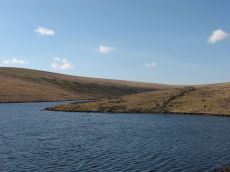
Venford Reservoir E. Embanked Cairn Circle
OS Map: SX 69033 70678
HER: MDV63936
ShortName: CC:VenfordResE
Notes: HER: A ring cairn sited 6m east of the Holne to Hexworthy road and on the crest of the ridge which extends between Bench Tor and Holne Lee. The cairn consists of a low (0.2m) circular earthwork with a diameter of approximately 20m, and a central mound. Much of the circle has been effaced, possibly by road builders and a pair of tinners' pits have destroyed part of the western sector. The best preserved section is on the northern side where a low, curved bank survives with a spread of approximately 2m. The eastern side is currently occupied by a car park, delineated by a row of large, loose boulders. The section of the circle within the car park has become badly eroded and the stony cairn material is exposed. The central mound is roughly elliptical measuring 9m by 7m.
Nearby sites: SX 69033 70678
Distance: 2.44km
Crad Hole Ring Cairn Circle
OS Map: SX 6721 6650
HER: MDV129288
ShortName: CC:Crad Hole
Butler map: 58.2
Notes: HER: Crad Hole Ring cairn at SX67216650 with a 'central piller'. Feature '4' at 'Crad Hole Ring' is a pair of huts the larger of which has been converted into a cairn of 7.5 metres diameters by 0.6 metres high with a small pillar in the centre.
Nearby sites: SX 6721 6650
Distance: 2.33km
Mardle Valley 6 Cairn Circle
OS Map: SX 6781 6872
HER: MDV5307
ShortName: CN:Mardle 6
Butler map: 58.12.6
Notes: HER: Oval cairn, 16 metres by 14 metres and 0.6 metres high. The central area (11 metres to 13 metres diameter) is very disturbed, with a small, off centre mound 0.6 metres high. The cairn has a rim 1.5 metres wide and 0.5 metres high, with a south-west facing gap, 2 metres wide. There is a single orthostat set into the rim on its east arc.
Visit by author 02/10/2025 to look for this site. Unable to locate cairns 5-8 due to dense vegetation cover. This site might be easier to locate when the bracken has died back more in the winter or early spring.
Nearby sites: SX 6781 6872
Distance: 1.05km
Holne Ridge N.11 Cairn Circle
OS Map: SX 66698 70020
HER: MDV61447
ShortName: CN:HolneRidg11
Butler map: 60.26.11
Notes: Ring cairn
Nearby sites: SX 66698 70020
Distance: 2.71km
Gripper's Hill W. Cairn
OS Map: SX 68118 65486
HER: MDV130228
Alternate name: Gripper's Hill W. Cairn
ShortName: CN:Grippers W
Butler map: 57.31
Notes: Butler: sited in full view of the reservoir. Butler gives OS as SX 6810 6547. Near to this there is a mound visible in Google Earth at SX 68118 65486 - presumably it is this cairn.
Nearby sites: SX 68118 65486
Distance: 2.84km
Gripper's Hill Summit 2 Cairn
OS Map: SX 68592 65501
HER: MDV5225
Alternate name: Gripper's Hill Summit 2 Cairn
ShortName: CN:Grippers 2
Butler map: 57.31.2
Grinsell: DEA 3
Notes: NMR B
Nearby sites: SX 68592 65501
Distance: 2.75km
Gripper's Hill Summit E. Cairn
OS Map: SX 68893 65580
HER: MDV5305
Alternate name: Gripper's Hill Summit E. Cairn
ShortName: CN:Grippers 5
Butler map: 57.31.5
Grinsell: DEA 4b
Nearby sites: SX 68893 65580
Distance: 2.67km

Snowdon 1 Cairn
OS Map: SX 66898 68171
HER: MDV5221
ShortName: CN Snowdon 1
Butler map: 58.10.1
Grinsell: BUC 4
Notes: The most southerly of a line of four cairns. Visible on Google earth. HER: Cairn with a diameter of 23.3m and 1m high and is constructed of boulders, of all sizes and has been heavily disturbed, especially on its east side, where a modern marker cairn, 1.5 m high and 3m diameter has been erected Grinselll: Cairn, hollow towards centre, crowned by modern stone heap, measuring 24.0 meters in diameter, and 1.0 meter in height. Butler: Southernmost of four cairns on Snowdon, this is the largest and is composed of a loosely piled mass of medium-sized stones. There are traces of an outer rim surrounding the pitted and hollowed interior and the cairn may have originally been more structured as the tops of some vertically set slabs are visible within the body of the mound which seem to form part of an inner ring. One block 0.8 metres high which is particularly noticeable within the western side of the mound is likely to have originally have stood on the margin.
Nearby sites: SX 66898 68171
Distance: 1.85km

Snowdon 3 Cairn
OS Map: SX 66846 68395
HER: MDV5222
ShortName: CN Snowdon 3
Butler map: 58.10.3
Grinsell: BUC 2
Notes: One of a line of four cairns. Visible on Google Earth. HER: The remains of a cairn of 16 metres diameter and 1.1 metres high constructed of turf covered boulders. It is in good condition except for a small central disturbance and a modern marker cairn, 0.8 m high and 1 m diameter. Butler: This cairn retains its shape better than the others, with fewer stones exposed and more shallow pitting.
Nearby sites: SX 66846 68395
Distance: 1.91km

Snowdon 4 Cairn
OS Map: SX 66878 68562
HER: MDV13203
ShortName: CN Snowdon 4
Butler map: 58.10.4
Grinsell: BUC 1
Notes: One of a line of four cairns. Butler: This cairn is the northernmost of four cairns on Snowdon and is ill-defined, blending into the slope of the hillside but apparently little interfered with.
Nearby sites: SX 66878 68562
Distance: 1.90km
Holne Lee 1 Cairn
OS Map: SX 67847 69575
HER: MDV5200
ShortName: CN:Holne Lee 1
Butler map: 58.11.1
Grinsell: HOL 9
Notes: HER: A round cairn, overall diameter 22.5 metres with a central platform, 7 metres diameter and 0.6 metres high, surrounded by a rim, 7.8 metres average width and 0.9 metres high. Butler: deformed by a saucer shaped depression in the surface now turfed over and comparatively smooth, the product of some ancient excavation.
Nearby sites: SX 67847 69575
Distance: 1.60km
Holne Lee 3 Cairn
OS Map: SX 67921 69599
HER: MDV5201
ShortName: CN:Holne Lee 3
Butler map: 58.11.3
Grinsell: HOL 11
Notes: HER: Round cairn, overall diameter 19.8m, is of similar form to A. having a central platform 8.7m diameter and 0.6m high, surrounded by a rim, 5.5m average width and 1.0m high. Gerrard: One of 5 cairns on Holne Lee situated 2 kilometres south-west of Fore Stoke. Round cairn. Diameter 21m, height 1.3m. Central pit 6m by 6m by 0.3m deep. Robbing pit is slightly east of the mound centre. Old animal burrows within the pit. Rushes in the pit, grass, gorse, bilberry and heather elsewhere.
Nearby sites: SX 67921 69599
Distance: 1.58km

Snowdon 2 Cairn
OS Map: SX 66871 68281
HER: MDV5220
ShortName: CN Snowdon 2
Butler map: 58.10.2
Grinsell: BUC 3
Notes: One of a line of four cairns. Visible on Google earth. HER: Round platform cairn, 16.5 m diameter and 11m high, and has been badly mutilated by the erection of a modern marker cairn, 1.5 m high and 3m diameter with a shelter upon it. This site is on the local list of Nationally Important Dartmoor sites. Butler: 18 metres diameter by 1.2 metres high. This cairn has a deep central pit and is slightly smaller than its southern neighbour. It is crowned with a modern stone heap.
Nearby sites: SX 66871 68281
Distance: 1.88km
Holne Lee 2 Cairn
OS Map: SX 67884 69583
HER: MDV13208
ShortName: CN:Holne Lee 2
Butler map: 58.11.2
Grinsell: HOL 10
Notes: HER: Grinsell (1978) described an additional cairn 'D' here, 10.0m. in diameter and 0.6m. high with a hollow in or near the centre. The Royal Commission Holne survey (1997) records this possible feature as 'somewhat enigmatic'; while from some aspects it resembles a cairn, it is probably the debris from a prospecting pit allied to the nearby extensive tinworking remains. Gerrard: One of 5 cairns on Holne Lee situated 2 kilometres south-west of Fore Stoke. Round cairn. Measures 9.5m by 7.8m. Central pit 4.4m by 2.9m. The mound is orientated at 340 degrees. The structure now looks like a rectangular building rather than a cairn. On balance, however, given its location it is more likely to represent a cairn. Butler: trenched and hollowed out to ground level.
Nearby sites: SX 67884 69583
Distance: 1.59km
Holne Lee 4 Cairn
OS Map: SX 67992 69641
HER: MDV5202
ShortName: CN:Holne Lee 4
Butler map: 58.11.4
Grinsell: HOL 12
Notes: HER: Oval cairn, 12 metres by 11 metres overall and 0.9 metres high with a regular central depression, 6 metres diameter and 0.9 metres deep. The surround is noticeably dipped to the east-south-east on the long axis, where it is only 0.6 metres high. The even turf cover of the stones and the regular profile suggest that this cairn has not been disturbed and maintains its original form as a hollow top cairn.
Nearby sites: SX 67992 69641
Distance: 1.58km
Holne Lee 5 Cairn
OS Map: SX 68495 69805
HER: MDV5198
ShortName: CN:Holne Lee 5
Butler map: 58.11.5
Grinsell: HOL 16
Notes: HER: One of two cairns of probable Bronze Age date on Holne Lee. Cairn has an overall diameter of 18.5m and is constructed of small boulders and comprises a central mound, 12.8m diameter, 0.9m high, which has been extensively disturbed. It is immediately surrounded by a ring, 2.9m thick and 0.5m high resulting in a cairn of embankment bowl type.
Nearby sites: SX 68495 69805
Distance: 1.58km
Holne Lee 6 Cairn
OS Map: SX 6849 6982
HER: MDV13209
ShortName: CN:Holne Lee 6
Butler map: 58.11.6
Grinsell: HOL 16a
Notes: HER: Oval cairn, 16 metres by 14 metres and 0.6 metres high. The central area (11 metres to 13 metres diameter) is very disturbed, with a small, off centre mound 0.6 metres high. The cairn has a rim 1.5 metres wide and 0.5 metres high, with a south-west facing gap, 2 metres wide. There is a single orthostat set into the rim on its east arc. Butler: Originally an outer bank seems to have surrounded a raised interior but this has become badly disordered and further damage has been caused to the edges by the well worn tracks approaching uphill from the ford across the Mardle
Nearby sites: SX 6849 6982
Distance: 1.59km
Holne Lee 8 Cairn
OS Map: SX 6869 6993
HER: MDV13198
ShortName: CN:Holne Lee 8
Butler map: 58.11.8
Grinsell: HOL 18
Notes: HER: A disturbed cairn 9.0 metres in diameter lies on the northern tip of Holne Lee overlooking Venford reservoir. Now standing 0.4 metres high this feature has suffered severe disturbance to its centre.
Nearby sites: SX 6869 6993
Distance: 1.68km
Mardle Valley 2 Cairn
OS Map: SX 6761 6922
HER: MDV5203
ShortName: CN:Mardle 2
Butler map: 58.12.2
Grinsell: HOL 13
Notes: HER quoting Gerrard: Round cairn. Diameter 8m, height 0.4m. A small trench leading in from the north-west is 1.5m long by 1m wide and 0.2m deep.
This cairn has been cleared of vegetation by the DPA in September 2025 and the author visited shortly afterwards on 02/10/2025. Of the 4 cairns cleared this one I was unable to locate with certainty but I was lacking time for a thorough search. I had probably located it but was uncertain I had correctly identified it. It maybe more obvious when the bracken has died back.
Nearby sites: SX 6761 6922
Distance: 1.50km

Mardle Valley 3 Cairn
OS Map: SX 67727 69038
HER: MDV5204
ShortName: CN Mardle 3
Butler map: 58.12.3
Grinsell: HOL 14
Notes: HER: Round cairn measures 8.5m diameter and 0.5m high. It has a rectangular trench, 2.3m by 1.6m and 0.3m deep dug into its centre.
This cairn has been cleared of vegetation by the DPA in September 2025 and the author visited shortly afterwards on 02/10/2025. Photos added and grid references updated.
Nearby sites: SX 67727 69038
Distance: 1.29km

Mardle Valley 4 Cairn
OS Map: SX 67627 68957
HER: MDV24792
ShortName: CN Mardle 4
Butler map: 58.12.4
Grinsell: HOL 15
Notes: HER quoting Gerrard: Round cairn. Diameter 9.8m, height 0.7m. A flat topped stoney mound with several hollows. A small number of edge set stones around the periphery may represent the remnants of a kerb.
This cairn has been cleared of vegetation by the DPA in September 2025 and the author visited shortly afterwards on 02/10/2025. Photos added and grid references updated.
Nearby sites: SX 67627 68957
Distance: 1.33km
Mardle Valley 5 Cairn
OS Map: SX 6779 6889
HER: MDV62034
ShortName: CN:Mardle 5
Butler map: 58.12.5
Notes: HER: Ovoid feature measuring 4.5 metres north to south by 5.2 metres and stands 1.1 metres high. An amorphous hollow roughly 1.0 metres in diameter is situated in the centre of the mound.
Visit by author 02/10/2025 to look for this site. Unable to locate cairns 5-8 due to dense vegetation cover. This site might be easier to locate when the bracken has died back more in the winter or early spring.
Nearby sites: SX 6779 6889
Distance: 1.15km
Mardle Valley 7 Cairn
OS Map: SX 6792 6855
HER: MDV5214
ShortName: CN:Mardle 7
Butler map: 58.12.7
Grinsell: BUC 5
Notes: HER: Round cairn measuring approximately 9 metres in diameter (around 0.6 metres high), almost on the summit of hill east of the River Mardle. It is constructed of small boulders and the centre has been disturbed.
Visit by author 02/10/2025 to look for this site. Unable to locate cairns 5-8 due to dense vegetation cover. This site would appear to be located in widespread dense gorse which is head height - impossible to investigate.
Nearby sites: SX 6792 6855
Distance: 0.88km
Ryders Hill Cairn
OS Map: SX 65982 69068
HER: MDV5223
ShortName: CN:Ryders Hill
Butler map: 58.13
Butler Vol 5: p.162 & Fig.101
Grinsell: HOL 8
Notes: HER: Large platform cairn, 30.5 m diameter and on average 1.0 m high is turf covered and in good condition, except for the erection of Petre's Bound Stone, a modern boundary stone, and an Ordnance Survey triangulation pillar upon it. It lies on the broad level summit of Ryder's Hill.
Nearby sites: SX 65982 69068
Distance: 2.89km
Holne Lee N. Cairn
OS Map: SX 6884 7032
HER: MDV6472
ShortName: CN:HolneLee N
Butler map: 59.1
Grinsell: HOL 7
Notes: HER: A cairn situated within the field system at SX68847032 survives as a 9.7 metre diameter flat-topped mound standing up to 0.8 metres high. A small hollow in the centre of the cairn suggests that it has been partially excavated or robbed.. Possibly visible at around 20m to the east of Butler's grid reference at SX 68864 70324 on Google satellite. This record will revert to Butler's NGR until location confirmed.
NB. record duplicated on HER as MDV129703 see SiteID=1841.
Nearby sites: SX 6884 7032
Distance: 2.07km
Venford Reservoir S.3 Cairn
OS Map: SX 6811 7050
HER: MDV64120
ShortName: CN:VenfordRes3
Butler map: 60.20.3
Notes: HER: Bronze Age cairn measures 6.7 metres diameter and 0.8 metres high and there is a small hollow in the centre of the mound from possible past excavation or robbing.
Nearby sites: SX 6811 7050
Distance: 2.34km
Holne Lee N. (Duplicate) Cairn
OS Map: SX 6884 7032
HER: MDV129703
ShortName: CN:HolneLeDup
Butler map: 59.1
Grinsell: HOL 7
Notes: This is record MDV129703 on the HER which is a duplicate of MDV6472 both referring to the cairn 59.1 Holne Lee N Butler grid reference SX 6884 7032. See also SiteID=1830.
Nearby sites: SX 6884 7032
Distance: 2.07km
Harbourne Head, NE of Cairn
OS Map: SX 69767 65582
HER: MDV5298
ShortName: CN:Harbourne 2
Grinsell: DEA 12
Notes: A cairn sited on hill slope on arable land crowned by a stoneheap.
Nearby sites: SX 69767 65582
Distance: 2.86km
Crad Hole Ring 2 Cairn
OS Map: SX 6721 6650
HER: MDV5260
ShortName: CC:CradHole2
Notes: HER: Roughly circular group of stones on Hickaton Hill, north-east of a Bronze Age hut circle settlement. May possibly be the remains of two concentric circles of stones, 8-10 meters in diameter.
These two circles include one that has been covnverted into a cairn, see separate record for Crad Hole Ring.
Nearby sites: SX 6721 6650
Distance: 2.33km
Holne Ridge N.15 Cairn
OS Map: SX 6694 7013
HER: MDV6476
ShortName: CN:HolneRidg15
Nearby sites: SX 6694 7013
Distance: 2.61km

Pupers Hill 1 Cairn
OS Map: SX 67391 67441
HER: MDV13191
ShortName: CN PupersHill1
Notes: Robinson R A barrow lying between Puper’s Rock and Inner Pupers. A low circular mound lying on fairly level ground in an area of turf and heather, visible due to the difference in heather growth on the mound. The mound is flat topped, measuring 0.5 meters high and 4.5 meters in diameter north-south, but only 3.0 meters east-west. There is a well-defined kerbstone concealed by heather and probing of the mound shows it to have been stone built. At the centre a cavity extends downwards beside a flat slab of stone set on edge around 0.6 meters long, lying east-west, which may represent the remains of a cist.
The author visited this on 13 July 2024 and there is indeed a clear cavity into this cairn.
Nearby sites: SX 67391 67441
Distance: 1.58km
Holne Lee 9 Cairn
OS Map: SX 67767 69497
HER: MDV61446
ShortName: CN:Holne Lee 9
Notes: HER: A small stoney cairn lies on the summit of Two Barrows Hill some 60m SW of three large skyline cairns. Some small stones protrude through the turf-covered mound which measures 4.8m N to S by 4.1m. It stands a maximum of 0.3m high. There is no trace of a cist or kerb. NB. Formerly listed as Holne Lee 11 but changed to 9.
Nearby sites: SX 67767 69497
Distance: 1.59km
Holne Ridge N.13 Cairn
OS Map: SX 66990 70457
HER: MDV61448
ShortName: CN:HolneRidg13
Notes: Cairn forms part of a cairn cemetery on Holne Ridge. Diameter 7.6 metres, height 1.0 metre. Central pit 1.1 metres wide, 0.6 metres deep. At the south-east end is a large slab which may represent a stone from a displaced cist.
Nearby sites: SX 66990 70457
Distance: 2.82km
Pupers Hill 2 Cairn
OS Map: SX 67830 67067
HER: MDV67607
ShortName: CN:PupersHill2
Notes: Greeves: An apparently undisturbed prehistoric flat-topped cairn approximately 5.0 meters in diameter by up to 0.5 meters high located to the south of 'Kit's Stone' on the track from 'Lud Gate' to 'Huntingdon Warren'. The author found this cairn on 02/08/2025 and the grid reference has been updated as it was a it inaccurate! No photos unfortunately.
Nearby sites: SX 67830 67067
Distance: 1.50km
Lambs Down 4 Clearance Cairn
OS Map: SX 69512 65809
HER: MDV13199
ShortName: CN:LambsDown 4
Nearby sites: SX 69512 65809
Distance: 2.56km
Lambs Down 1 Clearance Cairn
OS Map: SX 6973 6607
HER: MDV130234
ShortName: CN?LambsDown 1
Butler map: 57.33.1
Notes: Butler refers to burial cairns amongst clearance cairns.
Nearby sites: SX 6973 6607
Distance: 2.39km
Lambs Down 2 Clearance Cairn
OS Map: SX 69452 65895
HER: MDV5196
ShortName: CN:LambsDown 2
Butler map: 57.33.2
Notes: Butler refers to burial cairns amongst clearance cairns.
Nearby sites: SX 69452 65895
Distance: 2.46km
Lambs Down 3 Clearance Cairn
OS Map: SX 6946 6585
HER: MDV130235
ShortName: CN:LambsDown 3
Butler map: 57.33.3
Notes: Butler refers to burial cairns amongst clearance cairns.
Nearby sites: SX 6946 6585
Distance: 2.50km
Mardle Valley 8 Cairn
OS Map: SX 6778 6876
HER: MDV62033
ShortName: CN:Mardle 8
Notes: HER: One of two, possibly three, hut circles on the moderate west-facing slope above the left bank of the River Mardle. This third, possible, hut consists of coursed boulder and rubble walls 0.6m wide and 0.5m high enclose a roughly circular area 2.0m in diameter with a possible entrance in the south side. It is not certain whether this is a small hut circle or an elaborate clearance cairn relating to the medieval or later exploitation of this area.
Visit by author 02/10/2025 to look for this site. Unable to locate cairns 5-8 due to dense vegetation cover. This site might be easier to locate when the bracken has died back more in the winter or early spring.
Nearby sites: SX 6778 6876
Distance: 1.10km
Venford Brook S.2 Clearance Cairn
OS Map: SX 6764 7046
HER: MDV128837
ShortName: CN?Venford S2
Butler map: 60.8.4
Notes: HER: Two cairns or disturbed hut circles overlain by later clearance material lie at the foot of a steep north-facing slope above the right bank of the western tributary of the Venford Brook. These features have been Scheduled as cairns. The huts are largely infilled with small boulders and rocks and measure 6.5m and 5.5m in external diameter respectively. Both possess off-centre hollows roughly 0.5m deep and neither displays evidence of a former entrance. The fact that these features appear to be terraced into the slope would preclude their interpretation as burial cairns as suggested by Butler
Nearby sites: SX 6764 7046
Distance: 2.47km
Venford Reservoir S.1 Clearance Cairn
OS Map: SX 6827 7050
HER: MDV113643
ShortName: CNxVenfordRes1
Butler map: 60.20.1
Notes: Northern cairn of pair. HER: The two features depicted as prehistoric cairns by Butler are the product of medieval or later clearance. The northern feature, at SX 68277050, measures 3.0 metres in diameter and is 0.6 metres high while the southern mound measures 1.7 metres in diameter and stands 0.5 metres high. Neither possesses traces of cist or kerb and both are undisturbed. They lie in an area which has been subject to medieval or later agrarian activity which has effaced most of the prehistoric monuments in the immediate area.
Nearby sites: SX 6827 7050
Distance: 2.30km
Venford Reservoir S.2 Clearance Cairn
OS Map: SX 6826 7046
HER: MDV113643
ShortName: CNxVenfordRes2
Butler map: 60.20.2
Notes: Southern cairn of pair. HER: The two features depicted as prehistoric cairns by Butler are the product of medieval or later clearance. The northern feature, at SX 68277050, measures 3.0 metres in diameter and is 0.6 metres high while the southern mound measures 1.7 metres in diameter and stands 0.5 metres high. Neither possesses traces of cist or kerb and both are undisturbed. They lie in an area which has been subject to medieval or later agrarian activity which has effaced most of the prehistoric monuments in the immediate area.
Nearby sites: SX 6826 7046
Distance: 2.26km
Venford Reservoir Clearance Cairn
OS Map: SX 686 708
HER: MDV47780
ShortName: CNxVenfordRes
Notes: HER: Several clearance cairns observed on e and w sides of venford reservoir. Max height 0.5m, but most are less than 0.3m.(greeves)
Nearby sites: SX 686 708
Distance: 2.55km
Warmacombe 1 Clearance Cairn
OS Map: SX 6859 6774
HER: MDV5180
ShortName: CN:Warmacombe1
Notes: HER: One of three mounds thought to be clearance dumps. Reported in the 1970s as having been removed; 'nothing archaeological' was found.
Nearby sites: SX 6859 6774
Distance: 0.53km
Warmacombe 2 Clearance Cairn
OS Map: SX 6847 6756
HER: MDV5181
ShortName: CN:Warmacombe2
Notes: HER: One of three mounds that appear to be clearance cairns. Reported in the 1970s as being largely removed, only a general spread remains.
Nearby sites: SX 6847 6756
Distance: 0.74km
Warmacombe 3 Clearance Cairn
OS Map: SX 6856 6739
HER: MDV5182
ShortName: CN:Warmacombe3
Notes: HER: One of three mounds that appear to be clearance cairns. Reported in the 1970s as being largely removed, only a general spread remains.
Nearby sites: SX 6856 6739
Distance: 0.88km
Venford 2 Clearance Cairn
OS Map: SX 6794 7100
HER: MDV12987
ShortName: CN:Venford 2
Notes: HER: Several small clearance cairns lie on the moderate SE facing slope W of Venford reservoir. There is no evidence to suggest that these features which lie in an area of intensive medieval and later cultivation are prehistoric in origin.
Nearby sites: SX 6794 7100
Distance: 2.87km
Venford 3 Clearance Cairn
OS Map: SX 6797 7101
HER: MDV12988
ShortName: CN:Venford 3
Notes: HER: Several small clearance cairns lie on the moderate SE facing slope W of Venford reservoir. There is no evidence to suggest that these features which lie in an area of intensive medieval and later cultivation are prehistoric in origin.
Nearby sites: SX 6797 7101
Distance: 2.87km
Venford 4 Clearance Cairn
OS Map: SX 6820 7117
HER: MDV13000
ShortName: CN:Venford 4
Notes: HER: One of a group of three cairns on Holne Moor. The Ordnance Survey (1977) suggested these as Prehistoric cairns, but 1996 Royal Commission field survey (1996) reclassified as Medieval or later clearance mounds. This feature is turf covered and measures 2.7m diameter and 0.3m high, and is constructed of small boulders.
Nearby sites: SX 6820 7117
Distance: 2.97km
Venford 5 Clearance Cairn
OS Map: SX 6820 7116
HER: MDV13001
ShortName: CN:Venford 5
Notes: HER: One of a group of three cairns on Holne Moor. The Ordnance Survey (1977) suggested these as Prehistoric cairns, but 1996 Royal Commission field survey (1996) reclassified as Medieval or later clearance mounds. This feature measures 2.8m diameter and 0.6m high and is linked with MDV13002 by a slight scarp.
Nearby sites: SX 6820 7116
Distance: 2.96km
Venford 6 Clearance Cairn
OS Map: SX 6819 7116
HER: MDV13002
ShortName: CN:Venford 6
Notes: HER: One of a group of three cairns on Holne Moor. The Ordnance Survey (1977) suggested these as Prehistoric cairns, but 1996 Royal Commission field survey (1996) reclassified as Medieval or later clearance mounds. This feature measures 2.4m diameter and 0.3m high and partly turf covered.
Nearby sites: SX 6819 7116
Distance: 2.96km
Venford Reported Cist
OS Map: SX 68432 70973
HER: MDV47779
PMD: Venford
ShortName: CT?Venford 1
Notes: Radcliffe: "TAPG report while reservoir low. Walls, clearance cairn and cairn, with flint flakes. Cairn 4m dia with possible cist slab 1m by 0.5m by 0.2m. Probably at 6843 7097, found 29/9/03."
Nearby sites: SX 68432 70973
Distance: 2.74km
Gripper's Hill Summit 3 Reported Cairn
OS Map: SX 6838 6551
HER: MDV130230
Alternate name: Gripper's Hill Summit 3 Reported Cairn
ShortName: CN:Grippers 3
Butler map: 57.31.3
Notes: Butler: "the more conspicuous [of the cairns] has been trenched".
Nearby sites: SX 6838 6551
Distance: 2.76km
Gripper's Hill Summit 4 Reported Cairn
OS Map: SX 6837 6552
HER: MDV130232
Alternate name: Gripper's Hill Summit 4 Reported Cairn
ShortName: CN:Grippers 4
Butler map: 57.31.4
Notes: Butler: not trenched, "retains an even profile and seems to have been overlooked by the cairn diggers".
Nearby sites: SX 6837 6552
Distance: 2.76km
Gripper's Hill N.1 Reported Cairn
OS Map: SX 6830 6639
HER: MDV130233
Alternate name: Gripper's Hill N.1 Reported Cairn
ShortName: CN:GrippersN1
Butler map: 57.32.1
Notes: Butler. The reave "passes above an apparently undamaged cairn near the northern tip of the hill".
Nearby sites: SX 6830 6639
Distance: 1.91km
Gripper's Hill N.2 Reported Cairn
OS Map: SX 6838 6619
HER: MDV5302
Alternate name: Gripper's Hill N.2 Reported Cairn
ShortName: CN:GrippersN2
Butler map: 57.32.2
Nearby sites: SX 6838 6619
Distance: 2.09km

Pupers Hill E Reported Cairn
OS Map: SX 6780 6738
HER: MDV13190
ShortName: CN?PupersHillE
Butler map: 58.9
Notes: HER: Cairn east of Puper's Rock and Inner Pupers. Heath-covered peaty mound of 8.0 metres diameter and 0.5 metres high.. Butler: Pupers Hill 'E' cairn at SX 67806738 of 6.5 metres diameter by 0.5 metres high is an unremarkable mound which seems to have escaped the cairn diggers, the smooth rounded surface showing no sign of interference.
Nearby sites: SX 6780 6738
Distance: 1.29km
Venford Brook S.1 Reported Cairn
OS Map: SX 6763 7047
HER: MDV128837
ShortName: CN?Venford S1
Butler map: 60.8.3
Notes: HER: Two cairns or disturbed hut circles overlain by later clearance material lie at the foot of a steep north-facing slope above the right bank of the western tributary of the Venford Brook. These features have been Scheduled as cairns. The huts are largely infilled with small boulders and rocks and measure 6.5m and 5.5m in external diameter respectively. Both possess off-centre hollows roughly 0.5m deep and neither displays evidence of a former entrance. The fact that these features appear to be terraced into the slope would preclude their interpretation as burial cairns as suggested by Butler
Nearby sites: SX 6763 7047
Distance: 2.49km
Gripper's Hill (NW spur) Reported Cairn
OS Map: SX 683 660
HER: MDV21710
Alternate name: Gripper's Hill (NW spur) Reported Cairn
ShortName: CN?GrippersN3
Grinsell: DEA 4a
Notes: A cairn was alleged at this location but there does not now appear to be any physical evidence. HER 21740 is based on this recod but gives NMR as SX 683 680. The record originates with Grinsel who gives SX 683 660 "roughly" - which is 2km south!
Nearby sites: SX 683 660
Distance: 2.29km
Holne Ridge Reported Cairn
OS Map: SX 66 69
HER: MDV5251
ShortName: CN:HolneRidge
Notes: HER: Holne Ridge, tumulus indicated by Ordnance Survey, while making the 6 inch map. NB. This description is so vague as to be of no use. For this reason this record is being marked as a duplicate to exclude it from most listings. It is only included for completeness of HER records.
Nearby sites: SX 66 69
Distance: 2.85km
Lambs Down 5 Reported Cairn
OS Map: SX 6892 6605
HER: MDV20904
ShortName: CN?LambsDown 5
Nearby sites: SX 6892 6605
Distance: 2.21km
Harbourne Head Reported Cairn
OS Map: SX 6946 6535
HER: MDV21709
ShortName: CN?Harbourne 1
Nearby sites: SX 6946 6535
Distance: 2.99km
Hickaton Hill Reported Cairn
OS Map: SX 67390 66162
HER: MDV102675
ShortName: CN:Hickaton
Nearby sites: SX 67390 66162
Distance: 2.49km
Lambs Down 6 Cairnfield Master
OS Map: SX 6985 6565
HER: MDV5299
ShortName: CN?LambsDown 6
Notes: HER: "A series of mounds which may be the result of modern field clearance, or they possibly be the remains of prehistoric cairns. Four of the larger mounds may have entrances and average 8.7 metres in diameter and 0.6 metres in height."
Nearby sites: SX 6985 6565
Distance: 2.82km
Gibby Coombe Cairnfield Master
OS Map: SX 682 689
HER: MDV62227
ShortName: CN:Gibby
Notes: HER: Historic cairnfield north-west of Gibby Coombe. A scatter of around 70 small cairns lying within two large fields. These cairns are the result of clearance of surface stone.
Nearby sites: SX 682 689
Distance: 0.85km
Brockhill Settlement
OS Map: SX 677 657
HER: MDV5233
Megalithic Portal: 42627
ShortName: ST:Brockhill
Nearby sites: SX 677 657
Distance: 2.76km
Brockhill Ford Ring Setting Cairn and Cist
OS Map: SX 67809 65702
HER: MDV5234
Megalithic Portal: 705
PMD: Brockhill Ford
Alternate name: Brockhill Ford W. Ring Setting Cairn and Cist
ShortName: CT Brockhill
Butler map: 57.18
DPD page: 88
Grinsell: DEA 2
Turner: D3
Barrow Report: 68
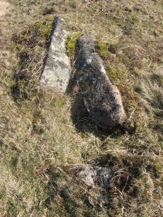
Notes: "The side stones, both 1.4m long, lean inwards and the end stones north west 0.7m long, southeast 0.8m long, are firmly set. The probable coverstone, 1.2m by 0.8m, is displaced and lies to the south east of the cist. The cist is surrounded by the remains of a stone circle, long axis 8.8m, aligned with cist, short axis 7.2m. It is constructed of large slabs, up to 1.4m long with a single upright stone, 0.5m high, set contiguously in the north west arc. There are no visible remains of a cairn." Lethbridge p.88 photo (note the diagram is not related). See also: Huntingdon cross walk. Butler Brockhill Ford W. - Vol. 4. Map 57.18 (pp.151-2 diagram p.152).
Nearby sites: SX 67809 65702
Distance: 2.72km
Dean Moor Enclosed Settlement
OS Map: SX 67741 65458
HER: MDV14799
Megalithic Portal: 45324
ShortName: ES Dean Moor
Notes: Enclosed settlement on Dean Moor, excavated between 1954 and 1956, prior to construction of the reservoir. Prehistoric walled enclosure containing at least 13 huts together with pens. Parallels have been drawn with the settlement at Kestor. Part of the prehistoric settlement was incorporated into a medieval farmstead (see HER record 14221). Part of site now flooded by Avon Reservoir.
Nearby sites: SX 67741 65458
Distance: 2.97km
Gripper's Hill Stone Ring Cairn Circle
OS Map: SX 68650 65503
HER: MDV5224
Megalithic Portal: 45822
Alternate name: Gripper's Hill Summit 1 Stone Ring Cairn Circle
ShortName: RC Grippers 1
Butler map: 57.31.1
Grinsell: DEA 4
Turner: A9
Notes: "Ring cairn on Gripper's Hill; stone ring 14.0 metres in diameter internally, with bank 1.2 meters wide and 0.3 meters high." NMR A
Nearby sites: SX 68650 65503
Distance: 2.75km
Hickaton Hill (South east) Enclosed Settlement
OS Map: SX 67585 65890
HER: MDV5227
ShortName: ES:HickatonSE
Notes: HER: Enclosed settlement consisting of four integrated enclosures all with huts and 3 detached hut circles.
Nearby sites: SX 67585 65890
Distance: 2.63km
Holne Lee Stone Ring Cairn Circle
OS Map: SX 68656 69919
HER: MDV5199
Megalithic Portal: 45836
Alternate name: Holne Lee 7 Stone Ring Cairn Circle
ShortName: RC Holne Lee 7
Butler map: 58.11.7
Grinsell: HOL 17
Turner: A32
Notes: HER: One of two cairns of probable Bronze Age date on Holne Lee. Cairn is 21 metres in diameter and is constructed of small boulders, and consists of a platform 14 metres diameter and about 0.2m high, with a perimeter rim average thickness 3.5m and 0.5m high. There is a gap, 4.3m wide, facing north north-east.
Nearby sites: SX 68656 69919
Distance: 1.67km
Huntingdon Barrow Cairn
OS Map: SX 66217 66912
HER: MDV5235
Megalithic Portal: 45571
Alternate name: Heap of Sinners Cairn
ShortName: CN:Huntingdon
Butler map: 58.14
DPD page: 87
Grinsell: LYD 103
Barrow Report: 65
Notes: HER: 'Huntingdon Barrow' or 'Heap of Sinners' cairn north of Huntingdon Warren. A large cairn measuring 22 metres in diameter with an average height of 1.4 metres. It is constructed of large boulders but has been mutilated by the erection of marker cairns and shelters on it
Nearby sites: SX 66217 66912
Distance: 2.86km

Inner Pupers Stone Ring Cairn Circle
OS Map: SX 67566 67421
HER: MDV13205
Megalithic Portal: 45847
PMD: Inner Pupers
ShortName: RC InnerPupers
Butler map: 58.9
DPD page: 89
Grinsell: BUC 6
Turner: A60
Notes: HER: The rock outcrop known as Inner Pupers is encompassed by a cairn of 13.0 meters overall diameter. It takes the shape of a platform 0.4 meters high around the rock, with a rim 1.5 meters wide and a further 0.4 meters high. Of small stones, with further 'natural' slabs protrude through. NB. This feature is very visible on Google Satellite.
Nearby sites: SX 67566 67421
Distance: 1.45km
Mardle Embanked Cairn Circle
OS Map: SX 67526 69359
HER: MDV5308
Megalithic Portal: 3374
Alternate name: Mardle Valley 1 Embanked Cairn Circle
ShortName: CC Mardle 1
Butler map: 58.12.1
Turner: B11
Notes: Turner: Embanked stone circle; an annular bank of earth and/or stone with an inner edge of orthostats. Much disturbed. Internal diam 6.5m with bank 1.2m wide and 0.4m high. This cairn has a very interesting structure appearing to be multiple circles of stones similar to the cairns at Corringdon Ball. This structure is difficult to capture in a photograph as the stones are small and the site much disturbed.
Nearby sites: SX 67526 69359
Distance: 1.65km

Pupers Rock Stone Ring Cairn Circle
OS Map: SX 67281 67376
HER: MDV5219
Megalithic Portal: 45845
Alternate name: Pupers Hill Summit Stone Ring Cairn Circle
ShortName: RC Pupers Rock
Butler map: 58.9
DPD page: 89
Grinsell: DEA 1
Turner: A58
Notes: HER: A natural outcrop some 10.0m across and 2.0m high, encompassed by a mass of small stones. Most are piled to the west of the outcrop but overall they form a cairn 16.0m in diameter and 1.0m high. On the southern side the precise perimeter is difficult to determine since a spread of stone on the surface extends for a further 8.0 metres. This site is on the local list of Nationally Important Dartmoor sites.. Turner: Ring cairn incorporating a large flat-topped granite outcrop. The stone ring measures 17 meters in diameter internally with 2.5 meter wide bank 0.6 meters high. There are the remains of a stone circle, around 1.0 meter high within the outcrop.
Nearby sites: SX 67281 67376
Distance: 1.71km