
Brockhill Ford Ring Setting Cairn and Cist
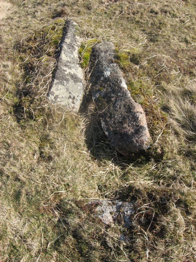
Photo taken on 25-03-2016
Database entries
OS Map: SX 67809 65702
OS Source: Google
Butler OS: SX67806570
HER: MDV5234
Megalithic Portal: 705
PMD: Brockhill Ford
Alternate name: Brockhill Ford W.
Short Name: CT Brockhill
Butler map: 57.18
Dixon Cist #: 101
Grinsell: DEAN PRIOR 2
Turner: D3
DPD page: 88
Exist: Yes
Record: Unique
Record Source: Butler
Hut Class: No
Cist Class: Yes
Cairn Class: Yes
Barrow Report: 68
Dimensions (m): 7.5 x 0 C
Lidar: SX 67809 65702
Guide Map: 52
Nearest Bus Stop: Buckfast Higher Mill Lane (8.2 km) [Route: 88]
Nearby sites: SX 67809 65702
Notes
"The side stones, both 1.4m long, lean inwards and the end stones north west 0.7m long, southeast 0.8m long, are firmly set. The probable coverstone, 1.2m by 0.8m, is displaced and lies to the south east of the cist. The cist is surrounded by the remains of a stone circle, long axis 8.8m, aligned with cist, short axis 7.2m. It is constructed of large slabs, up to 1.4m long with a single upright stone, 0.5m high, set contiguously in the north west arc. There are no visible remains of a cairn." Lethbridge p.88 photo (note the diagram is not related). See also: Huntingdon cross walk. Butler Brockhill Ford W. - Vol. 4. Map 57.18 (pp.151-2 diagram p.152).References
These are selected references with an emphasis on out of copyright sources linked as PDFs. For more detailed references try any linked HER or PMD record above.
- Butler, Jeremy, Dartmoor Atlas of Antiquities, vol.4: The South-East, (1993)
- Davidson, C. & Seabrook, R., Stone rings on south-east Dartmoor, D.A.S.P. No.31 (1973)
- Grinsell, L.V., Dartmoor Barrows, Devon Archaeological Society Proceedings No.36 (1978)
- Lethbridge, William D., Discover Preshistoric Dartmoor, (2015)
- Turner, J.R., Ring Cairns, stone circles and related monuments on Dartmoor, D.A.S.P. No.48 pp.27-86 (1990)
- Worth, R. Hansford, Barrow Report 68, T.D.A. Vol.81 pp.53-55 (1949)