
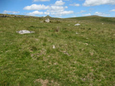
Prehistoric sites within 2km of SX 61320 76530
Guidance for walkers: The monuments featured in this database are archaeological treasures and need to be protected and preserved - please do not disturb any sites. Please check access and firing times before visiting sites, not all sites listed are on open access land. Firing ranges and boundaries of open access areas are marked on the OL28 OS Dartmoor Explorer map. Please stick to the country code and consider giving support to the numerous agencies that help to keep Dartmoor a fabulous natural and historic environment!
About the database listings: In all listings clicking on the photo or the site name will open a page for the site with a larger photo and further details from the database. The database now has over 6680 records covering nearly all publicly listed sites on Dartmoor including around 4800 round houses. This level of detail is of interest to archaeologists but tends to swamp listings of sites more likely to be of interest for walkers. For this reason, the listings default to around 550 core sites only. These are the stone circles, stone rows and the ring cairns listed by Turner. The default search radius is 2 km. The controls below the map can be used to start a new search by entering a 6- or 8-digit reference (without the prefix "SX"). The search radius can be specified and you can add incremental Display layers of detail on top of the core sites. If using a more detailed layer you will need to decrease the search radius to avoid getting hundreds of search results.
- Core sites Default listing of core sites consisting of stone circles & rows and some of the major ring cairns.
- Plus cairns adds approx. 1000 cairns and other minor sites not included in the core listings but excluding round houses.
- Plus round houses adds approx. 4800 round houses.
- Plus non-sites adds in the records for sites that no longer exist or are not prehistoric sites.
- Plus duplicates adds records excluded as duplicates. Those maybe duplicate records in external listings (e.g. the Historic Environment Records). For example, some sites have been identified as cairns in some listings and interpreted as round houses in other listings and both records appear.
These listings have incorporated, matched up and merged all of the records from all of the major archaeological listings including: Worth, Grinsell, Turner, Butler, Bill Radcliffe, Sandy Gerrard, Megalithic Portal, the National Monument Records and the Historic Environment Records. The author would like to thank Bill, Sandy, the lovely people both at Megalithic Portal (especially Anne Tate who did an amazing job to link listings) and at ACE Archaeology for collaborative work over the years to synchronise and correct listings across the various websites which now interlink. A culmination of years of work the final merger of cairn records took 3 months of cross referencing in 2017 the result being a snapshot of the records at that time. This data has in turn been refined since by field work and research. The round house data was supplied by Sandy Gerrard. Grid references are in order of accuracy: from Google Earth satellite, if visible and found, from a Garmin GPS reading, if visited by the author and from the literature otherwise. Individual site pages will state the source of the grid reference and provide satellite imagery. If a site listing lacks a photo it has not yet been visited by the author in which case the grid reference is from the literature.
Currently the database only includes sites which can be represented by a grid reference. Reaves are not included as they require GIS shape technology which is beyond the current capability of this system. To see the sources for the records, look at the tables on the resources menu. The database listings can also be viewed on a Google map and downloaded as GPS datasets for Garmin devices.
Corrections, or any feedback or suggestions are very welcome, email: info@dartmoorwalks.org.uk.
NOTE: Clicking on the icons for each monument in the map will give the name of the site. You can zoom in and out and drag the map around.
List of sites within 2km of SX 61320 76530
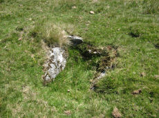
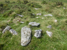
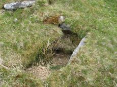
Littaford Tor E Cist
OS Map: SX 61846 76717
HER: MDV-1
PMD: Littaford Tor E.
ShortName: CT Littaford2
Notes: Radcliffe: "Long axis approx W-E . Stones visible on N ,E and S sides and some stone could be felt under grass on W side. Approx. 1m x 0.5m x 0.5m depth internally. No obvious sign of cairn mound. No obvious stonecutting in vicinity. TAP Greeves (pers. comm.) "
Nearby sites: SX 61846 76717
Distance: 0.56km
Higher White Tor (SW of) Reported Cairn
OS Map: SX 6163 7825
HER: MDV5957
ShortName: CN?Higher Wh1
Grinsell: LYD 41b
Notes: natural? round barrow between longford tor and higher white tor. A very large barrow 1.3m high with a diameter of 30m under gorse and heather. No sign of ditch or kerb exist and there is no indication of an earlier disturbance. The monument is in a classic position commanding a fine view of the cherry brook valley.
Nearby sites: SX 6163 7825
Distance: 1.75km
Stennen Hill 9 Reported Cairn
OS Map: SX 6257 7788
HER: MDV13520
ShortName: CNxStennen 9
Grinsell: LYD 48
Barrow Report: 57
Notes: Hut Circle NMR B. Barrow report 57: "Fifty-four feet from the centre of the last describedkistvaen, on a bearing S.3t'W., lies the centre of a retainingcircle of 16 feet 6 inches internal diameter, the lar5;est stoneof which is 7 feet by 6 inches on plan, and stands 3 feet inheight. There are but slight traces of the mound, and thereis no indication of a kistvaen." This is a duplicate of the record for the round house site 6512. NB. Worth & Grinsell name this Stennen Hill No.2 (It is Butler 9)
Nearby sites: SX 6257 7788
Distance: 1.84km
Stennen Hill 8 Reported Cairn
OS Map: SX 62525 77877
HER: MDV5848
ShortName: CN Stennen 8
Grinsell: LYD 50
Notes: Hut Circle NMR A. There are disturbed remains here within a prehistoric settlement. It seems likely these remains are of a round house.
Nearby sites: SX 62525 77877
Distance: 1.81km
Stennen Hill 5 Reported Cairn
OS Map: SX 62402 77797
HER: MDV5849
ShortName: CN Stennen 5
Grinsell: LYD 50a
Notes: Hut circle. There are disturbed remains here within a prehistoric settlement. It seems likely these remains are of a round house.
Nearby sites: SX 62402 77797
Distance: 1.67km
Stennen Hill 6 Reported Cairn
OS Map: SX 62431 77794
HER: MDV5850
ShortName: CN Stennen 6
Grinsell: LYD 50b
Notes: Hut circle
Nearby sites: SX 62431 77794
Distance: 1.68km
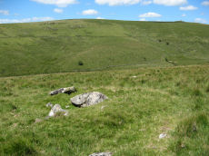
Crockern Tor N.W.2 Cairn
OS Map: SX 61262 75987
HER: MDV52777
ShortName: CN Crockern 2
Nearby sites: SX 61262 75987
Distance: 0.55km
Littaford Tor 3 Cairn
OS Map: SX 61849 77048
HER: MDV52779
ShortName: CN Littaford3
Nearby sites: SX 61849 77048
Distance: 0.74km
Stennen Hill 3 Cairn
OS Map: SX 62265 78280
HER: MDV52785
ShortName: CN Stennen 3
Nearby sites: SX 62265 78280
Distance: 1.99km
Muddilake (N) Reported Cairn
OS Map: SX 62761 75202
HER: MDV48858
ShortName: CN?Muddilake2
Turner: A37
Notes: Probable remains of a hut circle; this feature has previously been identified as a cairn. One of several associated with settlement site north of Muddilake Brook. Probably the second hut circle on NMR entry 442677
Nearby sites: SX 62761 75202
Distance: 1.96km
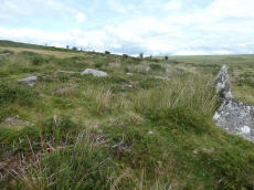
Longaford Tor Round House
OS Map: SX 61334 77325
HER: MDV105675
ShortName: HT:Longafd1
Nearby sites: SX 61334 77325
Distance: 0.80km
Longaford Tor Round House
OS Map: SX 61329 77303
HER: MDV105675
ShortName: HT:Longafd2
Nearby sites: SX 61329 77303
Distance: 0.77km
Longaford Tor Round House
OS Map: SX 61322 76768
HER: MDV105675
ShortName: HT:Longafd3
Nearby sites: SX 61322 76768
Distance: 0.24km
Longaford Tor Round House
OS Map: SX 61401 76943
HER: MDV105675
ShortName: HT:Longafd4
Nearby sites: SX 61401 76943
Distance: 0.42km
Longaford Tor Round House
OS Map: SX 6117 7771
HER: MDV105675
ShortName: HT:Longafd5
Nearby sites: SX 6117 7771
Distance: 1.19km
Longaford Tor Round House
OS Map: SX 61218 77718
HER: MDV105675
ShortName: HT:Longafd6
Nearby sites: SX 61218 77718
Distance: 1.19km
Longaford Tor Round House
OS Map: SX 61329 77356
HER: MDV105675
ShortName: HT:Longafd7
Nearby sites: SX 61329 77356
Distance: 0.83km
Longaford Tor Round House
OS Map: SX 61328 77213
HER: MDV105675
ShortName: HT:Longafd8
Nearby sites: SX 61328 77213
Distance: 0.68km
Longaford Tor Round House
OS Map: SX 61329 77418
HER: MDV105675
ShortName: HT:Longafd9
Nearby sites: SX 61329 77418
Distance: 0.89km
Longaford Tor Round House
OS Map: SX 61324 77380
HER: MDV105675
ShortName: HT:Longafd10
Nearby sites: SX 61324 77380
Distance: 0.85km
Longaford Tor Round House
OS Map: SX 61306 76653
HER: MDV105675
ShortName: HT:Longafd11
Nearby sites: SX 61306 76653
Distance: 0.12km
Longaford Tor Round House
OS Map: SX 61305 76624
HER: MDV105675
ShortName: HT:Longafd12
Nearby sites: SX 61305 76624
Distance: 0.10km
Longaford Tor Round House
OS Map: SX 61328 77479
HER: MDV105675
ShortName: HT:Longafd13
Nearby sites: SX 61328 77479
Distance: 0.95km
Longaford Tor Round House
OS Map: SX 61324 77294
HER: MDV105675
ShortName: HT:Longafd14
Nearby sites: SX 61324 77294
Distance: 0.76km
Longaford Tor Round House
OS Map: SX 61329 77256
HER: MDV105675
ShortName: HT:Longafd15
Nearby sites: SX 61329 77256
Distance: 0.73km
Longaford Tor Round House
OS Map: SX 61324 77221
HER: MDV105675
ShortName: HT:Longafd16
Nearby sites: SX 61324 77221
Distance: 0.69km
Longaford Tor Round House
OS Map: SX 61384 76638
HER: MDV105675
ShortName: HT:Longafd17
Nearby sites: SX 61384 76638
Distance: 0.13km
Longaford Tor Round House
OS Map: SX 61329 77356
HER: MDV105675
ShortName: HT:Longafd18
Nearby sites: SX 61329 77356
Distance: 0.83km
Longaford Tor Round House
OS Map: SX 61413 77184
HER: MDV105675
ShortName: HT:Longafd19
Nearby sites: SX 61413 77184
Distance: 0.66km
Longaford Tor Round House
OS Map: SX 61225 77540
HER: MDV105675
ShortName: HT:Longafd20
Nearby sites: SX 61225 77540
Distance: 1.01km
Longaford Tor Round House
OS Map: SX 61331 76910
HER: MDV105675
ShortName: HT:Longafd21
Nearby sites: SX 61331 76910
Distance: 0.38km
Longaford Tor Round House
OS Map: SX 6141 7707
HER: MDV105675
ShortName: HT:Longafd22
Nearby sites: SX 6141 7707
Distance: 0.55km
Longaford Tor Round House
OS Map: SX 61217 77571
HER: MDV105675
ShortName: HT:Longafd23
Nearby sites: SX 61217 77571
Distance: 1.05km
Longaford Tor Round House
OS Map: SX 61323 77241
HER: MDV105675
ShortName: HT:Longafd24
Nearby sites: SX 61323 77241
Distance: 0.71km
Longaford Tor Round House
OS Map: SX 6111 7786
HER: MDV105675
ShortName: HT:Longafd25
Nearby sites: SX 6111 7786
Distance: 1.35km
Crockern Tor S Round House
OS Map: SX 61159 75446
HER: MDV5970
ShortName: HT:Crockern 1
Nearby sites: SX 61159 75446
Distance: 1.10km
Longaford Tor Round House
OS Map: SX 61339 77278
HER: MDV105675
ShortName: HT:Longafd26
Nearby sites: SX 61339 77278
Distance: 0.75km
Crockern Tor W Round House
OS Map: SX 6121 7597
HER: MDV66152
ShortName: HT:Crockern 2
Nearby sites: SX 6121 7597
Distance: 0.57km
Longaford Tor Round House
OS Map: SX 6135 7652
HER: MDV105675
ShortName: HT:Longafd27
Nearby sites: SX 6135 7652
Distance: 0.03km
Crockern Tor W Round House
OS Map: SX 6116 7596
HER: MDV66154
ShortName: HT:Crockern 3
Nearby sites: SX 6116 7596
Distance: 0.59km
Longaford Tor Round House
OS Map: SX 61353 76627
HER: MDV105675
ShortName: HT:Longafd28
Nearby sites: SX 61353 76627
Distance: 0.10km
Crockern Tor W Round House
OS Map: SX 6120 7595
HER: MDV5949
ShortName: HT:Crockern 4
Nearby sites: SX 6120 7595
Distance: 0.59km
Longaford Tor Round House
OS Map: SX 61355 76652
HER: MDV105675
ShortName: HT:Longafd29
Nearby sites: SX 61355 76652
Distance: 0.13km
Crockern Tor W Round House
OS Map: SX 6117 7590
HER: MDV66155
ShortName: HT:Crockern 5
Nearby sites: SX 6117 7590
Distance: 0.65km
Longaford Tor Round House
OS Map: SX 61374 77302
HER: MDV105675
ShortName: HT:Longafd30
Nearby sites: SX 61374 77302
Distance: 0.77km
Crockern Tor W Round House
OS Map: SX 6116 7597
HER: MDV66153
ShortName: HT:Crockern 6
Nearby sites: SX 6116 7597
Distance: 0.58km
Longaford Tor Round House
OS Map: SX 61376 77276
HER: MDV105675
ShortName: HT:Longafd31
Nearby sites: SX 61376 77276
Distance: 0.75km
Longaford Tor Round House
OS Map: SX 61363 76729
HER: MDV105675
ShortName: HT:Longafd32
Nearby sites: SX 61363 76729
Distance: 0.20km
Longaford Tor Round House
OS Map: SX 61506 77081
HER: MDV105675
ShortName: HT:Longafd33
Nearby sites: SX 61506 77081
Distance: 0.58km
Longaford Tor Round House
OS Map: SX 61381 77324
HER: MDV105675
ShortName: HT:Longafd34
Nearby sites: SX 61381 77324
Distance: 0.80km
Longaford Tor Round House
OS Map: SX 61360 77106
HER: MDV105675
ShortName: HT:Longafd35
Nearby sites: SX 61360 77106
Distance: 0.58km
Longaford Tor Round House
OS Map: SX 61432 77026
HER: MDV105675
ShortName: HT:Longafd36
Nearby sites: SX 61432 77026
Distance: 0.51km
Longaford Tor Round House
OS Map: SX 61386 76942
HER: MDV105675
ShortName: HT:Longafd37
Nearby sites: SX 61386 76942
Distance: 0.42km
Longaford Tor Round House
OS Map: SX 61397 77281
HER: MDV105675
ShortName: HT:Longafd38
Nearby sites: SX 61397 77281
Distance: 0.75km
Longaford Tor Round House
OS Map: SX 61417 77076
HER: MDV105675
ShortName: HT:Longafd39
Nearby sites: SX 61417 77076
Distance: 0.55km
Longaford Tor Round House
OS Map: SX 61382 76650
HER: MDV105675
ShortName: HT:Longafd40
Nearby sites: SX 61382 76650
Distance: 0.14km
Longaford Tor Round House
OS Map: SX 61382 76660
HER: MDV105675
ShortName: HT:Longafd41
Nearby sites: SX 61382 76660
Distance: 0.14km
Longaford Tor Round House
OS Map: SX 61394 77059
HER: MDV105675
ShortName: HT:Longafd42
Nearby sites: SX 61394 77059
Distance: 0.53km
Longaford Tor Round House
OS Map: SX 61379 77300
HER: MDV105675
ShortName: HT:Longafd43
Nearby sites: SX 61379 77300
Distance: 0.77km
Longaford Tor Round House
OS Map: SX 60803 78077
HER: MDV52781
ShortName: HT:Longafd44
Nearby sites: SX 60803 78077
Distance: 1.63km
Longaford Tor Round House
OS Map: SX 6114 7785
HER: MDV105675
ShortName: HT:Longafd45
Nearby sites: SX 6114 7785
Distance: 1.33km
Longaford Tor Round House
OS Map: SX 6132 7653
HER: MDV105675
ShortName: HT:Longafd46
Nearby sites: SX 6132 7653
Distance: 0.00km
Longaford Tor Round House
OS Map: SX 61344 77362
HER: MDV105675
ShortName: HT:Longafd47
Nearby sites: SX 61344 77362
Distance: 0.83km
Higher White Tor SE Round House
OS Map: SX 6237 7782
HER: MDV27666
ShortName: HT:Higher Wh1
Nearby sites: SX 6237 7782
Distance: 1.66km
Longaford Tor Round House
OS Map: SX 61351 77489
HER: MDV105675
ShortName: HT:Longafd48
Nearby sites: SX 61351 77489
Distance: 0.96km
Higher White Tor SE Round House
OS Map: SX 62515 77665
HER: MDV60331
ShortName: HT:Higher Wh2
Nearby sites: SX 62515 77665
Distance: 1.65km
Longaford Tor Round House
OS Map: SX 61337 76927
HER: MDV105675
ShortName: HT:Longafd49
Nearby sites: SX 61337 76927
Distance: 0.40km
Higher White Tor SE Round House
OS Map: SX 62525 77675
HER: MDV27215
ShortName: HT:Higher Wh3
Nearby sites: SX 62525 77675
Distance: 1.66km
Longaford Tor Round House
OS Map: SX 61334 76787
HER: MDV105675
ShortName: HT:Longafd50
Nearby sites: SX 61334 76787
Distance: 0.26km
Higher White Tor SE Round House
OS Map: SX 62525 77655
HER: MDV60332
ShortName: HT:Higher Wh4
Nearby sites: SX 62525 77655
Distance: 1.65km
Longaford Tor Round House
OS Map: SX 61335 76790
HER: MDV105675
ShortName: HT:Longafd51
Nearby sites: SX 61335 76790
Distance: 0.26km
Higher White Tor SE Round House
OS Map: SX 62555 77885
HER: MDV13520
ShortName: HT:Higher Wh5
Nearby sites: SX 62555 77885
Distance: 1.83km
Longaford Tor Round House
OS Map: SX 61358 76930
HER: MDV105675
ShortName: HT:Longafd52
Nearby sites: SX 61358 76930
Distance: 0.40km
Higher White Tor SE Round House
OS Map: SX 6239 7775
HER: MDV60327
ShortName: HT:Higher Wh6
Nearby sites: SX 6239 7775
Distance: 1.62km
Longaford Tor Round House
OS Map: SX 6133 7655
HER: MDV105675
ShortName: HT:Longafd53
Nearby sites: SX 6133 7655
Distance: 0.02km
Higher White Tor SE Round House
OS Map: SX 62485 77625
HER: MDV60334
ShortName: HT:Higher Wh7
Nearby sites: SX 62485 77625
Distance: 1.60km
Longaford Tor Round House
OS Map: SX 6117 7770
HER: MDV105675
ShortName: HT:Longafd54
Nearby sites: SX 6117 7770
Distance: 1.18km
Higher White Tor SE Round House
OS Map: SX 62515 77685
HER: MDV60329
ShortName: HT:Higher Wh8
Nearby sites: SX 62515 77685
Distance: 1.66km
Longaford Tor Round House
OS Map: SX 61339 76625
HER: MDV105675
ShortName: HT:Longafd55
Nearby sites: SX 61339 76625
Distance: 0.10km
Higher White Tor SE Round House
OS Map: SX 62505 77665
HER: MDV60333
ShortName: HT:Higher Wh9
Nearby sites: SX 62505 77665
Distance: 1.64km
Longaford Tor Round House
OS Map: SX 61251 77510
HER: MDV105675
ShortName: HT:Longafd56
Nearby sites: SX 61251 77510
Distance: 0.98km
Higher White Tor SE Round House
OS Map: SX 62421 77792
HER: MDV27666
ShortName: HT:Higher Wh10
Nearby sites: SX 62421 77792
Distance: 1.67km
Longaford Tor Round House
OS Map: SX 6118 7771
HER: MDV105675
ShortName: HT:Longafd57
Nearby sites: SX 6118 7771
Distance: 1.19km
Higher White Tor SE Round House
OS Map: SX 6241 7782
HER: MDV27666
ShortName: HT:Higher Wh11
Nearby sites: SX 6241 7782
Distance: 1.69km
Longaford Tor Round House
OS Map: SX 61305 77525
HER: MDV105675
ShortName: HT:Longafd58
Nearby sites: SX 61305 77525
Distance: 1.00km
Higher White Tor SE Round House
OS Map: SX 62418 77845
HER: MDV27666
ShortName: HT:Higher Wh12
Nearby sites: SX 62418 77845
Distance: 1.71km
Longaford Tor Round House
OS Map: SX 61346 76749
HER: MDV105675
ShortName: HT:Longafd59
Nearby sites: SX 61346 76749
Distance: 0.22km
Higher White Tor SE Round House
OS Map: SX 62515 77875
HER: MDV5848
ShortName: HT:Higher Wh13
Nearby sites: SX 62515 77875
Distance: 1.80km
Longaford Tor Round House
OS Map: SX 61199 77822
HER: MDV105675
ShortName: HT:Longafd60
Nearby sites: SX 61199 77822
Distance: 1.30km
Higher White Tor SE Round House
OS Map: SX 6238 7774
HER: MDV60328
ShortName: HT:Higher Wh14
Nearby sites: SX 6238 7774
Distance: 1.61km
Longaford Tor Round House
OS Map: SX 61347 76621
HER: MDV105675
ShortName: HT:Longafd61
Nearby sites: SX 61347 76621
Distance: 0.09km
Longaford Tor Round House
OS Map: SX 61349 77259
HER: MDV105675
ShortName: HT:Longafd62
Nearby sites: SX 61349 77259
Distance: 0.73km
Longaford Tor Round House
OS Map: SX 6127 7750
HER: MDV105675
ShortName: HT:Longafd63
Nearby sites: SX 6127 7750
Distance: 0.97km
Longaford Tor Round House
OS Map: SX 61307 77333
HER: MDV105675
ShortName: HT:Longafd64
Nearby sites: SX 61307 77333
Distance: 0.80km
Longaford Tor Round House
OS Map: SX 61305 77439
HER: MDV105675
ShortName: HT:Longafd65
Nearby sites: SX 61305 77439
Distance: 0.91km
Longaford Tor Round House
OS Map: SX 6129 7689
HER: MDV105675
ShortName: HT:Longafd66
Nearby sites: SX 6129 7689
Distance: 0.36km
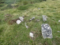
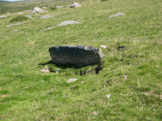
Littaford Tor Reported Cairn
OS Map: SX 61430 76490
HER: MDV52778
ShortName: CN Littaford1
Butler map: 29.1
Notes: A large granite slab lies the W side and a boulder is exposed just N of the centre. These may be part of a distroyed cist, but the boulder is very irregular and looks like a natural stone in situ around which the cairn may have been built.
Nearby sites: SX 61430 76490
Distance: 0.12km
Longaford Tor Round House
OS Map: SX 61237 77680
HER: MDV105675
ShortName: HT:Longafd67
Nearby sites: SX 61237 77680
Distance: 1.15km
Longaford Tor Round House
OS Map: SX 61302 76664
HER: MDV105675
ShortName: HT:Longafd68
Nearby sites: SX 61302 76664
Distance: 0.14km
Longaford Tor Round House
OS Map: SX 61234 77565
HER: MDV105675
ShortName: HT:Longafd69
Nearby sites: SX 61234 77565
Distance: 1.04km
Longaford Tor Round House
OS Map: SX 61259 77537
HER: MDV105675
ShortName: HT:Longafd70
Nearby sites: SX 61259 77537
Distance: 1.01km
Longaford Tor Round House
OS Map: SX 61259 77517
HER: MDV105675
ShortName: HT:Longafd71
Nearby sites: SX 61259 77517
Distance: 0.99km
Longaford Tor Round House
OS Map: SX 6126 7742
HER: MDV105675
ShortName: HT:Longafd72
Nearby sites: SX 6126 7742
Distance: 0.89km
Longaford Tor Round House
OS Map: SX 61294 77137
HER: MDV105675
ShortName: HT:Longafd73
Nearby sites: SX 61294 77137
Distance: 0.61km
Longaford Tor Round House
OS Map: SX 61255 77431
HER: MDV105675
ShortName: HT:Longafd74
Nearby sites: SX 61255 77431
Distance: 0.90km
Longaford Tor Round House
OS Map: SX 61242 77585
HER: MDV105675
ShortName: HT:Longafd75
Nearby sites: SX 61242 77585
Distance: 1.06km
Longaford Tor Round House
OS Map: SX 6129 7692
HER: MDV105675
ShortName: HT:Longafd76
Nearby sites: SX 6129 7692
Distance: 0.39km
Longaford Tor Round House
OS Map: SX 61270 77501
HER: MDV105675
ShortName: HT:Longafd77
Nearby sites: SX 61270 77501
Distance: 0.97km
Longaford Tor Round House
OS Map: SX 61238 77513
HER: MDV105675
ShortName: HT:Longafd78
Nearby sites: SX 61238 77513
Distance: 0.99km
Longaford Tor Round House
OS Map: SX 61283 77519
HER: MDV105675
ShortName: HT:Longafd79
Nearby sites: SX 61283 77519
Distance: 0.99km
Longaford Tor Round House
OS Map: SX 61285 77516
HER: MDV105675
ShortName: HT:Longafd80
Nearby sites: SX 61285 77516
Distance: 0.99km
Longaford Tor Round House
OS Map: SX 61287 77464
HER: MDV105675
ShortName: HT:Longafd81
Nearby sites: SX 61287 77464
Distance: 0.93km
Longaford Tor Round House
OS Map: SX 61299 77396
HER: MDV105675
ShortName: HT:Longafd82
Nearby sites: SX 61299 77396
Distance: 0.87km
Longaford Tor Round House
OS Map: SX 61237 77614
HER: MDV105675
ShortName: HT:Longafd83
Nearby sites: SX 61237 77614
Distance: 1.09km
Longaford Tor Round House
OS Map: SX 61301 77517
HER: MDV105675
ShortName: HT:Longafd84
Nearby sites: SX 61301 77517
Distance: 0.99km
Longaford Tor Round House
OS Map: SX 613 778
HER: MDV105675
ShortName: HT:Longafd85
Nearby sites: SX 613 778
Distance: 1.27km
Longaford Tor Round House
OS Map: SX 61290 77461
HER: MDV105675
ShortName: HT:Longafd86
Nearby sites: SX 61290 77461
Distance: 0.93km
Longaford Tor Round House
OS Map: SX 61260 77421
HER: MDV105675
ShortName: HT:Longafd87
Nearby sites: SX 61260 77421
Distance: 0.89km
Longaford Tor Round House
OS Map: SX 61232 77724
HER: MDV105675
ShortName: HT:Longafd88
Nearby sites: SX 61232 77724
Distance: 1.20km
Longaford Tor Round House
OS Map: SX 61256 77553
HER: MDV105675
ShortName: HT:Longafd89
Nearby sites: SX 61256 77553
Distance: 1.02km
Longaford Tor Round House
OS Map: SX 61233 77611
HER: MDV105675
ShortName: HT:Longafd90
Nearby sites: SX 61233 77611
Distance: 1.08km
Longaford Tor Round House
OS Map: SX 61304 76822
HER: MDV105675
ShortName: HT:Longafd91
Nearby sites: SX 61304 76822
Distance: 0.29km
Longaford Tor Round House
OS Map: SX 61319 77460
HER: MDV105675
ShortName: HT:Longafd92
Nearby sites: SX 61319 77460
Distance: 0.93km
Longaford Tor Round House
OS Map: SX 6125 7751
HER: MDV105675
ShortName: HT:Longafd93
Nearby sites: SX 6125 7751
Distance: 0.98km
Longaford Tor Round House
OS Map: SX 61305 76812
HER: MDV105675
ShortName: HT:Longafd94
Nearby sites: SX 61305 76812
Distance: 0.28km
Longaford Tor Round House
OS Map: SX 6125 7751
HER: MDV105675
ShortName: HT:Longafd95
Nearby sites: SX 6125 7751
Distance: 0.98km
Longaford Tor Round House
OS Map: SX 61315 77465
HER: MDV105675
ShortName: HT:Longafd96
Nearby sites: SX 61315 77465
Distance: 0.94km
Longaford Tor Round House
OS Map: SX 61259 77698
HER: MDV105675
ShortName: HT:Longafd97
Nearby sites: SX 61259 77698
Distance: 1.17km
Longaford Tor Round House
OS Map: SX 61245 77450
HER: MDV105675
ShortName: HT:Longafd98
Nearby sites: SX 61245 77450
Distance: 0.92km
Longaford Tor Round House
OS Map: SX 61258 77722
HER: MDV105675
ShortName: HT:Longafd99
Nearby sites: SX 61258 77722
Distance: 1.19km
Longaford Tor Round House
OS Map: SX 61246 77727
HER: MDV105675
ShortName: HT:Longafd100
Nearby sites: SX 61246 77727
Distance: 1.20km
Muddilake Round House
OS Map: SX 62621 75104
HER: MDV28590
ShortName: HT:Muddilake1
Nearby sites: SX 62621 75104
Distance: 1.93km
Muddilake Round House
OS Map: SX 62716 75279
HER: MDV28590
ShortName: HT:Muddilake4
Nearby sites: SX 62716 75279
Distance: 1.87km
Muddilake Round House
OS Map: SX 62756 75196
HER: MDV28590
ShortName: HT:Muddilake6
Nearby sites: SX 62756 75196
Distance: 1.96km
Muddilake Round House
OS Map: SX 62648 75194
HER: MDV28590
ShortName: HT:Muddilake7
Nearby sites: SX 62648 75194
Distance: 1.88km
Longaford Tor Reported Cist
OS Map: SX 6134 7785
HER: MDV57379
PMD: Longaford Tor
ShortName: CT?Longaford1
Notes: Cist set against a natural boulder that would have formed the south side stone, a possible end and side stone, with a large slab to north-west that could have been a capstone. Close to track from south of Longford Tor, towards leat take off point. Possible carn to east.
Nearby sites: SX 6134 7785
Distance: 1.32km
Beardown Hill N Round House
OS Map: SX 61073 76387
HER: MDV5897
ShortName: HT:Beardown 1
Nearby sites: SX 61073 76387
Distance: 0.29km
Beardown Hill N Round House
OS Map: SX 61105 76434
HER: MDV5897
ShortName: HT:Beardown 2
Nearby sites: SX 61105 76434
Distance: 0.24km
Beardown Hill N Round House
OS Map: SX 61088 76414
HER: MDV5897
ShortName: HT:Beardown 3
Nearby sites: SX 61088 76414
Distance: 0.26km
Beardown Hill N Round House
OS Map: SX 61082 76452
HER: MDV5897
ShortName: HT:Beardown 4
Nearby sites: SX 61082 76452
Distance: 0.25km
Beardown Hill N Round House
OS Map: SX 61050 76458
HER: MDV5897
ShortName: HT:Beardown 5
Nearby sites: SX 61050 76458
Distance: 0.28km
Beardown Hill N Round House
OS Map: SX 6109 7666
HER: MDV27240
ShortName: HT:Beardown 6
Nearby sites: SX 6109 7666
Distance: 0.26km
Beardown Hill S Round House
OS Map: SX 60906 75934
HER: MDV5898
ShortName: HT:Beardown 7
Nearby sites: SX 60906 75934
Distance: 0.73km
Beardown Hill S Round House
OS Map: SX 60856 75896
HER: MDV5898
ShortName: HT:Beardown 8
Nearby sites: SX 60856 75896
Distance: 0.79km
Beardown Hill S Round House
OS Map: SX 60831 75890
HER: MDV5898
ShortName: HT:Beardown 9
Nearby sites: SX 60831 75890
Distance: 0.81km
Beardown Hill S Round House
OS Map: SX 60834 75925
HER: MDV5898
ShortName: HT:Beardown 10
Nearby sites: SX 60834 75925
Distance: 0.78km
Beardown Hill S Round House
OS Map: SX 60845 75920
HER: MDV5898
ShortName: HT:Beardown 11
Nearby sites: SX 60845 75920
Distance: 0.77km
Beardown Hill S Round House
OS Map: SX 60871 75902
HER: MDV5898
ShortName: HT:Beardown 12
Nearby sites: SX 60871 75902
Distance: 0.77km
Beardown Hill S Round House
OS Map: SX 60917 75960
HER: MDV5898
ShortName: HT:Beardown 13
Nearby sites: SX 60917 75960
Distance: 0.70km
Beardown Hill S Round House
OS Map: SX 60922 75978
HER: MDV5898
ShortName: HT:Beardown 14
Nearby sites: SX 60922 75978
Distance: 0.68km
Beardown Tors E Round House
OS Map: SX 61007 77651
HER: MDV5851
ShortName: HT:Beardown 15
Nearby sites: SX 61007 77651
Distance: 1.16km
Beardown Tors E Round House
OS Map: SX 60998 77647
HER: MDV5851
ShortName: HT:Beardown 16
Nearby sites: SX 60998 77647
Distance: 1.16km
Beardown Tors E Round House
OS Map: SX 61006 77581
HER: MDV5851
ShortName: HT:Beardown 17
Nearby sites: SX 61006 77581
Distance: 1.10km
Beardown Tors E Round House
OS Map: SX 61035 77587
HER: MDV5851
ShortName: HT:Beardown 18
Nearby sites: SX 61035 77587
Distance: 1.09km
Beardown Tors E Round House
OS Map: SX 60983 77645
HER: MDV5851
ShortName: HT:Beardown 19
Nearby sites: SX 60983 77645
Distance: 1.16km
Beardown Tors E Round House
OS Map: SX 61012 77603
HER: MDV5851
ShortName: HT:Beardown 20
Nearby sites: SX 61012 77603
Distance: 1.12km
Beardown Tors E Round House
OS Map: SX 610 776
HER: MDV5851
ShortName: HT:Beardown 21
Nearby sites: SX 610 776
Distance: 1.12km
Beardown Tors E Round House
OS Map: SX 61026 77556
HER: MDV5851
ShortName: HT:Beardown 22
Nearby sites: SX 61026 77556
Distance: 1.07km
Beardown Platform Cairn Circle and Cist
OS Map: SX 60330 78092
HER: MDV14690
Megalithic Portal: 42853
PMD: Lydford Tor
Alternate name: Lydford Tor E. Platform Cairn Circle and Cist
ShortName: CT Beardown
Butler map: 29.17
Butler Vol 5: p.197 & Fig.140
DPD page: 109
Grinsell: LYD 41a
Turner: E27
Notes: "The cairn, 4.5 metres by 5.6 metres and 0.4 metres high has spread over the remains of a contiguous kerb 4.6 metres in diameter." ... "Three of the cist slabs lean inwards at the top, the fourth, east slab remains upright. The bottom of the cist contains several slabs. The coverstone is visible to the north west partially buried in the cairn." Lethbridge diagram p.107, photo top p.109. Butler Lydford Tor E Vol. 5. Map 29.17 (diagram Vol 5. p.197).
Nearby sites: SX 60330 78092
Distance: 1.85km
Beardown Farm Cist
OS Map: SX 604 754
HER: MDV5974
Megalithic Portal: 45789
PMD: Beardown Farm
ShortName: CTxBeardown Fm
Grinsell: LYD 46
Notes: The site is believed to have been destroyed many years ago Bray 1879 (included in listing as 130 in Grinsell list). Area is covered in Butler Vol 2 Map 29. "The remains of a cist surrounded by a rough pavement was examined by Mr Bray in September 1832 'two or three minutes walk north east of Beardown House' (at SX 604 754). Three stones of a four foot long cist stood six inches above ground level. A small piece of coarse pottery was found inside."
Nearby sites: SX 604 754
Distance: 1.46km
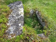
Crockern Tor Cist
OS Map: SX 61414 76055
HER: MDV57569
Megalithic Portal: 45816
PMD: Crockern Tor
Alternate name: Crockern Tor N.W. Cist
ShortName: CT CrockernTor
Butler Vol 5: p.32 & Fig.11
DPD page: 110
Notes: "Remains of a small cairn with cist on a moderate W slope in open grassland at SX 61407604 overlooking the West Dart in Crockern Newtake. It has been robbed heavily, leaving only one cist slab and fragments of the cairn material. The slab is restangular in side view and in section, firmly embedded on edge, measuring 1.2m long 0.48m high and 0.15m thick. It is aligned NW to SE." Butler Vol 5 p. 32. Lethbridge diagram and photo p.110.
Nearby sites: SX 61414 76055
Distance: 0.48km
Higher White Tor Stone Row
OS Map: SX 61917 78362
HER: MDV5834
Megalithic Portal: 2192
The Stone Rows of GB: Higher White Tor
PMD: Higher White Tor Stone Row
ShortName: SR:HigherWhito
Butler map: 29.16
DPD page: 110
Notes: "A Late Neolithic stone alignment on Higher White Tor, surviving as two parallel rows of stones aligned roughly north-south. The alignment is 95.4 metres long and contains twelve upright stones and 24 recumbent ones." Lethbridge diagram and photo p.110.
Nearby sites: SX 61917 78362
Distance: 1.93km
Muddilake Newtake Cist
OS Map: SX 62654 75194
HER: MDV5893
Megalithic Portal: 45745
PMD: Muddilake Newtake
ShortName: CT:Muddilake
Grinsell: LYD 105
Turner: A21
Barrow Report: 58
Notes: NMR states "A hut circle, not a cairn circle". This is almost certainly not a cist. "The measurements do not conform to those of Prowse but nothing else can be seen in the vicinity. It is most unlikely that these stones represent the remains of a cist, but are a natural occurrence." (see also duplicate HER record 5894 and SiteID=2547). This "cist" entry was listed by Dixon, however, it seems a dubious entry. This is not listed by Butler, the relevant map is Vol. 2. Map 29.9.
Nearby sites: SX 62654 75194
Distance: 1.89km
Muddy Lakes Newtake Reported Cairn
OS Map: SX 6258 7518
HER: MDV5894
Megalithic Portal: 45745
Alternate name: Muddilake West Reported Cairn
ShortName: CT?Muddilake3
Barrow Report: 58
Notes: Hut circle or cairn? Grinsell states "Traces of cairn with central slab, probably side-slab of cist. Diameter 6.0 meters, height is slight." Other observers say "no trace of cist". This is a duplicate of record 382 (HER 5893). Dixon #82. Bar Rep. 58 (TDA 71. 1939 illustration p.69).
Nearby sites: SX 6258 7518
Distance: 1.85km
Stennen Hill No. 1 Platform Cairn Circle and Cist
OS Map: SX 62573 77905
HER: MDV5846
Megalithic Portal: 45736
PMD: Powder Mills W.
Alternate name: Stennen Hill 1 Platform Cairn Circle and Cist
ShortName: CT Stennen 1
Butler map: 29.11.1
Butler Vol 5: p.199 & Fig.142
DPD page: 111
Grinsell: LYD 47
Turner: E13
Barrow Report: 57
Notes: "Cist lies approximately in the centre of a subcircular cairn measuring 7 by 6.5m the longer axis and cist aligned nne to ssw. It is stony but almost turf-covered with 2 large kerbstones, including burnards `menhir' remaining in situ in the nw. The cist is flush with the cairn top, which is flattish and stands only 0.2m high on the nw but up to 0.7m high on the se, downhill side. This may be the cairn's original form; built into the slope as a flat platform with the cist visible (nmr citing pattison)". See also HER. Lethbridge photo top p.111. Butler Stennen Hill 1 - Vol. 2. Map 29.11 (diagram Vol. 5. p.199). NB. Worth & Grinsell name this Stennen Hill No. 1
Nearby sites: SX 62573 77905
Distance: 1.86km
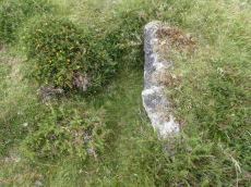
Stennen Hill No. 3 Cist
OS Map: SX 62615 77838
HER: MDV5847
Megalithic Portal: 45737
PMD: Powder Mills E.
Alternate name: Stennen Hill 2 Cist
ShortName: CT Stennen 2
Butler map: 29.11.2
Butler Vol 5: p.200 & Fig.143
DPD page: 111
Grinsell: LYD 49
Barrow Report: 57
Notes: "cist is oriented nw. - se. And is open with the south west side stone and the end stone buried beneath the turf. Internal dimensions 1.3m by 0.85m depth 0.5m. The mound, which is slight with a height of 0.3m is much disturbed. Judging by the remains of the retaining circle of which six stones can be seen the diameter of the mound was 4.5m. Condition of the cist is fair, of mound poor." Only one large stone remains in the mound of a cairn. Lethbridge photo top p.111. Butler Stennen Hill 2 - Vol. 2. Map 29.11 (diagram Vol. 5. p.200). NB. Worth & Grinsell name this Stennen Hill No. 3 (It is Butler 2)
Nearby sites: SX 62615 77838
Distance: 1.84km
Wistman's wood Settlement
OS Map: SX 6125 7750
HER: MDV66036
Megalithic Portal: 42854
ShortName: ST:Wistmans
Nearby sites: SX 6125 7750
Distance: 0.97km