
Guide to the Monuments on Drewsteignton and Spinsters Rock
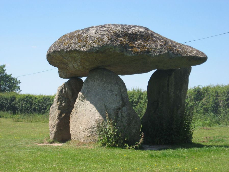
Table of Ritual and Burial Monuments on Drewsteignton and Spinsters Rock
Table of Round Houses on Drewsteignton and Spinsters Rock
| Guide # | Butler | SiteID | Site Name | OSX | Lat | Lon | NMR | HER | Barrow Report | Photo |
|---|---|---|---|---|---|---|---|---|---|---|
| 5710 | Cranbrook Down Round House | SX7390088860 | 50.68563080 | -3.78646994 | n/a | MDV27959 | N | |||
| 5711 | Cranbrook Down Round House | SX7368088850 | 50.68548965 | -3.78957009 | n/a | MDV27960 | N | |||
| 6000 | Easton Round House | SX7158088640 | 50.68313980 | -3.81921005 | n/a | MDV27518 | N | |||
| 7783 | Preston Round House | SX7479090330 | 50.69903183 | -3.77436996 | n/a | MDV26743 | N | |||
| 9168 | Uppacott Down Round House | SX7348089220 | 50.68877029 | -3.79253006 | n/a | MDV27961 | N |
Drewsteignton and Spinsters Rock Guide Map
Guidance for walkers: The monuments featured in this database are archaeological treasures and need to be protected and preserved - please do not disturb any sites. Please check access and firing times before visiting sites, not all sites listed are on open access land. Firing ranges and boundaries of open access areas are marked on the OL28 OS Dartmoor Explorer map. Please stick to the country code and consider giving support to the numerous agencies that help to keep Dartmoor a fabulous natural and historic environment!
List of Ritual and Burial Monuments on Drewsteignton and Spinsters Rock
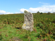
Butterdon Hill (nr. Moretonhampstead) Standing Stone
OS Map: SX 74784 88403
NMR record: SX 78 NW 33
HER record: MDV8278
Megalithic Portal: 33950
PMD: Butterdon Down Standing Stone
Alternate name: Butterdon Down Standing Stone
ShortName: SS Butterdon
Notes: Standing stone - prob. prehistoric. An upright stone, stands at the west edge of Butterdon Down, Moretonhampstead, beside the public footpath, 600 yards from Cranbrook Farm. It is between six and seven feet high and of slightly curved slab shape. Ref: Devon & Cornwall Notes & Queries 31 1970 pp. 225-26.
Nearby sites: SX74788840
Whiddon Park Crop Mark
OS Map: SX 72670 89200
NMR: No record found
HER record: MDV27528
ShortName: CN?WhiddonPark
Notes: Aerial Photograph
Nearby sites: SX72678920
Butterdon Down 1 Cairn
OS Map: SX 75038 88428
NMR record: SX 78 NE 30
HER record: MDV20070
ShortName: CN:Butterdon 1
Grinsell: MOR 7
Notes: On a small rise on the summit of Butterdon Down are two cairns, lying in an area of scattered boulders. This cairn measures 5.0 meters in diameter and is 1.3 meters high. Some stones could be modern additions. NMR 445433 A.
Nearby sites: SX75048843
Butterdon Down 2 Cairn
OS Map: SX 75044 88423
NMR record: SX 78 NE 30
HER record: MDV20071
ShortName: CN:Butterdon 2
Grinsell: MOR 8
Notes: Cairn, 7.8 meters in diameter and 1.1 meters high. It has an inner kerb 3.0 meters in diameter exposed by a central excavation pit. On the east side of this cairn there is an apparent semi-circle of spaced stones of rounded, earthfast, boulders. Possibly a peristalith. NMR 445433 B.
Nearby sites: SX75048842
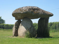
Spinsters Rock Chambered Tomb
OS Map: SX 70098 90789
NMR record: SX 79 SW 1
HER record: MDV8440
Megalithic Portal: 149
PMD: Spinsters Rock
ShortName: NT Spinsters
Butler Vol 5: p.155
DPD page: 150
Grinsell: A:DREW 1
Barrow Report: 56
Notes: Chambered tomb restored in 1862. No evidence to confirm or deny the existence of an original mound survives. The remains of the chamber consist of three granite orthostats 6 to 9 1/2 feet high which support a large capstone 14 1/2 feet long by 10 feet wide. No trace of any mound survives. It is associated with the nearby stones thought to have been circles and alignments (SX 69 SE 25) (see Shilstone Common & Spinster's Rock page).
Nearby sites: SX70109079
Shilstone Common (DRE 1a) Cairn Circle
OS Map: SX 69900 90800
NMR record: SX 69 SE 25
HER record: MDV7010
Megalithic Portal: 44557
The Stone Rows of GB: Spinsters Rock
PMD: Spinster's Rock Cairns and Stone Rows
Alternate name: Shilstone Common (nr. Spinsters Rock) Cairn Circle
ShortName: CC:ShilstoneA
Butler Vol 5: p.218
Grinsell: B:DRE 1a
Notes: Former remains on Shilstone Common near Spinsters rock. Remains no longer visible. Possibly sketched by Rev. John Swete in 1789. Site controversially mapped by Rev. William Grey in 1838 and published by Ormerod in 1872. Site dismissed by R.H. Worth but probable cairn remains found during field excavations by Major F.C. Tyler in 1930. For a reappraisal of Tyler's report see coverage on Prehistoric Dartmoor Walks.
Nearby sites: SX69909080
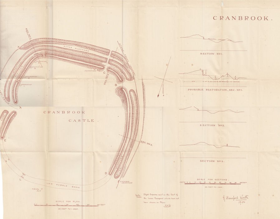
Cranbrook Castle Fort
OS Map: SX 73864 89021
NMR record: SX 78 NW 6
HER record: MDV8221
Megalithic Portal: 4624
Alternate name: Cranbrook Castle Fort
ShortName: FT Cranbrook
Notes: "The outer rampart cuts or overlies the banks of an earlier field system. Upwards of 30 clearance cairns are visible in the interior; date unknown. The outer defences on the east and west sides are clearly incomplete. On the north side the inner rampart line is marked by 2 very low linear dumps of stone, which appear to have acted as markers for the front and rear of the rampart. No trace of an accompanying ditch. The original bivallate plan of the hillfort is reinforced by the abrupt termination on the west side of both the outer bank and inner bank and ditch in line. Other aspects of the unfinished hillfort are the irregularities in height of inner rampart on the south side. These probably mark divisions between construction gangs."
Plan from the 7th Report of the Dartmoor Exploration Committee.
Nearby sites: SX73908900
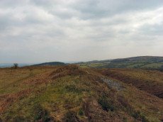
Prestonbury Castle Fort Fort
OS Map: SX 74678 90022
NMR record: SX 79 SW 5
HER record: MDV8439
Megalithic Portal: 29170
Alternate name: Prestonbury Castle Fort
ShortName: FT:Prestonbury
Notes: "Iron Age hillfort, inner works complete, but possibly outer works never finished. Prestonbury Castle is situated three miles north-west of Moretonhampstead high above the north bank of the R Teign. The bank of the inner enclosure measures 418 feet by 410 feet and is 7 1/2 feet high with entrances to the east and west. The middle enclosure bank has a simple entrance on its east side. The outer bank, only partially extant, is strengthened by a rock-cut ditch 20 feet broad. This bank divides into two at the crest of the southern slope. The bank has an inturned entrance facing northeas"
Nearby sites: SX74719001
Wooston Castle Fort Fort
OS Map: SX 76491 89671
NMR record: SX 78 NE 2
HER record: MDV8292
Megalithic Portal: 7767
Alternate name: Wooston Castle Fort
ShortName: FT:Wooston
Notes: "Wooston Castle comprises a defensive enclosure approached through a series of outworks which extend for up to 200 metres from east to west. From south to north the whole complex covers some 500 metres, at the northern extremity the defences lie within 50 metres of a precipitous drop to the River Teign."
Nearby sites: SX76538969
Shilstone Common (DRE 1b) Cairn Circle
OS Map: SX 69950 90800
NMR record: SX 69 SE 25
HER record: MDV7010
Megalithic Portal: 44557
Alternate name: Shilstone Common (nr. Spinsters Rock) Cairn Circle
ShortName: CC:ShilstoneB
Butler Vol 5: p.218
Grinsell: B:DRE 1b
Notes: Former remains on Shilstone Common near Spinsters rock. See Site 95 notes (B:DRE 1a)
Nearby sites: SX69959080
Shilstone Common (DRE 1c) Cairn Circle
OS Map: SX 70000 90550
NMR record: SX 69 SE 25
HER record: MDV7010
Megalithic Portal: 44557
Alternate name: Shilstone Common (nr. Spinsters Rock) Cairn Circle
ShortName: CC:ShilstoneC
Butler Vol 5: p.218
Grinsell: B:DRE 1c
Notes: Former remains on Shilstone Common near Spinsters rock. See Site 95 notes (B:DRE 1a)
Nearby sites: SX70009055
Cranbrook Castle Reported Cairn
OS Map: SX 73800 89000
NMR: No record found
HER record: MDV14531
ShortName: CN?Cranbrook
Notes: Hut circles?
Nearby sites: SX73808900
Drewsteignton 1 Reported Cairn
OS Map: SX 73470 91000
NMR: No record found
HER record: MDV26744
ShortName: CNxDrewsteig1
Nearby sites: SX73479100
Drewsteignton 2 Reported Cairn
OS Map: SX 73400 91420
NMR: No record found
HER record: MDV26745
ShortName: CNxDrewsteig2
Nearby sites: SX73409142
Page last updated 28/05/23