
Shilstone Common (DRE 1a) Cairn Circle
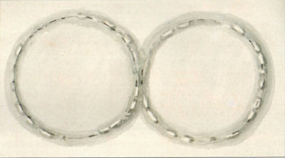
Swete's 1789 sketch of two prehistoric-circles, Drewsteignton (DRO, 64M/F1/61)
Database entries
PDW coverage: Dartmoor Site: Shilstone Common & Spinsters' Rock
OS Map: SX 699 908
OS Source: Butler
HER: MDV7010
Megalithic Portal: 44557
The Stone Rows of GB: Spinsters Rock
PMD: Spinster's Rock Cairns and Stone Rows
Alternate name: Shilstone Common 1
Short Name: CC:Shilstone A
Butler Vol 5: p.218
Grinsell: List B DRESTEIGNTON 1a
Exist: Maybe
Record: Unique
Record Source: Butler
Hut Class: No
Cairn Class: Yes
Lidar: SX 699 908
Guide Map: 14
Nearest Bus Stop: Chagford Sandy Park Inn (2.3 km) [Route: 173,178,671]
Nearby sites: SX 699 908
Notes
Former remains on Shilstone Common near Spinsters rock. Remains no longer visible. Possibly sketched by Rev. John Swete in 1789. Site controversially mapped by Rev. William Grey in 1838 and published by Ormerod in 1872. Site dismissed by R.H. Worth but probable cairn remains found during field excavations by Major F.C. Tyler in 1930. For a reappraisal of Tyler's report see coverage on Prehistoric Dartmoor Walks.Breton p.56 To the N. of the cromlech on this side of the road, a century ago stood two fine concentric stone circles with stone avenues leading up to them. These were all destroyed before 1865, and the stones were used for building purposes.
References
These are selected references with an emphasis on out of copyright sources linked as PDFs. For more detailed references try any linked HER or PMD record above.
- Brailsford, J. W, Bronze Age Stone Monuments of Dartmoor, Antiquity Volume 12, Number 48 pp.444-63 (1938)
- Breton, Henry Hugh, The Heart of Dartmoor, (1926)
- Burnard, Robert, Early Man, The Victoria History of the County of Devon: v. 1 (1906)
- Butler, Jeremy, Dartmoor Atlas of Antiquities, vol.5: The Second Millennium B.C., (1997)
- Grinsell, L.V., Dartmoor Barrows, Devon Archaeological Society Proceedings No.36 (1978)
- Ormerod, George Wareing, Notice of Pre-Historic Remains Formerly Existing Near Drewsteignton Cromlech, T.D.A. Vol.5. pp.73-74 (1872)
- Rowe, Samuel, A Perambulation of Dartmoor (3rd Edition), (1896)
- Swete, John, A Tour Across Dartmoor Into North Devon, Devon Notes & Queries, Vol.1, pp.88-96 (1901)
- Tyler, Major F. C., The Stone Remains in Drewsteignton , T.D.A. Vol.62 pp.248-260 (1930)
- Wall, J. Charles, Ancient Earthworks, The Victoria History of the County of Devon: v. 1 pp.573-630 (1906)
- Worth, R.N., The Stone Rows of Dartmoor - Part 1, T.D.A. Vol.24 pp.387-417 (1892)