
A Reappraisal of Tyler's The Stone Remains in Drewsteignton
Introductory note: Shilstone Common is private land situated below Bradmere Pool across the road from Spinsters' Rock. There is no public access to Shilstone Common and there are no longer any significant visible archaeological remains to be seen there. The public right of way is to Spinsters' Rock only. The discussion that follows builds upon previous commentary on this website, see: The mystery of the stone circles and avenues of Shilstone Common and aims to give a critical analysis of the investigations made by Major F. C. Tyler in the article The Stone Remains in Drewsteignton in T.D.A. Vol. 62 pp. 249-260 (1930). Tyler's article is speculative in trying to reconcile the contradiction between what he found through field survey and archaeological excavation and the inaccurate old field reports. The analysis that follows is also speculative and the alternative interpretations may or may not be any more valid!
Swete's Circles Published
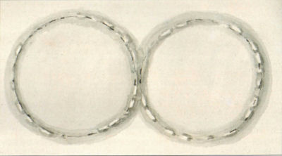
Swete's 1789 sketch of two prehistoric-circles, Drewsteignton (DRO, 64M/F1/61)
The Swete sketch of circles near Spinsters Rock was published for the first time by Major F.C. Tyler in 1928 in Devon Notes & Queries Vol. 15. In a short accompanying article he noted that they had not previously been published and that there were some points of similarity between the Grey and Swete circles. Both Grey's original map (see Ormerod's composite map below) and Swete's sketch had been put together with detailed accompanying field notes. The "eastern circles of the plans agree fairly well in dimensions, and in the arrangement of the stones. Otherwise, there is no point of resemblance". Tyler promised to investigate further and the results of his investigations were published in 1930 in the Transactions and Reports of the Devonshire Association Vol. 62.
Remarkably, in the same edition of the Transactions and Reports that published Tyler's report there is a Presidential Address given by R.H. Worth. Worth was the President of the Devonshire Association in 1930. It is a mystery as to why Worth's 1946 dismissive article Stray notes on the Teign Valley makes no mention of Tyler's report given he must have seen it. Perhaps Worth's article was written before this and was not published until 1946, with the war years adding to the delay, but it is a shame that Worth did not ensure that it was updated to reflect the research done by Tyler. This omission was not corrected when it was republished posthumously as an appendix in Worth's Dartmoor in 1953 (Worth died in 1950). Butler observes that Worth "was however not quite correct to be so 'certain that no independent observer has since reported having seen these remains' as the circles had been identified and partly excavated only a few years previously by Major F.C. Tyler" [Butler Vol. 5 p.218]. Butler refers to the claimed stone rows & avenues as "doubtful". Butler comments:
There may have been one or more stone rows in the fields surrounding Drewsteignton Cromlech, a controversial site first mentioned by Chapple (1750) and periodically re-assessed in the literature over the last two and a half centuries 'which for complication and incomprehensibility would be unique' according to R.H. Worth, a remark applying equally well to the coverage it has since received.
Butler's comments are understandable. Tyler's analysis of his own findings is very confusing. In part this was inevitable given he was attempting to reconcile what he found with impossibly contradictory and probably erroneous earlier field reports. Worth's later "authoritative" and dismissive comments with no reference to Tyler's earlier work adds to the confusion.

Ormerod's composite map of Grey's circles and Polwhele's pillars from Vol. 5 of the T.D.A.
The Polwhele (Swete) Pillars
Tyler found very contradictory information about the pillars which had all been previously reported as having long disappeared. Tyler found several four foot pillars and one of the alignment of pillars is possibly still there to this day but they are located in an orientation almost 45 degrees out from the exact east-west claims made by Polwhele (Swete). Tyler suggests that whilst Swete may have been relatively accurate with his measurements of distances by pacing he might have been a long way out with his compass bearings. This is very plausible, in the original text of a Tour Across North Devon Swete claims that the main capstone of Spinsters Rock is orientated east to west since: "The edges or angles seemed to present themselves (as far as I could make an observation from the sun) exactly to the cardinal points".

Tyler's diagram showing locations of observed pillars and circles
Swete had no modern GPS system or even a compass; he was on horseback with a sketchpad making his observations by pacing and getting his orientation "from the sun". The distances between three pillars found by Tyler match remarkably with the distances given by Swete (Longstones A, G & B where G is a gatepost on the road side of field A - assumed to be in its original position). Tyler assumes 3 feet to a Swete pace. This matches Swete's southern row but paradoxically Tyler found a fourth pillar (Longstone C) precisely where it would be expected as the eastern pillar of the second row if you invert Ormerod's version of Swete's plan! [N.B. Compare the Ormerod and Tyler diagrams above]. Tyler suggests that if just one more pillar had been removed (hypothetical longstone f) then Swete's pillars are still there except we have to reverse the north and south alignments and conclude that this "druidical avenue" does not lead anywhere near to Spinsters Rock. Tyler suggests that Swete had seen two noteworthy objects, the circles and Spinsters Rock, and when writing up his notes weeks or months after the event he had conflated the two. Tyler interprets Swete's circles as being a different set to Grey's circles being Circle 3 on his diagram. This is not a particularly plausible explanation given the significance that Swete gave to the "druidical avenue" leading to Spinsters Rock and the time he must have spent taking notes, preliminary sketches and pacing out the site. To be fair it is impossible to reconcile the account given by Swete with what actually appears there today on the ground.
An alternative explanation could be that Swete did indeed get his compass bearings totally wrong but there was also once a northern alignment of pillars heading across field B (Swete only mentioned two pillars anyway) that created an apparent "avenue" to Spinsters Rock. Ormerod's composite map assumed the two northern pillars were to the east of the northern alignment. Swete states "The area between is ninety-three paces, in the midway of which, at the eastern extremity, stands the Cromlech". Whether this means that Spinsters Rock is mid-way between two end pillars or midway between the two projected parallel rows is not clear (i.e. another conceivable interpretation is that the two northern pillars are further towards the west and not to the east as Ormerod assumes, see rough diagram below - the positioning of the two northern pillars being arbitrarily chosen, they could have been anywhere to the east or west on a similiar alignment). Either way he could have been referring to stones to the north. Tyler reports that there are numerous stones and general clitter in Field A but that Field B is entirely clear and as such stones must have been removed from Field B, so maybe Swete's two "northern" pillars were indeed once in Field B and have now gone and the Longstone C is another pillar unrelated to Swete's original observations. It is difficult with this explanation to reconcile the orientation of the alignment. Perhaps, without a compass, widely separated alignments could appear to be parallel when they actually diverge considerably. With the benefit of the plan above this may look implausible but on the ground it is conceivable that the distances and the lay of the land could have led to such a mistake. It is also possible that Tyler's diagram is inaccurate in terms of the orientation of the field boundary between field A and B. Tyler has this line at around 47 degrees from east-west when it would seem to be slightly less than this on online OS maps (the author is unable to confirm this with any precise data) - so the alignment still doesn't point to Spinsters Rock but maybe slightly less out of alignment than appears from Tyler's diagram. Either way, it is difficult to do anything other than speculate much as Tyler did.
A rough diagram of an alternative interpretation of Swete's pillars
Grey's Circles rediscovered, bell-shaped cremation pit found
Tyler also found possible evidence of Grey's circles to the west of the road. Four substantial stones, one recumbent and over 6 feet in length, were found for the eastern circle in a location that would fit with the dimensions of the reported circles although they are slightly south of the boundary line between the north and south fields whereas the original reports had the eastern circle north of that line. However, given the dubious orientation of earlier reports and the rather cobbled together nature of Grey's map as reproduced by Ormerod this seems very plausible. Assuming he had found the eastern circle Tyler investigated the area which he thought would cover the western circle. At one point:
"Further probing round about this area resulted in the crowbar suddenly sinking, almost by its own weight and almost to its own length, into a very soft place. As the subsoil is only one to two feet (or a bit more in places) deep, this was rather startling". [...] "In the subsoil had been excavated an almost square pit, practically 5 feet each way, and one foot deep. In one quarter of this square pit is a hole, oval in plan, and under-cut at one end. It is 1 ft. 8 in. deep (i.e., below the bottom of the square pit), its bottom being, therefore, 5 feet below the surface of the ground."
Tyler gives a detailed diagram of the construction of this pit. Tyler speculates:
This large pit is undoubtedly of artificial origin. And its purpose can hardly be other than in connexion with stone circles - and those circles must be Grey's. What this purpose was can only he conjectured. Personally, I think it can have been no other than a 'bothros,' or sacrificial pit, such as Hadrian Allcroft connects with the 'Moot Circles' of the British Isles, in his work, The Circle and The Cross, on p. 256 of which (Vol. 1) he says that "No structural bothros has been found in the circles of the south-western counties ....," and adds that the reason may be that the circles of that area are of too late a date. Had he lived to hear of this pit, he might have been inclined to assign an earlier date to these circles.
Whilst Tyler does not mention it, the pit is typical of Beaker period pits previously found in some Dartmoor cairns. It is strikingly similar to the bell shaped pits found by the Barrow Committee in cairns such as at Stannon Bottom and Hemstone Rocks, (see 21st Report of the Barrow committee). These pits were often off centre and contained cremation remains. Tyler found:
"a quantity of grains of charcoal, together with a larger bit, about half an inch long. Two similar pieces were found on the bottom of the square pit. At the bottom of the hole were three stones each about the size of a half-brick. The extreme bottom of the pit is stone, probably the natural granite [...] This pit was inspected by several interested people, amongst them Mr. Radford and Dr. E. H. Young. The hole, itself, was filled with earth, mixed with a peculiar ashy substance; but, unfortunately, there was not sufficient of this taken to afford a test of its composition. Dr. E. H. Young was kind enough to examine, microscopically, the larger pieces of charcoal, and pronounced them to be charcoal, probably oak, and of great age. Mr. G. T. Harris, also, was kind enough to examine them, and agreed with Dr. Young's opinion."
Tyler found three candidate stones for the western circle assuming a circle of similar dimensions adjacent to the first (although as Tyler points out a circle can be made to pass through any three points). Combined with the pit within this western circle and the probable packing stones for a central pillar for the western circle (see below), it would seem these were cairn circles although at around 90 feet across they are exceptionally large for Dartmoor cairn circles. Tyler suggests that the western circle is much smaller than reported by Grey in that it does not overlap the eastern circle. The centre, however, is pretty much where it would be expected in relation to the eastern circle as given by the Grey map i.e. the circles do not overlap and are of nearly the same size. Tyler does not say it but the dimensions he finds for the two circles are more accurate to those given by Swete.
Are Grey's Circles the same as Swete's Circles?
Tyler suggests that the circles sketched by Swete are not Grey's circles but circles on the east side of the road to the south of Spinsters Rock (Circle 3 on Tyler's diagram). This assumption, as we have seen, is used by Tyler to try to explain Swete's observations of the avenues assuming Swete conflated his circles and Spinsters Rock. The Grey circles lie directly along the line of the alignment of three pillars referred to by Tyler. This would suggest Swete paced right over the top of Grey's circles and avenues whilst pacing out the distance between Longstone A and the gatepost G without noticing the remains reported nearly 50 years later by Grey. That some of these remains were robbed out after Grey is possible but it is hard to see how Swete could have missed them under his own feet!
Tyler claims there is a possible barrow that could be Swete's circles just slightly north of a tree ring (as depicted on Tyler's diagram above). The reason Tyler suggests that they are different sites is because:
It is clear, from Swete's text (N. & Q.) that he saw circles down over the hill, to the south of longstone C., Fig. (i), and in the vicinity of Sandsgate about a quarter of a mile away, on the road from Whiddon Down to Moretonhampstead and Chagford. He refers to the circles as being near to some peculiar rocks, of which he gives a water-colour sketch (reproduced in N. & Q., Vol. 1). and which can be identified as those at Sandsgate.
Tyler could be right, but Swete's account flitters around the area, and his text could be interpreted quite differently. Tyler assumes that Swete is referring to Tyler's longstone C but maybe this is wrong. It is also likely that the whole area transformed beyond recognition between 1790 and the mid-twentieth century. The road and the fields may have been less well defined in terms of hedges and boundaries and the area generally more open.
There is a National Monument Record for a claimed barrow reported by L.J. Taylor at this location in 1976, it states (see Monument No. 445812):
SX 701905. A barrow 25.0m. in diameter seen by L.J Taylor in 1976. (1) [...] The only feature in this area resembling Taylor's description is a tree-ring at SX 70039052. The oval ring measures 17.5m. by 21.5m and stands 0.8m. high and 1.8m wide and is portrayed on the current 1:2500 O.S. plan. (2)
The NMR record here suggests that the barrow claimed by Taylor is the same as the tree-ring which can be seen marked on the OS map and is clearly marked on Tyler's diagram (below Circle 3). The diameter given by Swete for his circles is 31 paces or around 93 feet. The supposed barrow that Tyler suggests as being the one referred to by Swete is 30 feet in diameter judging by the diagram he provides [although the barrow claimed at this location by L.J Taylor in 1976 is 25m which would be 75 feet]. The diameter of the Grey circles is given by both Grey and Tyler as in the region of 90 feet which corresponds with Swete's circles. Tyler asserts that Swete was very inaccurate with compass bearings but accurate with distances yet he has Swete being out by a factor of three when it comes to the diameter of his circles! Swete refers to the pillars in his circles as being around four feet in height; this is the typical size of the stones in the circles found by Tyler. Maybe the Swete circles and the Grey circles are one and the same after all! Either way it is clear that Tyler uncovered likely remains of two cairn circles, one with an internment pit, and it is common for such cairns to have stone rows consisting of small stones associated with them (we refer here to some of the rows reported by Grey not to Swete's avenues). Of course, if this analysis is wrong and Tyler was right that Swete's circles were not Grey's circles, then, presuming Swete had not imagined his circles, the situation is even more interesting as there must have been two sets of massive double cairn circles in the vicinity of Spinsters Rock.
Central pillar in the western circle - a possible double circle?
Interestingly, Tyler also found evidence of a possible central pillar in the western circle. He describes finding a central pit surrounded by potential packing stones.
I experimentally fixed the centres of both circles, using Grey's plan for that of No. 1. A very short time spent in probing the ground round the conjectural centre of circle No. 1 gave a greater depth of soil at the point marked (by a cross) at 8 in Fig. (ii). Excavation revealed a pit in the hard subsoil. Round about the pit were four smallish and flattish stones, marked in Fig. (ii) by the smaller dots. This pit is similar to those which were found, subsequently, at 6 and 11, Fig. (ii). That it was made for the purpose of receiving the base of a standing stone can hardly be doubted. [...] The smaller stones which lay round the pit (and those, marked similarly by small dots, at 17 in No. 2 circle), are flattish stones, varying from 1 to 2 ft. in length, which may well have been footing-stones, now pushed slightly out of place by the action of the plough. It is possible to surmise that they may have served as footings for the stones shown by Grey round the centre of his circle No. 1, Fig. (iii), and for some of those which composed the easterly portion of the avenue. The pit itself may have served for a central standing stone ...
Whilst central standing stones are occasionally found in the centre of stone circles in Cornwall such as at Boscawen-Un this is not a feature of stone circles or typically of cairn circles on Dartmoor. There is one exception which is the case of the Laughtor Man longstone which is located on a cairn (see Laughter Tor Stone Row). Tyler points out that Grey's map might include these central packing stones. He goes on to speculate whether a symbol used by Ormerod could represent a dolmen in the centre of the circle but this seems most unlikely even if it was a common feature of stone circles in Derbyshire. The other main feature of interest is the possibility that the western circle was in fact a double circle. This is not apparent in Swete's sketch and Tyler's investigations are inconclusive but hint at this being possible. However, double or multiple kerb circles around cairns are not that uncommon on Dartmoor and given the very large size of these cairns it wouldn't be that surprising if they had more than one ring which is quite common for large cairns on Dartmoor. The other thing that is very common for cairns is associated rows of small stones leading to large terminal stones. Perhaps some of the pillars (e.g. Longstone A and longstone G) are simply terminal stones for rows that once accompanied the cairns and it was an embellished version of these that Grey mapped with other clitter and possibly plough scattered remains explaining his more extravagant rows.
Conclusion: Cairn circles and likely stone rows on Shilstone Common
Perhaps we will never know the truth about this site, trying to reconcile the conflicting accounts with the little real evidence that remains today is a near impossibility. What does seem likely is that there were once very large cairns on Shilstone Common and possibly other standing stones all in the vicinity of Spinsters Rock. This would suggest that this Neolithic site was of significance to those of the beaker culture in the early Bronze Age.
Bibliography & references
Butler, J. 1994. Dartmoor Atlas of Antiquities, vol.5: The Second Millennium B.C. pp. 217-18 (Devon Books, 1994)
Ormerod, G. Wareing. 1872. 'Notice of Pre-Historic Remains Formerly Existing Near Drewsteignton Cromlech' Report & Transactions of the Devonshire Association Vol. 5. pp.73-74
Ormerod, G. Wareing. 1872. 'Notice of the fall and restoration of the Spinster's Rock' The Archaeological Journal Vol. 29. pp. 342-351
Ormerod, G. Wareing. 1881. 'Letter: Drewsteignton Cromlech' Antiquary Vol. 3. pp. 91-92
Polwhele, Richard . 1793. Historical Views of Devonshire Vol. 1. p. 61.
Polwhele, Richard . 1797. History of Devon Vol. 1. p. 150.
Rowe, Samuel. 1896. A Perambulation of Dartmoor (Devon Books, 1985) pp. 110-119
Swete, John. 1789. 'A Tour Across Dartmoor Into North Devon' Devon Notes & Queries Vol. 1 (1901) pp. 88-96
Swete, John. 1796. 'On some of the more remarkable BRITISH MONUMENTS IN DEVON' Essays, by a society of gentlemen, at Exeter pp.106-130
Swete, John. 1789. Travels in Georgian Devon Vol. 1 (Editor Todd Gray, Halsgrove, 1997)
Tyler, F.C. 1928. Stone Circles at Drewsteignton in Devon Notes & Queries Vol. 15 (1928)
Tyler, F.C. 1930.The Stone Remains in Drewsteignton in T.D.A. Vol. 62 pp. 249-260 (1930)
Worth, R.H. 1902. Twenty-first Report of the Barrow Committee T.D.A Vol. 78 pp. 161-170 in T.D.A. Vol. 34 pp.104- 146
Worth, R.H. 1946. Stray notes on the Teign Valley T.D.A Vol. 78 pp. 161-170 in Worth's Dartmoor Appendix VI p468-470 (David & Charles, 1971)
Acknowledgements
Swete's sketch of two prehistoric-circles, Drewsteignton (DRO, 64M/F1/61) reproduced with permission from Devon Records Office.
Page last updated 14/10/11