
Cranbrook Castle Fort
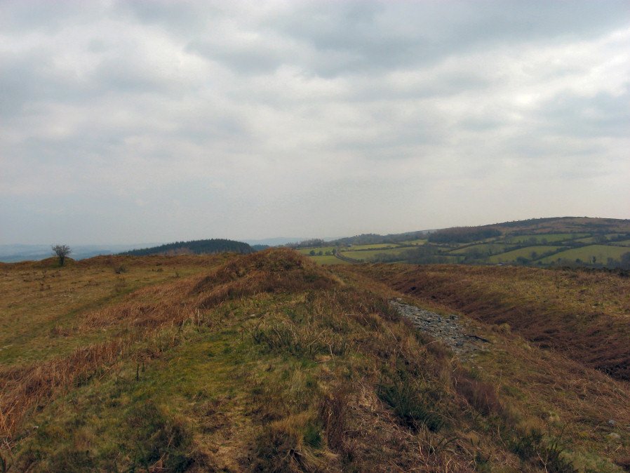
Photo taken on 17-03-2016
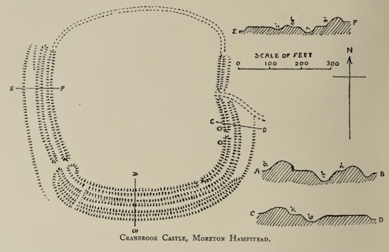
Plan: J.C. Wall in Ancient Earthworks (1906)
Database entries
PDW coverage: Dartmoor Walk: Butterdon Hill (nr Moretonhampstead) Standing Stone
OS Map: SX 73858 89023
OS Source: Google
HER: MDV8221
Megalithic Portal: 4624
Alternate name: Cranbrook Castle
Short Name: FT Cranbrook
Exist: Yes
Record: Unique
Record Source: PDW
Hut Class: No
Lidar: SX 73858 89023
Guide Map: 14
Nearest Bus Stop: Drewsteignton Square (2.5 km) [Route: 173]
Nearby sites: SX 73858 89023
Notes
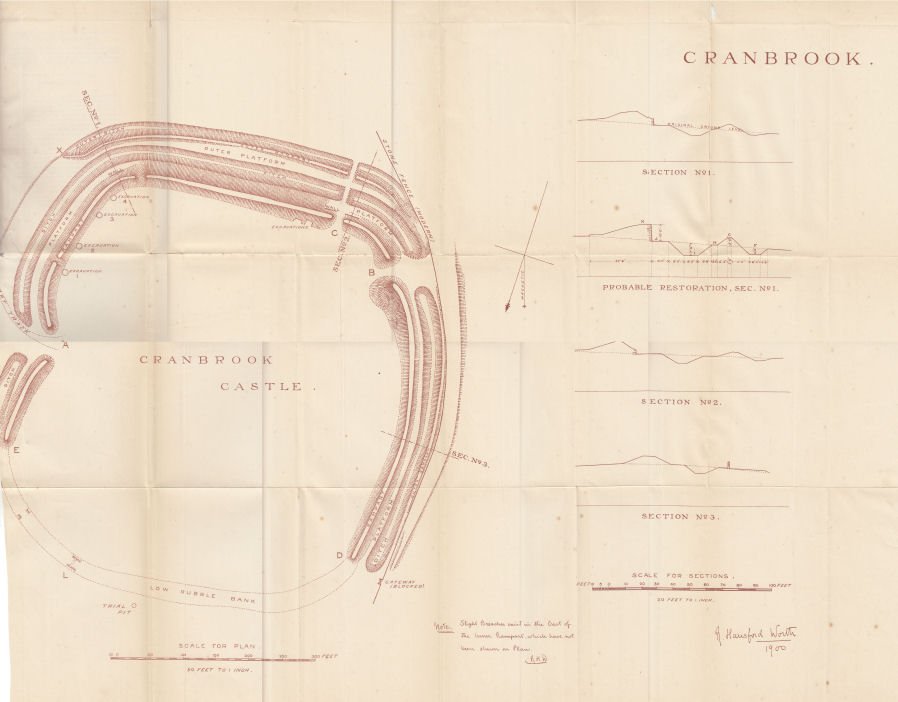
"The outer rampart cuts or overlies the banks of an earlier field system. Upwards of 30 clearance cairns are visible in the interior; date unknown. The outer defences on the east and west sides are clearly incomplete. On the north side the inner rampart line is marked by 2 very low linear dumps of stone, which appear to have acted as markers for the front and rear of the rampart. No trace of an accompanying ditch. The original bivallate plan of the hillfort is reinforced by the abrupt termination on the west side of both the outer bank and inner bank and ditch in line. Other aspects of the unfinished hillfort are the irregularities in height of inner rampart on the south side. These probably mark divisions between construction gangs."Plan from the 7th Report of the Dartmoor Exploration Committee.
References
These are selected references with an emphasis on out of copyright sources linked as PDFs. For more detailed references try any linked HER or PMD record above.
- Baring-Gould, Sabine, Seventh Report of the Dartmoor Exploration Committee, T.D.A. Vol.33 pp.130-138 (1901)
- Brailsford, J. W, Bronze Age Stone Monuments of Dartmoor, Antiquity Volume 12, Number 48 pp.444-63 (1938)
- Burnard, Robert, Early Man, The Victoria History of the County of Devon: v. 1 (1906)
- Fox, Aileen, Prehistoric hillforts in Devon, (1996)
- Gerrard, Sandy, English Heritage Book of Dartmoor: Landscapes Through Time, (1997)
- Greeves, T, The Archaeology of Dartmoor from the Air, (1985)
- Newman, Phil, The Field Archaeology of Dartmoor, (2011)
- Pilkington-Rogers, C. W., The Date of the Dartmoor Antiquities, T.D.A. Vol.64 pp.379-388 (1932)
- Rowe, Samuel, A Perambulation of Dartmoor (3rd Edition), (1896)
- Silvester, R., The Relationship of First Millennium Settlement to the Upland Areas of the South West., D.A.S.P. No.37 pp.178-179 (1979)
- Swete, John, A Tour Across Dartmoor Into North Devon, Devon Notes & Queries, Vol.1, pp.88-96 (1901)
- Wall, J. Charles, Ancient Earthworks, The Victoria History of the County of Devon: v. 1 pp.573-630 (1906)
- Wilkinson J. Gardner, British Remains on Dartmoor, Journal Brit. Arch. Assoc. xviii. pp.22-53, 111-133. (1862)
- Worth, R. Hansford, Stray notes on the Teign Valley, T.D.A Vol.78 pp.161-170 (1946)