
Guide to the Monuments on Beardown and Conies Down
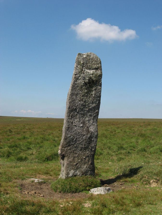
Table of Ritual and Burial Monuments on Beardown and Conies Down
The following table lists the records currently in this Guide Map. For an explantion of the Guide Maps and a table of all 62 Guide Maps, follow this link: Guide List Table. Introductory text will be added to each guide list in 2025. Notes on duplication and omissions will appear below the table once checks have been finalised.
Notes on possible duplications and omissions
Devils Tor Cairns: When these 3 records were first added they related to observed features with photos and accurate grid references. At the time there was one HER record MDV4217 which referred to a cairn described by Worth. A second HER record was added (and/or restored) later which subsumed the location of that one pushing it westwards. This matched descriptions in the old NMR records of two features, one a natural feature to the west of a cairn south of Beardown's Man. This pair of alleged features are roughly the same distance from Beardown man as the distance given by Worth 270 yards (approx 250m). A more likely cairn feature lies halfway between this pair and the standing stone but has no HER entry (1400m south of the standing stone and 100m to the north of the pair). The HER entries refer to Worth's description in 1948 but no source is given and no such source can be found. It is probably this entry from The Dartmoor Menhirs (1940).
PS. These notes are to assist untangling complicated records and are neither permanent nor a criticism of the HER who do a fantastic job! The author finds it easier to systematically work through these records (2000+ of them) and add these notes, which are then to be communicated with the HER, if appropriate, it is a pragmatic way of dealing with lots of data without continually stopping and starting.
Beardown and Conies Down Guide Map
Guidance for walkers: The monuments featured in this database are archaeological treasures and need to be protected and preserved - please do not disturb any sites. Please check access and firing times before visiting sites, not all sites listed are on open access land. Firing ranges and boundaries of open access areas are marked on the OL28 OS Dartmoor Explorer map. Please stick to the country code and consider giving support to the numerous agencies that help to keep Dartmoor a fabulous natural and historic environment!
List of Ritual and Burial Monuments on Beardown and Conies Down
Broad Hole S. Reported Cairn
OS Map: SX 59150 78240
HER record: MDV49705
ShortName: CN:BroadHole S
Butler map: 29.14
Notes: HER has this listed as a hut circle. Butler describes as a cairn and NMR suggests possible capstone of a cist. Butler OS SX 5910 7824. NMR OS SX 5915 7824
Nearby sites: SX59157824
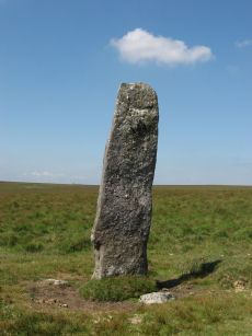
Beardown Man Standing Stone
OS Map: SX 59616 79634
HER record: MDV4200
Megalithic Portal: 4144
PMD: Beardown Man Standing Stone
ShortName: SS BeardownMan
Butler map: 29.15
Butler Vol 5: p.220
DPD page: 108
Notes: A Bronze Age standing stone measuring 3.4m high, 1m by 0.4m in section and in good condition. One of the few isolated menhirs on Dartmoor. See also, Legendary Dartmoor: Dartmoor's Beardown Man. Lethbridge diagram p.107, photo p.108.
Nearby sites: SX59627963
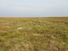
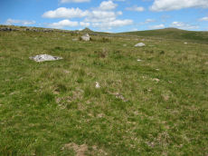
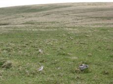
Devils Tor 1 Reported Cairn
OS Map: SX 59630 79497
HER: No record found
ShortName: CN DevilsTor 1
Notes: The author found this walking south from the Beardown man standing stone on 15/09/20. It is quite clearly a cairn although whether or not it is prehistoric is another matter. There does not seem to be much evidence of clearance taking place in this area which would suggest a prehistoric cairn.
Nearby sites: SX59637950
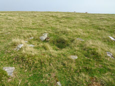
Devils Tor 2 Reported Cairn
OS Map: SX 59578 79408
HER record: MDV131162
ShortName: CN DevilsTor 2
Notes: SX 59667941. A low ovoid cairn located in an area of peat cuttings and shell craters on a ridge crest, 250m south of Devils Tor. It is partially obscured by heather and measures 3.1m in diameter with a maximum height of 0.4m. There are no indications of a kerb or cist and no obvious sign of disturbance. A natural stone pile at SX 59457939 (SX 57 NE 2) has been erroneously claimed as the feature described by Worth ('A cairn about 200 yards south of Beardown Man'; see MDV4217).
Formerly linked to MDV4217 with grid reference SX 59570 79409. That HER entry has been updated and moved to the West and the entry replaced with MDV131162.
Nearby sites: SX59587941
Devils Tor Reported Cist
OS Map: SX 59479 79414
HER record: MDV4217
Alternate name: Devils Tor 3 Reported Cist
ShortName: CT-DevilsTor 3
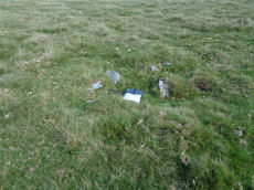
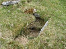
Notes: This feature was reported by Russell Chapman to Bill Radcliffe. The current author was visiting Beardown and had mentioned this to Bill who suggested that it should be checked out. The grid reference given by Russell was SX 59475 79416. The feature is a rectangular pit lined by small stones. It does not have the appearance of a Bronze Age cist. The nature and function of this feature is unclear but would seem most likely to be relatively modern. The author would like to thank Russell and Bill for the details.
The HER record MDV4217 has been moved to the west and now roughly coincides with this feature - it didn't previously. On that basis that record is now being matched with this feature although the match is uncertain.
Nearby sites: SX59487941

Higher White Tor Stone Row
OS Map: SX 61917 78362
HER record: MDV5834
Megalithic Portal: 2192
The Stone Rows of GB: Higher White Tor
PMD: Higher White Tor Stone Row
ShortName: SR HigherWhite
Butler map: 29.16
DPD page: 110
Notes: "A Late Neolithic stone alignment on Higher White Tor, surviving as two parallel rows of stones aligned roughly north-south. The alignment is 95.4 metres long and contains twelve upright stones and 24 recumbent ones." Lethbridge diagram and photo p.110. Site visited 28/05/2025 by the author. The main photo above gives a more realistic picture than the more "artistic" second photo.
Nearby sites: SX61927836
Higher White Tor Reported Cairn
OS Map: SX 61630 78250
HER record: MDV5957
ShortName: CN?HigherWhite
Grinsell: LYD 41b
Notes: natural? round barrow between longford tor and higher white tor. A very large barrow 1.3m high with a diameter of 30m under gorse and heather. No sign of ditch or kerb exist and there is no indication of an earlier disturbance. The monument is in a classic position commanding a fine view of the cherry brook valley.
Nearby sites: SX61637825
Littaford Tor 3 Cairn
OS Map: SX 61849 77048
HER record: MDV52779
ShortName: CN Littaford3
Nearby sites: SX61857705

Longaford Tor Reported Cist
OS Map: SX 61340 77850
HER record: MDV57379
PMD: Longaford Tor
ShortName: CT?Longaford1
Notes: Cist set against a natural boulder that would have formed the south side stone, a possible end and side stone, with a large slab to north-west that could have been a capstone. Close to track from south of Longford Tor, towards leat take off point. Possible carn to east.
Nearby sites: SX61347785
Wistman's wood Settlement
OS Map: SX 61250 77500
HER record: MDV5933
Megalithic Portal: 42854
Alternate name: Wistman's wood Settlement
ShortName: ST:Wistmans
Nearby sites: SX61257750
Rough Tor Cairn
OS Map: SX 60880 80170
HER record: MDV61965
ShortName: CN:Rough Tor
Nearby sites: SX60888017
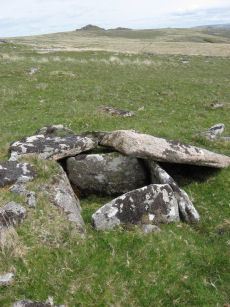
Beardown Platform Cairn Circle and Cist
OS Map: SX 60330 78092
HER record: MDV14690
Megalithic Portal: 42853
PMD: Lydford Tor
Alternate name: Lydford Tor E. Platform Cairn Circle and Cist
ShortName: CT Beardown
Butler map: 29.17
Butler Vol 5: p.197 & Fig.140
DPD page: 109
Grinsell: LYD 41a
Turner: E27
Notes: "The cairn, 4.5 metres by 5.6 metres and 0.4 metres high has spread over the remains of a contiguous kerb 4.6 metres in diameter." ... "Three of the cist slabs lean inwards at the top, the fourth, east slab remains upright. The bottom of the cist contains several slabs. The coverstone is visible to the north west partially buried in the cairn." Lethbridge diagram p.107, photo top p.109. Butler Lydford Tor E Vol. 5. Map 29.17 (diagram Vol 5. p.197).
Nearby sites: SX60337809
Crow Tor Platform Cairn Circle and Cist
OS Map: SX 60531 78683
HER record: MDV5938
Megalithic Portal: 45775
PMD: Crow Tor
ShortName: CT Crow Tor
Butler map: 29.18
Butler Vol 5: p.196 & Fig.139
DPD page: 109
Grinsell: LYD 41
Turner: E39
Notes: "A kerbed cairn and cist. The cairn consists of a stony, turf-covered mound, and measures 4.5m in diameter and 0.45m in height. There are traces of a retaining kerb of leaning, granite slabs to the northeast and south. The cist is set slightly to the north of the centre of the cairn. It is trapezoidal in shape, and measures 0.65m and 0.95m in length, 0.8m in width, and 0.5m in depth. The cover-stone, which is 0.9m long, 0.5m wide and 0.2m thick, is displaced and lies just to the south east of the cist." Lethbridge diagram p.107, photo bottom p.109. Butler Vol. 2. Map 29.18 (p.63, photo on p.124, diagram Vol. 5. p.196).
Nearby sites: SX60537868
Maiden Hill Cist
OS Map: SX 58831 79380
HER record: MDV4216
Megalithic Portal: 45815
PMD: Maiden Hill
Alternate name: Conies Down Summit Cist
ShortName: CT:MaidenHill
Butler map: 30.11
Butler Vol 5: p.158 & Fig.28
DPD page: 108
Grinsell: LYD 32
Notes: Maybe natural rather than a cist. "large turf-covered cairn which has been dug into from its southern edge. No stones are visible in the saucer-shape depression in the centre but a setting of three slabs near the northern edge may be the sides of a cist which contained a secondary burial inserted at a later date into the side of the mound" (Butler). Lethbridge diagram p.107, photo p.108. Butler Vol 2 30.11 p. 77. See very useful notes on Megalithic Portal.
Nearby sites: SX58837938
Conies Down Stone Row
OS Map: SX 58591 79076
HER record: MDV4592
Megalithic Portal: 1846
The Stone Rows of GB: Conies Down
PMD: Conies Down Stone Row
ShortName: SR ConiesDown
Butler map: 30.11
DPD page: 107
Notes: "The Conies Down stone row is oriented a few degrees west of north-south and is 145m long. Originally a double alignment of stones, only three pairs of upright stones now survive. There are a total of 17 upright and 15 recumbent stones. The average gap between stones is 10m and between the pairs the gap is some 1.4m wide". Lethbridge diagram p.107.
Nearby sites: SX58597908
Conies Down Stone Row Cairn
OS Map: SX 58590 79050
HER record: MDV133300
ShortName: CN:Conies 1
Butler map: 30.11
Notes: HER: Possible cairn of circa 3.0 metres diameter by 0.2 metres high at the north end of the stone row on Conies Down
Nearby sites: SX58597905
Conies Down stone row (natural outcrop) Reported Cairn
OS Map: SX 58600 78900
HER record: MDV4592
ShortName: CNxConies 2
Grinsell: LYD 33
Notes: Natural outcrop which is probably the small cairn described by Crossing. Probably duplicate of Conies Down (alleged) but the "roughly" NGR give by Grinsell does not match.
Nearby sites: SX58607890
Conies Down 3 Cairn
OS Map: SX 59170 79240
HER record: MDV48268
ShortName: CN:Conies 3
Nearby sites: SX59177924
Conies Down 4 (alleged) Reported Cist
OS Map: SX 58120 79630
HER record: MDV12809
PMD: Spriddle Lake
ShortName: CNxConies 4
Notes: No cist could be found in this area. At NGR SX 58167968 are several granite blocks which may have been mistaken for a cist. Probably Grinsell Lydford 33 - but NGR given by Grinsell suggests possible different site.
Nearby sites: SX58127963
Conies Down 5 Long Cairn
OS Map: SX 57570 79500
HER record: MDV61736
ShortName: CN:Conies 5
Notes: HER: An apparent long cairn on north-west flank of Conies Down
Greeves via HER: an apparent long cairn on nw flank of conies down. Aligned down slope, c 20m x 9m x im high. Long axis is nw-se, aligned to nw on limsboro cairn. An ancient dry leat (sx57ne/45) passes along contour immediately above cairn. Vegetation cover is mossy, with some heather and grasses, and distinct from surrounding vegetation. On ne side of cairn is an apparent discrete round cairn , 6-7m in diameter and c 0.3m high, with similar vegetation cover. No stones are visible on the long cairn, but 3 lie in a shallow pit c 3m to the sw. This pit is 2.5m diam x 0.5m deep and probably of modern military origin. C 100m to w is a crescentric bank of unknown purpose
Nearby sites: SX57577950
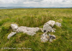
Broad Down Reported Cairn
OS Map: SX 61940 80883
HER record: MDV80630
ShortName: CN-BroadDown
Notes: Photo by Peter Brooks and reproduced here with his kind permission (copyright remains with Peter)."Peat cutter's shelter constructed from natural granite slabs 900 meters south of Sandy Hole Pass in an area of extensive peat cutting." Listed on the Modern Antiquarian as a cairn - but clearly a shelter. The author visited this location on 12/10/24 and my first thought was "shelter". I will keep Peter's photo of this site. See: Broad Down Cairn
Nearby sites: SX61948088
Spriddle Lake Reported Cairn
OS Map: SX 57680 79680
HER record: MDV68891
ShortName: CN?Spriddle
Nearby sites: SX57687968
Page last updated 10/12/24