
Prehistoric sites within 2km of SX 70220 71700
Guidance for walkers: The monuments featured in this database are archaeological treasures and need to be protected and preserved - please do not disturb any sites. Please check access and firing times before visiting sites, not all sites listed are on open access land. Firing ranges and boundaries of open access areas are marked on the OL28 OS Dartmoor Explorer map. Please stick to the country code and consider giving support to the numerous agencies that help to keep Dartmoor a fabulous natural and historic environment!
About the database listings: In all listings clicking on the photo or the site name will open a page for the site with a larger photo and further details from the database. The database now has over 6680 records covering nearly all publicly listed sites on Dartmoor including around 4800 round houses. This level of detail is of interest to archaeologists but tends to swamp listings of sites more likely to be of interest for walkers. For this reason, the listings default to around 550 core sites only. These are the stone circles, stone rows and the ring cairns listed by Turner. The default search radius is 2 km. The controls below the map can be used to start a new search by entering a 6- or 8-digit reference (without the prefix "SX"). The search radius can be specified and you can add incremental Display layers of detail on top of the core sites. If using a more detailed layer you will need to decrease the search radius to avoid getting hundreds of search results.
- Core sites Default listing of core sites consisting of stone circles & rows and some of the major ring cairns.
- Plus cairns adds approx. 1000 cairns and other minor sites not included in the core listings but excluding round houses.
- Plus round houses adds approx. 4800 round houses.
- Plus non-sites adds in the records for sites that no longer exist or are not prehistoric sites.
- Plus duplicates adds records excluded as duplicates. Those maybe duplicate records in external listings (e.g. the Historic Environment Records). For example, some sites have been identified as cairns in some listings and interpreted as round houses in other listings and both records appear.
These listings have incorporated, matched up and merged all of the records from all of the major archaeological listings including: Worth, Grinsell, Turner, Butler, Bill Radcliffe, Sandy Gerrard, Megalithic Portal, the National Monument Records and the Historic Environment Records. The author would like to thank Bill, Sandy, the lovely people both at Megalithic Portal (especially Anne Tate who did an amazing job to link listings) and at ACE Archaeology for collaborative work over the years to synchronise and correct listings across the various websites which now interlink. A culmination of years of work the final merger of cairn records took 3 months of cross referencing in 2017 the result being a snapshot of the records at that time. This data has in turn been refined since by field work and research. The round house data was supplied by Sandy Gerrard. Grid references are in order of accuracy: from Google Earth satellite, if visible and found, from a Garmin GPS reading, if visited by the author and from the literature otherwise. Individual site pages will state the source of the grid reference and provide satellite imagery. If a site listing lacks a photo it has not yet been visited by the author in which case the grid reference is from the literature.
Currently the database only includes sites which can be represented by a grid reference. Reaves are not included as they require GIS shape technology which is beyond the current capability of this system. To see the sources for the records, look at the tables on the resources menu. The database listings can also be viewed on a Google map and downloaded as GPS datasets for Garmin devices.
Corrections, or any feedback or suggestions are very welcome, email: info@dartmoorwalks.org.uk.
NOTE: Clicking on the icons for each monument in the map will give the name of the site. You can zoom in and out and drag the map around.
List of sites within 2km of SX 70220 71700
Aish Tor E Round House
OS Map: SX 7060 7155
HER: MDV25133
ShortName: HT:Aish Tor 1
Nearby sites: SX 7060 7155
Distance: 0.41km
Bench Tor Round House
OS Map: SX 69081 71484
HER: MDV6447
ShortName: HT:Bench Tor1
Nearby sites: SX 69081 71484
Distance: 1.16km
Bench Tor Round House
OS Map: SX 68957 71430
HER: MDV6447
ShortName: HT:Bench Tor2
Nearby sites: SX 68957 71430
Distance: 1.29km
Bench Tor Round House
OS Map: SX 69015 71451
HER: MDV6447
ShortName: HT:Bench Tor3
Nearby sites: SX 69015 71451
Distance: 1.23km
Bench Tor Round House
OS Map: SX 68986 71564
HER: MDV6447
ShortName: HT:Bench Tor4
Nearby sites: SX 68986 71564
Distance: 1.24km
Bench Tor Round House
OS Map: SX 68947 71446
HER: MDV6447
ShortName: HT:Bench Tor5
Nearby sites: SX 68947 71446
Distance: 1.30km
Bench Tor Round House
OS Map: SX 68991 71537
HER: MDV6447
ShortName: HT:Bench Tor6
Nearby sites: SX 68991 71537
Distance: 1.24km
Bench Tor Round House
OS Map: SX 68977 71301
HER: MDV12990
ShortName: HT:Bench Tor7
Nearby sites: SX 68977 71301
Distance: 1.31km
Bench Tor Round House
OS Map: SX 69015 71451
HER: MDV6447
ShortName: HT:Bench Tor8
Nearby sites: SX 69015 71451
Distance: 1.23km
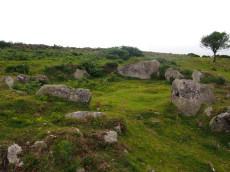
Brake Corner Round House
OS Map: SX 70222 71727
HER: MDV8030
ShortName: HT:Brake Cor1
Nearby sites: SX 70222 71727
Distance: 0.03km
Deeper Marsh Round House
OS Map: SX 7138 7124
HER: MDV25137
ShortName: HT:Deeper Ma1
Nearby sites: SX 7138 7124
Distance: 1.25km
Hannaford Round House
OS Map: SX 708 708
HER: MDV25139
ShortName: HT:Hannaford1
Nearby sites: SX 708 708
Distance: 1.07km
Holne Moor Round House
OS Map: SX 68662 70552
HER: MDV6381
ShortName: HT:Holne Moo6
Nearby sites: SX 68662 70552
Distance: 1.94km
Holne Moor Round House
OS Map: SX 68914 70468
HER: MDV6382
ShortName: HT:Holne Moo22
Nearby sites: SX 68914 70468
Distance: 1.80km
Holne Moor Round House
OS Map: SX 68660 70547
HER: MDV6381
ShortName: HT:Holne Moo25
Nearby sites: SX 68660 70547
Distance: 1.94km
Holne Moor Round House
OS Map: SX 6868 7175
HER: MDV20674
ShortName: HT:Holne Moo29
Nearby sites: SX 6868 7175
Distance: 1.54km
Holne Moor Round House
OS Map: SX 68842 70446
HER: MDV6382
ShortName: HT:Holne Moo38
Nearby sites: SX 68842 70446
Distance: 1.86km
Holne Moor Round House
OS Map: SX 68270 71547
HER: MDV12979
ShortName: HT:Holne Moo61
Nearby sites: SX 68270 71547
Distance: 1.96km
Holne Moor Round House
OS Map: SX 68947 70461
HER: MDV6471
ShortName: HT:Holne Moo64
Nearby sites: SX 68947 70461
Distance: 1.78km
Holne Moor Round House
OS Map: SX 68674 70593
HER: MDV6382
ShortName: HT:Holne Moo66
Nearby sites: SX 68674 70593
Distance: 1.90km
Holne Moor Round House
OS Map: SX 68640 70613
HER: MDV6382
ShortName: HT:Holne Moo68
Nearby sites: SX 68640 70613
Distance: 1.92km
Holne Moor Round House
OS Map: SX 6875 7161
HER: MDV26269
ShortName: HT:Holne Moo70
Nearby sites: SX 6875 7161
Distance: 1.47km
Holne Moor Round House
OS Map: SX 68816 70463
HER: MDV12984
ShortName: HT:Holne Moo77
Nearby sites: SX 68816 70463
Distance: 1.87km
Leusdon Round House
OS Map: SX 7049 7325
HER: MDV25125
ShortName: HT:Leusdon1
Nearby sites: SX 7049 7325
Distance: 1.57km
Mel Tor Round House
OS Map: SX 69524 72537
HER: MDV6453
ShortName: HT Mel Tor1
Nearby sites: SX 69524 72537
Distance: 1.09km
Mel Tor Round House
OS Map: SX 6943 7263
HER: MDV26252
ShortName: HT:Mel Tor2
Nearby sites: SX 6943 7263
Distance: 1.22km
Mel Tor Round House
OS Map: SX 69105 71451
HER: MDV6447
ShortName: HT:Mel Tor3
Nearby sites: SX 69105 71451
Distance: 1.14km
Sharp Tor E Round House
OS Map: SX 68903 72933
HER: MDV28606
ShortName: HT:Sharp Tor13
Nearby sites: SX 68903 72933
Distance: 1.80km
Spitchwick Manor Round House
OS Map: SX 7096 7261
HER: MDV25124
ShortName: HT:Spitchwic1
Nearby sites: SX 7096 7261
Distance: 1.17km
West Shallowford Round House
OS Map: SX 6955 7263
HER: MDV26251
ShortName: HT:West Shal2
Nearby sites: SX 6955 7263
Distance: 1.15km
Brake Corner 1 Cairn
OS Map: SX 7022 7170
HER: MDV8030
ShortName: CN?Brake 1
Butler map: 11.1.1
Turner: A17
Notes: Hut circle at brake corner. HER: A circular enclosure bounded by a bank consisting of small stone. Part of the interior has been filled in with cleared field stones. there is no trace of an entrance. Certain identification of the feature as a hut circle could not be made. No orthostats are visible and the construction using small stones is unusual for a hut. The exposed situation on the crest of a spur is more appropriate to a cairn but the walling, at best about 0.4 m. high, appears too regular for a cairn rim
Nearby sites: SX 7022 7170
Distance: 0.00km
Holne Lee N. Cairn
OS Map: SX 6884 7032
HER: MDV6472
ShortName: CN:HolneLee N
Butler map: 59.1
Grinsell: HOL 7
Notes: HER: A cairn situated within the field system at SX68847032 survives as a 9.7 metre diameter flat-topped mound standing up to 0.8 metres high. A small hollow in the centre of the cairn suggests that it has been partially excavated or robbed.. Possibly visible at around 20m to the east of Butler's grid reference at SX 68864 70324 on Google satellite. This record will revert to Butler's NGR until location confirmed.
NB. record duplicated on HER as MDV129703 see SiteID=1841.
Nearby sites: SX 6884 7032
Distance: 1.95km
Holne Lee N. (Duplicate) Cairn
OS Map: SX 6884 7032
HER: MDV129703
ShortName: CN:HolneLeDup
Butler map: 59.1
Grinsell: HOL 7
Notes: This is record MDV129703 on the HER which is a duplicate of MDV6472 both referring to the cairn 59.1 Holne Lee N Butler grid reference SX 6884 7032. See also SiteID=1830.
Nearby sites: SX 6884 7032
Distance: 1.95km
Venford Reservoir E. Embanked Cairn Circle
OS Map: SX 69033 70678
HER: MDV63936
ShortName: CC:VenfordResE
Notes: HER: A ring cairn sited 6m east of the Holne to Hexworthy road and on the crest of the ridge which extends between Bench Tor and Holne Lee. The cairn consists of a low (0.2m) circular earthwork with a diameter of approximately 20m, and a central mound. Much of the circle has been effaced, possibly by road builders and a pair of tinners' pits have destroyed part of the western sector. The best preserved section is on the northern side where a low, curved bank survives with a spread of approximately 2m. The eastern side is currently occupied by a car park, delineated by a row of large, loose boulders. The section of the circle within the car park has become badly eroded and the stony cairn material is exposed. The central mound is roughly elliptical measuring 9m by 7m.
Nearby sites: SX 69033 70678
Distance: 1.57km
Venford Reservoir Clearance Cairn
OS Map: SX 686 708
HER: MDV47780
ShortName: CNxVenfordRes
Notes: HER: Several clearance cairns observed on e and w sides of venford reservoir. Max height 0.5m, but most are less than 0.3m.(greeves)
Nearby sites: SX 686 708
Distance: 1.85km
Sherberton Common Stone Row Reported Cist
OS Map: SX 691 732
HER: MDV6426
PMD: Sherberton Common Stone Row
ShortName: CT?SherberCom
Butler map: 11.6
Grinsell: WID 22
Notes: NGR taken from NMR. Grinsell gives location SX 691739. Destroyed by 1897 but see entry for the stone row which is in fact a passageway to a round house.
Nearby sites: SX 691 732
Distance: 1.87km
Venford Reported Cist
OS Map: SX 68432 70973
HER: MDV47779
PMD: Venford
ShortName: CT?Venford 1
Notes: Radcliffe: "TAPG report while reservoir low. Walls, clearance cairn and cairn, with flint flakes. Cairn 4m dia with possible cist slab 1m by 0.5m by 0.2m. Probably at 6843 7097, found 29/9/03."
Nearby sites: SX 68432 70973
Distance: 1.93km
Brake Corner 2 Reported Cairn
OS Map: SX 7018 7168
ShortName: CN?Brake 2
Butler map: 11.1.2
Notes: Possible hut circle.
Nearby sites: SX 7018 7168
Distance: 0.04km
Bench Tor S. Reported Cairn
OS Map: SX 6916 7140
HER: MDV130253
ShortName: CN?Bench Tor
Butler map: 59.2
Notes: Butler: in the field system "a small mound near the north end was probably a cairn".
Nearby sites: SX 6916 7140
Distance: 1.10km
Sherberton Common Reported Stone Row
OS Map: SX 69148 73346
HER: MDV6426
The Stone Rows of GB: Sherberton Common
PMD: Sherberton Common
ShortName: SR:SherberCom
Butler map: 11.6
Butler Vol 5: p.214
Notes: Sandy Gerrard (see link to SRGB): According R.N. Worth this is a double stone row that measured 68.6m long situated on a gently sloping south facing slope. According to him the row was destroyed in 1897 shortly after its discovery. The rows were described as being between 8 and 9 feet apart and included some contiguous stones. Jeremy Butler suggested that it was a passage similar to one surviving at Fernworthy Reservoir but he was unable to identify the site of the feature described by Worth (Butler, J., 1997, 214). Fresh fieldwork has identified the structure, which survives comparatively well and is clearly a passageway leading to a robbed roundhouse from a length of prehistoric rubble walling. The structure has only been partly robbed and several stones remain together with the original 1897 stone robbing pits.
Nearby sites: SX 69148 73346
Distance: 1.96km