
Guide to Dartmoor Stone Circles

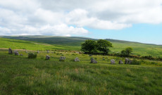
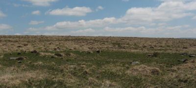
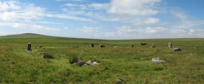
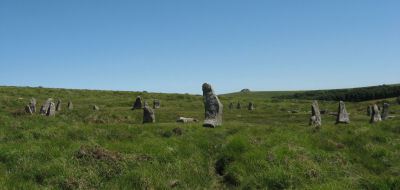
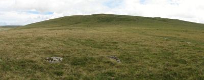
Photo: White Moor (Little Hound Tor) Stone Circle
There are 15 stone circles included in the Prehistoric Dartmoor Walks database, click here to skip to the listings with links to further coverage and photos.
The stone circles of the British Isles are thought to have an indigenous origin and date from around 2500 - 1300 B.C1. They arose in the context of the rise of farming in the late Neolithic and early Bronze Age and most are thought to have been constructed during the second millennium B.C. Whilst stone circles are not unique to the British Isles the examples in the rest of Europe are typically later and smaller and usually surround burial mounds, the exception being stone circles in Brittany which are similar to those found in the south-west peninsular of England and probably have the same cultural roots2. There are hundreds of stone circles in the British Isles that have survived mostly in the highland areas.3 It is very likely that there were many more which have not survived due to clearance and there is evidence that in some areas such structures were constructed of wood. In the West Country there are 25 stone circles in Cornwall, 17 in Devon (15 of these on Dartmoor), 5 or 6 in Somerset and 7 in Dorset4. NB. Since this article was first written two new circles have been found on Dartmoor. There are now known to be 19 in Devon with 17 on Dartmoor.
Arc formed by eight stone circles (Sittaford in blue)
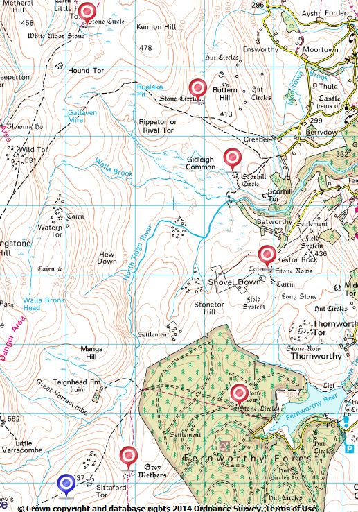
See also: Map of Dartmoor Stone Circles
Dartmoor Stone Circles
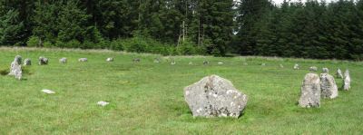
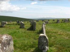
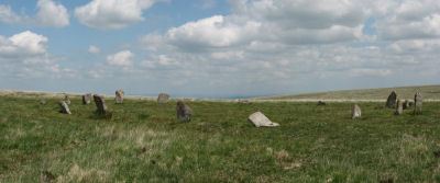
The stone circles of Dartmoor are parochial and small in character in contrast to the grand regional circles at Stanton Drew and Avesbury. The Dartmoor stone circles are around 20-40 metres in diameter and typically consist of small stones enclosing a flat interior located on very gently inclined slopes. The Dartmoor stone circles are mostly of a similar local character and do not include characteristics such as central pillars found in some of the circles in Cornwall such as Boscawen-Un. The largest by diameter are the Mardon Down stone circle (38.2 m) and the Grey Wethers (North 32.2 & South 33.6), the smallest are the Shovel Down (17.7 m) and Merrivale (19 m) circles.
Scorhill Circle is arguably the most impressive stone circle having the largest stones, one of which is over 8 feet in height. In contrast the nearly complete Fernworthy circle consists of 27 stones averaging just over 0.5m in height with the largest being 1.1m tall. Curiously the stones of Fernworthy appear to be graded by height with the taller stones in the south of the circle. The Grey Wethers, Brisworthy and White Moor (Little Hound Tor) circles were all restored and are impressive although they have smaller stones than Scorhill. Langstone circle was another impressive restored site until it was badly damaged by troops stationed nearby who used it for target practise during the Second World War. The Merrivale circle consists of 11 stones which are smaller than those at Fernworthy. The remainder of the circles are fragmentary with many of the stones either fallen or long lost as is the case for the Mardon, Buttern Hill, Down Ridge, Sherberton and the Shovel Down circles. The Sourton Tors circle consists of 32 stones all but 6 of which remain were they have fallen. The Tottiford circle was discovered in 2009 when there was lower than usual levels of water in Tottiford reservoir; it featured as part of a Time Team dig in 2010.
The Grey Wethers is the only example of a pair of stone circles on Dartmoor with two circles of approximately the same size separated by about 6m with centres forming an almost exact north-south axis, the stones all being over 1m in height. There are also multiple stone circle groups in Cornwall such as the three stone circles known as The Hurlers on Bodmin. The existence of groups of circles adds intrigue to the unknown purpose of stone circles.
It is interesting to note that 7 (now 8, see below) of these stone circles form an arc, or crescent, with each site separated by around 2 kilometres, they are; Grey Wethers (2 circles), Fernworthy, Shovel Down, Scorhill, Buttern Hill and Little Hound Tor (White Moor). Butler suggests that they are "apparently in a planned configuration".5
Since this article was first written a newly discovered stone circle was announced in the January 2014 edition of the Devon Archaelogical Society Newsletter No.117. The Sittaford circle was found by Alan Endacott in 2007. It is 32m in diameter consisting of recumbent stones of a similiar size to those used in the Grey Wethers. It is located 1km from the Grey Wethers and remarkably extends the arc pattern bringing the total to 8 stone circles in the apparent arc (see diagram above and Map of Dartmoor Stone Circles - Sittaford circle marked in blue).
The generally accepted number of stone circles on Dartmoor is 16 including the one discovered in 2009 under Tottiford reservoir (see table below) and the newly reported Sittaford stone circle. The precise definition of which monuments are included as stone circles has changed over the years resulting in different numbers of circles being stated by different authorities. Butler (1997) states that there are "thirteen fairly certain stone circles on the Moor"6 and includes a table listing 14 (this of course being prior to the discovery of the Tottiford circle). Worth (1953) lists 11 circles but this was prior to the discovery of the Sourton Tors circle in 1966 and does not include Mardon (perhaps not considered on the moor) or Shovel Down although he does refer to it as a "stone circle?" in a discussion about the rows on Shovel Down7. With these additions Worth's list agrees with Butler. Petit (1974) refers to 12 circles (his list presumably excluding Shovel Down & Mardon). Newman (2011) refers to 12 circles with "some other doubtful examples" (presumably Shovel Down being considered a doubtful circle). Gerrard (1997) states there are 18 circles which is 4 more than Butler although he includes the 4-fold cairn circles at Yellowmead and Shoveldown and two other smaller circles which presumably would now be considered to be cairn circles. Burl8 (1976) and Turner (1990) both list around 30-40 circles but these listings include sites which are now considered to be cairn circles (see Turner Stone Circles). Gerrard suggests Brisworthy stone circle could possibly be a ring cairn as a "low rubble bank, some 2.5m (8ft 2in) wide surrounds 75 per cent of the circumference"9 although Butler suggests this is probably a later feature.10
There is a possibility according to the investigations of the Dartmoor Exploration Committee that the Merrivale and Langstone Moor stone circles originally consisted of two concentric circles. Socket holes were found at Merrivale: "The outlying stone to the east of the circle and the two 0.3m deep pits survive in situ; they may represent the remains of a second, concentric, stone circle". At Langstone: "Outside this circle appear to have been another concentric with it; of this, however, only two stones remain in situ, but the pit hole of another, and the broken top of the stone taken from it remain. The singular feature of this outer circle is that the three stones are of a fine elvan, entirely different from the nature of the stones in the inner circle, with the exception of one, which also is of elvan."
Diagram & Table of Dartmoor Stone Circles by Diameter
| Stone Circle | Diam | No. of stones |
|---|---|---|
| Brisworthy | 25 | c.40 |
| Buttern Hill | 24.8 | c.40 |
| Down Ridge | c.25 | ? |
| Fernworthy | 20.0 | 29 |
| Grey Wethers N | 32.2 | 30 |
| Grey Wethers S | 33.6 | 30 |
| Langstone Moor | 20.9 | 16 |
| Little Hound Tor | 20.2 | 20 |
| Mardon Down | 38.2 | c.61 |
| Merrivale | c.19 | c.11 |
| Scorhill | 27.0 | c.60 |
| Sherberton | 29.6 | ? |
| Shovel Down | 17.7 | 13 |
| Sittaford | 32 | 30 |
| Sourton Tors | 33.5 | c.32 |
| Tottiford | 24 | 9-18 |
Circles of Stone or Stone Circles?
There are a number of monuments on Dartmoor that are often referred to by authors as stone circles but are not strictly categorised as stone circles. The generally accepted definition of a stone circle is a circle of stones thought to be a ritual site that does not include a cairn or burial. This excludes the numerous cairn circles and hut circles on Dartmoor. The stones of a cairn circle are designed to bound and contain the cairn whereas the stones of a stone circle are intended to be permeable11 to allow physical access to the interior as well as visible access to the landscape outside.
Typically cairn circles on Dartmoor are much smaller in size with very few having diameters greater than 20 metres. Particularly fine examples include the Nine Stones on Belstone Common, the Soussons Common cairn circle and a fine cairn circle on Mardon Down. Many of the stone rows on Dartmoor lead to a cairn circle and not all of these obviously include a cairn, again these are not considered to be proper stone circles. Fine examples include the Erme or Stall Moor Circle, The Pulpit (Trowlesworthy Warren E.), the Down Tor Circle (Hingston Hill) and the Ringmoor Down cairn circle and the Hartor cairn circle. In addition there are the multiple cairn circles at Shovel Down and Yellowmead. The outer ring of Yellowmead is the largest by diameter of these examples with a diameter that approaches 20 metres. The examples of cairn circles mentioned here are those that have commonly been referred to as stone circles and represent the more substantial monuments, there are over 13012 cairns with retaining circles the vast majority of which are less than 10m in diameter (see Cairn Circles).
Notable Cairn Circles by Diameter
| Cairn Circle | Diam | No. of stones |
|---|---|---|
| Down Tor | 11.5 | 24 |
| The Dancers (Erme Circle) | 15.8 | 26 |
| Hart Tor North | 9.3 | 14 |
| Mardon Down | 9 | 9 |
| Nine Stones (Belstone) | 7.7 | 16 |
| Ringmoor Down | 12.6 | 9 |
| Shovel Down 4-Circle | 9 | 9 |
| Soussons Common | 8.6 | 22 |
| Trowlesworthy Warren (E) | 6.5 | 8 |
| Yellowmead 4-Circle | 18.7 | 24 |
The Exploration and Restoration of Dartmoor Stone Circles
The current condition of many of the Dartmoor stone circles owes much to the work of the Dartmoor Exploration Committee (D.E.C.) which was formed by the Devonshire Association in 1893. With the notable exception of the Scorhill stone circle most of the stone circles were in a poor state of disrepair with most of the stones fallen and worse still the monuments had been robbed as a source of stone for newtake walls and gateposts and some Dartmoor monuments were still prone to being robbed by road builders.13 The Langstone Moor circle was one of the first to be restored for this reason (see Extract from Second Report of the Dartmoor Exploration Committee). The restoration of some of the Dartmoor monuments became controversial but there can be no doubt that these efforts helped to rescue these monuments from further neglect and despoliation. As well as restorations the D.E.C. carried out excavations, the following are the most notable cases related to Dartmoor stone circles.
- Merrivale circle was excavated in 1871 by Spence Bate.14 The only find was a flint.
- Langstone Moor stone circle was restored in 1894. The restoration was supervised by Baring-Gould. According to Burnard, "all the stones, some of which are five to six feet long to the number of sixteen had fallen ... the whole of these have been ... set up in the pits in which they originally stood".15
- White Moor (Little Hound Tor) circle was restored in 1896.16
- Fernworthy was excavated in 1897. An excavation trench was dug right across the circle and was found "strewn with small pieces of wood charcoal". In addition three pits were also dug; "the whole of these gave the same indications of charcoal - the remnants of fires of wood; in fact, fires seem to have been kindled all over the circle, for every scoop of the pick and shovel ... displayed charcoal."17
- Grey Wethers had a partial excavation in 1898 which uncovered remains of charcoal.
- Down Ridge (Hexworthy) was partially excavated in 1904 with charcoal being found "strewn on the floor". It had only 4 stones standing and 3 prostrate, the remainder having been removed by new-take wall builders.
- Brisworthy was excavated and underwent major reconstruction carried out by Breton and the Barrow Committee in 1909. Before the restoration only 4 stones remained standing, a limited excavation found evidence of charcoal.18
- The Grey Wethers were restored in 1909 by Burnard. At the time only 9 stones remained standing in the north circle and 7 in the south circle. Both circles have 30 stones.
Since the days of the Dartmoor Exploration Committee when hundreds of hut circles and other monuments were excavated in a decade or so of frantic activity only a few Dartmoor monuments have been excavated. In large part this is due to the fact that excavation is an inherently destructive process and in modern times there have to be very good reasons to proceed with excavations. The only stone circle to be excavated since the days of the D.E.C is the Tottiford stone circle which is normally submerged under Tottiford reservoir. It was discovered in 2009 when reservoir levels were very low and excavated in 2010 by the Time Team. The dig did not find specific dating evidence for the stone circle but it appeared as part of a ceremonial complex of other monuments including a double stone row which appeared to lead to a large mound. A number of Mesolithic flints were found and a burnt hazelnut shell which was carbon dated to the very late Mesolithic (calibrated date was 4590-4450 cal. BC at 95.4% probability).19 There is no dating evidence for the stone circle itself and it seems most likely that the stone circle and stone rows were built much later in the Neolithic on a site that had been in use much earlier in the late Mesolithic. This has some similarity with the Shovel Down Ceremonial Complex which has stone rows and a stone circle which are thought to date to the late Neolithic or early Bronze Age (approx 2500-1300 B.C.). The biggest finds so far of Mesolithic remains on Dartmoor are the thousands of Mesolithic flints found at Gidleigh and Batworthy corner near Shovel Down.20 It is not known whether these sites were continually occupied over the millennia between the late Mesolithic and the early Bronze Age (or late Neolithic) or whether they were vacated and re-occupied at various times. In the case of Shovel Down the excavation of the nearby Roundy Pound showed evidence of iron working and the extensive reave and field system in the area between Shovel Down and Kestor would suggest the area was occupied during the late Bronze Age and through to the Iron Age.21
Whilst specific dating evidence of Dartmoor Stone Circles is lacking there is evidence from other archaeological excavations which might throw some light on the context of the stone circles. In 2004 a previously unknown stone row was found on the remote Cut Hill, approximately 4km west of the Grey Wethers. Carbon dating of the peat surrounding the recumbent stones suggests a date "around the second half of the fourth millennium BC".22 This surprising result suggest that some of the Dartmoor monuments are much older than previously thought, that is from earlier in the Neolithic. However, it is thought that this stone row is atypical and the bulk of Dartmoor monuments date from the late Neolithic and early Bronze Age. For example, another recent excavation in August 2011 of a cist at Whitehorse Hill, just over 3km north-west of Grey Wethers, results in an estimated "date between the 19th and 17th century BC"23 which fits in more with the generally accepted time frame of Dartmoor monuments i.e. late Neolithic and early Bronze Age (to see both Cut Hill Stone Row and Whitehorse Hill Cist in relation to Grey Wethers, see Monuments within 4km of Grey Wethers or alternatively easier to see via Monuments within 4km of Quintins Man Cairn). A number of the ceremonial centres include stone circles, stone rows and cist burials which suggests the stone circles are roughly contemporaneous with the culture that practised cist burials, although many of the cist burials could have been later. The other notable excavation was of the Cholwich town stone row and cairn circle carried out in 1964 by George Eogan. This site was excavated prior to being buried underneath the clay workings at Cholwich town. No dating evidence was found but pollen analysis suggested the row and accompanying cairn circle had been built in a forest clearing.24
Stone Circles as Ritual Centres
The exact purpose of stone circles remains unknown. The excavations at Fernworthy, Grey Wethers and Merrivale all produced evidence of substantial fires at the sites. These fires might have been for cremations or for feasts and celebrations, we can only speculate on this. In terms of funerary practise it should be pointed out that cists often have cremation remains and they are widely distributed, often very distant from stone circles, although they could reflect later cultural practise. So far we do not even have accurate dating evidence for these monuments although it seems that they are from the late Neolithic and early Bronze Age. There are theories that they have an astronomical connection but the evidence to support this is lacking, indeed most of the circles are, much like most of the stone rows, only very roughly constructed. It would not be difficult to produce accurate circular structures with a peg and a rope yet only the Scorhill, Little Hound Tor and the two Grey Wethers circles are close to being exact circles, the others having the appearance of having been laid out roughly by eye. With such lack of precision in their construction it would seem most unlikely that they had an astronomical purpose. 25
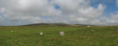
The location of the stone circles varies greatly. Many appear to have been located to give the most impressive vista on approach, the Buttern Hill circle would have been silhouetted on the skyline when approached from the south, on the other hand the Little Hound Tor circle when approached from the west only comes to view at a distance of 100m. The Buttern Hill and Tottiford circles are in valleys where as the Mardon circle is on the summit of a large hill. The Scorhill, Brisworthy circles are located near rivers but others such as the Mardon circle are nowhere near a river. It would seem that most of the circles are located on unenclosed open land near the boundaries of settlements. Butler points out that reaves constructed later near the circles seemed to make deliberate deviations in their course to ensure that the circles were not included in enclosed land such as at Scorhill and perhaps at Fernworthy (the reave at Fernworthy has been destroyed but the projected path excludes the circle), only the "Grey Wethers pair, Langstone Moor and Little Hound Tor are located some distance from settled areas".26
Whilst there is no indication of burials within the circles many of the circles are part of wider ceremonial complexes. There are stone rows and cairns close to the Fernworthy, Merrivale, Shovel Down and Tottiford circles. It would seem likely that most circles were established near population centres and sited to ensure ease of access to the whole community, they probably acted as ritual centres and perhaps also a place for community gatherings much like a local church or town hall.
Notes & References
1Burl (1976) p.11
2Burl (1976) p.20-1
3Burl (1976) (p.8, 11) states that there are over 900 stone circles. This figure is often quoted by authors but it should be pointed out that Burl (1976) is including stone rings or cairn circles. The County Gazetteer for Devon (p.344-5) includes 40 stone rings on Dartmoor most of which are cairn circles. This would suggest the figure for "true" stone circles is considerably smaller. In A Guide to the Stone Circles of Britain, Ireland and Brittany Aubrey Burl (1995) there are 368 stone circles listed in the British Isles with 21 listed for Dartmoor, 13 of which would be considered cairn circles.
4Butler (1997) p.145
5Butler (1997) p.146
6Butler (1997) p.154
7Worth (1953) On Shoveldown see p. 221, on stone circles see pp.248-264
8Burl p344-5 & Turner pp.80-2
9Gerrard (1997) p.61
10Butler (1997) p.145
11Newman p. 36, Bradley (1998, p. 116)
12Grinsell (1978) p. 86
13As late as 1902 Robert Burnard complained bitterly in the Transactions of the Devonshire Association that under the provisions of the Highways Act of William IV the road builders had the legal right to utilise any surface stone to repair roads and he claimed that Dartmoor monuments were still suffering as a consequence and that they had no real legal protection. See The Disappearing Stone Monuments of Dartmoor T.D.A. Vol 34 pp.116-7 (1902) . Baring-Gould in his A Book of Dartmoor (pp.53-55) published in 1900 gives a catalogue of sites that had been severely robbed in living memory.
14Bate (1872), see Report on the Prehistoric Antiquities of Dartmoor
15Burnard (1894) pp. 63-4 (also picture of restored Langstone circle as frontispiece)
16Baring-Gould, Fourth Report of the Dartmoor Exploration Committee, T.D.A. Vol. 29 pp.145-65 (1897)
17Baring-Gould Fifth Report of the Dartmoor Exploration Committee, T.D.A. Vol. 30 pp.97-115 (1898)
18Breton (1990) Part 1, pp.51-2
19Wessex Archaeology Time Team Report Appendix 2 Radiocarbon Report on Charred Hazelnut Shell p. 37 (2011)
20Newman (2011) p.25, Gerrard (1997) p.24
21Fox (1953)
22Fyfe, Ralph M. & Greeves, Tom (2010)
23Jones, Marchand, Sheridan, Straker, Quinnell (April 2012)
24Eogan, George & Simmons, J.G. (1964)
25The most convincing evidence for an astronomical alignment at a Dartmoor stone row is at Down Tor (Hingstone Hill). At sunrise around the summer solstice the shadows of the stones leading to the cairn circle are cast back from one stone to the next along the length of the row. This could be by design or it could be a coincidence given the wide range of orientations of Dartmoor stone rows. For a fascinating account, see: Walker, Jack Dartmoor Sun Halsgrove (2005)
26Butler (1997) p.146
Bibliography
Baring-Gould, S, A Book of Dartmoor, (1900), (Halsgrove reprint 2002)
Baring-Gould, Sabine, Fourth Report of the Dartmoor Exploration Committee, T.D.A. Vol. 29 pp.145-65 (1897)
Baring-Gould, Sabine, Fifth Report of the Dartmoor Exploration Committee, T.D.A. Vol. 30 pp.97-115 (1898)
Bate, C Spence, On the Prehistoric Antiquities of Dartmoor, T.D.A. Vol. 4 pp.491-5515 (1871) or Report on the Prehistoric Antiquities of Dartmoor, The Journal of the Royal Anthropological Institute of Great Britain and Ireland Vol. 1 (1872)
Breton, Henry Hugh, Beautiful Dartmoor And Its Interesting Antiquities, (1990)
Burnard, Robert, Dartmoor Pictorial Records Vol. IV (1894), (2010, Kessinger Publishing reprint)
Burnard, Robert, The Disappearing Stone Monuments of Dartmoor T.D.A. Vol 34 pp.116-7 (1902)
Burl, Aubrey The Stone Circles of the British Isles (Yale University Press, 1976)
Butler, J. Dartmoor Atlas of Antiquities: Vol. 5. - The Second Millennium B.C. (Devon Books, 1997)
Eogan, George & Simmons, J.G. The excavation of a stone alignment and circle at Cholwichtown, Lee Moor, Devonshire, England Proceedings of the Prehistoric Society Volume 30 pp.25-38 (1964)
Fox, A Excavations at KestorT.D.A Vol. 86 (1953)
Fyfe, Ralph M. & Greeves, Tom The date and context of a stone row: Cut Hill, Dartmoor, south-west England Antiquity Vol 84, No. 323 pp55-70. (2010). The article can be read on line here: The date and context of a stone row: Cut Hill, Dartmoor, south-west England
Gerrard, Sandy, English Heritage Book of Dartmoor: Landscapes Through Time, (1997)
Jones, Marchand, Sheridan, Straker, Quinnell Excavations at the Whitehorse Hill cist, Dartmoor PAST - the newsletter of the Prehistoric Society, Number 70 p.14-16 (April 2012)
Newman, Phil The Field Archaeology of Dartmoor (English Heritage, 2011)
Pettit, Paul. Prehistoric Dartmoor (David & Charles, 1974)
Turner, J.R., Ring Cairns, stone circles and related monuments on Dartmoor, D.A.S.P. No. 48 pp. 27-86 (1990)
Wessex Archaeology Time Team Report: Tottiford Reservoir, Archaeological Evaluation and Assessment of Results (2011)
Walker, Jack Dartmoor Sun (Halsgrove, 2005)
Worth, R.H. Worth's Dartmoor (David & Charles, 1971)
External Links
There are 15 stone circles on Dartmoor (this is counting Grey Wethers as two circles) and they are all listed below with links to their location on the OS map, to their National Monument Records and to any coverage on this website.
Default listing is by Site Name, click here to order instead by: Site Name, OS
Brisworthy Stone Circle
Prehistoric Dartmoor Walks: Dartmoor Site: Brisworthy Stone Circle
OS Map: SX 56467 65495
HER: MDV3983
Megalithic Portal: 542
PMD: Brisworthy Stone Circle
Short Name: SC Brisworthy
Butler map: 49.18
Turner: G8
DPD: 35
Barrow Report: 29 35
Dimensions (m): 24.0 x 27.0
Notes: The Brisworthy circle underwent major reconstruction carried out by Breton and the Barrow Committee in 1909. At the time only 4 stones remained standing whilst another 21 were lying roughly in place. Some 15 stones out of 40 are missing, no doubt robbed for nearby enclosures and walls. A low rubble bank surrounds the circle which can be seen on LIDAR data. This is discussed in detail in the article 'Dartmoor Site: Brisworthy Stone Circle' linked above in this listing.
Nearest Bus Stop: Meavy Primary School (2.6 km) [Route: 56]
Nearby sites: SX 56467 65495
Buttern Hill Stone Circle
OS Map: SX 64949 88481
HER: MDV4371
Megalithic Portal: 724
PMD: Buttern Hill Stone Circle
Short Name: SC Buttern 1
Turner: G7
DPD: 147
Dimensions (m): 24.8
Notes: NNE of Scorhill about 2Km. "The remains of a Bronze Age stone circle situated on level ground overlooking the valley of the North Teign River and Whitemoor Marsh. The stone circle measures 24.8 metres in diameter and is denoted by five upright granite slabs standing up to 0.76 metres high. A further 12 recumbent stones lie where they have fallen." Also known as the Throwleigh circle. According to R.N. Worth, although not confirmed since, there was "a small cairn between five and six yards in from the southern edge" and also there is a companion circle a short distance on the slope westward, 60 feet in diameter consisting of four stones with a possible large central pillar, see. The Stone Rows of Dartmoor - Part 3. Breton p.58. - Throwleigh Circle.
Nearest Bus Stop (Minor): Wonson Telephone Box (2.6 km) [Route: 670]
Nearest Bus Stop (Major): Ramsley (4.7 km) [Route: 670,671,6A]
Nearby sites: SX 64949 88481
Down Ridge Stone Circle
OS Map: SX 65516 72084
HER: MDV6400
Megalithic Portal: 863
PMD: Down Ridge Stone Circle
Short Name: SC DownRidge
Turner: G9
DPD: 92
Dimensions (m): 25.0
Notes: Also known as Hexworthy Circle. "situated on a gentle north facing slope overlooking the valley of the River Dart. The stone circle measures 25 meters in diameter and is denoted by five upright granite slabs, standing up to 1.45 meters high, which are confined to its south western sector. A further six recumbent stones lie where they have fallen. The stone circle was partially excavated in 1904 by the Dartmoor Exploration Committee and their work revealed the original ground surface covered with charcoal. An associated outlying standing stone is located 85 meters south-east of the stone circle and survives as a triangular shaped block up to 0.86 meters high." [HER MDV6400]. For photos of this site, see: Megalithic Portal: Down Ridge - Stone Circle
Nearest Bus Stop (Minor): Powder Mills (5.2 km) [Route: 171(20/07/26 to 19/09/26)]
Nearest Bus Stop (Major): Postbridge Bellever (5.3 km) [Route: 98]
Nearby sites: SX 65516 72084
Fernworthy Stone Circle
Prehistoric Dartmoor Walks: Dartmoor Site: Fernworthy Ceremonial Complex
OS Map: SX 65486 84126
HER: MDV6534
Megalithic Portal: 530
PMD: Fernworthy Stone Circle
Short Name: SC Fernworthy
Turner: G13
DPD: 138
Dimensions (m): 19.3
Notes: The Fernworthy circle is part of a group of ceremonial monuments including 3 stone rows and 5 cairns that may once have rivalled Merrivale and Shovel Down as ceremonial centres. The site is in a small clearing in Fernworthy Forrest off the path to Teignhead Farm. The circle is remarkably intact with all but 2 stones still in their original places ... It is 20m in diameter and consists of 27 small stones. The stone rows and cairns probably came later and surround the site. The circle was excavated by the Dartmoor Exploration Committee in 1897. They found that the interior of the circle was covered in a layer of charcoal suggesting that it had been the scene of very many fires - perhaps funeral pyres or feasts. See also Legendary Dartmoor: Dartmoor's Fernworthy Stone. DNP Post 3D. Breton p.66-67
Nearest Bus Stop (Minor): Warren House Inn (3.7 km) [Route: 171(20/07/26 to 19/09/26)]
Nearest Bus Stop (Major): Postbridge Post Office (5.3 km) [Route: 98,171(20/07/26 to 19/09/26)]
Nearby sites: SX 65486 84126
Grey Wethers (N) Stone Circle
Prehistoric Dartmoor Walks: Dartmoor Site: Grey Wethers Double Stone Circle
OS Map: SX 63875 83161
HER: MDV6758
Megalithic Portal: 532
PMD: Grey Wethers Stone Circles
Short Name: SC Grey Weth N
Turner: G4
DPD: 134
Dimensions (m): 31.5
Notes: "Northern stone circle of the pair known collectively as The Grey Wethers. This circle measures 31.5 metres in diameter and is denoted by 20 upright granite slabs with an average height of 1.1 metres. Excavations carried out by the Dartmoor Exploration Committee towards the end of the 19th century revealed a layer of charcoal covering the original ground surface. A shallow trench visible leading through the southern circle may be the result of this excavation. The circle was restored at this time". Grinsell [Folklore 1976]: The stones turn round at sunrise. King 1873, 780; St Leger Gordon 1972, 71-2.
Nearest Bus Stop (Minor): Warren House Inn (4.2 km) [Route: 171(20/07/26 to 19/09/26)]
Nearest Bus Stop (Major): Postbridge Post Office (4.4 km) [Route: 98,171(20/07/26 to 19/09/26)]
Nearby sites: SX 63875 83161

Grey Wethers (S) Stone Circle
Prehistoric Dartmoor Walks: Dartmoor Site: Grey Wethers Double Stone Circle
OS Map: SX 63874 83121
HER: MDV6759
Megalithic Portal: 532
PMD: Grey Wethers Stone Circles
Short Name: SC Grey Weth S
Turner: G2
DPD: 134
Dimensions (m): 33.0
Notes: This site is one of the most impressive on Dartmoor. The circles were restored in 1909 by Burnard. At the time only 9 stones remained standing in the north circle and 7 in the south circle. It is thought that the reconstruction is fairly accurate. The circles are separated by a few meters and are almost identical. Both circles have 30 stones and diameters very close to 33 m and they are within 2 degrees of being on an exact north to south alignment. The slight differences between the two circles could even be a result of the restoration. Apparently "wether" is an old English name for sheep and legend has it that a drunken farmer leaving the Warren House Inn was persuaded that the Grey Wethers were a desirable flock for sale! See also, Legendary Dartmoor: Grey Wethers. Grinsell [Folklore 1976]: The stones turn round at sunrise. King 1873, 780; St Leger Gordon 1972, 71-2.
Nearest Bus Stop (Minor): Warren House Inn (4.2 km) [Route: 171(20/07/26 to 19/09/26)]
Nearest Bus Stop (Major): Postbridge Post Office (4.3 km) [Route: 98,171(20/07/26 to 19/09/26)]
Nearby sites: SX 63874 83121
Langstone Moor Stone Circle
Prehistoric Dartmoor Walks: Dartmoor Site: Langstone Moor Stone Circle, Stone Row & Settlements
OS Map: SX 55638 78204
HER: MDV4226
Megalithic Portal: 1062
PMD: Langstone Moor Stone Circle
Short Name: SC Langstone
Butler map: 30.10
Turner: G10
DPD: 14
Dimensions (m): 20.4
Notes: The Langstone standing stone and also the stone circle were used for target practice by American troops who were stationed nearby during the Second World War. Bullet holes can be seen on the Langstone standing stone and the circle was sadly smashed to smithereens. The Langstone Moor Stone circle had been restored in 1894 when all of the stones were re-erected in their original socket holes.
Nearest Bus Stop: Merrivale Dartmoor Inn (3.1 km) [Route: 98,171(20/07/26 to 19/09/26)]
Nearby sites: SX 55638 78204
Little Hound Tor (or White Moor) Stone Circle
Prehistoric Dartmoor Walks: Dartmoor Site: Little Hound Tor Stone Circle
OS Map: SX 63285 89611
HER: MDV4374
Megalithic Portal: 528
PMD: White Moor Stone Circle
Short Name: SC White Moor
Turner: G11
DPD: 154
Dimensions (m): 20.2
Notes: The circle is in good condition today but only 13 stones remained standing when the Dartmoor Exploration Committee re-erected 5 of the stones in 1896. The site is a fairly accurate circle of circumference 20.2m. A cairn lies close to the circle, a heather covered mound about 8.5m across. The White Moor stone lies 160m to the SE of the circle and it is thought to be contemporary with the circle but probably out of position having been re-erected at some point. It is now a boundary marker. Breton p.52. See also, Legendary Dartmoor: Dartmoor's Bronze Age Landscape of Whitmoor.
Nearest Bus Stop (Minor): Throwleigh Cross (3.7 km) [Route: 670]
Nearest Bus Stop (Major): Ramsley (3.9 km) [Route: 670,671,6A]
Nearby sites: SX 63285 89611
Mardon Down Stone Circle
Prehistoric Dartmoor Walks: Dartmoor Site: Mardon Down Stone Circle & Cairns
OS Map: SX 76764 87203
HER: MDV8289
Megalithic Portal: 3376
PMD: Mardon Down Stone Circle
Short Name: SC Mardon Down
Butler Vol 5: p.148 & Fig.90
Turner: G1
DPD: 149
Dimensions (m): 38.0
Notes: Mardon Down stone circle is the biggest by circumference on Dartmoor with a diameter of 38m. The site would have been impressive in its day and is one of the only ones sited on the top of high ground and has a fine view of the surrounding area. Today the circle is fairly dilapidated. Six stones remain upright and another 16 lie roughly in place. There are two massive megaliths one of which is on the north-western part of the circle. A short arc of seven stones remains in position on the south-east of the circle. The circle was first described by Dr Milles in 1772 who reported around 70 stones. Butler suggests it probably originally consisted of around 61 stones many of which are probably buried under the peat where they originally fell although some have no doubt been robbed out.
Nearest Bus Stop: Moretonhampstead Court Street Car Park (2.0 km) [Route: 173, 171(20/07/26 to 19/09/26)]
Nearby sites: SX 76764 87203
Merrivale Stone Circle
Prehistoric Dartmoor Walks: Dartmoor Site: Merrivale Ceremonial Complex [Photo Set 2]
OS Map: SX 55361 74641
HER: MDV4998
Megalithic Portal: 116
PMD: Merrivale Stone Circle
Short Name: SC Merrivale
Turner: G14
DPD: 17
Dimensions (m): 18.6 x 20.2
Notes: "A stone circle with a diameter of 20.0m. measured from northeast to southwest and 18.0m from northwest to southeast. It is formed by eleven stones spaced between 2.7m and 6.7m. apart and from 0.3m. to 0.5m. high. Three of the stones are of post type and eight are upright slabs. An additional stone, 7.5m. from the northeast side and 0.3m high, is angled towards the circle and may be quite unassociated".
Nearest Bus Stop: Merrivale Dartmoor Inn (0.7 km) [Route: 98,171(20/07/26 to 19/09/26)]
Nearby sites: SX 55361 74641
Metheral Stone Circle
OS Map: SX 62049 90436
HER: No record
Megalithic Portal: 61225
Short Name: SC:Metheral
Dimensions (m): 40m x 35m
Nearest Bus Stop (Minor): Belstone Car Park (3.4 km) [Route: 670]
Nearest Bus Stop (Major): Ramsley (3.9 km) [Route: 670,671,6A]
Nearby sites: SX 62049 90436
Scorhill Stone Circle
Prehistoric Dartmoor Walks: Dartmoor Site: Scorhill Stone Circle
OS Map: SX 65458 87399
HER: MDV6122
Megalithic Portal: 540
PMD: Scorhill Stone Circle
Short Name: SC Scorhill
Butler map: 38.8
Butler Vol 5: p.249 & Fig.175
Turner: G6
DPD: 146
Dimensions (m): 27.0
Notes: One of the most impressive stone circles on Dartmoor and one of the few that has not been restored. The circle consists of 23 granite slabs up to 2.5m high with a further 11 recumbent stones. The circle is not the largest in terms of diameter but it is the most striking circle on Dartmoor with some of the largest standing stones. See also, Legendary Dartmoor: Scorhill Stone Circle and HER MDV6122
Nearest Bus Stop (Minor): Wonson Telephone Box (2.9 km) [Route: 670]
Nearest Bus Stop (Major): Chagford The Square (4.6 km) [Route: 173,178,671]
Nearby sites: SX 65458 87399
Sherberton Stone Circle
OS Map: SX 63946 73187
HER: MDV6290
Megalithic Portal: 1252
PMD: Sherberton Stone Circle
Short Name: SC Sherberton
Turner: G5
DPD: 101
Dimensions (m): 29.5
Notes: Remains of a 97 ft diameter stone circle with a stone wall passing through its western side. "Nine of the original stones are still standing, plus one larger stone which is incorporated in the remains of the old wall which bisects the western extremity of the circle. This stone appears to have been removed from the original circumference, and its height is 1.4m. The remaining nine stones range in height from 0.3m to 0.75m. The original circle appears to have been c. 30m across, although no stones appear to the west of the old wall. The length of the 2 fallen stones at the southern end is 2.6m and 2.4m".
Nearest Bus Stop: Two Bridges Hotel (3.5 km) [Route: 98,171(20/07/26 to 19/09/26)]
Nearby sites: SX 63946 73187
Shovel Down Stone Circle
Prehistoric Dartmoor Walks: Dartmoor Site: Shovel Down Ceremonial Complex
OS Map: SX 65829 86196
HER: MDV29944
Megalithic Portal: 1259
PMD: Shovel Down Stone Circle
Short Name: SC Shovel Down
Butler map: 36.6
Turner: G15
DPD: 139
Dimensions (m): 16
Notes: "The remains of an alleged stone circle lie on the gentle NE facing slope of Shovel Down 200m SW of Batworthy Corner. Three upright stones, between 0.3m and 0.75m high, are visible. The two close-set NE stones display smaller packing stones in the erosion hollows at their bases. The third stone is partly obscured by the bank of the South Hill Leat (SX 68 SW 97). It is possible that these stones constitute the remains of a stone circle however, no such feature is noted in the antiquarian records so it must remain a doubtful site". In fact a sketch of the Shovel Down rows made by Wilkinson in 1860 marks and illustrates "stones" at the location of the stone circle. For a photo, see Megalithic Portal: Shovel Down NW stone circle. Lethbridge pp.139-145, diagram p.139.
Nearest Bus Stop (Minor): Wonson Telephone Box (3.7 km) [Route: 670]
Nearest Bus Stop (Major): Chagford The Square (4.4 km) [Route: 173,178,671]
Nearby sites: SX 65829 86196
Sittaford Stone Circle
OS Map: SX 63017 82814
HER: MDV110432
Megalithic Portal: 35327
PMD: Sittaford Tor
Short Name: SC Sittaford
Dimensions (m): 34.0
Notes: Discovered by Alan Endacott in 2007 as described in Devon Archaeological Society Newsletter No. 117 January 2014. Circle consists of 30 recumbent stones and has a diameter of 32m. It is about 1km from the Grey Wethers which are to the ENE. It is on the same arc as the previously known circles in northeastern Dartmoor.
Nearest Bus Stop: Postbridge Post Office (4.3 km) [Route: 98,171(20/07/26 to 19/09/26)]
Nearby sites: SX 63017 82814
Sourton Tors Stone Circle
OS Map: SX 54683 89587
HER: MDV4626
Megalithic Portal: 3472
PMD: Sourton (Corn Ridge) Stone Circle
Short Name: SC Sourton Tor
Butler map: 43.6
Turner: G3
Dimensions (m): 32.0
Notes: "A stone circle, diameter about 110 ft and appearing to have comprised 32 stones of which all but six remain where they have fallen, has been discovered between Sourton Tors and Cornridge. In size it compares with the circles of the Grey Wethers and Scorhill". For a photo of this site, see: Megalithic Portal: Sourton Tors Stone Circle
Nearest Bus Stop: Sourton Windard Terrace (1.5 km) [Route: 118]
Nearby sites: SX 54683 89587
Tottiford Stone Circle
OS Map: SX 81095 83161
HER: MDV102539
Megalithic Portal: 24205
PMD: Tottiford Reservoir
Short Name: SC Tottiford
Dimensions (m): 25.0
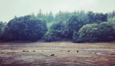
Notes: The Tottiford circle was discovered in 2009 when there was lower than usual levels of water in Tottiford reservoir; it featured as part of a Time Team dig in 2010. Normally it is submerged within the reservoir. During the drought of August 2022 the stones were exposed again for the first time for years. Photo by Zoe Lester taken on 04/09/22. Reproduced with kind permission - copyright remains with Zoe.
Nearest Bus Stop: Lustleigh Turn (2.4 km) [Route: 178]
Nearby sites: SX 81095 83161