
Prehistoric sites within 2km of SX 55694 68465
Guidance for walkers: The monuments featured in this database are archaeological treasures and need to be protected and preserved - please do not disturb any sites. Please check access and firing times before visiting sites, not all sites listed are on open access land. Firing ranges and boundaries of open access areas are marked on the OL28 OS Dartmoor Explorer map. Please stick to the country code and consider giving support to the numerous agencies that help to keep Dartmoor a fabulous natural and historic environment!
About the database listings: In all listings clicking on the photo or the site name will open a page for the site with a larger photo and further details from the database. The database now has over 6680 records covering nearly all publicly listed sites on Dartmoor including around 4800 round houses. This level of detail is of interest to archaeologists but tends to swamp listings of sites more likely to be of interest for walkers. For this reason, the listings default to around 550 core sites only. These are the stone circles, stone rows and the ring cairns listed by Turner. The default search radius is 2 km. The controls below the map can be used to start a new search by entering a 6- or 8-digit reference (without the prefix "SX"). The search radius can be specified and you can add incremental Display layers of detail on top of the core sites. If using a more detailed layer you will need to decrease the search radius to avoid getting hundreds of search results.
- Core sites Default listing of core sites consisting of stone circles & rows and some of the major ring cairns.
- Plus cairns adds approx. 1000 cairns and other minor sites not included in the core listings but excluding round houses.
- Plus round houses adds approx. 4800 round houses.
- Plus non-sites adds in the records for sites that no longer exist or are not prehistoric sites.
- Plus duplicates adds records excluded as duplicates. Those maybe duplicate records in external listings (e.g. the Historic Environment Records). For example, some sites have been identified as cairns in some listings and interpreted as round houses in other listings and both records appear.
These listings have incorporated, matched up and merged all of the records from all of the major archaeological listings including: Worth, Grinsell, Turner, Butler, Bill Radcliffe, Sandy Gerrard, Megalithic Portal, the National Monument Records and the Historic Environment Records. The author would like to thank Bill, Sandy, the lovely people both at Megalithic Portal (especially Anne Tate who did an amazing job to link listings) and at ACE Archaeology for collaborative work over the years to synchronise and correct listings across the various websites which now interlink. A culmination of years of work the final merger of cairn records took 3 months of cross referencing in 2017 the result being a snapshot of the records at that time. This data has in turn been refined since by field work and research. The round house data was supplied by Sandy Gerrard. Grid references are in order of accuracy: from Google Earth satellite, if visible and found, from a Garmin GPS reading, if visited by the author and from the literature otherwise. Individual site pages will state the source of the grid reference and provide satellite imagery. If a site listing lacks a photo it has not yet been visited by the author in which case the grid reference is from the literature.
Currently the database only includes sites which can be represented by a grid reference. Reaves are not included as they require GIS shape technology which is beyond the current capability of this system. To see the sources for the records, look at the tables on the resources menu. The database listings can also be viewed on a Google map and downloaded as GPS datasets for Garmin devices.
Corrections, or any feedback or suggestions are very welcome, email: info@dartmoorwalks.org.uk.
NOTE: Clicking on the icons for each monument in the map will give the name of the site. You can zoom in and out and drag the map around.
List of sites within 2km of SX 55694 68465
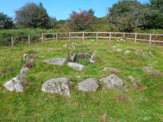
Leather Tor Platform Cairn Circle and Cist
OS Map: SX 56325 69524
HER: MDV3434
Megalithic Portal: 34457
PMD: Cross Gate
Alternate name: Leather Tor S. Platform Cairn Circle and Cist
ShortName: CT Leather Tor
Butler map: 45.17
DPD page: 23
Grinsell: WAL 25
Turner: E20
Barrow Report: 54
Notes: "A cist, consisting of two side stones and an end stone, contained within a barrow surrounded by a 16ft 6 ins diameter Kerb circle." Butler Leather Tor S. - Vol. 3. Map 45.17 (diagram p.52).
Nearby sites: SX 56325 69524
Distance: 1.23km
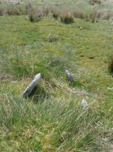
Yellowmead Stone Row
Prehistoric Dartmoor Walks: Dartmoor Site: Yellowmead 4-fold Cairn Circle
OS Map: SX 57482 67842
HER: MDV80769
Megalithic Portal: 2202
The Stone Rows of GB: Yellowmead Down
PMD: Yellowmead Stone Row
Alternate name: Yellowmead Down Stone Row
ShortName: SR Yellowmead
Butler map: 47.14
DPD page: 31
Barrow Report: 41 56
Notes: "A group of four concentric stone circles of which the innermost one is considered to be a cairn circle. Three stones were standing in 1921 when all the fallen stones were raised during restoration. There also appears to have been a stone row leading away from the stone circles." and "The double row as planned by Worth except that one stone is now missing. It is 6.9m long with mostly small line slabs, set on edge. They are about 0.3m long and 0.3m high, the intervals between stones and between the rows being 0.8m". Breton, see Megalithic circles on Yellowmead Down, Sheepstor (Heart of Dartmoor pp.89-91).
Nearby sites: SX 57482 67842
Distance: 1.89km
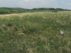
Yellowmead Down Encircled Cairn
Prehistoric Dartmoor Walks: Dartmoor Site: Yellowmead 4-fold Cairn Circle
OS Map: SX 57535 67861
HER: MDV4025
Megalithic Portal: 31040
Alternate name: Yellowmead Down 1 Encircled Cairn
ShortName: EC Yellowmd 1
Butler map: 47.14.1
DPD page: 31
Grinsell: SHE 5
Turner: F21
Barrow Report: 41
Notes: Cairn around 50 meters north-east of the Yellowmead stone circles, consisting of an earth and stone mound approximately 4 meters in diameter and up to 0.3 meters high. Four stones of a retaining kerb on its west and south sides. Turner F21.
Nearby sites: SX 57535 67861
Distance: 1.94km

Yellowmead Fourfold Cairn Circle
Prehistoric Dartmoor Walks: Dartmoor Site: Yellowmead 4-fold Cairn Circle
OS Map: SX 57488 67846
HER: MDV3338
Megalithic Portal: 1371
PMD: Yellowmead Stone Circles
Alternate name: Yellowmead fourfold circle Cairn Circle
ShortName: CC Fourfold
Butler map: 47.14
DPD page: 31
Grinsell: SHE 4
Turner: G30
Barrow Report: 41 56
Notes: "A group of four concentric stone circles of which the innermost one is considered to be a cairn circle. Three stones were standing in 1921 when all the fallen stones were raised during restoration. There also appears to have been a stone row leading away from the stone circles." See also, Legendary Dartmoor: Yellowmead Stone Circle. Breton, see Megalithic circles on Yellowmead Down, Sheepstor (Heart of Dartmoor pp.89-91).
Nearby sites: SX 57488 67846
Distance: 1.90km