
Assycombe Round House
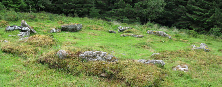
Photo taken on 25-07-2015
Database entries
OS Map: SX 66018 82593
OS Source: Sandy
HER: MDV6569
Alternate name: Assycombe
Short Name: HT Assycombe8
Exist: Yes
Record: Unique
Record Source: Sandy
Hut Class: Yes
Lidar: SX 66018 82593
Guide Map: 19
Nearest Bus Stop: Warren House Inn (2.9 km) [Route: 171]
Nearby sites: SX 66018 82593
Notes
HER: The largest hut circle in the Assycombe Brook settlement of 8.1 metres with walls 1.5 metres wide by 0.9 metres high and the only one not to have been planted over. It is on the south side and at the west end of Assycombe Stone Row. It was excavated in 1894 in an attempt to discover the relationship between it and the stone row. Unfortunately, however, it was found to have been dug into as a source of stone and nothing useful was found.. Breton p.68.References
These are selected references with an emphasis on out of copyright sources linked as PDFs. For more detailed references try any linked HER or PMD record above.
- Breton, Henry Hugh, The Heart of Dartmoor, (1926)
- Newman, Phil, The Archaeology of Fernworthy Forest, Dartmoor, Southwest Landscape Investigations (2013)
- Worth, R. Hansford, The Stone Rows of Dartmoor Part 1, T.D.A. Vol.78 pp.285-316 (1946)