
Scorhill Circle Standing Stone
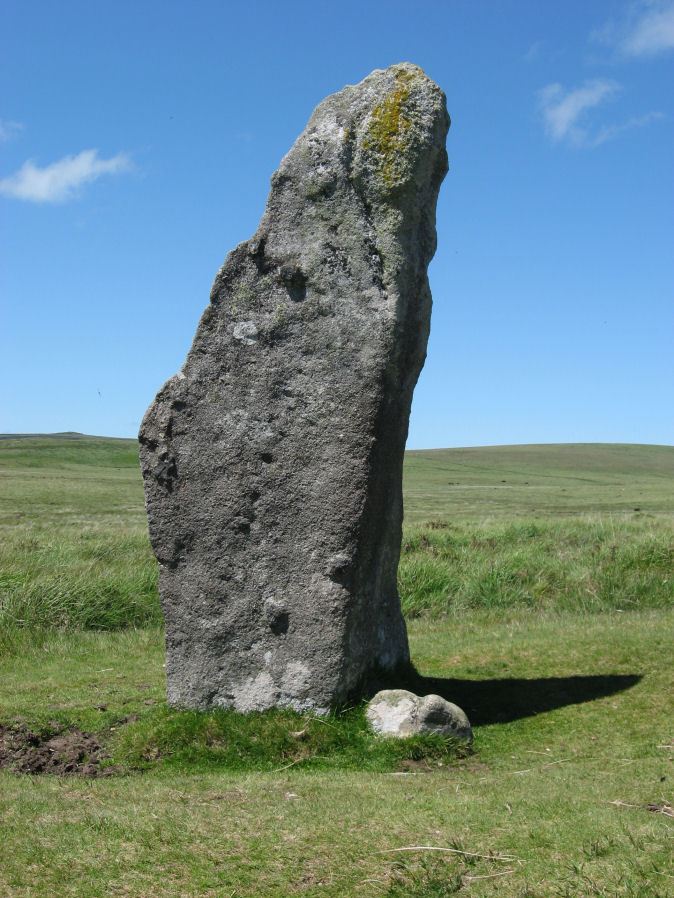
Photo taken on 26-06-2011
Database entries
PDW coverage: Dartmoor Site: Scorhill Stone Circle
OS Map: SX 6546 8738
OS Source: Constructed
HER: MDV6122
Megalithic Portal: 540
PMD: Scorhill Stone Circle
Alternate name: Scorhill Circle
Short Name: SS Scorhill
Butler map: 38.8
DPD page: 146
Exist: Yes
Record: Unique
Record Source: PDW
Hut Class: No
Dimensions (m): 2.25
Lidar: SX 6546 8738
Guide Map: 12
Nearest Bus Stop (Minor): Wonson Telephone Box (3.8 km) [Route: 670]
Nearest Bus Stop (Major): Chagford The Square (4.6 km) [Route: 173,178,671]
Nearby sites: SX 6546 8738
Notes
Largest stone in the Scorhill Circle. In strict terms this would not typically be classified as a "standing stone" as it is a member of the stone circle. It is the largest stone in a Dartmoor stone circle at 8 feet 2 inches tall.References
These are selected references with an emphasis on out of copyright sources linked as PDFs. For more detailed references try any linked HER or PMD record above.
- Brailsford, J. W, Bronze Age Stone Monuments of Dartmoor, Antiquity Volume 12, Number 48 pp.444-63 (1938)
- Burl, Aubrey, The Stone Circles of the British Isles, (1976)
- Burnard, Robert, The Disappearing Stone Monuments of Dartmoor, T.D.A. Vol.34 pp.166-167 (1902)
- Butler, Jeremy, Dartmoor Atlas of Antiquities, vol.2: The North, (1991)
- Crossing, William, Guide to Dartmoor, (2001)
- Fox, Aileen, Cairns and stone alignments on Shovel Down, Archaeological Journal Vol 114. pp.155-158 (1957)
- Lethbridge, William D., Discover Preshistoric Dartmoor, (2015)
- Parsons, Hamlyn, Investigations into the Burford Down Stone Row, D.A.S.P. No.85 pp.145-147 (1953)
- Wilkinson J. Gardner, The Rock-basins of Dartmoor, and some British Remains in England, Journal Brit. Arch. Assoc. xvi. pp.101-132. (1860)
- Wilkinson J. Gardner, British Remains on Dartmoor, Journal Brit. Arch. Assoc. xviii. pp.22-53, 111-133. (1862)
- Worth, R. Hansford, The Prehistoric Monuments of Scorhill, Buttern Hill, and Shuggledown (Shoveldown), T.D.A. Vol.64 pp.280-287 (1932)