
Wigford Down Cairn Circle
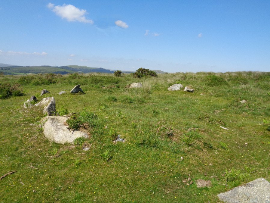
Photo taken on 18-06-2017
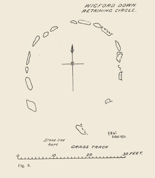
Plan by RHW. Barrow Report 51. TDA Vol.64 1932
Database entries
OS Map: SX 54172 65243
OS Source: Garmin
HER: MDV2300
Alternate name: Wigford Down 12
Short Name: CN Wigford12
Grinsell: MEAVY 2a
Exist: Yes
Record: Unique
Record Source: Grinsell
Hut Class: Maybe
Cairn Class: Yes
Dimensions (m): 8 x 0.6
Lidar: SX 54172 65243
Guide Map: 46
Nearest Bus Stop: Shaugh Prior Shaugh Bridge (2.5 km) [Route: 59]
Nearby sites: SX 54172 65243
Notes
Retaining circle on nw slope of wigford down a little way to north of a green track which leads from the salient point of the enclosure wall between Urgles and Higher Bellever to the high road near durance.183m away lies a pound with two hut circles associated. Southern circumference of circle has been robbed and stones of cairn removed. The stones of the circle are small, only one exceeding 1.22mReferences
These are selected references with an emphasis on out of copyright sources linked as PDFs. For more detailed references try any linked HER or PMD record above.
- Grinsell, L.V., Dartmoor Barrows, Devon Archaeological Society Proceedings No.36 (1978)
- Worth, R. Hansford, Barrow Report 51, T.D.A. Vol.64 pp.115-18 (1932)