
Skerraton Gate East Cairnfield Master
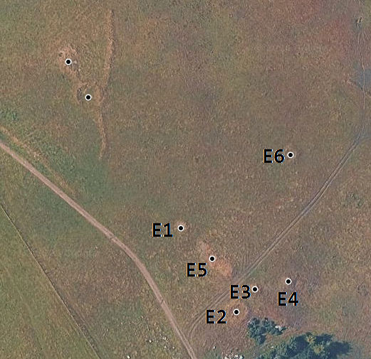
Skerraton Gate Cairns plan
Database entries
OS Map: SX 70238 64962
OS Source: PDW
Alternate name: Skerraton Gate East
Short Name: CN:Skerraton M
Butler map: 57.34
Butler Vol 5: p.17 & Fig.1
Exist: Yes
Record: Duplicate
Record Source: HER
Hut Class: No
Cairn Class: Yes
Lidar: SX 70238 64962
Guide Map: 52
Nearby sites: SX 70238 64962
Notes
This master record has been added to help understand the Skerraton Gate group of cairns. They are planned by Butler (1997) p.17 Fig 1. Cairns E1-E4 are listed in the appendix in the back of Vol. 4 but not all are mentioned in the text. E2 is matched based on the side given. E3 and E4 are roughly at the grid references given. E5 is mention in Vol 5 only and E6 is shown in the plan but not mentioned in the text.The following cairns are listed here:
Skerraton Gate E1 Cairn
Skerraton Gate E2 Cairn
Skerraton Gate E3 Cairn
Skerraton Gate E4 Cairn
Skerraton Gate E5 Cairn
Skerraton Gate E6 Cairn
The two cairns at the top of this image are:
Skerraton Down 3 Clearance Cairn
Skerraton Down 4 Clearance Cairn
References
These are selected references with an emphasis on out of copyright sources linked as PDFs. For more detailed references try any linked HER or PMD record above.
- Butler, Jeremy, Dartmoor Atlas of Antiquities, vol.4: The South-East, (1993)
- Butler, Jeremy, Dartmoor Atlas of Antiquities, vol.5: The Second Millennium B.C., (1997)