
Prehistoric sites within 2km of SX 48200 81300
Guidance for walkers: The monuments featured in this database are archaeological treasures and need to be protected and preserved - please do not disturb any sites. Please check access and firing times before visiting sites, not all sites listed are on open access land. Firing ranges and boundaries of open access areas are marked on the OL28 OS Dartmoor Explorer map. Please stick to the country code and consider giving support to the numerous agencies that help to keep Dartmoor a fabulous natural and historic environment!
About the database listings: In all listings clicking on the photo or the site name will open a page for the site with a larger photo and further details from the database. The database now has over 6680 records covering nearly all publicly listed sites on Dartmoor including around 4800 round houses. This level of detail is of interest to archaeologists but tends to swamp listings of sites more likely to be of interest for walkers. For this reason, the listings default to around 550 core sites only. These are the stone circles, stone rows and the ring cairns listed by Turner. The default search radius is 2 km. The controls below the map can be used to start a new search by entering a 6- or 8-digit reference (without the prefix "SX"). The search radius can be specified and you can add incremental Display layers of detail on top of the core sites. If using a more detailed layer you will need to decrease the search radius to avoid getting hundreds of search results.
- Core sites Default listing of core sites consisting of stone circles & rows and some of the major ring cairns.
- Plus cairns adds approx. 1000 cairns and other minor sites not included in the core listings but excluding round houses.
- Plus round houses adds approx. 4800 round houses.
- Plus non-sites adds in the records for sites that no longer exist or are not prehistoric sites.
- Plus duplicates adds records excluded as duplicates. Those maybe duplicate records in external listings (e.g. the Historic Environment Records). For example, some sites have been identified as cairns in some listings and interpreted as round houses in other listings and both records appear.
These listings have incorporated, matched up and merged all of the records from all of the major archaeological listings including: Worth, Grinsell, Turner, Butler, Bill Radcliffe, Sandy Gerrard, Megalithic Portal, the National Monument Records and the Historic Environment Records. The author would like to thank Bill, Sandy, the lovely people both at Megalithic Portal (especially Anne Tate who did an amazing job to link listings) and at ACE Archaeology for collaborative work over the years to synchronise and correct listings across the various websites which now interlink. A culmination of years of work the final merger of cairn records took 3 months of cross referencing in 2017 the result being a snapshot of the records at that time. This data has in turn been refined since by field work and research. The round house data was supplied by Sandy Gerrard. Grid references are in order of accuracy: from Google Earth satellite, if visible and found, from a Garmin GPS reading, if visited by the author and from the literature otherwise. Individual site pages will state the source of the grid reference and provide satellite imagery. If a site listing lacks a photo it has not yet been visited by the author in which case the grid reference is from the literature.
Currently the database only includes sites which can be represented by a grid reference. Reaves are not included as they require GIS shape technology which is beyond the current capability of this system. To see the sources for the records, look at the tables on the resources menu. The database listings can also be viewed on a Google map and downloaded as GPS datasets for Garmin devices.
Corrections, or any feedback or suggestions are very welcome, email: info@dartmoorwalks.org.uk.
NOTE: Clicking on the icons for each monument in the map will give the name of the site. You can zoom in and out and drag the map around.
List of sites within 2km of SX 48200 81300
Gibbet Hill 4 Cairn
OS Map: SX 496 808
HER: MDV124453
ShortName: CN:GibbetHill4
Notes: Well-preserved small, low cairn, visible within a firebreak of mown vegetation. Measures approximately 9 - 10 metres in diameter and a maximum height of 0.3 - 0.4 metres. It is slightly dished in the centre. Small stones are visible as part of its make-up.
Nearby sites: SX 496 808
Distance: 1.49km
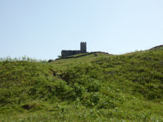
Brent Tor Fort
Prehistoric Dartmoor Walks: Dartmoor Resource: Table of Devon Iron Age Forts
OS Map: SX 471 804
HER: MDV1669
Megalithic Portal: 28169
ShortName: FT Brent Tor
Notes: HER: Iron Age hillfort at Brent Tor, with an incomplete rampart enclosing the north and eastern sides of the tor. The hill was subsequently used by the abbots of Tavistock as the site for Brentor parish church. Additional earthworks within the area enclosed by the rampart may represent the site of a medieval fair and post-medieval quarrying or mining.
Nearby sites: SX 471 804
Distance: 1.42km
Brent Tor A Ancient Pool
OS Map: SX 46543 80335
HER: MDV127195
ShortName: PO:Brent Tor A
Notes: Greeves: Brent Tor pool A measures around 40 by 30m. One of over 40 such 'sacred' pools identified on Dartmoor (or just outside the boundary of the National Park) that are thought to have potentially been designed during the prehistoric period
Nearby sites: SX 46543 80335
Distance: 1.92km
Brent Tor B Ancient Pool
OS Map: SX 46610 80291
HER: MDV127199
ShortName: PO:Brent Tor B
Notes: Greeves: Brent Tor pool B measures around 50 by 40m. One of over 40 such 'sacred' pools identified on Dartmoor (or just outside the boundary of the National Park) that are thought to have potentially been designed during the prehistoric period
Nearby sites: SX 46610 80291
Distance: 1.88km
Brent Tor C Ancient Pool
OS Map: SX 46648 80267
HER: MDV127200
ShortName: PO:Brent Tor C
Notes: Greeves: Brent Tor pool C measures around 40 by 35m. One of over 40 such 'sacred' pools identified on Dartmoor (or just outside the boundary of the National Park) that are thought to have potentially been designed during the prehistoric period
Nearby sites: SX 46648 80267
Distance: 1.86km
Brent Tor D Ancient Pool
OS Map: SX 46679 80226
HER: MDV127201
ShortName: PO:Brent Tor D
Notes: Greeves: Brent Tor pool D measures around 28 by 25m. One of over 40 such 'sacred' pools identified on Dartmoor (or just outside the boundary of the National Park) that are thought to have potentially been designed during the prehistoric period
Nearby sites: SX 46679 80226
Distance: 1.86km

Gibbet Hill 1 Stone Ring Cairn Circle
OS Map: SX 49975 80875
HER: MDV22751
Megalithic Portal: 45828
ShortName: RC GibbetHill1
Grinsell: MAR 1
Notes: "A stone ring, probably the remains of a ring cairn, 430 metres south-west of Gibbet Hill summit. This site is on the local list of Nationally Important Dartmoor sites. Dimensions noted by Greeves as approximately 22 metres in external diameter with the ring bank being a maximum of approximately 7.0 metres wide by approximately 0.5 metres in height."
Photo and annotated photo reproduced with kind permision by Steve Grigg. Copyright remains with Steve. See also coverage on Dartmoor Explorations: Gibbet Hill Mine.
Nearby sites: SX 49975 80875
Distance: 1.83km