
Prehistoric sites within 3km of SX 70000 60750
Guidance for walkers: The monuments featured in this database are archaeological treasures and need to be protected and preserved - please do not disturb any sites. Please check access and firing times before visiting sites, not all sites listed are on open access land. Firing ranges and boundaries of open access areas are marked on the OL28 OS Dartmoor Explorer map. Please stick to the country code and consider giving support to the numerous agencies that help to keep Dartmoor a fabulous natural and historic environment!
About the database listings: In all listings clicking on the photo or the site name will open a page for the site with a larger photo and further details from the database. The database now has over 6680 records covering nearly all publicly listed sites on Dartmoor including around 4800 round houses. This level of detail is of interest to archaeologists but tends to swamp listings of sites more likely to be of interest for walkers. For this reason, the listings default to around 550 core sites only. These are the stone circles, stone rows and the ring cairns listed by Turner. The default search radius is 2 km. The controls below the map can be used to start a new search by entering a 6- or 8-digit reference (without the prefix "SX"). The search radius can be specified and you can add incremental Display layers of detail on top of the core sites. If using a more detailed layer you will need to decrease the search radius to avoid getting hundreds of search results.
- Core sites Default listing of core sites consisting of stone circles & rows and some of the major ring cairns.
- Plus cairns adds approx. 1000 cairns and other minor sites not included in the core listings but excluding round houses.
- Plus round houses adds approx. 4800 round houses.
- Plus non-sites adds in the records for sites that no longer exist or are not prehistoric sites.
- Plus duplicates adds records excluded as duplicates. Those maybe duplicate records in external listings (e.g. the Historic Environment Records). For example, some sites have been identified as cairns in some listings and interpreted as round houses in other listings and both records appear.
These listings have incorporated, matched up and merged all of the records from all of the major archaeological listings including: Worth, Grinsell, Turner, Butler, Bill Radcliffe, Sandy Gerrard, Megalithic Portal, the National Monument Records and the Historic Environment Records. The author would like to thank Bill, Sandy, the lovely people both at Megalithic Portal (especially Anne Tate who did an amazing job to link listings) and at ACE Archaeology for collaborative work over the years to synchronise and correct listings across the various websites which now interlink. A culmination of years of work the final merger of cairn records took 3 months of cross referencing in 2017 the result being a snapshot of the records at that time. This data has in turn been refined since by field work and research. The round house data was supplied by Sandy Gerrard. Grid references are in order of accuracy: from Google Earth satellite, if visible and found, from a Garmin GPS reading, if visited by the author and from the literature otherwise. Individual site pages will state the source of the grid reference and provide satellite imagery. If a site listing lacks a photo it has not yet been visited by the author in which case the grid reference is from the literature.
Currently the database only includes sites which can be represented by a grid reference. Reaves are not included as they require GIS shape technology which is beyond the current capability of this system. To see the sources for the records, look at the tables on the resources menu. The database listings can also be viewed on a Google map and downloaded as GPS datasets for Garmin devices.
Corrections, or any feedback or suggestions are very welcome, email: info@dartmoorwalks.org.uk.
NOTE: Clicking on the icons for each monument in the map will give the name of the site. You can zoom in and out and drag the map around.
List of sites within 3km of SX 70000 60750
Bloody Pool (S. Brent) Ancient Pool
OS Map: SX 70302 62639
HER: MDV7955
ShortName: PO:BloodyPool
Notes: "Bloody Pool is one of over 40 such pool sites on Dartmoor which may date to the Prehistoric period and may have had a sacred function. This pool was noted in 1960 as having been filled in and its site now forms part of a roadside verge. In 1854, a hoard of Bronze Age metalwork was recovered from the pool, including four bronze ferrules, with three barbed bronze spearheads. All items were broken and are thought to have been votive deposits; the only pool on the moor where such items have been found."
Nearby sites: SX 70302 62639
Distance: 1.91km

Brent Hill Fort
Prehistoric Dartmoor Walks: Dartmoor Resource: Table of Devon Iron Age Forts
OS Map: SX 70394 61725
HER: MDV7957
Megalithic Portal: 7753
ShortName: FT Brent Hill
Notes: This monument includes a slight univallate hillfort with outworks, hut circle platforms and beacon situated at the summit of the prominent Brent Hill. The hillfort survives as an irregularly shaped enclosure surrounding the summit of a naturally steep and rocky hillside which is further enhanced by a partial rampart and ditch.
Nearby sites: SX 70394 61725
Distance: 1.05km
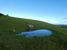
Brent Hill 1 Round House
OS Map: SX 70331 61656
HER: MDV13631
ShortName: HT BrentHill1
Notes: Visited with Steve Szypko on 3/12/25. A circular level platform dug into the side of the hill. At the time of our visit there had been recent heavy rainfall and water was pooled in the feature.
Nearby sites: SX 70331 61656
Distance: 0.96km
Brent Hill 2 Round House
OS Map: SX 70462 61655
HER: MDV13632
ShortName: HT:BrentHill2
Nearby sites: SX 70462 61655
Distance: 1.02km
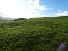
Brent Hill 3 Round House
OS Map: SX 70448 61764
HER: MDV13633
ShortName: HT BrentHill3
Notes: Visited with Steve Szypko on 3/12/25. A circular level platform dug into the side of the hill.
Nearby sites: SX 70448 61764
Distance: 1.11km
Corringdon Ball Round House
OS Map: SX 67182 61108
HER: MDV5786
ShortName: HT:Corringdo1
Nearby sites: SX 67182 61108
Distance: 2.84km
Corringdon Ball Round House
OS Map: SX 6749 6060
HER: MDV25697
ShortName: HT:Corringdo5
Nearby sites: SX 6749 6060
Distance: 2.51km
Corringdon Ball Round House
OS Map: SX 67049 60919
HER: MDV5818
ShortName: HT:Corringdo7
Nearby sites: SX 67049 60919
Distance: 2.96km
Corringdon Ball Round House
OS Map: SX 6714 6055
HER: MDV26432
ShortName: HT:Corringdo8
Nearby sites: SX 6714 6055
Distance: 2.87km
Corringdon Ball Round House
OS Map: SX 67064 61033
HER: MDV5817
ShortName: HT:Corringdo9
Nearby sites: SX 67064 61033
Distance: 2.95km
Corringdon Ball Round House
OS Map: SX 67191 60727
HER: MDV13258
ShortName: HT:Corringdo10
Nearby sites: SX 67191 60727
Distance: 2.81km
Corringdon Ball Round House
OS Map: SX 67046 60986
HER: MDV5817
ShortName: HT:Corringdo12
Nearby sites: SX 67046 60986
Distance: 2.96km
Corringdon Ball Round House
OS Map: SX 67108 60797
HER: MDV5813
ShortName: HT:Corringdo17
Nearby sites: SX 67108 60797
Distance: 2.89km
Corringdon Ball Round House
OS Map: SX 6755 6061
HER: MDV13275
ShortName: HT:Corringdo19
Nearby sites: SX 6755 6061
Distance: 2.45km

Corringdon Ball Round House
OS Map: SX 67172 60909
HER: MDV5815
ShortName: HT Corringdo21
Nearby sites: SX 67172 60909
Distance: 2.83km
Corringdon Ball Round House
OS Map: SX 6740 6053
HER: MDV25694
ShortName: HT:Corringdo22
Nearby sites: SX 6740 6053
Distance: 2.61km
Corringdon Ball Round House
OS Map: SX 67375 60667
HER: MDV13291
ShortName: HT:Corringdo27
Nearby sites: SX 67375 60667
Distance: 2.63km
Corringdon Ball Round House
OS Map: SX 67324 60988
HER: MDV5816
ShortName: HT:Corringdo34
Nearby sites: SX 67324 60988
Distance: 2.69km
Corringdon Ball Round House
OS Map: SX 67419 60666
HER: MDV13482
ShortName: HT:Corringdo35
Nearby sites: SX 67419 60666
Distance: 2.58km
Corringdon Ball Round House
OS Map: SX 67022 61006
HER: MDV5817
ShortName: HT:Corringdo36
Nearby sites: SX 67022 61006
Distance: 2.99km
Corringdon Ball Round House
OS Map: SX 672 606
HER: MDV13270
ShortName: HT:Corringdo37
Nearby sites: SX 672 606
Distance: 2.80km
Corringdon Ball Round House
OS Map: SX 67023 61015
HER: MDV5817
ShortName: HT:Corringdo38
Nearby sites: SX 67023 61015
Distance: 2.99km
Corringdon Ball Round House
OS Map: SX 67031 60774
HER: MDV26434
ShortName: HT:Corringdo39
Nearby sites: SX 67031 60774
Distance: 2.97km
Dockwell Ridge S Round House
OS Map: SX 6878 6347
HER: MDV25708
ShortName: HT:Dockwell 29
Nearby sites: SX 6878 6347
Distance: 2.98km
Dockwell Ridge S Round House
OS Map: SX 68819 63404
HER: MDV5812
ShortName: HT:Dockwell 30
Nearby sites: SX 68819 63404
Distance: 2.90km
Dockwell Ridge S Round House
OS Map: SX 68820 63407
HER: MDV5812
ShortName: HT:Dockwell 31
Nearby sites: SX 68820 63407
Distance: 2.91km
Dockwell Ridge S Round House
OS Map: SX 68823 63410
HER: MDV5812
ShortName: HT:Dockwell 32
Nearby sites: SX 68823 63410
Distance: 2.91km
Glazebrook Farm Cairn
OS Map: SX 6894 5893
HER: MDV13163
ShortName: CN:GlazebrkFm
Notes: A possible barrow. A low irregular heap of stones, mostly turf covered. Approximate diameter 20m, height 0.5-0.7m. If it is a barrow it has been mutilated on the west side. This may be associated with an anti-aircraft emplacement in the field in the 1939-45 war, for which the barrow may have been used for a quarry.
Nearby sites: SX 6894 5893
Distance: 2.11km
Harbourneford 1 Reported Cairn
OS Map: SX 7137 6235
HER: MDV13641
ShortName: CN:Harbourne1
Grinsell: BRE 11
Notes: The site of a round barrow which has been under the plough for some years. A large number of worked flints have been found on the site.
Nearby sites: SX 7137 6235
Distance: 2.11km
Harbourneford 2 Cairn
OS Map: SX 7142 6224
HER: MDV13640
ShortName: CN:Harbourne2
Grinsell: BRE 12
Notes: Round barrow in arable field
Nearby sites: SX 7142 6224
Distance: 2.06km
Harbourneford 3 Reported Cairn
OS Map: SX 7145 6247
HER: MDV13641
ShortName: CN:Harbourne3
Grinsell: BRE 13
Notes: A round barrow situated in the south west corner of a grass field; the hedge turns to take account of it.
Nearby sites: SX 7145 6247
Distance: 2.25km
Lutton Cairn
OS Map: SX 6934 6149
HER: MDV13290
ShortName: CN:Lutton
Notes: A possible barrow lies in a field known as wash park nw of lutton at sx69356150. It is best seen from lutton green from where in the right light it is sometimes quite conspicuous. It is turf covered about 0.5m and 10-12m diam, roughly in the centre of the field. Viewed from above it is much less convincing and its edge merges into the slope. The fact that it is on a very steep slope would seem to cast doubt upon it.
Nearby sites: SX 6934 6149
Distance: 0.99km
Treeland Brake Stone Row
OS Map: SX 6741 6158
HER: MDV5827
Megalithic Portal: 6333473
The Stone Rows of GB: Treeland Brake
PMD: Treeland Brake Stone Row
ShortName: SRxTreeland Bk
Butler map: 56.11
Notes: Notes from the NMR record: "Treeland Brake Stone Row. The only record of the row is a photograph taken by Mr HG Hurrell in the late 1950s. Mr Hurrell remembers about five erect stones and about five fallen, aligned north-east to south-west. The row has been destroyed by agricultural activity by 1977. (Photograph is in the possession of S & M Register)." Also: "A colour print taken by Mr Hurrell from approximately SX 67206130 shows the stones aligned to a field corner at SX 67296147. Approximate centre of row, SX 67276141; the area is now under pasture."
Nearby sites: SX 6741 6158
Distance: 2.72km
Treeland Downs Round House
OS Map: SX 67272 61232
HER: MDV5787
ShortName: HT:Treeland 1
Nearby sites: SX 67272 61232
Distance: 2.77km
Treeland Downs Round House
OS Map: SX 67417 61416
HER: MDV5788
ShortName: HT:Treeland 2
Nearby sites: SX 67417 61416
Distance: 2.67km
Treeland Plantation Round House
OS Map: SX 6764 6137
HER: MDV13271
ShortName: HT:Treeland 3
Nearby sites: SX 6764 6137
Distance: 2.44km
Tynacombe Stone Ring Cairn Circle
OS Map: SX 7037 6328
HER: MDV13638
Megalithic Portal: 45832
ShortName: RC:Tynacombe
Turner: A20
Notes: "Ring cairn. Thynacombe stone ring 7.5 meters in diameter internally, with bank 1.5 meters wide and 0.2 meters high, damaged on the east side."
Nearby sites: SX 7037 6328
Distance: 2.56km
Tynacombe 2 Clearance Cairn
OS Map: SX 703 633
HER: MDV13636
Megalithic Portal: 45832
ShortName: CN:Tynacombe2
Notes: HER: Remains of barrow. Thinacombes. Possible field clearance cairn. Vis=-/5/1968? (robinson, r. ). A long narrow heap of stones, partly turfed over in the nw corner of field os no 1863, tithe apportionment no.206(1843) 'cold east field'. It measures 16m x 4m lying roughly e-w with the w end about 26m from the west field boundary. It has well defined edge to the s giving a height of about 0.5m but on the n or uphill side it merges into the slope. This may well represent field clearance. There is another possible ring cairn in the same field. The area is slate and the stones comprising the heap, where visible are small pieces of slate. This has been inspected by mr. T. Greeves who considered the site a very doubtful barrow or the result of field clearance. Vis=not visible on raf 1948 aph (rchm aph 1985).
Nearby sites: SX 703 633
Distance: 2.57km
Tynacombe 3 Cairn
OS Map: SX 704 634
HER: MDV13637
ShortName: CN:Tynacombe3
Notes: HER: A low grass-covered mound in the north-west corner of a field, which measures around 0.5 metres in height and 10 metres in diameter, with no stones visible. The edge is most clearly defined on the downhill side tending to merge into the natural hillside on the upper side.
Nearby sites: SX 704 634
Distance: 2.68km
Yalland Warren Round House
OS Map: SX 68919 63337
ShortName: HT:Yalland W1
Nearby sites: SX 68919 63337
Distance: 2.80km
Yalland Warren Round House
OS Map: SX 68902 63232
HER: MDV5758
ShortName: HT:Yalland W2
Nearby sites: SX 68902 63232
Distance: 2.71km
Yalland Warren Round House
OS Map: SX 68880 63329
ShortName: HT:Yalland W3
Nearby sites: SX 68880 63329
Distance: 2.81km
Yalland Warren Round House
OS Map: SX 68879 63320
ShortName: HT:Yalland W4
Nearby sites: SX 68879 63320
Distance: 2.80km
Yalland Warren Round House
OS Map: SX 68852 63338
ShortName: HT:Yalland W5
Nearby sites: SX 68852 63338
Distance: 2.83km
Yalland Warren Round House
OS Map: SX 68916 63240
HER: MDV5758
ShortName: HT:Yalland W6
Nearby sites: SX 68916 63240
Distance: 2.72km
Yellowberries Copse Fort
Prehistoric Dartmoor Walks: Dartmoor Resource: Table of Devon Iron Age Forts
OS Map: SX 69217 58614
HER: MDV2925
ShortName: FT:Yellowberri
Nearby sites: SX 69217 58614
Distance: 2.27km