
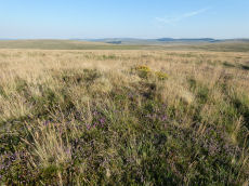
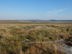
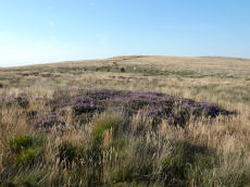
Prehistoric sites within 2km of SX 61400 89970
Guidance for walkers: The monuments featured in this database are archaeological treasures and need to be protected and preserved - please do not disturb any sites. Please check access and firing times before visiting sites, not all sites listed are on open access land. Firing ranges and boundaries of open access areas are marked on the OL28 OS Dartmoor Explorer map. Please stick to the country code and consider giving support to the numerous agencies that help to keep Dartmoor a fabulous natural and historic environment!
About the database listings: In all listings clicking on the photo or the site name will open a page for the site with a larger photo and further details from the database. The database now has over 6680 records covering nearly all publicly listed sites on Dartmoor including around 4800 round houses. This level of detail is of interest to archaeologists but tends to swamp listings of sites more likely to be of interest for walkers. For this reason, the listings default to around 550 core sites only. These are the stone circles, stone rows and the ring cairns listed by Turner. The default search radius is 2 km. The controls below the map can be used to start a new search by entering a 6- or 8-digit reference (without the prefix "SX"). The search radius can be specified and you can add incremental Display layers of detail on top of the core sites. If using a more detailed layer you will need to decrease the search radius to avoid getting hundreds of search results.
- Core sites Default listing of core sites consisting of stone circles & rows and some of the major ring cairns.
- Plus cairns adds approx. 1000 cairns and other minor sites not included in the core listings but excluding round houses.
- Plus round houses adds approx. 4800 round houses.
- Plus non-sites adds in the records for sites that no longer exist or are not prehistoric sites.
- Plus duplicates adds records excluded as duplicates. Those maybe duplicate records in external listings (e.g. the Historic Environment Records). For example, some sites have been identified as cairns in some listings and interpreted as round houses in other listings and both records appear.
These listings have incorporated, matched up and merged all of the records from all of the major archaeological listings including: Worth, Grinsell, Turner, Butler, Bill Radcliffe, Sandy Gerrard, Megalithic Portal, the National Monument Records and the Historic Environment Records. The author would like to thank Bill, Sandy, the lovely people both at Megalithic Portal (especially Anne Tate who did an amazing job to link listings) and at ACE Archaeology for collaborative work over the years to synchronise and correct listings across the various websites which now interlink. A culmination of years of work the final merger of cairn records took 3 months of cross referencing in 2017 the result being a snapshot of the records at that time. This data has in turn been refined since by field work and research. The round house data was supplied by Sandy Gerrard. Grid references are in order of accuracy: from Google Earth satellite, if visible and found, from a Garmin GPS reading, if visited by the author and from the literature otherwise. Individual site pages will state the source of the grid reference and provide satellite imagery. If a site listing lacks a photo it has not yet been visited by the author in which case the grid reference is from the literature.
Currently the database only includes sites which can be represented by a grid reference. Reaves are not included as they require GIS shape technology which is beyond the current capability of this system. To see the sources for the records, look at the tables on the resources menu. The database listings can also be viewed on a Google map and downloaded as GPS datasets for Garmin devices.
Corrections, or any feedback or suggestions are very welcome, email: info@dartmoorwalks.org.uk.
NOTE: Clicking on the icons for each monument in the map will give the name of the site. You can zoom in and out and drag the map around.
List of sites within 2km of SX 61400 89970
White Hill Round House
OS Map: SX 62628 90844
HER: MDV6887
ShortName: HT:White Hil40
Nearby sites: SX 62628 90844
Distance: 1.51km
White Hill Round House
OS Map: SX 62647 90807
HER: MDV6887
ShortName: HT:White Hil41
Nearby sites: SX 62647 90807
Distance: 1.50km
White Hill Round House
OS Map: SX 62642 90846
HER: MDV6887
ShortName: HT:White Hil42
Nearby sites: SX 62642 90846
Distance: 1.52km
White Hill Round House
OS Map: SX 63025 90379
HER: MDV6893
ShortName: HT:White Hil43
Nearby sites: SX 63025 90379
Distance: 1.68km
White Hill Round House
OS Map: SX 62818 90584
HER: MDV6887
ShortName: HT:White Hil44
Nearby sites: SX 62818 90584
Distance: 1.55km
White Hill Round House
OS Map: SX 62634 90799
HER: MDV6887
ShortName: HT:White Hil45
Nearby sites: SX 62634 90799
Distance: 1.49km
White Hill Round House
OS Map: SX 6260 9074
HER: MDV6887
ShortName: HT:White Hil46
Nearby sites: SX 6260 9074
Distance: 1.43km
White Hill Round House
OS Map: SX 63017 90382
HER: MDV6893
ShortName: HT:White Hil47
Nearby sites: SX 63017 90382
Distance: 1.67km
Cosdon Hill SW Round House
OS Map: SX 62835 91285
HER: MDV56874
ShortName: HT:Cosdon Hi5
Nearby sites: SX 62835 91285
Distance: 1.95km
White Hill Round House
OS Map: SX 62615 90823
HER: MDV6887
ShortName: HT:White Hil48
Nearby sites: SX 62615 90823
Distance: 1.48km
Cosdon Hill SW Round House
OS Map: SX 62845 91245
HER: MDV56874
ShortName: HT:Cosdon Hi6
Nearby sites: SX 62845 91245
Distance: 1.93km
Cosdon Hill SW Round House
OS Map: SX 62845 91225
HER: MDV56874
ShortName: HT:Cosdon Hi7
Nearby sites: SX 62845 91225
Distance: 1.91km
Steeperton Tor, NE of Reported Cairn
OS Map: SX 6204 8907
HER: MDV19986
ShortName: CN?Steeperto1
Grinsell: LYD 5
Notes: Cairn with retaining circle. Hillslope siting. Diameter 5.5m. May be that recorded by crossing in 'guide to dartmoor' (1907) p 207 (grinsell)
Nearby sites: SX 6204 8907
Distance: 1.10km
Cosdon Hill SW Round House
OS Map: SX 62855 91275
HER: MDV56874
ShortName: HT:Cosdon Hi8
Nearby sites: SX 62855 91275
Distance: 1.95km
Cosdon Hill SW Round House
OS Map: SX 62855 91195
HER: MDV56874
ShortName: HT:Cosdon Hi9
Nearby sites: SX 62855 91195
Distance: 1.90km
Cosdon Hill SW Round House
OS Map: SX 62865 91225
HER: MDV56874
ShortName: HT:Cosdon Hi10
Nearby sites: SX 62865 91225
Distance: 1.93km
Oke Tor Round House
OS Map: SX 6144 8984
HER: MDV60303
ShortName: HT:Oke Tor1
Nearby sites: SX 6144 8984
Distance: 0.14km
Cosdon Hill SW Round House
OS Map: SX 62865 91205
HER: MDV56874
ShortName: HT:Cosdon Hi11
Nearby sites: SX 62865 91205
Distance: 1.92km
Oke Tor Round House
OS Map: SX 6145 8981
HER: MDV60304
ShortName: HT:Oke Tor2
Nearby sites: SX 6145 8981
Distance: 0.17km
Cosdon Hill SW Round House
OS Map: SX 62875 91225
HER: MDV56874
ShortName: HT:Cosdon Hi12
Nearby sites: SX 62875 91225
Distance: 1.94km
Oke Tor Round House
OS Map: SX 6140 8997
HER: MDV60299
ShortName: HT:Oke Tor3
Nearby sites: SX 6140 8997
Distance: 0.00km
Little Hound Tor 2 Cairn
OS Map: SX 63259 89886
HER: MDV52480
ShortName: CN Little Ho2
Notes: A round cairn was recorded at this location situated on a SW facing slope of Little Hound Tor overlooking the valley of the Small Brook. This record is a duplicate of ST 6 but this record is retained as the master record and South Tawton (ST) 6 has been marked as the duplicate.
Nearby sites: SX 63259 89886
Distance: 1.86km
Cosdon Hill SW Round House
OS Map: SX 62855 91255
HER: MDV56874
ShortName: HT:Cosdon Hi13
Nearby sites: SX 62855 91255
Distance: 1.94km
Oke Tor Round House
OS Map: SX 6138 8996
HER: MDV60299
ShortName: HT:Oke Tor4
Nearby sites: SX 6138 8996
Distance: 0.02km
Little Hound Tor Cairn
OS Map: SX 63286 89938
HER: MDV28608
ShortName: CN Little Ho1
Butler map: 40.11
Grinsell: ST 6a
Notes: "Round cairn on summit of Little Hound Tor. Diameter 10m, 0.9m high. Trench cut through the centre suggests partial early excavation. A large earthfast granite slab forms the w side of the mound. A modern pile of stones, 2m diameter, 0.7m high sits atop the cairn"
Nearby sites: SX 63286 89938
Distance: 1.89km
Taw Marsh S.1 Clearance Cairn
OS Map: SX 6210 9047
HER: MDV13059
ShortName: CN?Taw Marsh2
Butler map: 40.
Grinsell: LYD 2
Notes: A turf covered cairn on level stoney ground which lies between the north western foot of Metheral Hill and Taw Marsh. ...It is probably of medieval or later in origin and constructed to mark the boundary of Dartmoor Forest and South Tawton parishes which in this area runs in a straight line from two boundary stones.
Nearby sites: SX 6210 9047
Distance: 0.86km
Taw Marsh S.2 Reported Cairn
OS Map: SX 6217 9043
HER: MDV13061
ShortName: CN:Taw Marsh4
Butler map: 40.
Grinsell: LYD 2a
Notes: HER 13061 & HER 13062 are duplicates
Nearby sites: SX 6217 9043
Distance: 0.90km
Taw Marsh S.4 Clearance Cairn
OS Map: SX 6218 9038
HER: MDV51214
ShortName: CN:TawMarshS4
Notes: "an irregular, much disturbed cairn situated on gently sloping stony ground at nw foot of metheral hill and measuring 4.1m ne to sw by 2.5m with maximum height of 0.6m.3 large learning slabs lie on sw side with visible smaller boulders forming the matrix. Probably designed to mark parish boundaries of dartmoor forest and south tawton, running from ngr sx62539001 on metheral hill to ngr sx61769094 on the river taw."
Nearby sites: SX 6218 9038
Distance: 0.88km
Taw Marsh S.9 Clearance Cairn
OS Map: SX 6210 9047
ShortName: CN:TawMarshS9
Notes: UPDATE 31/12/2022. This was formerly listed on the HER as MDV52832 and duplicated with MDV52833 - both HER records have been removed. This record is being retained here until there is clarity as to whether or not it represents an actual cairn. All details originate from the now deleted HER record. NB. Taw Marsh S.8 was deleted as a duplicate, but rather than renumber this entry it will be left as "9" as renaming can cause confusion.
Nearby sites: SX 6210 9047
Distance: 0.86km
Taw Marsh S.3 Cairn
OS Map: SX 6216 9043
HER: MDV60315
ShortName: CN:TawMarshS3
Nearby sites: SX 6216 9043
Distance: 0.89km
Little Hound Tor (site of) Reported Cairn
OS Map: SX 6315 8996
HER: MDV4373
ShortName: CN?Little Ho3
Grinsell: ST 6
Notes: Not located. Cairn on summit of hill of Little Hound Tor (Prowse 1890s). Grinsell and later observers were unable to locate this cairn. There are two cairns on the summit of Little hound tor. 6A includes material piled on a rocky outcrop. This record is described as being "W of little hound tor". This suggests it is the other summit cairn SiteID=4112 HER=MDV52480. This record is being marked as a duplicate of SiteID=4112 HER=MDV52480.
Nearby sites: SX 6315 8996
Distance: 1.75km
Taw Marsh S.5 Cairn
OS Map: SX 6219 9039
ShortName: CN:TawMarshS5
Notes: This record originated with the now deleted HER record MDV60317. It may well be a duplicate record but it is being left here until that is confirmed or not.
Nearby sites: SX 6219 9039
Distance: 0.89km
Taw Marsh S.6 Cairn
OS Map: SX 6226 9035
HER: MDV60318
ShortName: CN:TawMarshS6
Nearby sites: SX 6226 9035
Distance: 0.94km
Taw Marsh S.7 Cairn
OS Map: SX 6230 9037
HER: MDV60319
ShortName: CN:TawMarshS7
Nearby sites: SX 6230 9037
Distance: 0.98km
Steeperton Gorge Round House
OS Map: SX 6162 8938
HER: MDV27710
ShortName: HT:Steeperto1
Nearby sites: SX 6162 8938
Distance: 0.63km
Steeperton Gorge Round House
OS Map: SX 6169 8950
HER: MDV60308
ShortName: HT:Steeperto2
Nearby sites: SX 6169 8950
Distance: 0.55km
Steeperton Gorge Round House
OS Map: SX 6160 8924
HER: MDV27709
ShortName: HT:Steeperto3
Nearby sites: SX 6160 8924
Distance: 0.76km
Steeperton Gorge Round House
OS Map: SX 6159 8928
HER: MDV60311
ShortName: HT:Steeperto4
Nearby sites: SX 6159 8928
Distance: 0.72km
Oke Tor Reported Cist
OS Map: SX 61202 90099
HER: MDV6936
PMD: Oke Tor
ShortName: CT?Oke Tor1
Grinsell: LYD 2b
Notes: A stone row on the western slopes of oke tor. The stone row runs a little north of west and south of east directly downhill towards the river(east okement). It is single, and runs between two large stone slabs which probably once formed part of cists, and at the further end two large stones lying prone within 2m of each other. One of the two slabs is set amidst other stones which may have formed a circle. Between the slabs is a fallen stone.(worth). Grinsell gives ngr 610-902- for apparently the same site. The cist is contained in the remains of a cairn.
Nearby sites: SX 61202 90099
Distance: 0.24km
Steeperton Tor NE Round House
OS Map: SX 6225 8892
HER: MDV60293
ShortName: HT:Steeperto5
Nearby sites: SX 6225 8892
Distance: 1.35km
Steeperton Tor NE Round House
OS Map: SX 6216 8904
HER: MDV4388
ShortName: HT:Steeperto6
Nearby sites: SX 6216 8904
Distance: 1.20km
Steeperton Tor NE Round House
OS Map: SX 6215 8906
HER: MDV4388
ShortName: HT:Steeperto7
Nearby sites: SX 6215 8906
Distance: 1.18km
Steeperton Tor NE Round House
OS Map: SX 6217 8905
HER: MDV4388
ShortName: HT:Steeperto8
Nearby sites: SX 6217 8905
Distance: 1.20km
Steeperton Tor NE Round House
OS Map: SX 6223 8896
HER: MDV34257
ShortName: HT:Steeperto9
Nearby sites: SX 6223 8896
Distance: 1.31km
Steeperton Tor NE Round House
OS Map: SX 6218 8895
HER: MDV60294
ShortName: HT:Steeperto10
Nearby sites: SX 6218 8895
Distance: 1.28km
Steeperton Tor NE Round House
OS Map: SX 6215 8903
HER: MDV4388
ShortName: HT:Steeperto11
Nearby sites: SX 6215 8903
Distance: 1.20km
Steeperton Tor NE Round House
OS Map: SX 6209 8907
HER: MDV4388
ShortName: HT:Steeperto12
Nearby sites: SX 6209 8907
Distance: 1.13km
Steeperton Tor NE Round House
OS Map: SX 6222 8895
HER: MDV60290
ShortName: HT:Steeperto13
Nearby sites: SX 6222 8895
Distance: 1.31km
Steeperton Tor NE Round House
OS Map: SX 6205 8911
HER: MDV4388
ShortName: HT:Steeperto14
Nearby sites: SX 6205 8911
Distance: 1.08km
Steeperton Tor NE Round House
OS Map: SX 6213 8903
HER: MDV4388
ShortName: HT:Steeperto15
Nearby sites: SX 6213 8903
Distance: 1.19km
Steeperton Tor NE Round House
OS Map: SX 6207 8908
HER: MDV4388
ShortName: HT:Steeperto16
Nearby sites: SX 6207 8908
Distance: 1.11km
Oke Tor (E of) Cairn
OS Map: SX 6150 8968
HER: MDV60306
ShortName: CN:Oke Tor 1
Notes: Lying midway between the two settlements is a 4.9m diameter flat topped cairn standing up to 0.7m high
Nearby sites: SX 6150 8968
Distance: 0.31km
Steeperton Tor NE Round House
OS Map: SX 6222 8897
HER: MDV60295
ShortName: HT:Steeperto17
Nearby sites: SX 6222 8897
Distance: 1.29km
Metheral Hill 1 Cairn
OS Map: SX 62526 90085
HER: MDV60321
ShortName: CN:MetheralHi1
Notes: The eastern of two round cairns on the north slope of Metheral Hill. This heather and grass-covered cairn measures 8.0 meters in diameter, height 0.9 meters and has not been robbed. There are a couple of stones protruding. This cairn lies 185.5 degrees from the eastern of the nearby boundary stones and 193.5 degrees from the western one. The second cairn is 280 degrees and 40.5 meters from this one.
Nearby sites: SX 62526 90085
Distance: 1.13km
Steeperton Tor NE Round House
OS Map: SX 6210 8914
HER: MDV4388
ShortName: HT:Steeperto18
Nearby sites: SX 6210 8914
Distance: 1.09km
Metheral Hill 2 Cairn
OS Map: SX 62485 90094
HER: MDV60322
ShortName: CN:MetheralHi2
Notes: "The western of two round cairns on the northern slope of Metheral Hill. This heather and grass covered mound measures 5.0 meters in diameter, height 0.65 meters. An edge set stone on the southern edge of the mound may indicate a kerb. This cairn is located 171 degrees from east boundary stone and 173 degrees from the western boundary stone."
Nearby sites: SX 62485 90094
Distance: 1.09km
Steeperton Tor NE Round House
OS Map: SX 6222 8891
HER: MDV60292
ShortName: HT:Steeperto19
Nearby sites: SX 6222 8891
Distance: 1.34km
Steeperton Tor NE Round House
OS Map: SX 6211 8906
HER: MDV4388
ShortName: HT:Steeperto20
Nearby sites: SX 6211 8906
Distance: 1.15km
Higher Tor Round House
OS Map: SX 6133 9172
HER: MDV66657
ShortName: HT:Higher To1
Nearby sites: SX 6133 9172
Distance: 1.75km
Steeperton Tor NE Round House
OS Map: SX 6211 8903
HER: MDV4388
ShortName: HT:Steeperto21
Nearby sites: SX 6211 8903
Distance: 1.18km
Higher Tor Round House
OS Map: SX 6134 9174
HER: MDV66657
ShortName: HT:Higher To2
Nearby sites: SX 6134 9174
Distance: 1.77km
Steeperton Tor NE Round House
OS Map: SX 6213 8907
HER: MDV4388
ShortName: HT:Steeperto22
Nearby sites: SX 6213 8907
Distance: 1.16km
Higher Tor Round House
OS Map: SX 6135 9171
HER: MDV66657
ShortName: HT:Higher To3
Nearby sites: SX 6135 9171
Distance: 1.74km
Steeperton Tor NE Round House
OS Map: SX 6213 8903
HER: MDV4388
ShortName: HT:Steeperto23
Nearby sites: SX 6213 8903
Distance: 1.19km
Black-a-ven Brook Round House
OS Map: SX 597 908
HER: MDV69491
ShortName: HT:Black-a-v1
Nearby sites: SX 597 908
Distance: 1.89km
Higher Tor Round House
OS Map: SX 6134 9170
HER: MDV66657
ShortName: HT:Higher To4
Nearby sites: SX 6134 9170
Distance: 1.73km
Steeperton Tor NE Round House
OS Map: SX 6210 8908
HER: MDV4388
ShortName: HT:Steeperto24
Nearby sites: SX 6210 8908
Distance: 1.13km
Higher Tor E Round House
OS Map: SX 6154 9168
HER: MDV58443
ShortName: HT:Higher To5
Nearby sites: SX 6154 9168
Distance: 1.72km
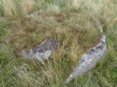
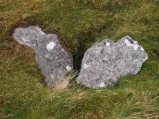
Small Brook 6 Reported Cist
OS Map: SX 63035 90407
HER: MDV6893
PMD: Small Brook
ShortName: CT-Small Bro5
Butler Vol 5: p.28 & Fig.9
Notes: Butler says possible cairn and cist. HER says small hut c. The author visited on 27/08/17. This is in the vicinity of many hut circles. The site itself looks like a cist when looked at from the right direction. Looked at from another direction (see photo above) it looks like a natural arrangement of rocks.
Nearby sites: SX 63035 90407
Distance: 1.69km
Higher Tor E Round House
OS Map: SX 6147 9168
HER: MDV58440
ShortName: HT:Higher To6
Nearby sites: SX 6147 9168
Distance: 1.71km
Higher Tor E Round House
OS Map: SX 6149 9171
HER: MDV58444
ShortName: HT:Higher To7
Nearby sites: SX 6149 9171
Distance: 1.74km
Higher Tor E Round House
OS Map: SX 6149 9169
HER: MDV58439
ShortName: HT:Higher To8
Nearby sites: SX 6149 9169
Distance: 1.72km
Higher Tor E Round House
OS Map: SX 6148 9165
HER: MDV58442
ShortName: HT:Higher To9
Nearby sites: SX 6148 9165
Distance: 1.68km
Higher Tor E Round House
OS Map: SX 6146 9166
HER: MDV58441
ShortName: HT:Higher To10
Nearby sites: SX 6146 9166
Distance: 1.69km
Higher Tor SE Round House
OS Map: SX 61482 91404
HER: MDV26792
ShortName: HT:Higher To11
Nearby sites: SX 61482 91404
Distance: 1.44km
Higher Tor SE Round House
OS Map: SX 61451 91391
HER: MDV27381
ShortName: HT:Higher To12
Nearby sites: SX 61451 91391
Distance: 1.42km
Higher Tor SE Round House
OS Map: SX 61409 91435
HER: MDV58447
ShortName: HT:Higher To13
Nearby sites: SX 61409 91435
Distance: 1.47km
Metheral Hill 3 Reported Cairn
OS Map: SX 62520 90122
HER: MDV79345
ShortName: CN?MetheralHi3
Nearby sites: SX 62520 90122
Distance: 1.13km
Taw Marsh N Round House
OS Map: SX 62325 91325
HER: MDV27948
ShortName: HT:Taw Marsh1
Nearby sites: SX 62325 91325
Distance: 1.64km
Taw Marsh N Round House
OS Map: SX 62245 91315
HER: MDV27948
ShortName: HT:Taw Marsh2
Nearby sites: SX 62245 91315
Distance: 1.59km
Taw Marsh N Round House
OS Map: SX 62355 91275
HER: MDV27948
ShortName: HT:Taw Marsh3
Nearby sites: SX 62355 91275
Distance: 1.62km
Taw Marsh N Round House
OS Map: SX 62345 91165
HER: MDV56877
ShortName: HT:Taw Marsh4
Nearby sites: SX 62345 91165
Distance: 1.52km
Taw Marsh N Round House
OS Map: SX 62245 91255
HER: MDV27948
ShortName: HT:Taw Marsh5
Nearby sites: SX 62245 91255
Distance: 1.54km
Taw Marsh N Round House
OS Map: SX 62345 91265
HER: MDV27948
ShortName: HT:Taw Marsh6
Nearby sites: SX 62345 91265
Distance: 1.60km
Taw Marsh N Round House
OS Map: SX 62385 91115
HER: MDV56877
ShortName: HT:Taw Marsh7
Nearby sites: SX 62385 91115
Distance: 1.51km
Taw Marsh N Round House
OS Map: SX 62325 91285
HER: MDV27948
ShortName: HT:Taw Marsh8
Nearby sites: SX 62325 91285
Distance: 1.61km
Taw Marsh N Round House
OS Map: SX 62325 91315
HER: MDV27948
ShortName: HT:Taw Marsh9
Nearby sites: SX 62325 91315
Distance: 1.63km
Taw Marsh N Round House
OS Map: SX 6224 9139
HER: MDV27947
ShortName: HT:Taw Marsh10
Nearby sites: SX 6224 9139
Distance: 1.65km
Taw Marsh N Round House
OS Map: SX 62216 91268
HER: MDV27948
ShortName: HT:Taw Marsh11
Nearby sites: SX 62216 91268
Distance: 1.53km
Taw Marsh N Round House
OS Map: SX 62365 91315
HER: MDV27948
ShortName: HT:Taw Marsh12
Nearby sites: SX 62365 91315
Distance: 1.66km
Taw Marsh N Round House
OS Map: SX 62235 91325
HER: MDV27948
ShortName: HT:Taw Marsh13
Nearby sites: SX 62235 91325
Distance: 1.59km
Taw Marsh N Round House
OS Map: SX 62385 91155
HER: MDV56877
ShortName: HT:Taw Marsh14
Nearby sites: SX 62385 91155
Distance: 1.54km
Taw Marsh N Round House
OS Map: SX 62335 91245
HER: MDV27948
ShortName: HT:Taw Marsh15
Nearby sites: SX 62335 91245
Distance: 1.58km
Taw Marsh N Round House
OS Map: SX 62385 91105
HER: MDV56877
ShortName: HT:Taw Marsh16
Nearby sites: SX 62385 91105
Distance: 1.50km
Taw Marsh N Round House
OS Map: SX 62355 91245
HER: MDV27948
ShortName: HT:Taw Marsh17
Nearby sites: SX 62355 91245
Distance: 1.59km
Taw Marsh N Round House
OS Map: SX 62265 91335
HER: MDV27948
ShortName: HT:Taw Marsh18
Nearby sites: SX 62265 91335
Distance: 1.62km
Taw Marsh N Round House
OS Map: SX 62238 91263
HER: MDV27948
ShortName: HT:Taw Marsh19
Nearby sites: SX 62238 91263
Distance: 1.54km
Taw Marsh N Round House
OS Map: SX 62248 91218
HER: MDV27948
ShortName: HT:Taw Marsh20
Nearby sites: SX 62248 91218
Distance: 1.51km
Taw Marsh N Round House
OS Map: SX 62265 91255
HER: MDV27948
ShortName: HT:Taw Marsh21
Nearby sites: SX 62265 91255
Distance: 1.55km
Winter Tor Round House
OS Map: SX 6090 9136
HER: MDV27405
ShortName: HT:Winter To1
Nearby sites: SX 6090 9136
Distance: 1.48km
Taw Marsh N Round House
OS Map: SX 62265 91285
HER: MDV27948
ShortName: HT:Taw Marsh22
Nearby sites: SX 62265 91285
Distance: 1.57km
Taw Marsh N Round House
OS Map: SX 62365 91145
HER: MDV56877
ShortName: HT:Taw Marsh23
Nearby sites: SX 62365 91145
Distance: 1.52km
Taw Marsh N Round House
OS Map: SX 62315 91255
HER: MDV27948
ShortName: HT:Taw Marsh24
Nearby sites: SX 62315 91255
Distance: 1.58km
Winter tor (alleged cist) Reported Cist
OS Map: SX 609 915
HER: MDV6901
ShortName: CT?Winter to1
Notes: A cist on Winter Tor, but this could not be located during field investigation.
Nearby sites: SX 609 915
Distance: 1.61km
Taw Marsh N Round House
OS Map: SX 62285 91235
HER: MDV27948
ShortName: HT:Taw Marsh25
Nearby sites: SX 62285 91235
Distance: 1.54km
Taw Marsh N Round House
OS Map: SX 62285 91275
HER: MDV27948
ShortName: HT:Taw Marsh26
Nearby sites: SX 62285 91275
Distance: 1.58km
Taw Marsh N Round House
OS Map: SX 62230 91277
HER: MDV27948
ShortName: HT:Taw Marsh27
Nearby sites: SX 62230 91277
Distance: 1.55km
Taw Marsh N Round House
OS Map: SX 62305 91325
HER: MDV27948
ShortName: HT:Taw Marsh28
Nearby sites: SX 62305 91325
Distance: 1.63km
Taw Marsh N Round House
OS Map: SX 62282 91224
HER: MDV27948
ShortName: HT:Taw Marsh29
Nearby sites: SX 62282 91224
Distance: 1.53km
Small Brook, west bank (site of) Reported Cist
OS Map: SX 6225 9039
HER: MDV33597
PMD: Taw Marsh
ShortName: CT?Small Bro14
Notes: cist on the west bank of the Small Brook. This was not located during field investigation (Crossing).
Nearby sites: SX 6225 9039
Distance: 0.95km
Taw Marsh N Round House
OS Map: SX 62305 91255
HER: MDV27948
ShortName: HT:Taw Marsh30
Nearby sites: SX 62305 91255
Distance: 1.57km
Taw Marsh N Round House
OS Map: SX 62224 91266
HER: MDV27948
ShortName: HT:Taw Marsh31
Nearby sites: SX 62224 91266
Distance: 1.54km
Taw Marsh N Round House
OS Map: SX 62275 91245
HER: MDV27948
ShortName: HT:Taw Marsh32
Nearby sites: SX 62275 91245
Distance: 1.55km
Taw Marsh N Round House
OS Map: SX 62214 91230
HER: MDV27948
ShortName: HT:Taw Marsh33
Nearby sites: SX 62214 91230
Distance: 1.50km
Taw Marsh N Round House
OS Map: SX 62275 91285
HER: MDV27948
ShortName: HT:Taw Marsh34
Nearby sites: SX 62275 91285
Distance: 1.58km
Taw Marsh S.1 (duplicate) Reported Cairn
OS Map: SX 6212 9048
HER: MDV13060
ShortName: CN:Taw Marsh3
Notes: Duplicate of HER 13059
Nearby sites: SX 6212 9048
Distance: 0.88km
Taw Marsh N Round House
OS Map: SX 62255 91255
HER: MDV27948
ShortName: HT:Taw Marsh35
Nearby sites: SX 62255 91255
Distance: 1.54km
Taw Marsh N Round House
OS Map: SX 62255 91295
HER: MDV27948
ShortName: HT:Taw Marsh36
Nearby sites: SX 62255 91295
Distance: 1.58km
Taw Marsh N Round House
OS Map: SX 62265 91245
HER: MDV27948
ShortName: HT:Taw Marsh37
Nearby sites: SX 62265 91245
Distance: 1.54km
Taw Marsh N Round House
OS Map: SX 62315 91285
HER: MDV27948
ShortName: HT:Taw Marsh38
Nearby sites: SX 62315 91285
Distance: 1.60km
Taw Marsh N Round House
OS Map: SX 62315 91275
HER: MDV27948
ShortName: HT:Taw Marsh39
Nearby sites: SX 62315 91275
Distance: 1.59km
Taw Marsh N Round House
OS Map: SX 62255 91325
HER: MDV27948
ShortName: HT:Taw Marsh40
Nearby sites: SX 62255 91325
Distance: 1.60km
Taw Marsh NE Round House
OS Map: SX 624 909
HER: MDV64886
ShortName: HT:Taw Marsh41
Nearby sites: SX 624 909
Distance: 1.37km
Taw Marsh S Round House
OS Map: SX 6212 9033
HER: MDV60313
ShortName: HT:Taw Marsh42
Nearby sites: SX 6212 9033
Distance: 0.80km
Taw Marsh S Round House
OS Map: SX 6214 9048
HER: MDV60312
ShortName: HT:Taw Marsh43
Nearby sites: SX 6214 9048
Distance: 0.90km
White Hill Round House
OS Map: SX 63044 90422
HER: MDV6893
ShortName: HT:White Hil1
Nearby sites: SX 63044 90422
Distance: 1.71km
Taw Marsh S Round House
OS Map: SX 6213 9031
HER: MDV60314
ShortName: HT:Taw Marsh44
Nearby sites: SX 6213 9031
Distance: 0.81km
White Hill Round House
OS Map: SX 63060 90365
HER: MDV6893
ShortName: HT:White Hil2
Nearby sites: SX 63060 90365
Distance: 1.71km
Taw Marsh S Round House
OS Map: SX 6213 9030
HER: MDV51216
ShortName: HT:Taw Marsh45
Nearby sites: SX 6213 9030
Distance: 0.80km
White Hill Round House
OS Map: SX 63038 90351
HER: MDV6893
ShortName: HT:White Hil3
Nearby sites: SX 63038 90351
Distance: 1.68km
White Hill Round House
OS Map: SX 6305 9040
HER: MDV6893
ShortName: HT:White Hil4
Nearby sites: SX 6305 9040
Distance: 1.71km
White Hill Round House
OS Map: SX 63046 90372
HER: MDV6893
ShortName: HT:White Hil5
Nearby sites: SX 63046 90372
Distance: 1.69km
White Hill Round House
OS Map: SX 63042 90390
HER: MDV6893
ShortName: HT:White Hil6
Nearby sites: SX 63042 90390
Distance: 1.69km
White Hill Round House
OS Map: SX 63039 90384
HER: MDV6893
ShortName: HT:White Hil7
Nearby sites: SX 63039 90384
Distance: 1.69km
White Hill Round House
OS Map: SX 62797 90398
HER: MDV6887
ShortName: HT:White Hil8
Nearby sites: SX 62797 90398
Distance: 1.46km
White Hill Round House
OS Map: SX 62997 90368
HER: MDV6887
ShortName: HT:White Hil9
Nearby sites: SX 62997 90368
Distance: 1.65km
White Hill Round House
OS Map: SX 62984 90386
HER: MDV6887
ShortName: HT:White Hil10
Nearby sites: SX 62984 90386
Distance: 1.64km
Higher Tor S.2 Cairn
OS Map: SX 612 915
HER: MDV17241
ShortName: CN:Higher To2
Notes: "On the south side of higher tor, belstone common, are the apparent remains of a small 'tor cairn' built around an outcrop which, although substantial, is not shown on os 6" 1965. Cairn material mainly on the northern side of the tor. Approximately 15-20m in diameter."
Nearby sites: SX 612 915
Distance: 1.54km
White Hill Round House
OS Map: SX 62830 90596
HER: MDV6887
ShortName: HT:White Hil11
Nearby sites: SX 62830 90596
Distance: 1.56km
White Hill Round House
OS Map: SX 62804 90555
HER: MDV6887
ShortName: HT:White Hil12
Nearby sites: SX 62804 90555
Distance: 1.52km
White Hill Round House
OS Map: SX 62993 90424
HER: MDV6887
ShortName: HT:White Hil13
Nearby sites: SX 62993 90424
Distance: 1.66km
White Hill Round House
OS Map: SX 62687 90831
HER: MDV6887
ShortName: HT:White Hil14
Nearby sites: SX 62687 90831
Distance: 1.55km
White Hill Round House
OS Map: SX 62991 90363
HER: MDV6887
ShortName: HT:White Hil15
Nearby sites: SX 62991 90363
Distance: 1.64km
White Hill Round House
OS Map: SX 62674 90548
HER: MDV6887
ShortName: HT:White Hil16
Nearby sites: SX 62674 90548
Distance: 1.40km
White Hill Round House
OS Map: SX 62990 90448
HER: MDV6887
ShortName: HT:White Hil17
Nearby sites: SX 62990 90448
Distance: 1.66km
White Hill Round House
OS Map: SX 62826 90550
HER: MDV6887
ShortName: HT:White Hil18
Nearby sites: SX 62826 90550
Distance: 1.54km
White Hill Round House
OS Map: SX 62844 90608
HER: MDV6887
ShortName: HT:White Hil19
Nearby sites: SX 62844 90608
Distance: 1.58km
White Hill Round House
OS Map: SX 62687 90638
HER: MDV6887
ShortName: HT:White Hil20
Nearby sites: SX 62687 90638
Distance: 1.45km
White Hill Round House
OS Map: SX 62794 90624
HER: MDV6887
ShortName: HT:White Hil21
Nearby sites: SX 62794 90624
Distance: 1.54km
White Hill Round House
OS Map: SX 62786 90374
HER: MDV6887
ShortName: HT:White Hil22
Nearby sites: SX 62786 90374
Distance: 1.44km
White Hill Round House
OS Map: SX 62689 90586
HER: MDV6887
ShortName: HT:White Hil23
Nearby sites: SX 62689 90586
Distance: 1.43km
White Hill Round House
OS Map: SX 62950 90372
HER: MDV6887
ShortName: HT:White Hil24
Nearby sites: SX 62950 90372
Distance: 1.60km
White Hill Round House
OS Map: SX 63073 90355
HER: MDV6893
ShortName: HT:White Hil25
Nearby sites: SX 63073 90355
Distance: 1.72km
White Hill Round House
OS Map: SX 6271 9080
HER: MDV6887
ShortName: HT:White Hil26
Nearby sites: SX 6271 9080
Distance: 1.55km
White Hill Round House
OS Map: SX 62803 90610
HER: MDV6887
ShortName: HT:White Hil27
Nearby sites: SX 62803 90610
Distance: 1.54km
White Hill Round House
OS Map: SX 62641 90592
HER: MDV6887
ShortName: HT:White Hil28
Nearby sites: SX 62641 90592
Distance: 1.39km
White Hill Round House
OS Map: SX 62677 90826
HER: MDV6887
ShortName: HT:White Hil29
Nearby sites: SX 62677 90826
Distance: 1.54km
White Hill Round House
OS Map: SX 62677 90840
HER: MDV6887
ShortName: HT:White Hil30
Nearby sites: SX 62677 90840
Distance: 1.55km
White Hill Round House
OS Map: SX 63034 90367
HER: MDV6893
ShortName: HT:White Hil31
Nearby sites: SX 63034 90367
Distance: 1.68km
White Hill Round House
OS Map: SX 62674 90813
HER: MDV6887
ShortName: HT:White Hil32
Nearby sites: SX 62674 90813
Distance: 1.53km
White Hill Round House
OS Map: SX 62664 90805
HER: MDV6887
ShortName: HT:White Hil33
Nearby sites: SX 62664 90805
Distance: 1.51km
White Hill Round House
OS Map: SX 63033 90378
HER: MDV6893
ShortName: HT:White Hil34
Nearby sites: SX 63033 90378
Distance: 1.68km
White Hill Round House
OS Map: SX 62799 90370
HER: MDV6887
ShortName: HT:White Hil35
Nearby sites: SX 62799 90370
Distance: 1.46km
White Hill Round House
OS Map: SX 63026 90427
HER: MDV6893
ShortName: HT:White Hil36
Nearby sites: SX 63026 90427
Distance: 1.69km
White Hill Round House
OS Map: SX 63063 90371
HER: MDV6893
ShortName: HT:White Hil37
Nearby sites: SX 63063 90371
Distance: 1.71km
White Hill Round House
OS Map: SX 62655 90598
HER: MDV6887
ShortName: HT:White Hil38
Nearby sites: SX 62655 90598
Distance: 1.40km
White Hill Round House
OS Map: SX 63007 90420
HER: MDV6893
ShortName: HT:White Hil39
Nearby sites: SX 63007 90420
Distance: 1.67km
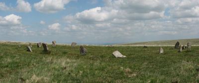
Little Hound Tor (or White Moor) Stone Circle
Prehistoric Dartmoor Walks: Dartmoor Site: Little Hound Tor Stone Circle
OS Map: SX 63285 89611
HER: MDV4374
Megalithic Portal: 528
PMD: White Moor Stone Circle
ShortName: SC White Moor
DPD page: 154
Turner: G11
Notes: The circle is in good condition today but only 13 stones remained standing when the Dartmoor Exploration Committee re-erected 5 of the stones in 1896. The site is a fairly accurate circle of circumference 20.2m. A cairn lies close to the circle, a heather covered mound about 8.5m across. The White Moor stone lies 160m to the SE of the circle and it is thought to be contemporary with the circle but probably out of position having been re-erected at some point. It is now a boundary marker. See also, Legendary Dartmoor: Dartmoor's Bronze Age Landscape of Whitmoor.
Nearby sites: SX 63285 89611
Distance: 1.92km
White Hill Enclosed Settlement
OS Map: SX 62656 90597
HER: MDV6887
Megalithic Portal: 36009
ShortName: ST:WhiteHill
Nearby sites: SX 62656 90597
Distance: 1.40km
White Moor Cairn
OS Map: SX 63299 89545
HER: MDV4372
Megalithic Portal: 10327
Alternate name: White Moor Stone (NW of) Cairn
ShortName: CN White Moor
Butler map: 40.5
Grinsell: ST 7
Notes: "Cairn, nw of white moor stone … turf and heather covered, in good condition … small cairn 64m nw of whitmoor stone, … (grinsell) cairn, slightly hollowed towards centre. Diameter 7.0m, height 0.6m"
Nearby sites: SX 63299 89545
Distance: 1.95km
Winter Tor Cist
OS Map: SX 61112 91352
HER: MDV6881
Megalithic Portal: 45779
PMD: Winter Tor
Alternate name: Higher Tor S.1 Cist
ShortName: CT WinterTor
Butler map: 40.15
Butler Vol 5: p.169 & Fig.108
Grinsell: LYD 1
Notes: [Formerly listed as Higher Tor (S), renamed after PMD] Butler Higher Tor (S) Vol. 2. Map 40.15. (diagram Vol. 5. p.169).
Nearby sites: SX 61112 91352
Distance: 1.41km