
Guide to the Monuments on Throwleigh Common and Buttern Hill
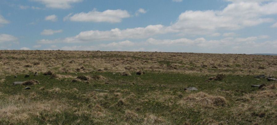
Table of Ritual and Burial Monuments on Throwleigh Common and Buttern Hill
The following table lists the records currently in this Guide Map. For an explantion of the Guide Maps and a table of all 62 Guide Maps, follow this link: Guide List Table. Introductory text will be added to each guide list in 2025. Notes on duplication and omissions will appear below the table once checks have been finalised.
Notes on possible duplications and omissions
Blackaton Brook Cairns: Both HER records MDV58679 (Scheduled Monument 1018905) and MDV58680 (Scheduled Monument 1018906) are master records relating to the Blackaton Brook records. The two scheduled monument entries were both created 04/02/1999. All of the individual cairn records link to Scheduled Monument 1018906, which suggests 1018905 and MDV58679 were superseded. I suggest these two HER records be merged and MDV58679 deleted.Kennon Hill Reported Cist and Shilstone Lane Reported Cairn. These two features are worthy for inclusion on this website but arguably not on the HER.
Kennon Hill S.1 Reported Cist. This entry maybe duplicated on the Scorhill Guide, see Rival Tor Reported Cairn. This record is marked as unique and the other as a duplicate. NB. There is no duplication on the HER.
Kennon Hill Reported Stone Row All good but Emma has confirmed typo in grid reference, should be SX 64246 88657 not (SX 64246 86657). HER record needs correcting.
PS. These notes are to assist untangling complicated records and are neither permanent nor a criticism of the HER who do a fantastic job! The author finds it easier to systematically work through these records (2000+ of them) and add these notes, which are then to be communicated with the HER, if appropriate, it is a pragmatic way of dealing with lots of data without continually stopping and starting.
Throwleigh Common and Buttern Hill Guide Map
Guidance for walkers: The monuments featured in this database are archaeological treasures and need to be protected and preserved - please do not disturb any sites. Please check access and firing times before visiting sites, not all sites listed are on open access land. Firing ranges and boundaries of open access areas are marked on the OL28 OS Dartmoor Explorer map. Please stick to the country code and consider giving support to the numerous agencies that help to keep Dartmoor a fabulous natural and historic environment!
List of Ritual and Burial Monuments on Throwleigh Common and Buttern Hill
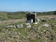
Gidleigh - South Chambered Tomb
OS Map: SX 65670 88550
HER record: MDV6213
Megalithic Portal: 10040
PMD: Gidleigh South Chambered Cairn
Alternate name: Buttern Hill 1 Chambered Tomb
ShortName: NT Gidleigh S
Butler map: 38.7.1
Butler Vol 5: p.157
DPD page: 147
Notes: "The remains of a Neolithic chambered cairn on Buttern Hill. The cairn survives as a mound standing up to 0.6 metres high. The chamber and associated entrance passage include seven orthostats, two of which form a portaled entrance. A leat runs to the west of the cairn."
Nearby sites: SX65678855
Gidleigh - North Chambered Tomb
OS Map: SX 65867 88956
HER record: MDV6212
Megalithic Portal: 45581
PMD: Gidleigh North Chambered Cairn
Alternate name: Buttern Hill 2 Chambered Tomb
ShortName: NT Gidleigh N
Butler map: 38.7.2
Butler Vol 5: p.157
Grinsell: A:GID 1
Notes: "A chambered cairn located on an east facing slope of Buttern Hill. The cairn mound measures 26 metres long and 9 metres wide and stands up to 1 metre high. Several set stones at the western end of the mound represent the remains of a passage leading towards a chamber."
Nearby sites: SX65878896

Gidleigh - South 2 Chambered Cairn
OS Map: SX 65534 88378
HER record: MDV20318
Alternate name: Buttern Hill 3 Chambered Cairn
ShortName: NT Gidleigh S2
Notes: HER quoting Turner: Possible chambered cairn recorded at SX 6554 8837 on Gidleigh Common. A simple chamber cairn with evidence of a chamber (two fallen large stones at south, south-west end). Although many large boulders still remain in position, cairn has obviously been heavily robbed for later enclosure lying to the north.
Measurements: length 15.5m, width 3.5 to 5.5m, height 0.8m. This features differs from the other Gidleigh chamber tombs (North and South) as there is no evidence for a passage. It appears to be on the same axis and similar to the Corringdon ball example. Orientation south, south-west by north, north-east.
Nearby sites: SX65538838
Throwleigh Chambered Cairn
OS Map: SX 65153 89768
HER record: MDV13022
ShortName: NT:Throwleigh
Notes: HER: Megalithic granite stone of 1.3 metres high by 1 metre wide and 0.3 metres thick may possibly be the remains of a burial chamber. Two 'Standing Stones' are shown on modern mapping.. The NGR used on the this record is 20m to the north of the HER entry based on Google satellite imagery.
Nearby sites: SX65158977
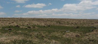
Buttern Hill 4 Cairn Circle
OS Map: SX 65400 89490
HER record: MDV13021
ShortName: CC:Buttern 4
Notes: HER: A small cairn circle situated at SX 65408949 in open moorland immediately below the crest of a broad topped spur at about 1300 ft OD. It has a diameter of 6.0m and consists of 13 turf-fast stones; three are recumbent, one stands to a height of 0.4m, and the remainder barely protrude through the turf.
Nearby sites: SX65408949
Buttern Hill 5 Cairn
OS Map: SX 65230 88490
HER record: MDV28684
ShortName: CN:Buttern 5
Notes: HER: Poorly preserved remains of a small possible ring cairn, 4.0 metres in diameter, with a turfed over rim up to 0.4 metres high. Located during field investigation in 1978 and surveyed by the Ordnance Survey
Nearby sites: SX65238849
Buttern Hill 6 Clearance Cairn
OS Map: SX 65650 89170
HER record: MDV103612
ShortName: CN:Buttern 6
Nearby sites: SX65658917
Buttern Hill 7 Reported Cist
OS Map: SX 65700 88960
HER record: MDV6191
PMD: Ensworthy
ShortName: CT?Buttern 7
Notes: The remains of two alleged cists are reported at this location. Recent field investigation could not locate them and therefore it is thought likely that they are probably natural features.
Nearby sites: SX65708896
Buttern Hill Enclosed Settlement
OS Map: SX 65501 89146
HER record: MDV6140
Megalithic Portal: 25242
ShortName: ES:ButternHill
Nearby sites: SX65508915
Buttern Hill Stone Circle
OS Map: SX 64949 88481
HER record: MDV4371
Megalithic Portal: 724
PMD: Buttern Hill Stone Circle
ShortName: SC Buttern 1
DPD page: 147
Turner: G7
Notes: NNE of Scorhill about 2Km. "The remains of a Bronze Age stone circle situated on level ground overlooking the valley of the North Teign River and Whitemoor Marsh. The stone circle measures 24.8 metres in diameter and is denoted by five upright granite slabs standing up to 0.76 metres high. A further 12 recumbent stones lie where they have fallen." Also known as the Throwleigh circle. According to R.N. Worth, although not confirmed since, there was "a small cairn between five and six yards in from the southern edge" and also there is a companion circle a short distance on the slope westward, 60 feet in diameter consisting of four stones with a possible large central pillar, see. The Stone Rows of Dartmoor - Part 3. Breton p.58. - Throwleigh Circle.
Nearby sites: SX64958848
Buttern Hill 2 Reported Stone Circle
OS Map: SX 64882 88469
HER record: MDV4392
Megalithic Portal: 725
PMD: Buttern Hill W
ShortName: SC:Buttern 2
Notes: R.N. Worth Throwleigh (i.e.Buttern) circle is also noteworthy for having a companion, a short distance on the slope to the westward. The existence of this circle has not been put on record until now, and indeed it might well escape observation, seeing that there are only four certain stones still standing, with possibly a fifth, and that the remainder have disappeared. This circle was clearly not less than 60 feet in diameter. There is a very large block of irregular outline within its limits, which at one time may have stood fully six feet high. Menhirs occur in circles in Cornwall.
Nearby sites: SX64888847
Buttern Hill 3 Reported Stone Circle
OS Map: SX 64769 88580
HER record: MDV4392
ShortName: SC:Buttern 3
Notes: HER: Possible circle circa 180 metres north-west of the Buttern Hill circle comprising four or five stones around a fallen standing stone. Recorded by Worth (1894) and apparently seen by the Ordnance Survey in 1950, although the recorder in 1951 could not locate it, this feature has not been confirmed since 1950.
Nearby sites: SX64778858
Kennon Hill 1 Reported Stone Circle
OS Map: SX 64354 89001
HER: No record found
ShortName: SC:KennonHill1
Notes: Possible stone circle reported by Robert Naylor. R.N. Worth Throwleigh (i.e.Buttern) circle is also noteworthy for having a companion, a short distance on the slope to the westward. The existence of this circle has not been put on record until now, and indeed it might well escape observation, seeing that there are only four certain stones still standing, with possibly a fifth, and that the remainder have disappeared. This circle was clearly not less than 60 feet in diameter. There is a very large block of irregular outline within its limits, which at one time may have stood fully six feet high. Menhirs occur in circles in Cornwall.
Nearby sites: SX64358900
Kennon Hill 2 Reported Stone Circle
OS Map: SX 64201 88735
HER record: MDV130499
ShortName: SC:KennonHill2
Notes: Hemery, E., 1983, High Dartmoor, 796-797 When referring to Sandy Road, Hemery records that in crossing the south foot of Kennon between Rewelake Pit and Sandy Ford, it passes below the ruins of a possible stone circle. Spencer (Maps) has marked this as 'Kennon Circle six stones standing' and, running north-eastward from it, 'stone row one hundred yards'. The circle is described as 'completely unphotogenic', appears to have had a diameter of approximately sixty feet and now has only one standing stone. Not able to confirm the stone row.
Nearby sites: SX64208874
Kennon Hill Reported Stone Row
OS Map: SX 64246 88657
HER record: MDV130499
ShortName: SR:KennonHill
Notes: Hemery, E., 1983, High Dartmoor, 796-797 When referring to Sandy Road, Hemery records that in crossing the south foot of Kennon between Rewelake Pit and Sandy Ford, it passes below the ruins of a possible stone circle. Spencer (Maps) has marked this as 'Kennon Circle six stones standing' and, running north-eastward from it, 'stone row one hundred yards'. The circle is decribed as 'completely unphotogenic', appears to have had a diameter of approximately sixty feet and now has only one standing stone. Not able to confirm the stone row. Cunis, E, 2020, Possible stone circle and row, Kennon (14/12/2020) Features recorded during site visit with archaeologist from Dartmoor National Park Authority. Photographs of the features included. Possible stone circle and row recorded. In a very ruinous condition with vegetation covering the majority of the stone row. Circle SX 64201 88735, Row SX 64246 88657.. NB. Grid reference for row confirmed by Emma and corrected.
Nearby sites: SX64258866
Kennon Hill Cairn Circle
OS Map: SX 64213 88723
HER record: MDV130499
ShortName: CC Kennon Hill
Notes: This cairn circle has a diameter of 10 metres or approx 30 feet. It has a slab in its centre which matches the 1894 report by R.N. Worth except for the size and distance/location of the Buttern Hill stone circle. The central area of the circle is raised and the circle has a ring or bank. The raised centre suggests it is not a round house.
Nearby sites: SX64218872
Kennon Hill S.W.1 Cairn
OS Map: SX 63916 88974
HER record: MDV19463
ShortName: CN Kennon SW1
Butler map: 41.1
Notes: Butler describes a heather-covered cairn with a pair of slabs visible in the body of the mound. This cairn is not covered in heather but then this photo is taken 20 year on. There are signs of the slabs in the mound so it is probably the same cairn. The HER refers to another cairn 50m due w of this one - the author could not locate that but then the area is very overgrown.
Nearby sites: SX63928897

Kennon Hill S.W.2 Reported Cairn
OS Map: SX 63861 88979
HER record: MDV58865
ShortName: CN Kennon SW2
Notes: The HER refers to another cairn 50m due w of the Kennon Hill S.W. Cairn - the author could not locate that on 27/08/17 but then the area is very overgrown.
Nearby sites: SX63868898
Kennon Hill S.W.3 Reported Cairn
OS Map: SX 63800 89100
HER record: MDV19462
ShortName: CN Kennon SW3
Notes: HER: Unlikely cairn - a mound of 5.0 metres diameter by 0.4 metres high to south-west of Kennon Hill
Nearby sites: SX63808910
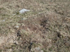
Kennon Hill Reported Cist
OS Map: SX 64375 88926
HER: No record found
ShortName: CT KennonHill
Notes: This looks like a cist but is in fact remains from tar and feather work as identified by Robert Naylor. This photo taken in August 2014 by the author and labelled as "looks like a cist" and marked as a Garmin waypoint "cist?". Located on the southern slope of Kennon Hill in an area of very deep tussocky grass. The author was unable to get back to check it out and posted about this on 4 February 2020 on a Dartmoor Facebook group. The author is grateful to Robert Naylor for having checked it out and clarifying that it is not a cist. Listing here as not a cist will help those in future who stumble across this. For more on this thanks to Max Piper and Dartefacts, see: feather-and-tare-cist-on-kennon-hill
Nearby sites: SX64388893
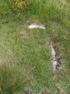
Kennon Hill S.1 Reported Cist
OS Map: SX 64534 88357
HER record: MDV61776
PMD: Kennon Hill S.
ShortName: CT:Kennon S1
Notes: Cairn and cist. Possible cist consists of a single large slab, 0.75m x 0.25m, x 0.6m high, oriented slightly e of n. Probably duplicated by this record: Rival Tor Reported Cairn
Nearby sites: SX64538836
Kennon Hill S.2 Reported Cairn
OS Map: SX 64530 88350
HER record: MDV64130
ShortName: CN:Kennon S2
Notes: 2 cairns and 1 cairn and cist at Kennock Hill South (HER 64130, HER 61776, HER 64129)
Nearby sites: SX64538835
Kennon Hill S.3 Reported Cairn
OS Map: SX 64680 88260
HER record: MDV64129
ShortName: CN:Kennon S3
Notes: 2 cairns and 1 cairn and cist at Kennock Hill South (HER 64130, HER 61776, HER 64129)
Nearby sites: SX64688826
Ruelake Pit Cairnfield Master
OS Map: SX 64060 88750
HER record: MDV58866
ShortName: CN:RuelakePit
Notes: HER: Cairnfield of apparent Prehistoric date consisting of at least a dozen stony heaps, many c.2m diam x 0.5m-1m high. Several seem to have been dug into. The location is on the southern flank of Kennon Hill, east of the upper portion of the tin openwork known as Ruelake Pit.
Nearby sites: SX64068875
Raybarrow Pool Reported Cist
OS Map: SX 64200 90500
HER record: MDV58681
PMD: Raybarrow Pool
ShortName: CNxRaybarrow1
Notes: Recorded as a possible cist and retaining circle, but confirmed as natural fetaure.
Nearby sites: SX64209050
Blackaton Brook 1-6 Cairnfield Master
OS Map: SX 64410 90280
HER record: MDV58680
ShortName: CN:Blackaton M
Notes: This record is a duplicate, a master record, of the HER records: 59576, 59577, 59578, 59579, 59580, 59581 the Blackaton Brook 1-6 cairns.
Nearby sites: SX64419028
Blackaton Brook 1-8 (duplicate) Cairnfield Master
OS Map: SX 64350 90560
HER record: MDV58679
ShortName: CN:BlackatoDup
Notes: This HER record relates to Scheduled Monument 1018905. This is suspiciously similar to the very nearby Scheduled Monument 1018906 which relates to the HER records: 59576, 59577, 59578, 59579, 59580, 59581 the Blackaton Brook 1-6 cairns. This requires further investigation to confirm that it is not a duplicate.
Nearby sites: SX64359056
Blackaton Brook 1 Cairn
OS Map: SX 64545 90378
HER record: MDV59576
PMD: Blackaton Brook
ShortName: CT:Blackaton 1
Notes: The monument includes a cairn cemetery and sinuous linear earthwork bank situated on a gentle east facing slope overlooking the valley of the Blackaton Brook. The cairn cemetery survives as a linear cluster of six mounds standing between 0.6m and 1.3m high. Three of the mounds are circular in shape with their diameters varying between 4.5m and 8m. The remainder are oval with lengths between 5.5m and 13m. Four of the mounds have been robbed or partially excavated and an edge set stone in the centre of the northern cairn may represent the remnants of a cist.
Nearby sites: SX64559038
Blackaton Brook 2 Cairn
OS Map: SX 64530 90340
HER record: MDV59577
ShortName: CN:Blackaton 2
Nearby sites: SX64539034
Blackaton Brook 3 Cairn
OS Map: SX 64500 90330
HER record: MDV59578
ShortName: CN:Blackaton 3
Nearby sites: SX64509033
Blackaton Brook 4 Cairn
OS Map: SX 64490 90330
HER record: MDV59579
ShortName: CN:Blackaton 4
Nearby sites: SX64499033
Blackaton Brook 5 Cairn
OS Map: SX 64480 90320
HER record: MDV59580
ShortName: CN:Blackaton 5
Nearby sites: SX64489032
Blackaton Brook 6 Cairn
OS Map: SX 64470 90290
HER record: MDV59581
ShortName: CN:Blackaton 6
Nearby sites: SX64479029
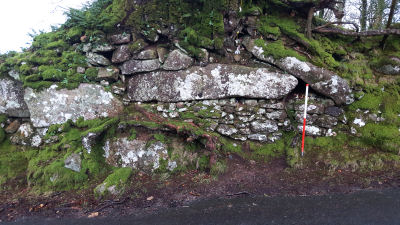
Shilstone Lane Reported Cairn
OS Map: SX 65955 90139
HER: No record found
ShortName: CN-Shilstone
Notes: This record arose from a posting by Clive Darke on a Dartmoor Facebook forum. Clive posted a photo of this feature on the side of the road and asked whether it could perhaps be a re-used menhir in a Devon wall.
Nearby sites: SX65969014
Throwleigh Common 1 Cairn
OS Map: SX 65420 90670
HER record: MDV59305
ShortName: CN:Throw 1
Butler map: 39.1.1
Notes: HER: Northern of five cairns of 7.5 metres diameter by 0.5 metres high to the west of the settlement on Throwleigh Common
Nearby sites: SX65429067
Throwleigh Common 2 Reported Cairn
OS Map: SX 65410 90530
HER record: MDV59307
ShortName: CN:Throw 2
Butler map: 39.1.2
Notes: See: 1476178
Nearby sites: SX65419053
Throwleigh Common 3 Clearance Cairn
OS Map: SX 65460 90550
HER record: MDV59307
ShortName: CN?Throw 3
Butler map: 39.1.3
Notes: Clearance cairn within reave system.
Nearby sites: SX65469055
Throwleigh Common 4 Clearance Cairn
OS Map: SX 65460 90560
HER record: MDV59307
ShortName: CN?Throw 4
Butler map: 39.1.4
Notes: Clearance cairn within reave system.
Nearby sites: SX65469056
Throwleigh Common 5 Clearance Cairn
OS Map: SX 65540 90440
HER record: MDV134156
ShortName: CN?Throw 5
Butler map: 39.1.5
Notes: HER reffering to Butler: Throwleigh Common cairn '5' of 7.4 metres diameter by 0.3 metres high. On the other side of the hill, out of sight of the settlement on Trowleigh Common but still within its boundaries, is a cairn cemetery which may well have been the burial ground for the hut dwellers. This southern cairn is located in a square field on the north side of the 'leat' to the west of the settlement.
Nearby sites: SX65549044
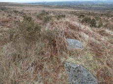
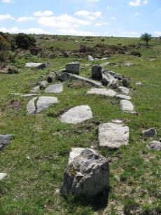
Throwleigh Common 6 Platform Cairn Circle and Cist
OS Map: SX 65203 89798
HER record: MDV13020
PMD: Forder Brook
ShortName: CT:Throw 6
Notes: Round cairn. Diameter 6.4 metres, height 1 metre. Cist 0.6 metres wide, oriented north-south. Central pit 1.5 metres by 1.1 metres by 0.25 meters deep. Situated on downslope edge of a natural terrace. Three edge set stones lying parallel to each other are exposed in the central pit. The two eastern ones may represent the edges of a cist with a length or width of 0.6 metres. A number of edge set stones around the edge represent a kerb. Gorse covered. NOTE: NMR gives location as SX 6519 8978.
The overgrown feature in the photo from 17/03/2025 is possibly this feature but it is a considerable distance from the NMR grid reference. That is located at SX 65203 89798
Nearby sites: SX65208980
Throwleigh East M Cairnfield Master
OS Map: SX 65070 90010
HER: No record found
ShortName: CN:ThrowE M
Notes: There are 11 clearance cairns in very close proximity to each other listed on the HER. This record has been added as a master record and hence set as a duplicate. See the individual records.
Nearby sites: SX65079001
Throwleigh East 1 Clearance Cairn
OS Map: SX 65100 89830
HER record: MDV59333
ShortName: CN:ThrowE 1
Notes: HER: Possible cairn of 8.3 metres diameter by 1 metre high on the east slope of Kennon Hill with a central pit of 1.5 metres by 0.9 metres by 0.5 metres deep
Nearby sites: SX65108983
Throwleigh East 2 Clearance Cairn
OS Map: SX 65060 89990
HER record: MDV59334
ShortName: CN:ThrowE 2
Notes: HER: Clearance cairn of 2.5 metres by 2.3 metres by 0.6 metres high on the eastern slope of Kennon Hill
Nearby sites: SX65068999
Throwleigh East 3 Clearance Cairn
OS Map: SX 65070 90000
HER record: MDV59335
ShortName: CN:ThrowE 3
Notes: HER: Clearance cairn of 9.5 metres by 3.5 metres by 0.7 metres high on the eastern slope of Kennon Hill. May have originally been built as part of an agglomerated enclosure which was never completed.
Nearby sites: SX65079000
Throwleigh East 4 Clearance Cairn
OS Map: SX 65060 90020
HER record: MDV59336
ShortName: CN:ThrowE 4
Notes: HER: Clearance cairn of 5.5 metres by 3 metres by 0.5 metres high on the eastern slope of Kennon Hill
Nearby sites: SX65069002
Throwleigh East 5 Clearance Cairn
OS Map: SX 65080 90020
HER record: MDV59337
ShortName: CN:ThrowE 5
Notes: HER: Clearance cairn of 4 metres by 2 metres by 0.4 metres high on the eastern slope of Kennon Hill
Nearby sites: SX65089002
Throwleigh East 6 Clearance Cairn
OS Map: SX 65090 90020
HER record: MDV59338
ShortName: CN:ThrowE 6
Notes: HER: Clearance cairn of 10 metres by 3 metres by 0.6 metres high on the eastern slope of Kennon Hill. May have originally been built as part of an agglomerated enclosure which was never completed.
Nearby sites: SX65099002
Throwleigh East 7 Clearance Cairn
OS Map: SX 65080 90040
HER record: MDV59339
ShortName: CN:ThrowE 7
Notes: HER: Clearance cairn of 5 metres by 3 metres by 0.7 metres high on the eastern slope of Kennon Hill
Nearby sites: SX65089004
Throwleigh East 8 Clearance Cairn
OS Map: SX 65090 90040
HER record: MDV59340
ShortName: CN:ThrowE 8
Notes: HER: Clearance cairn of 6 metres by 1.8 metres by 0.7 metres high on the eastern slope of Kennon Hill
Nearby sites: SX65099004
Throwleigh East 9 Clearance Cairn
OS Map: SX 65050 90060
HER record: MDV59341
ShortName: CN:ThrowE 9
Notes: HER: Clearance cairn of 3 metres diameter by 0.5 metres high on the eastern slope of Kennon Hill
Nearby sites: SX65059006
Throwleigh East 10 Clearance Cairn
OS Map: SX 65060 90050
HER record: MDV59342
ShortName: CN:ThrowE10
Notes: HER: Clearance cairn of 13 metres by 4 metres by 0.7 metres high on the eastern slope of Kennon Hill. May have originally been built as part of an agglomerated enclosure which was never completed.
Nearby sites: SX65069005
Throwleigh East 11 Clearance Cairn
OS Map: SX 65080 90060
HER record: MDV59343
ShortName: CN:ThrowE11
Notes: HER: Clearance cairn of 16 metres by 4 metres by 0.9 metres high on the eastern slope of Kennon Hill. May have originally been built as part of an agglomerated enclosure which was never completed.
Nearby sites: SX65089006
Page last updated 10/12/24