
Guide to the Monuments on Brent Hill and Harbourneford
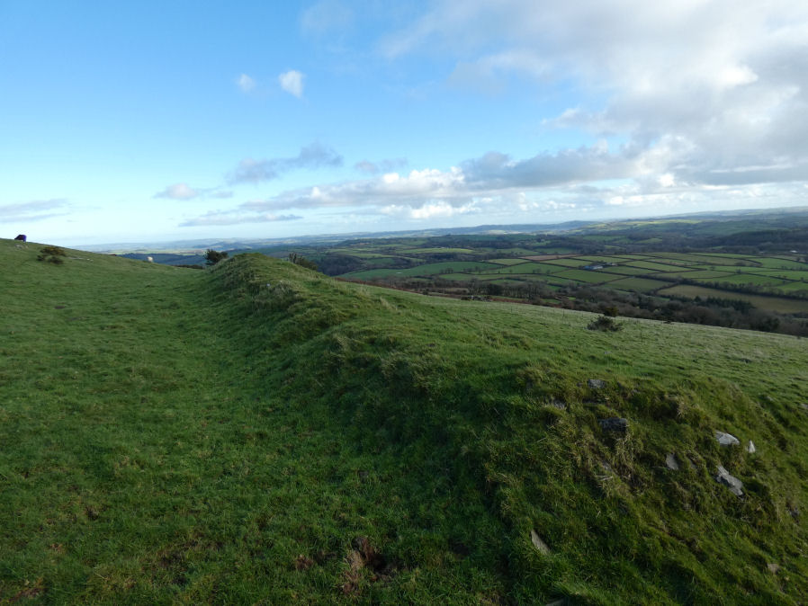
Table of Ritual and Burial Monuments on Brent Hill and Harbourneford
The following table lists the records currently in this Guide Map. For an explantion of the Guide Maps and a table of all 62 Guide Maps, follow this link: Guide List Table. Introductory text will be added to each guide list in coming years (it is a large task). Notes on duplication and omissions will appear below the table once checks have been finalised.
To see the table below listed with just sites with no photos i.e. unvisited/unconfirmed sites, click on this link: List of sites with no photos (click here to show all)
| Guide # | Butler | SiteID | Site Name | ShortName | Record Source | Map | Turner | HER | Photo | Unique? | Checked |
|---|---|---|---|---|---|---|---|---|---|---|---|
| 99 | 4407 | Bloody Pool (S. Brent) Ancient Pool | PO:BloodyPool | Greeves | SX7030262639 | MDV7955 | N | Unique | 0 | ||
| 99 | 646 | Brent Hill Fort | FT Brent Hill | PDW | SX7039461725 | MDV7957 | Y | Unique | 0 | ||
| 99 | 677 | Yellowberries Copse Fort | FT:Yellowberri | Wikipedia | SX6921758614 | MDV2925 | N | Unique | 0 | ||
| 99 | 1203 | Lutton Cairn | CN:Lutton | HER | SX6934061490 | MDV13290 | N | Unique | 0 | ||
| 99 | 1204 | Glazebrook Farm Cairn | CN:GlazebrkFm | HER | SX6894058930 | MDV13163 | N | Unique | 0 | ||
| 99 | 2544 | Harbourneford 1 Reported Cairn | CN:Harbourne1 | Grinsell | SX7137062350 | MDV13641 | N | Unique | 0 | ||
| 99 | 2545 | Harbourneford 2 Cairn | CN:Harbourne2 | Grinsell | SX7142062240 | MDV13640 | N | Unique | 0 | ||
| 99 | 2546 | Harbourneford 3 Reported Cairn | CN:Harbourne3 | Grinsell | SX7145062470 | MDV13641 | N | Unique | 0 |
Brent Hill and Harbourneford Guide Map
Guidance for walkers: The monuments featured in this database are archaeological treasures and need to be protected and preserved - please do not disturb any sites. Please check access and firing times before visiting sites, not all sites listed are on open access land. Firing ranges and boundaries of open access areas are marked on the OL28 OS Dartmoor Explorer map. Please stick to the country code and consider giving support to the numerous agencies that help to keep Dartmoor a fabulous natural and historic environment!
List of Ritual and Burial Monuments on Brent Hill and Harbourneford
Bloody Pool (S. Brent) Ancient Pool
OS Map: SX 70302 62639
HER record: MDV7955
ShortName: PO:BloodyPool
Notes: "Bloody Pool is one of over 40 such pool sites on Dartmoor which may date to the Prehistoric period and may have had a sacred function. This pool was noted in 1960 as having been filled in and its site now forms part of a roadside verge. In 1854, a hoard of Bronze Age metalwork was recovered from the pool, including four bronze ferrules, with three barbed bronze spearheads. All items were broken and are thought to have been votive deposits; the only pool on the moor where such items have been found."
Nearby sites: SX70306264

Brent Hill Fort
OS Map: SX 70394 61725
HER record: MDV7957
Megalithic Portal: 7753
ShortName: FT Brent Hill
Notes: This monument includes a slight univallate hillfort with outworks, hut circle platforms and beacon situated at the summit of the prominent Brent Hill. The hillfort survives as an irregularly shaped enclosure surrounding the summit of a naturally steep and rocky hillside which is further enhanced by a partial rampart and ditch.
Nearby sites: SX70396173
Yellowberries Copse Fort
OS Map: SX 69217 58614
HER record: MDV2925
ShortName: FT:Yellowberri
Nearby sites: SX69225861
Lutton Cairn
OS Map: SX 69340 61490
HER record: MDV13290
ShortName: CN:Lutton
Notes: A possible barrow lies in a field known as wash park nw of lutton at sx69356150. It is best seen from lutton green from where in the right light it is sometimes quite conspicuous. It is turf covered about 0.5m and 10-12m diam, roughly in the centre of the field. Viewed from above it is much less convincing and its edge merges into the slope. The fact that it is on a very steep slope would seem to cast doubt upon it.
Nearby sites: SX69346149
Glazebrook Farm Cairn
OS Map: SX 68940 58930
HER record: MDV13163
ShortName: CN:GlazebrkFm
Notes: A possible barrow. A low irregular heap of stones, mostly turf covered. Approximate diameter 20m, height 0.5-0.7m. If it is a barrow it has been mutilated on the west side. This may be associated with an anti-aircraft emplacement in the field in the 1939-45 war, for which the barrow may have been used for a quarry.
Nearby sites: SX68945893
Harbourneford 1 Reported Cairn
OS Map: SX 71370 62350
HER record: MDV13641
ShortName: CN:Harbourne1
Grinsell: BRE 11
Notes: The site of a round barrow which has been under the plough for some years. A large number of worked flints have been found on the site.
Nearby sites: SX71376235
Harbourneford 2 Cairn
OS Map: SX 71420 62240
HER record: MDV13640
ShortName: CN:Harbourne2
Grinsell: BRE 12
Notes: Round barrow in arable field
Nearby sites: SX71426224
Harbourneford 3 Reported Cairn
OS Map: SX 71450 62470
HER record: MDV13641
ShortName: CN:Harbourne3
Grinsell: BRE 13
Notes: A round barrow situated in the south west corner of a grass field; the hedge turns to take account of it.
Nearby sites: SX71456247
Page last updated 10/12/24