
Castle Dyke (Chudleigh) Fort
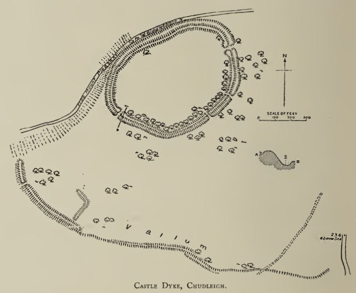
Plan: J.C. Wall in Ancient Earthworks (1906)
Database entries
PDW coverage: Dartmoor Resource: Table of Devon Iron Age Forts
OS Map: SX 87478 78757
OS Source: Google
HER: MDV9008
Megalithic Portal: 7755
Alternate name: Castle Dyke (Chudleigh)
Short Name: FT:Chudleigh
Exist: Yes
Record: Unique
Record Source: Fox
Hut Class: No
Lidar: SX 87478 78757
Nearby sites: SX 87478 78757
References
These are selected references with an emphasis on out of copyright sources linked as PDFs. For more detailed references try any linked HER or PMD record above.
- Fox, Aileen, Prehistoric hillforts in Devon, (1996)
- Hutchinson, P. O., On the Hill Fortresses, Tumuli, and some other Antiquities of Eastern Devon, Journal of the British Archaeological Association Vol.18 pp.53-66 (1862)
- Wall, J. Charles, Ancient Earthworks, The Victoria History of the County of Devon: v. 1 pp.573-630 (1906)