
Castle Dyke (Ashcombe) Fort
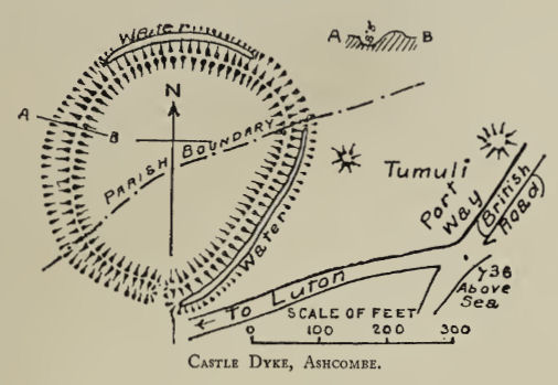
Plan: J.C. Wall in Ancient Earthworks (1906)
Database entries
PDW coverage: Dartmoor Resource: Table of Devon Iron Age Forts
OS Map: SX 92132 77002
OS Source: Google
HER: MDV9783
Megalithic Portal: 26977
Alternate name: Castle Dyke (Ashcombe)
Short Name: FT:Ashcombe
Exist: Yes
Record: Unique
Record Source: Fox
Hut Class: No
Lidar: SX 92132 77002
Nearby sites: SX 92132 77002
Notes
"Castle Dyke, in the Tower Plantation. A small ring work, situated on level ground, on Little Haldon. Defences, a bank 1.22 meters high and ditch measuring 13.72 meters overall. The entry: on the east is probably original, the diagonal cut beside the metalled road is probably recent. Date uncertain might be Bronze Age, since not defensively sited. Condition good, has never been ploughed."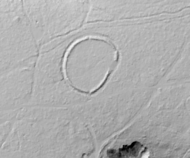
DTM Lidar image from LidarFinder.com
References
These are selected references with an emphasis on out of copyright sources linked as PDFs. For more detailed references try any linked HER or PMD record above.
- Fox, Aileen, Prehistoric hillforts in Devon, (1996)
- Wall, J. Charles, Ancient Earthworks, The Victoria History of the County of Devon: v. 1 pp.573-630 (1906)