
Wedlake Enclosed Settlement
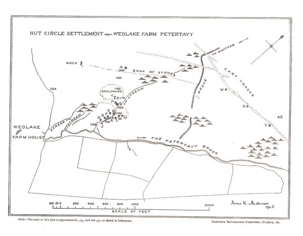
Plan by Rev. I. K. Anderson DEC Report 10 (1906)
Database entries
OS Map: SX 53974 77769
OS Source: HER
HER: MDV4106
Alternate name: Wedlake
Short Name: ST:Wedlake
Butler map: 31.9
Butler Vol 5: p.95
Exist: Yes
Record: Unique
Record Source: HER
Lidar: SX 53974 77769
Guide Map: 24
Nearest Bus Stop: Merrivale Dartmoor Inn (3.5 km) [Route: 98,171(20/07/26 to 19/09/26)]
Nearby sites: SX 53974 77769
Notes
HER: Hut circle settlement to the north-east of Wedlake Farm and to the west of the Colly Brook with four incomplete enclosures and at least fifteen hut circles.Plan: Butler (1991) p.88 Fig 31.4.
References
These are selected references with an emphasis on out of copyright sources linked as PDFs. For more detailed references try any linked HER or PMD record above.
- Anderson, I. K. (Rev.), Eleventh Report of the Dartmoor Exploration Committee, T.D.A. Vol.38 pp.101-113 (1906)
- Baring-Gould, Sabine, Sixth Report of the Dartmoor Exploration Committee, T.D.A. Vol.31 pp.146-155 (1899)
- Baring-Gould, Sabine, Tenth Report of the Dartmoor Exploration Committee, T.D.A. Vol.37 pp.141-145 (1905)
- Butler, Jeremy, Dartmoor Atlas of Antiquities, vol.2: The North, (1991)
- Newman, Phil, The Langstone Moor Stone Circle, Peter Tavy, Devon and its Prehistoric Environs, English Heritage (2003)
- Newman, Phil, Archaeological Sites within Merrivale Training Area (2018), Southwest Landscape Investigations (2018)