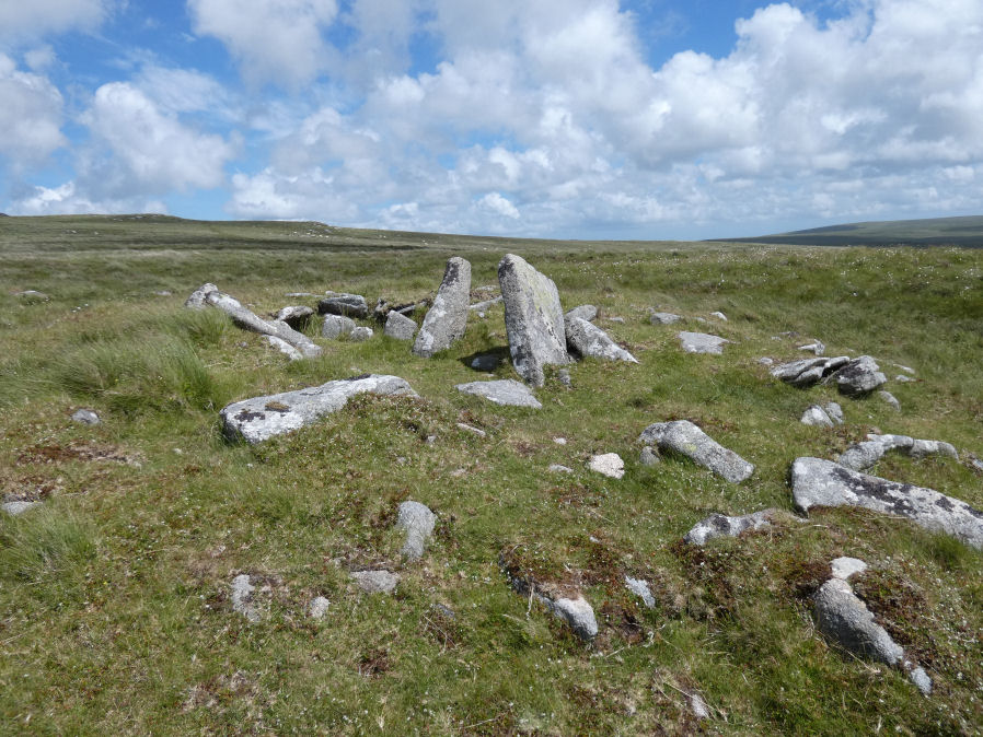
Fordsland Ledge Chambered Cairn

Photo taken on 26-06-2022
Database entries
OS Map: SX 57581 88897
OS Source: Google
Butler OS: SX57578888
HER: MDV3169
Megalithic Portal: 36418
PMD: Fordsland Ledge
Alternate name: Fordsland Ledge
Short Name: CN Fordsland
Butler map: 42.3
Butler Vol 5: p.160 & Fig.98
Grinsell: OKEHAMPTON HAMLETS 4
Exist: Yes
Record: Unique
Record Source: Butler
Hut Class: No
Cist Class: Maybe
Cairn Class: Yes
Dimensions (m): 10 x 0.4
Lidar: SX 57581 88897
Guide Map: 6
Nearest Bus Stop: Sourton Windard Terrace (5.7 km) [Route: 118]
Nearby sites: SX 57581 88897
Notes
" In a crest position on Fordsland Ledge at 581.0m OD is the disturbed remains of a turf-and-heather-covered cairn. It measures 12.2m by 13.9m in diameter and is 1.1m high. In a hollow in the centre are a number of large stones suggesting the possibility of a former cist or even a chamber, utilizing the natural outcrop as its base." "The large stones visible in the centre of the feature are somewhat unusual and not typical of a cist-like structure. The presence of a chamber is very doubtful and it is more likely that the interior of the cairn has, at some point, been remodelled to create a small shelter."References
These are selected references with an emphasis on out of copyright sources linked as PDFs. For more detailed references try any linked HER or PMD record above.
- Butler, Jeremy, Dartmoor Atlas of Antiquities, vol.2: The North, (1991)
- Butler, Jeremy, Dartmoor Atlas of Antiquities, vol.5: The Second Millennium B.C., (1997)
- Crossing, William, Guide to Dartmoor, (2001)
- Grinsell, L.V., Dartmoor Barrows, Devon Archaeological Society Proceedings No.36 (1978)
- Newman, Phil, Archaeological Sites within Okehampton Training Area, Southwest Landscape Investigations (2014)