
Whitehorse Hill Cist
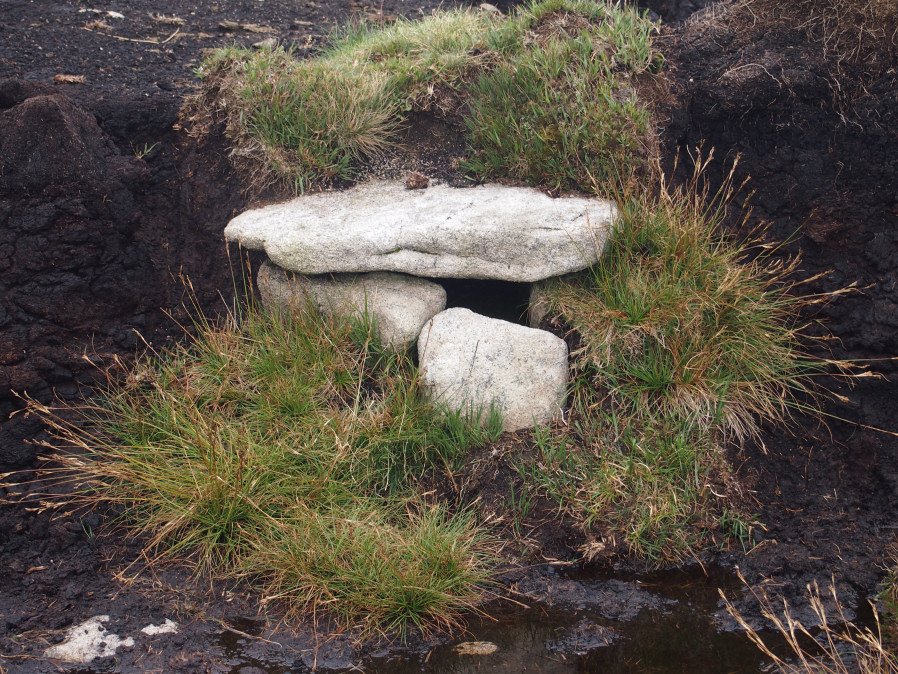
Photo taken on 04-09-2016
Database entries
OS Map: SX 61735 85482
OS Source: Google
HER: MDV66367
Megalithic Portal: 29778
PMD: White Horse Hill
Alternate name: Whitehorse Hill
Short Name: CT Whitehorse1
Dixon Cist #: 132
DPD page: 131
Exist: Yes
Record: Unique
Record Source: PDW
Hut Class: No
Cist Class: Yes
Cairn Class: Yes
Dimensions (m): 0.79 x 0.66 C
Lidar: SX 61735 85482
Guide Map: 11
Nearest Bus Stop (Minor): Wonson Telephone Box (9.0 km) [Route: 670]
Nearest Bus Stop (Major): Postbridge Post Office (7.3 km) [Route: 98,171(20/07/26 to 19/09/26)]
Nearby sites: SX 61735 85482
Notes
This cist was excavated in August 2011. It possibly featured on an 1892 map by John Chudleigh in An Exploration of Dartmoor's Antiquities. It was re-discovered in 1999 and recently excavated.Carbon dating suggests it is Bronze Age in date. Dates for the top of the cist gives 2800-1890BC and for the bottom of the cist 3650-3100BC. Provisional carbon dates for artefacts suggest the remains are Bronze Age (1900-1500BC). Inside the cist an animal hide bag was found containing cremation remains including a number of artefacts including amber beads (amber would have been imported from overseas), wooden ear studs, a delicate bracelet studded with tin beads, a textile fragment with detailed leather fringing and a unique coiled bag.
There is some good coverage on the Legendary Dartmoor website, see: Whitehorse Kist 1, Whitehorse Kist 2 and Whitehorse Kist 3.
See also DNPA: Update on Whitehorse Hill Cist excavation and Dartmoor tomb treasure horde uncovered by archaeologists. Not listed in Butler - relevant map of area is Vol. 2. Map 41. Lethbridge pp.131-132
References
These are selected references with an emphasis on out of copyright sources linked as PDFs. For more detailed references try any linked HER or PMD record above.
- Jones, Andy M., Preserved in the Peat: An Extraordinary Bronze Age Burial on Whitehorse Hill, Dartmoor, and its Wide, (2016)
- Lethbridge, William D., Discover Preshistoric Dartmoor, (2015)
- Newman, Phil, Archaeological Sites within Okehampton Training Area, Southwest Landscape Investigations (2014)
- Turner, J.R., A Cist on Whitehorse Hill, D.A.S.P. No.58 pp.249-250 (2000)