
Mardon Down 8 Reported Cairn
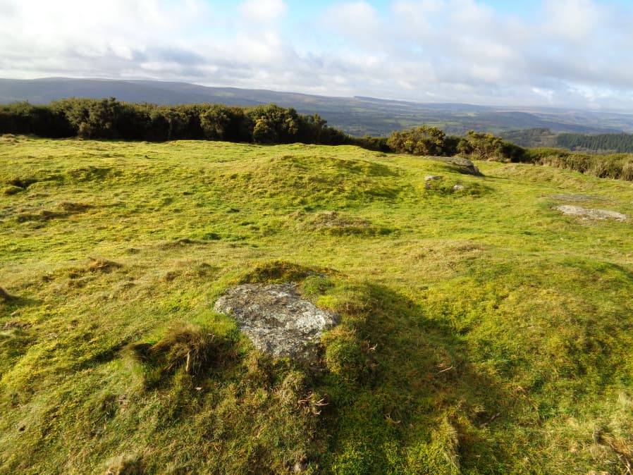
Photo taken on 26-01-2018
Database entries
PDW coverage: Dartmoor Site: Mardon Down Stone Circle & Cairns
OS Map: SX 76730 87238
OS Source: Google
HER: MDV15159
Alternate name: Mardon Down 8
Short Name: CN Mardon 8
Exist: Yes
Record: Unique
Record Source: HER
Hut Class: No
Cairn Class: Yes
Dimensions (m): 15
Lidar: SX 76730 87238
Guide Map: 59
Nearest Bus Stop: Moretonhampstead Court Street Car Park (2.6 km) [Route: 173, 171(20/07/26 to 19/09/26)]
Nearby sites: SX 76730 87238
Notes
Newman (2017) This earthwork, which sits 18m north of the stone circle, has in the past been recorded as a cairn. However, there has to be some uncertainty over this because, apart from its location (on a hilltop and associated with other prehistoric monuments), the layout of the surviving earthworks make it very difficult to interpret precisely.The earthworks appear random but vestiges of what might have been a bank forming part of a perimeter runs around the northeast and west sides, although this is breached on the northern corner and cannot be traced along the southern side. The central area of the feature is slightly raised and embanked in places, with a natural granite outcrop on its western corner, which appears undisturbed. Some additional detached slabs of stone appear to be naturally placed moorstone and probably do not form part of a monument. The total spread of the earthworks is 24m at the broadest point, and the central mound is 0.4m high. It is possible therefore that an inner mound or platform, which incorporated a natural outcrop, has become disturbed and misshapen, but was once surrounded by an outer bank, thus perhaps representing the earthworks of a sepulchral monument. However, insufficient evidence survives in an intact state to be certain. N.B. Extending Butlers 1-5 PDW is numbering this 8.
References
These are selected references with an emphasis on out of copyright sources linked as PDFs. For more detailed references try any linked HER or PMD record above.
- Newman, Phil, A Stone Circle and Cairn Group on Mardon Down, Moretonhampstead, Devon An Earthwork Survey, Southwest Landscape Investigations (2017)