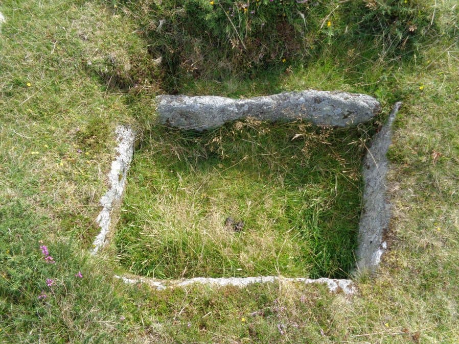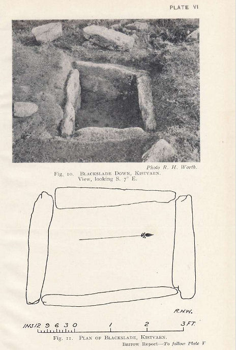
Blackslade Down Cist

Photo taken on 26-08-2017

Plan by RHW. Barrow Report 53. TDA Vol.66 1934
Database entries
OS Map: SX 73416 75519
OS Source: Google
Butler OS: SX73397551
HER: MDV7437
Megalithic Portal: 32071
PMD: Blackslade Down
Alternate name: Blackslade Down
Short Name: CT Blackslade
Butler map: 9.8
Butler Vol 5: p.47 & Fig.26
Dixon Cist #: 59
Grinsell: WIDECOMBE IN THE MOOR 14
DPD page: 129
Exist: Yes
Record: Unique
Record Source: Butler
Hut Class: No
Cist Class: Yes
Cairn Class: Yes
Barrow Report: 53 56
Dimensions (m): 10.0 x 0.5 C
Lidar: SX 73416 75519
Guide Map: 37
Nearest Bus Stop (Minor): Widecombe in the Moor Car Park (2.6 km) [Route: 271]
Nearest Bus Stop (Major): Poundsgate Tavistock Inn (4.5 km) [Route: 172]
Nearby sites: SX 73416 75519
Notes
Butler Vol. 1. Map 9.8 (photo on p.61, diagram Vol. 5. p.47). Lethbridge diagram p.129 and photo bottom p.129.Grinsell [Folklore 1976], Widecombe cist: Opened by a former parson of Widecombe, whose house was destroyed by an explosion the following night. Crossing 1911, 20.
References
These are selected references with an emphasis on out of copyright sources linked as PDFs. For more detailed references try any linked HER or PMD record above.
- Baring-Gould, Sabine, Fourth Report of the Dartmoor Exploration Committee, T.D.A. Vol.29 pp.145-65 (1897)
- Butler, Jeremy, Dartmoor Atlas of Antiquities, vol.1: The East, (1991)
- Butler, Jeremy, Dartmoor Atlas of Antiquities, vol.5: The Second Millennium B.C., (1997)
- Crossing, William, Guide to Dartmoor, (2001)
- Grinsell, L.V., Grinsell, Folklore of Prehistoric Sites in England, (1976)
- Grinsell, L.V., Dartmoor Barrows, Devon Archaeological Society Proceedings No.36 (1978)
- Lethbridge, William D., Discover Preshistoric Dartmoor, (2015)
- Newman, Phil, Rippon Tor Premier Archaeological Landscape, Dartmoor National Park, Devon, Southwest Landscape Investigations (2015)
- Rowe, Samuel, A Perambulation of Dartmoor (3rd Edition), (1896)
- St Leger-Gordon, Douglas, Under Dartmoor hills, (1954)
- Worth, R. Hansford, Barrow Report 21, T.D.A. Vol.34 pp.104- 146 (1902)
- Worth, R. Hansford, Barrow Report 53, T.D.A. Vol.66 pp.39-42 (1934)
- Worth, R. Hansford, Barrow Report 56, T.D.A. Vol.69 pp.75-109 (1937)