
Longstone Hill Standing Stone
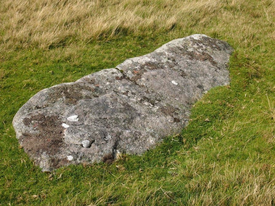
Photo taken on 28-08-2016
Database entries
OS Map: SX 56725 90890
OS Source: Google
HER: MDV5571
Megalithic Portal: 36422
PMD: Longstone Hill Standing Stone
Alternate name: Longstone Hill
Short Name: SS Longstone
Butler map: 42.
Butler Vol 5: p.220
DPD page: 156
Exist: Yes
Record: Unique
Record Source: PDW
Hut Class: No
Dimensions (m): 1.75 x 0.8 x 0.45
Lidar: SX 56725 90890
Guide Map: 4
Nearest Bus Stop: Sourton Windard Terrace (4.4 km) [Route: 118]
Nearby sites: SX 56725 90890
Notes
Possible recumbent longstone on summit of Longstone Hill, east of Meldon Reservoir. Suggested as possible menhir by Butler and Newman. Historic England:A sinuous 50 metres long, 2 metres wide and 0.25 metres high bank lying within the monument leads towards a large recumbent stone. This stone measures 1.75 metres long, 0.8 metres wide and 0.45 metres thick and is the only large stone visible on Longstone Hill. It has been suggested that this may be the longstone which once stood upright to give the hill its name. The presence of this stone, which would have been broadly contemporary with the cairns, provides additional support for the ritual and funerary character ascribed to many cairns within the group.References
These are selected references with an emphasis on out of copyright sources linked as PDFs. For more detailed references try any linked HER or PMD record above.
- Brailsford, J. W, Bronze Age Stone Monuments of Dartmoor, Antiquity Volume 12, Number 48 pp.444-63 (1938)
- Butler, Jeremy, Dartmoor Atlas of Antiquities, vol.2: The North, (1991)
- Butler, Jeremy, Dartmoor Atlas of Antiquities, vol.5: The Second Millennium B.C., (1997)
- Lethbridge, William D., Discover Preshistoric Dartmoor, (2015)
- Newman, Phil, Archaeological Sites within Okehampton Training Area, Southwest Landscape Investigations (2014)