
Shovel Down Long Stone Standing Stone
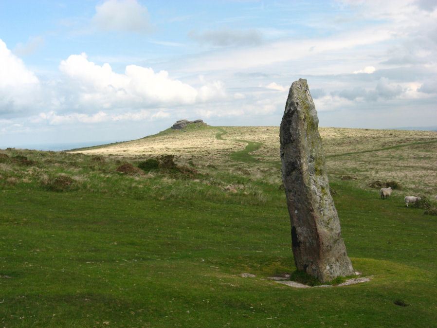
Photo taken on 06-06-2010
Database entries
PDW coverage: Dartmoor Site: Shovel Down Ceremonial Complex
OS Map: SX 66031 85683
OS Source: Google
HER: MDV6149
Megalithic Portal: 10378
PMD: Shovel Down
Alternate name: Shovel Down Long Stone
Short Name: SS Long Stone
Butler map: 36.6
Butler Vol 5: p.56 & Fig.34
DPD page: 140
Exist: Yes
Record: Unique
Record Source: PDW
Hut Class: No
Dimensions (m): 3.4
Lidar: SX 66031 85683
Guide Map: 13
Nearest Bus Stop (Minor): Wonson Telephone Box (5.3 km) [Route: 670]
Nearest Bus Stop (Major): Chagford The Square (4.4 km) [Route: 173,178,671]
Nearby sites: SX 66031 85683
Notes
The Long Stone has been used as a boundary stone but it appears to be the terminal stone for a Bronze Age stone row and it may be of a contemporary date. Grinsell [Folklore 1976]: At the beating of the bounds of Gidleigh Common, the first man to reach the Long Stone is (or was) given a money prize. Fielden 1933. The current author has been informed this tradition continues. See also, Legendary Dartmoor: The Shoveldon LongstoneReferences
These are selected references with an emphasis on out of copyright sources linked as PDFs. For more detailed references try any linked HER or PMD record above.
- Butler, Jeremy, Dartmoor Atlas of Antiquities, vol.2: The North, (1991)
- Butler, Jeremy, Dartmoor Atlas of Antiquities, vol.5: The Second Millennium B.C., (1997)
- Fox, Aileen, Cairns and stone alignments on Shovel Down, Archaeological Journal Vol 114. pp.155-158 (1957)
- Fox, Aileen, South-West England, 3500 BC-AD 600, (1973)
- Grinsell, L.V., Grinsell, Folklore of Prehistoric Sites in England, (1976)
- Lethbridge, William D., Discover Preshistoric Dartmoor, (2015)
- Lukis, W.C, Report on the Monuments of Dartmoor, Proceeding of the Society of Antiquaries Vol.8 (1881)
- Ormerod, George Wareing, Archaeological memoirs relating to the East of Dartmoor, (1876)
- Whale, T. W., Some Remarks on the Bounds of the Forest of Dartmoor, T.D.A. Vol.25 pp.510-534 (1893)
- Wilkinson J. Gardner, The Rock-basins of Dartmoor, and some British Remains in England, Journal Brit. Arch. Assoc. xvi. pp.101-132. (1860)
- Worth, R. Hansford, The Prehistoric Monuments of Scorhill, Buttern Hill, and Shuggledown (Shoveldown), T.D.A. Vol.64 pp.280-287 (1932)
- Worth, R. Hansford, The Dartmoor Menhirs, T.D.A. Vol.72 pp.191-200 (1940)
- Worth, R. Hansford, The Stone Rows of Dartmoor Part 1, T.D.A. Vol.78 pp.285-316 (1946)