
Langstone Moor Standing Stone
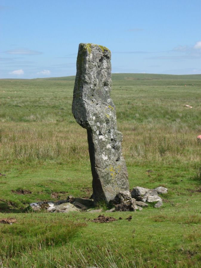
Photo taken on 25-07-2010
Database entries
PDW coverage: Dartmoor Site: Langstone Moor Stone Circle, Stone Row & Settlements
OS Map: SX 55023 78742
OS Source: Google
HER: MDV4225
Megalithic Portal: 17504
PMD: Langstone Moor Standing Stone
Alternate name: Langstone Moor
Short Name: SS Langstone
Butler map: 30.12
Butler Vol 5: p.230
DPD page: 13
Exist: Yes
Record: Unique
Record Source: PDW
Hut Class: No
Dimensions (m): 2.76
Lidar: SX 55023 78742
Guide Map: 24
Nearest Bus Stop: Merrivale Dartmoor Inn (4.7 km) [Route: 98,171(20/07/26 to 19/09/26)]
Nearby sites: SX 55023 78742
Notes
The Langstone standing stone is 2.76m high and can be seen from some distance. It was restored in its original socket in 1893. The Langstone is close to a stone row consisting of very small stones. The Langstone standing stone and also the stone circle were used for target practice by American troops who were stationed nearby during the second world. Bullet holes can be seen on the Langstone standing stone. Lethbridge pp.13-14. Breton (p.17) The stone is composed of local gabbro, and was formerly prostrate, but His Grace the Duke of Bedford has re-erected it in its original socket-hole.References
These are selected references with an emphasis on out of copyright sources linked as PDFs. For more detailed references try any linked HER or PMD record above.
- Baring-Gould, Sabine, Dartmoor Menhirs - Seventeenth Report of the Committee on Scientific Memoranda, T.D.A. Vol.25 p.172 (1893)
- Baring-Gould, Sabine, Second Report of the Dartmoor Exploration Committee, T.D.A. Vol.27 pp.81-92 (1895)
- Breton, Henry Hugh, The Heart of Dartmoor, (1926)
- Butler, Jeremy, Dartmoor Atlas of Antiquities, vol.2: The North, (1991)
- Butler, Jeremy, Dartmoor Atlas of Antiquities, vol.5: The Second Millennium B.C., (1997)
- Lethbridge, William D., Discover Preshistoric Dartmoor, (2015)
- Newman, Phil, The Langstone Moor Stone Circle, Peter Tavy, Devon and its Prehistoric Environs, English Heritage (2003)
- Worth, R. Hansford, The Dartmoor Menhirs, T.D.A. Vol.72 pp.191-200 (1940)