
Tables of Devon Bus Stops
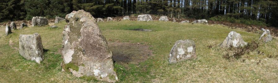
Photo (18/04/2010): Soussons Common Ring Setting Cairn and Cist
This page is a under construction. It is an attempt to address the question of what prehistoric archaeology can be visited using the new "Transmoor" bus service 171 and also the Haytor Hoppa (271) Service. Tables have also been added now for other services. The bus stops are listed alphabetically for each service.
A table of the major bus stops is now in the database behind this website and it opens up possibilities to improve the interface to assist planning journeys using buses. Step one is to build that table which has been done. It may take a bit of development work to make good use of this new resource and the author wants to use it to plan days out right away so I have decided to publish while it is still a work in progress. A possibility is that the individual site pages have a nearvy bus stop listing.
The tables below give the major stops on the various routes. There are minor stops which have not been included you can find those by looking at the offical resources on the Public Transport page. There are two listings of sites nearby. The Map column just shows the location of the bus stop on a map.
The first column Nearby - Walkers lists the core sites within 5 km of the bus stop around a 2 hour walk. The core sites are the less detailed listings of the major sites and include the stone circles and stone rows and most major features of interest to walkers. It does not include more detailed coverage of the very numerous minor cairns which are of interest to archaeologists but probably of less interest to most walkers. These are included in the Nearby - Detailed listings. Thi sstill excludes round houses which can swamp listings. In either case you can use the drop downs on the serach results to increse or decrease the level of details and the distance.
Country Bus 171: Newton Abbot - Tavistock via M'hampstead
| Bus Stop | Short Name | Map | Nearby - walkers | Nearby - detailed |
|---|---|---|---|---|
| Batworthy Miniature Pony Centre | BS Batworthy M | SX 71792 84763 | SX 71792 84763 | SX 71792 84763 |
| Bovey Tracey Dolphin Square | BS Bovey Sq | SX 81295 78110 | SX 81295 78110 | SX 81295 78110 |
| Heathfield Drumbridges Roundabout | BS Heathfield | SX 82991 75194 | SX 82991 75194 | SX 82991 75194 |
| Lustleigh Eastwrey Barton Hotel | BS Lustleigh | SX 78123 82816 | SX 78123 82816 | SX 78123 82816 |
| Merrivale Dartmoor Inn | BS Merrivale | SX 54878 75177 | SX 54878 75177 | SX 54878 75177 |
| Moretonhampstead Court Street Car Park | BS Moretonhamp | SX 75145 86065 | SX 75145 86065 | SX 75145 86065 |
| Newton Abbot Sherborne Road | BS SherbournRd | SX 85901 71399 | SX 85901 71399 | SX 85901 71399 |
| Postbridge Post Office | BS Post Office | SX 64744 78870 | SX 64744 78870 | SX 64744 78870 |
| Powder Mills | BS PowderMills | SX 62918 76618 | SX 62918 76618 | SX 62918 76618 |
| Princetown Dartmoor Visitor Centre | BS Princetown | SX 59038 73512 | SX 59038 73512 | SX 59038 73512 |
| Tavistock Bus Station | BS Tavistock | SX 47969 74266 | SX 47969 74266 | SX 47969 74266 |
| Tavistock Higher Longford | BS HigherLong | SX 51682 74772 | SX 51682 74772 | SX 51682 74772 |
| Two Bridges Hotel | BS Two Bridges | SX 60925 75021 | SX 60925 75021 | SX 60925 75021 |
| Warren House Inn | BS WarrenHouse | SX 67458 80970 | SX 67458 80970 | SX 67458 80970 |
Country Bus 271: Haytor Hoppa: Newton Abbot to Widecombe via Bovey Tracey (Sat & Thurs only)
| Bus Stop | Short Name | Map | Nearby - walkers | Nearby - detailed |
|---|---|---|---|---|
| Bovey Tracey Tesco Express | BS Bovey Tesco | SX 81571 78466 | SX 81571 78466 | SX 81571 78466 |
| Brimley Edgemoor Hotel | BS Brimley | SX 79918 78193 | SX 79918 78193 | SX 79918 78193 |
| Haytor Vale Moorlands House | BS Haytor Vale | SX 76741 77300 | SX 76741 77300 | SX 76741 77300 |
| Heathfield Drumbridges Roundabout | BS Heathfield | SX 82991 75194 | SX 82991 75194 | SX 82991 75194 |
| Manaton Becky Falls | BS Becky Falls | SX 75842 80028 | SX 75842 80028 | SX 75842 80028 |
| Manaton Bus Shelter | BS Manaton | SX 75011 81178 | SX 75011 81178 | SX 75011 81178 |
| Newton Abbot Rail Station | BS NewtonAbbot | SX 86698 71194 | SX 86698 71194 | SX 86698 71194 |
| Newton Abbot Sherborne Road | BS SherbournRd | SX 85901 71399 | SX 85901 71399 | SX 85901 71399 |
| Swallerton Gate | BS Swallerton | SX 73918 79119 | SX 73918 79119 | SX 73918 79119 |
| Widecombe in the Moor Car Park | BS Widecombe | SX 71919 76847 | SX 71919 76847 | SX 71919 76847 |
MD Coaches 671: Okehampton to Newton Abbot (Weds only)
| Bus Stop | Short Name | Map | Nearby - walkers | Nearby - detailed |
|---|---|---|---|---|
| Belstone Tongue End Cross | BS TongueEndX | SX 62306 94905 | SX 62306 94905 | SX 62306 94905 |
| Chagford Sandy Park Inn | BS Sandy Park | SX 71202 89615 | SX 71202 89615 | SX 71202 89615 |
| Chagford The Square | BS Chagford | SX 70067 87546 | SX 70067 87546 | SX 70067 87546 |
| Manaton Becky Falls | BS Becky Falls | SX 75842 80028 | SX 75842 80028 | SX 75842 80028 |
| Manaton Bus Shelter | BS Manaton | SX 75011 81178 | SX 75011 81178 | SX 75011 81178 |
| Okehampton Fore Street Arcade | BS Okehampton | SX 58785 95209 | SX 58785 95209 | SX 58785 95209 |
| Ramsley | BS Ramsley | SX 64837 93200 | SX 64837 93200 | SX 64837 93200 |
| Sticklepath Devonshire Inn | BS Sticklepath | SX 64109 94095 | SX 64109 94095 | SX 64109 94095 |
Dartline 66: Exeter to Okehampton
| Bus Stop | Short Name | Map | Nearby - walkers | Nearby - detailed |
|---|---|---|---|---|
| Belstone Tongue End Cross | BS TongueEndX | SX 62306 94905 | SX 62306 94905 | SX 62306 94905 |
| Cheriton Cross Young Farmers Club | BS Cheriton | SX 77353 93003 | SX 77353 93003 | SX 77353 93003 |
| Okehampton Fore Street Arcade | BS Okehampton | SX 58785 95209 | SX 58785 95209 | SX 58785 95209 |
| Okehampton Railway Station | BS OkeStation | SX 59214 94456 | SX 59214 94456 | SX 59214 94456 |
| Ramsley | BS Ramsley | SX 64837 93200 | SX 64837 93200 | SX 64837 93200 |
| Sticklepath Devonshire Inn | BS Sticklepath | SX 64109 94095 | SX 64109 94095 | SX 64109 94095 |
| Whiddon Down Post Inn | BS Whiddon Dn | SX 69033 92542 | SX 69033 92542 | SX 69033 92542 |
Stagecaoch 118: Tavistock to Okehampton Via Mary Tavy, Lydford
| Bus Stop | Short Name | Map | Nearby - walkers | Nearby - detailed |
|---|---|---|---|---|
| Dartmoor Inn | BS DartmoorInn | SX 52291 85282 | SX 52291 85282 | SX 52291 85282 |
| Fox and Hounds Hotel | BS FoxHounds | SX 52511 86681 | SX 52511 86681 | SX 52511 86681 |
| Lydford Gorge Lower Entr | BS Lydford Gor | SX 50132 83166 | SX 50132 83166 | SX 50132 83166 |
| Lydford War Memorial | BS Lydford War | SX 51295 85105 | SX 51295 85105 | SX 51295 85105 |
| Mary Tavy War Memorial | BS Mary Tavy | SX 50253 79579 | SX 50253 79579 | SX 50253 79579 |
| North Brentor War Memorial | BS Nbrentor | SX 48109 81437 | SX 48109 81437 | SX 48109 81437 |
| Okehampton Fore Street Arcade | BS Okehampton | SX 58785 95209 | SX 58785 95209 | SX 58785 95209 |
| Okehampton Railway Station | BS OkeStation | SX 59214 94456 | SX 59214 94456 | SX 59214 94456 |
| Sourton Windard Terrace | BS Sourton | SX 53374 90225 | SX 53374 90225 | SX 53374 90225 |
| Tavistock Bus Station | BS Tavistock | SX 47969 74266 | SX 47969 74266 | SX 47969 74266 |
Stagecaoch 38: Exeter to Plymouth via Ashburton, Buckfastleigh, South Brent & Ivybridge
| Bus Stop | Short Name | Map | Nearby - walkers | Nearby - detailed |
|---|---|---|---|---|
| Ashburton Bull Ring | BS Ashburton A | SX 75555 69855 | SX 75555 69855 | SX 75555 69855 |
| Bovey Tracey Tesco Express | BS Bovey Tesco | SX 81571 78466 | SX 81571 78466 | SX 81571 78466 |
| Buckfastleigh Station Approach | BS Buckfastl A | SX 74399 66178 | SX 74399 66178 | SX 74399 66178 |
| Heathfield Drumbridges Roundabout | BS Heathfield | SX 82991 75194 | SX 82991 75194 | SX 82991 75194 |
| Ivybridge BP Garage (Stop B) | BS Ivybridge | SX 63728 56106 | SX 63728 56106 | SX 63728 56106 |
| Lemonford Caravan Park | BS Lemonford | SX 79488 72601 | SX 79488 72601 | SX 79488 72601 |
| South Brent Pool Park | BS South Brent | SX 70201 59918 | SX 70201 59918 | SX 70201 59918 |
Oakleys 98: Tavistock to Yelverton Via Princetown, Postbridge
| Bus Stop | Short Name | Map | Nearby - walkers | Nearby - detailed |
|---|---|---|---|---|
| Dousland Burrator Inn | BS BurratorInn | SX 53720 68907 | SX 53720 68907 | SX 53720 68907 |
| Merrivale Dartmoor Inn | BS Merrivale | SX 54878 75177 | SX 54878 75177 | SX 54878 75177 |
| Postbridge Bellever | BS Bellever | SX 65513 77361 | SX 65513 77361 | SX 65513 77361 |
| Postbridge Post Office | BS Post Office | SX 64744 78870 | SX 64744 78870 | SX 64744 78870 |
| Princetown Dartmoor Visitor Centre | BS Princetown | SX 59038 73512 | SX 59038 73512 | SX 59038 73512 |
| Tavistock Bus Station | BS Tavistock | SX 47969 74266 | SX 47969 74266 | SX 47969 74266 |
| Tavistock Higher Longford | BS HigherLong | SX 51682 74772 | SX 51682 74772 | SX 51682 74772 |
| Two Bridges Hotel | BS Two Bridges | SX 60925 75021 | SX 60925 75021 | SX 60925 75021 |
Page last updated 04/05/24