
Cadbury Castle Fort
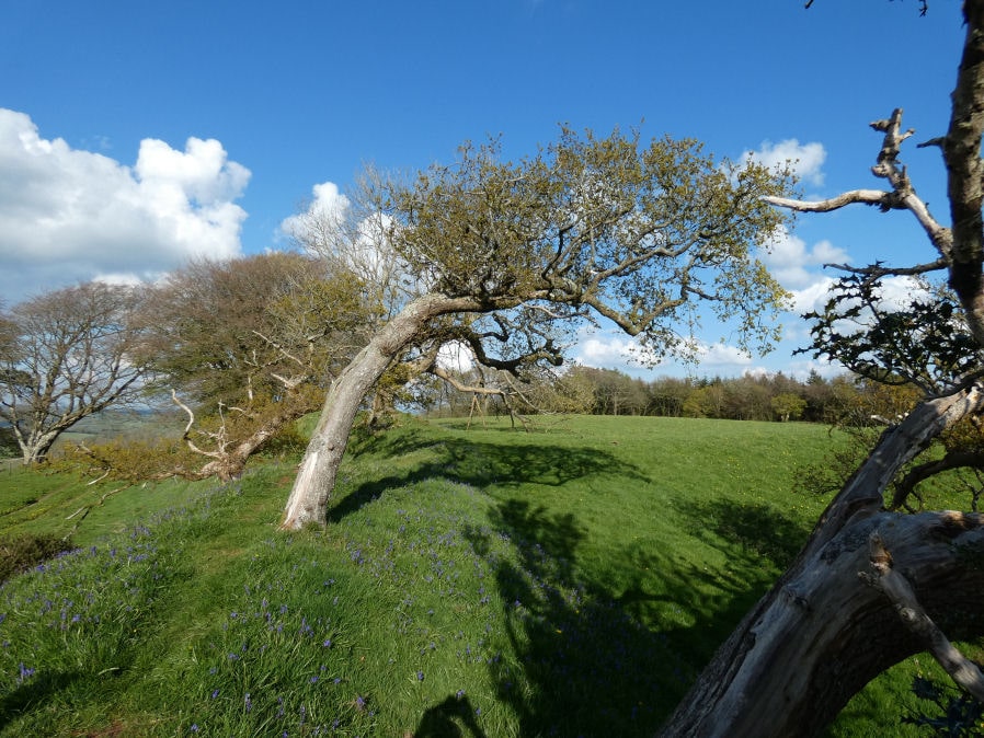
Photo taken on 28-04-2024
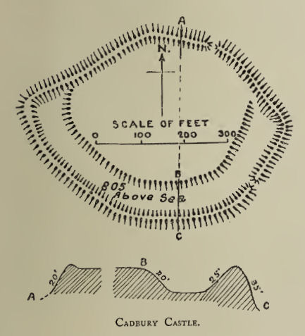
Plan: J.C. Wall in Ancient Earthworks (1906)
Database entries
PDW coverage: Dartmoor Resource: Table of Devon Iron Age Forts
OS Map: SS 91335 05282
OS Source: Google
HER: MDV1213
Megalithic Portal: 17012
Alternate name: Cadbury Castle
Short Name: FT Cadbury
Exist: Yes
Record: Unique
Record Source: Fox
Hut Class: No
Lidar: SS 91335 05282
Nearby sites: SS 91335 05282
Notes
HER: The fort consists of a main enclosure defended by a single rampart and ditch with a narrow annexe added on the south west side. The approach was from the south through inturned entrances to both enclosures. A 30 foot well was found in the centre in 1843 containing Roman objects of the 3rd century AD which are at Fursdon House. The interior is occasionally ploughed and the rampart and entrance consequently reduced. Other details: Monument 98.HER quoting Griffith, F.M. + Quinnell, H. + Wilkes, E,: Hillfort which still preserves its massive ramparts. The original embanked enlcosure, which had an inturned entrance on its eastern side, was enlarged by the addition of an outer enclosure around its western and southern sides with an entranceway through on the south side. The original ditch was blocked inside the new entrance directing those entering the fort to turn along the ditch to enter the inner enclosure by its original entrance.
No excavation has taken place within the fort but an assemblage of fragments of 4th century AD copper alloy bracelets, fragments of shale bracelets, beads and 4th century Roman pottery was found by the landowner in a shaft or well in the interior in 1848. The interior of the hillfort has been subsequently heavily ploughed so that it is difficult now to locate the depression marking the location of the well.
Recent geophysical survey has provided detail of a segmented structure of the inner rampart (tree cover prevented magnetometry over the outer rampart), traces of possible roundhouses in the interior, the blocking of the phase 1 ditch by the phase 2 entrance, apparently deliberate kinks at the junctions of the phase 1 and phase 2 ramparts and a previously unknown outer ditch around the south and west sides. It is suggested that this ditch, which has a pronounded dogleg on its south side may be related to the hillforts use by Fairfax's army in 1645-6 during the Civil War.
The author visited on 28th April 2024 and again on 10th May 2026 and hopefully the photos capture how beautiful this site can be with bluebell cover in the spring.

Photo 10/05/26
References
These are selected references with an emphasis on out of copyright sources linked as PDFs. For more detailed references try any linked HER or PMD record above.
- Fox, Aileen, Prehistoric hillforts in Devon, (1996)
- Grinsell, L.V., Grinsell, Folklore of Prehistoric Sites in England, (1976)
- Wall, J. Charles, Ancient Earthworks, The Victoria History of the County of Devon: v. 1 pp.573-630 (1906)