
Hook Lake Round House
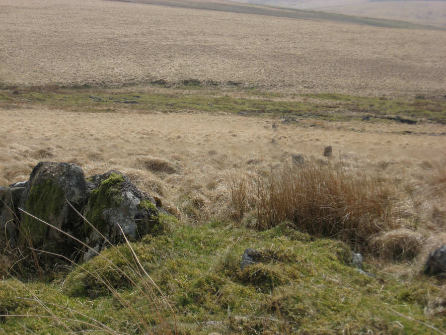
Photo taken on 02-05-2013
Database entries
OS Map: SX 64119 65302
OS Source: Sandy
HER: MDV5147
The Stone Rows of GB: Hook Lake
Alternate name: Hook Lake
Short Name: HT Hook Lake6
Exist: Yes
Record: Unique
Record Source: Sandy
Hut Class: Yes
Barrow Report: 38
Lidar: SX 64119 65302
Guide Map: 51
Nearest Bus Stop: Cornwood Crossways (8.8 km) [Route: 59]
Nearby sites: SX 64119 65302
Notes
This hut circle is of great interest in as much as it lies in the path of the Hook Lake stone row. Indeed, one of the stones from the stone row is actually incorporated into the wall of the hut circle. The photo of this site shows two massive slabs of the hut circle on the left hand side of the photo. On the right hand side of the photo the Hook Lake stone row can be seen going down hill. For further coverage of this see the Stone Rows of Great Britain page linked from this record.References
These are selected references with an emphasis on out of copyright sources linked as PDFs. For more detailed references try any linked HER or PMD record above.
- Newman, Phil, The Upper Erme Valley Dartmoor National Park Devon An Archaeological Survey, Southwest Landscape Investigations (2018)
- Worth, R. Hansford, Barrow Report 38, T.D.A. Vol.51 p.79 (1919)
- Worth, R. Hansford, The Dartmoor Hut Circles, T.D.A. Vol.77 pp.225-256 (1945)
- Worth, R. Hansford, The Stone Rows of Dartmoor Part 1, T.D.A. Vol.78 pp.285-316 (1946)