
Mardle Embanked Cairn Circle
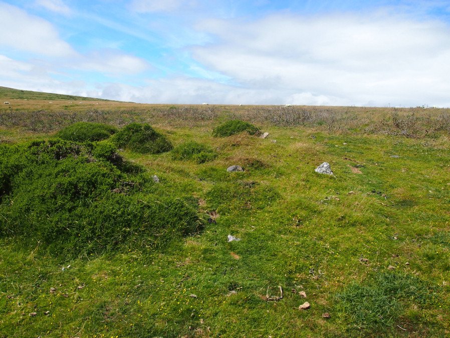
Photo taken on 15-07-2016
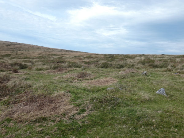
Photo 02/10/2025 shortly after clearance work done by the DPA in Sept 2025.
Database entries
OS Map: SX 67526 69359
OS Source: Garmin
Butler OS: SX67526935
HER: MDV5308
Megalithic Portal: 3374
Alternate name: Mardle Valley 1
Short Name: CC Mardle 1
Butler map: 58.12.1
Turner: B11
Exist: Yes
Record: Unique
Record Source: Butler
Hut Class: No
Cairn Class: Yes
Dimensions (m): 12.0 x 0.3
Lidar: SX 67526 69359
Guide Map: 45
Nearest Bus Stop: Dartmeet Badgers Holt (5.1 km) [Route: 172]
Nearby sites: SX 67526 69359
Notes
Turner: Embanked stone circle; an annular bank of earth and/or stone with an inner edge of orthostats. Much disturbed. Internal diam 6.5m with bank 1.2m wide and 0.4m high. This cairn has a very interesting structure appearing to be multiple circles of stones similar to the cairns at Corringdon Ball. This structure is difficult to capture in a photograph as the stones are small and the site much disturbed.HER: A flat-topped cairn with a disturbed bank around its crest lies on a moderate south-west slope above the left bank of the River Mardle. The feature is circular, 11.8 metres in diameter, and stands a maximum of 0.8 metres high. The stoney ring measures 1.2 metres wide and 0.3 metres high and there are no traces of a cist or kerb in the main structure. The source of the disturbance is unclear though there does not appear to have been an excavation.
This cairn has been cleared of vegetation by the DPA in September 2025 and the author visited shortly afterwards on 02/10/2025. The main photo is from 15/07/2016 and the secondary photo was taken after the recent clearance work. The grid reference taken on 02/10/2025 was SX 67524 69358 which is a close match to the retained one from 2016.
References
These are selected references with an emphasis on out of copyright sources linked as PDFs. For more detailed references try any linked HER or PMD record above.
- Butler, Jeremy, Dartmoor Atlas of Antiquities, vol.4: The South-East, (1993)
- Newman, Phil; Probert, S. A. J, Holne Moor, Dartmoor, Devonshire. A Landscape Survey, Royal Commission on the Historical Monuments of England (1997)
- Turner, J.R., Ring Cairns, stone circles and related monuments on Dartmoor, D.A.S.P. No.48 pp.27-86 (1990)