
Hare Tor N.1 Cairn
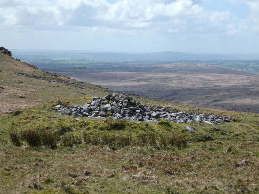
Photo taken on 18-04-2026
Database entries
OS Map: SX 55182 84570
OS Source: Garmin
Butler OS: SX55188457
HER: MDV3574
Alternate name: Hare Tor N.1
Short Name: CN:Hare Tor N1
Butler map: 32.20.1
Grinsell: LYDFORD 13
Exist: Yes
Record: Unique
Record Source: Butler
Hut Class: No
Cairn Class: Yes
Barrow Report: 24 56
Dimensions (m): 10.0 x 1.3
Lidar: SX 55182 84570
Guide Map: 16
Nearest Bus Stop: Dartmoor Inn (3.9 km) [Route: 118]
Nearby sites: SX 55182 84570
Notes
HER: Cairn of 11.6 metres diameter by 0.8 metres high lying between the summits of Hare Tor and Sharp TorButler: Substantial flat-topped cairn and although the centre has been badly damaged the outer rim and sides appear to be intact. It was excavated in 1905 but no artefacts were recorded
References
These are selected references with an emphasis on out of copyright sources linked as PDFs. For more detailed references try any linked HER or PMD record above.
- Butler, Jeremy, Dartmoor Atlas of Antiquities, vol.2: The North, (1991)
- Grinsell, L.V., Dartmoor Barrows, Devon Archaeological Society Proceedings No.36 (1978)
- Worth, R. Hansford, Barrow Report 24, T.D.A. Vol.37 pp.87-95 (1905)
- Worth, R. Hansford, Barrow Report 56, T.D.A. Vol.69 pp.75-109 (1937)